Archive - Date
Archive - Activity
-
Bike trip (120)
- Bike trip - mixed (38)
- Bike trip - road (5)
-
Other trip (1)
- Kayaking (1)
-
Other winter trip (4)
- Snowshoe trip (4)
- Ski trip (4)
- Trip by foot (732)
Archive - Geography
Peakbook-Friends
Hesjadalsnovene from Øyadalen
- Date:
- 21.07.2022
- Characteristic:
- Hike
- Duration:
- 5:00h
- Distance:
- 14.8km
 With quite some cloud cover predicted, we decided for a medium-high hike on our way back to Bergen. Driving out Eksingedalen to Eidslandet and then further along Eidsfjorden, we came to Kalland shortly after. Rounding Stamnesfjellet on the road brought us to the narrow road up from Vik to Vikadalen. Turning right right after the bridge over Vikavatnet, we arrived at the lower end of Øyadalen and parked there at a proper parking place. The map had indicated that one could choose from walking into Øyadalen either on its northwestern side, or on its southeastern one. To see it all, we decided to walk into Øyadalen on its northwestern side, first. Given the substantial amounts of rain on the day before, we quickly learned that this would turn into a very (very!) wet hike soon! :-) Yes, >>>
An attempt to Slettefjellet via Eikemostølen
- Date:
- 20.07.2022
- Characteristic:
- Hike
- Duration:
- 2:00h
- Distance:
- 4.4km
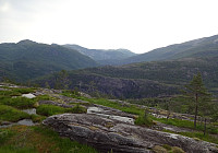 The weather forecast was not really promising, but we decided to still give it a chance. Driving down Eksingedalen and passing by the tunnel to Modalen, we soon came to Treshaugen near Eikemo, where we parked the car right next to the road. We had read up front that we should be able to locate a (steep) trail up to Eikemostølen from there and indeed we could find some blue marks on a couple of trees right next to the road near the northern bend of Ekso (in the northeast of Eikemo). Still, finding the "trail" did then require a lot of imagination (yes, a good number of trees were marked on the way up to Eikemostølen, but the "trail" was hard to see, or not, and partially covered fully with vegetation like high grass or farns). Nonetheless, it was then without major >>>
Saudalsnovi from Flatekvål in Eksingedalen
- Date:
- 19.07.2022
- Characteristic:
- Hike
- Duration:
- 6:00h
- Distance:
- 16.4km
 Expecting a nice day, we aimed at Saudalsnovi in the southwest of Lavik in Eksingedalen. We drove to Flatekvål, a short stretch down Eksingedalen from Lavik, and parked at the parking place for the church, Eksingedalen Kyrkje, right next to Eksingedalsvegen. From there, we walked along Sørdalsvegen, passing by the church and crossing over river Ekso close to where Sørdalen comes down on the other, southern side. After crossing the flat spot at Øyna and entering Sørdalen, we came to a few (commercial?) buildings. There, on the back-side of these buildings, we found a simple pedestrians' bridge that lead us over to the other, western side of the Sørdalselvi. There, we quickly found a marked trail that would lead us (steeply) up to the ridge above Furneslii. Once up there, at about >>>
Det Høga Bungane from Haugen
- Date:
- 18.07.2022
- Characteristic:
- Hike
- Duration:
- 2:00h
- Distance:
- 6.5km
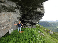 After some driving, we ended up in Lavik, Eksingedalen, in the early evening. We decided that it was still enough time for a short walk and followed a recommendation from one we had talked to in Lavik, driving up to Haugen in Fagerdalen, just northeast of Lavik. From there, we started walking, reaching Lavikstølen at the end of the gravel road leading up there from Haugen. At Lavikstølen, we still wished to include a bit more and so we continued along a trail that leads upwards (in western direction) from Lavikstølen. First, we thought that this trail would lead up to Nipa, just to find out rather quickly that the trail tended more and more into southwestern direction, instead. Once above 700mosl, it became clear that this trail would lead around some pronounced cliffs in the south >>>
Høgafjellet (and Hikletten) from Lonadalen
- Date:
- 05.06.2022
- Characteristic:
- Hike
- Duration:
- 5:30h
- Distance:
- 17.7km
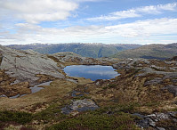 Very nice round including Høgafjellet on Osterøy, starting from its south, i.e., Lonadalen. Using Osterøybrua to conveniently cross over to Osterøy, we turn right before entering the tunnel, driving to Bruvik from there. Leaving the fjord there, we ascended to the saddle in the north of Bruvik (and in the east of Brøknipa) to connect to the interior of Osterøy along road 5418. Before getting all the way down to the large lakes in the middle of Osterøy, we turned right, entering a gravel road that would bring us to Lonadalen, passing by Sagatjørna, Midtvatnet, and Blomdalsvatnet. Near the saddle in Lonadalen, where also the trail from Høgafjellet comes down, we parked and started our hike in northeastern direction, following Lonadalen a bit further, first. At Midttun, we passed >>>
Round around Meland church
- Date:
- 21.11.2021
- Characteristic:
- Hike
- Duration:
- 4:00h
- Distance:
- 8.6km
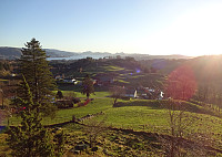 Expecting a nice November Sunday, we aimed at a round around Meland church near Knarvik in the north of Bergen. Driving along E39 from Bergen brought us across Salhusfjorden with the help of Nordhordlandsbrua. As soon as we touched ground on Flatøy, again, we changed to Rosslandsvegen, leading westwards into the direction of Meland and Holsnøy. Near Frekhaug, we turned right (onto the comparably narrow road to Meland). After crossing over from Dale to Meland, we parked near Meland church and started our hike from there. The first sub-goal of the day was Salbukletten in the northwest of Meland. We passed by Erstad, first, and then ascended from there to Salbukletten (into northwestern direction from Erstad). This ascent, even though without trail, was nice and easy! On Salbukletten, >>>
Nice round around Bysheimvatnet
- Date:
- 31.10.2021
- Characteristic:
- Hike
- Duration:
- 5:30h
- Distance:
- 16.1km
 The weather forecast had improved and promised nice hiking conditions, which let us decide for a "proper" hike. :-) For some time already, we had looked at Skolmen on Osterøy and now a hike up there seemed just right to us. We drove from Bergen to Osterøy (via the bridge) and on Osterøy further to Gjerstad. Continuing past Gjerstad church and Skistad on Gjerstadvegen, we turned right on the other side of the stream, leading us towards Solbjørg. Taking the next turn to the left, we started our passage through Solbjørgsdalen, before turning right, again, at Rymla, driving eastwards into the direction of Låstadvatnet. After passing by the rather large business area next to the stream that comes out of Låstadvatnet, we parked at the side of the road and started hiking from >>>
Nice round around Fedje
- Date:
- 19.06.2021
- Characteristic:
- Hike
- Duration:
- 4:00h
- Distance:
- 11.0km
 We took the ferry to Fedje and started our hike around the island from there. Our plan was to round Fedje in clockwise direction. Accordingly, we headed southwestwards, first, to pass by Husavatnet on its western side. Continuing in southwestern direction, we got around the wetter inner areas of Fedje near the west coast of the island. After walking by Vassviketjørna, we made a short detour to Vassvika to enjoy a short lunch break. From there, we continued further southwards until we were very close to Hellisøy with its impressive lighthouse. We then switched over to the eastern side of the island by following Fyrsundvegen. After a few steps on Stormarkvegen, we turned onto Mortevikvegen, which brought us to the head of the trail along the eastern coast of Fedje. Following this trail >>>
Gladihaug and Krossane from Votno
- Date:
- 01.05.2021
- Characteristic:
- Hike
- Duration:
- 4:00h
- Distance:
- 13.5km
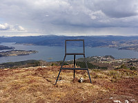 For a while, we had contemplated to hike Gladihaug one day. This morning, we decided to finally do it! :-) We took the car to the north of Bergen, driving along E39 towards Knarvik. Once there, we turned left in Knarvik and continued along road 57 (into the direction of Mongstad in the north of Knarvik). After driving through Espelandstunnelen and Herlandstunnelen on Lindåsvegen, we parked right next to the road (where one also could drive off to Seim only a bit further in the north). We then started our hike towards Gladihaug by walking into Votno, approaching the significant ridge of Hellefjellet from its north. As soon as we found ourselves on this ridge (in the south of Votno), we also had found a simple trail that was easy to follow. At about 250mosl, this trail even got "upgraded" >>>
Tveitafjellet from Fotlandsvåg
- Date:
- 18.04.2021
- Characteristic:
- Hike
- Duration:
- 3:00h
- Distance:
- 8.3km
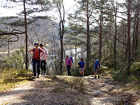 We started in Fotlandsvåg on the north of Osterøy, right next to Fjordslottet (between Herlandsvatnet in the south and Fotlandsvågen in the north), first walking up to the fotball field (in the west of Fotlandsvåg), and from there, diagonally upwards, along a forest road in southern direction. At a bit more than 50mosl, we then stepped onto a marked trail that leads up to Fotlandssætra (about 200mosl) and from there further up to Vetaskaret. While nobody could have asked for a nicer day, with spring temperatures and lots of sun, we soon found the somewhat steep ascent towards Vetaskaret covered in (relatively hard) snow. With a bit of care, however, and/or the right shoes, we nonetheless made our way up without major difficulties. At Vetaskaret, we briefly contemplated a short detour >>>


