Archive - Date
Archive - Activity
-
Bike trip (137)
- Bike trip - mixed (51)
- Bike trip - road (9)
-
Other trip (1)
- Kayaking (1)
-
Other winter trip (4)
- Snowshoe trip (4)
- Ski trip (4)
- Trip by foot (740)
Archive - Geography
Peakbook-Friends


Collected lists
-
Bergen ≥ 50m pf. og ≥ 100 m.o.h.
(87/89)
 97%
97% -
Most dominating tops of the Bergen peninsula
(68/75)
90%
-
Utvalgte topper og turmål i Bergen
(316/350)
90%
-
Alle topper i Bergen
(357/398)
89%
-
Opptur Bergen
(100/113)
88%
-
De syv fjell rundt Bergen
(6/7)
85%
-
Sund ≥ 50m pf.
(14/18)
77%
-
Os ≥ 50m pf.
(25/34)
73%
-
Søyler (fastmerker) i Bergen
(68/100)
68%
-
Fjell ≥ 50m pf.
(21/32)
65%

To Åsane via Bergen and back
- Date:
- 07.05.2026
- Characteristic:
- Bike trip - road
- Duration:
- 2:30h
- Distance:
- 56.1km
 I had something to do in Åsane and thus decided to extend my bike to trip to Bergen by a detour via Åsane. On my way back, I included a traverse via Munkebotn (instead of cycling around Eidsvågsneset again) and Fjellveien.
See also the related FB-page Hiking around Bergen, Norway .
On web page prominent-mountains.no , there's a [xxx|useful page about Xxx].
Similarly, on web page WestCoastPeaks.com , there's also a [xxx|useful page about Xxx].
I had something to do in Åsane and thus decided to extend my bike to trip to Bergen by a detour via Åsane. On my way back, I included a traverse via Munkebotn (instead of cycling around Eidsvågsneset again) and Fjellveien.
See also the related FB-page Hiking around Bergen, Norway .
On web page prominent-mountains.no , there's a [xxx|useful page about Xxx].
Similarly, on web page WestCoastPeaks.com , there's also a [xxx|useful page about Xxx].
Through Wien from Hauptbahnhof
- Date:
- 29.04.2026
- Characteristic:
- Bike trip - road
- Duration:
- 0:45h
- Distance:
- 9.4km
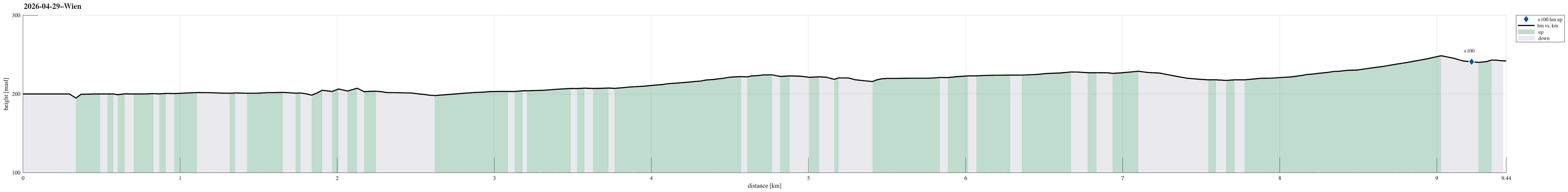 After first biking from Smolenice to Marchegg and then taking a train to Vienna, I still had to cover some 10km in Vienna. This worked as planned and there's nothing special to report about the route.
See also the related FB-page Hiking around Bergen, Norway .
After first biking from Smolenice to Marchegg and then taking a train to Vienna, I still had to cover some 10km in Vienna. This worked as planned and there's nothing special to report about the route.
See also the related FB-page Hiking around Bergen, Norway .
Through Wien to Donaukanal
- Date:
- 26.04.2026
- Characteristic:
- Bike trip - road
- Duration:
- 1:00h
- Distance:
- 13.2km
 Main goal for this day was to get from Vienna to Smolenice (partly by boat, partly by bike). To first get to the boat (TwinCityLiner) in Vienna, I needed to bridge some 13km by bike in the early morning, first. Nothing special about the bike-route, though, to report.
Selected photos are available as Google photo album .
The TwinCityLiner is an interesting alternative option to get from Vienna to Bratislava (or the other way around).
Main goal for this day was to get from Vienna to Smolenice (partly by boat, partly by bike). To first get to the boat (TwinCityLiner) in Vienna, I needed to bridge some 13km by bike in the early morning, first. Nothing special about the bike-route, though, to report.
Selected photos are available as Google photo album .
The TwinCityLiner is an interesting alternative option to get from Vienna to Bratislava (or the other way around).
To Åsane, and back
- Date:
- 19.04.2026
- Characteristic:
- Bike trip - road
- Duration:
- 3:00h
- Distance:
- 55.1km
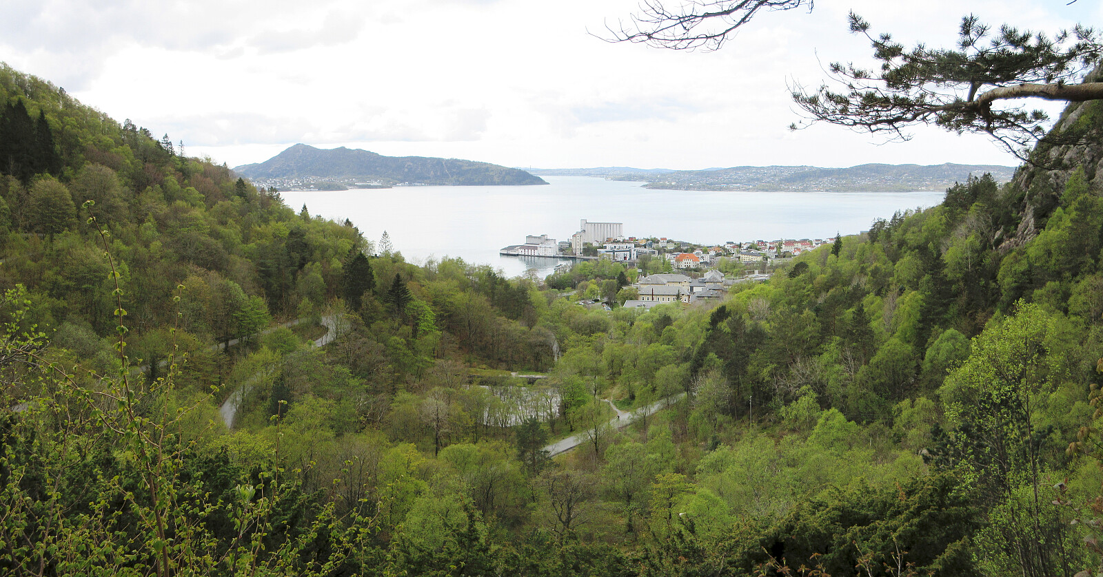
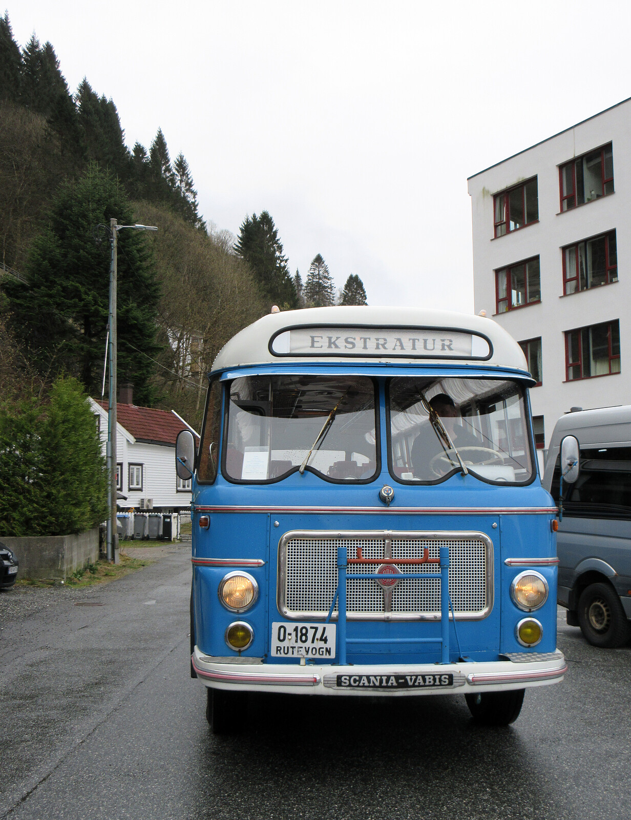 The main plan for the day was to visit the textile factor museum in Salhus. To get there, we had planned to take a historic bus from Åsane terminal. To get to Åsane, we used our bikes. Nothing special to report about the bike-trip, though (we biked the same route there and back, using the main bike route around Eidsvågsneset).
See also the related FB-page Hiking around Bergen, Norway .
The main plan for the day was to visit the textile factor museum in Salhus. To get there, we had planned to take a historic bus from Åsane terminal. To get to Åsane, we used our bikes. Nothing special to report about the bike-trip, though (we biked the same route there and back, using the main bike route around Eidsvågsneset).
See also the related FB-page Hiking around Bergen, Norway .
Wet cycling around Damsgårdsfjellet
- Date:
- 01.12.2024
- Characteristic:
- Bike trip - road
- Duration:
- 1:30h
- Distance:
- 23.2km
 The indeed very wet Sunday did not really invite to a hike. Making a bike-trip, however, seemed just OK to get some fresh air. Starting at Varden, I first biked along Bjørgeveien into the direction of Loddefjord. Between Svartaberget in the southeast and Skarkafjellet in the northwest, I then turned into the direction of Laksevåg (towards the northeast). After cycling along Liavatnet, I was in the mood to double-check whether there wasn't a way to connect from Nordre Banuren to Gravdalslien with the bike (my memory was that there certainly is no way to drive this connection with a car, though). After cycling up to Nordre Banuren, I got the very clear impression that crossing over to Gravdalslien with the bike was neither possible (not without carrying the bike etc.). I thus biked back >>>
Cycling around Nordåsvatnet
- Date:
- 03.11.2024
- Characteristic:
- Bike trip - road
- Duration:
- 2:30h
- Distance:
- 25.0km
 After changing to spikes on our bikes, we wished to bike one round to see that everything works well. Lacking a more creative idea, we decided to simply bike once around Nordåsvatnet. While we did get quite a bit wet, we still returned satisfied after a bit of work-out...
See also the related FB-page Hiking around Bergen, Norway .
After changing to spikes on our bikes, we wished to bike one round to see that everything works well. Lacking a more creative idea, we decided to simply bike once around Nordåsvatnet. While we did get quite a bit wet, we still returned satisfied after a bit of work-out...
See also the related FB-page Hiking around Bergen, Norway .
Traudalen
- Date:
- 02.11.2024
- Characteristic:
- Bike trip - road
- Duration:
- 1:00h
- Distance:
- 8.6km
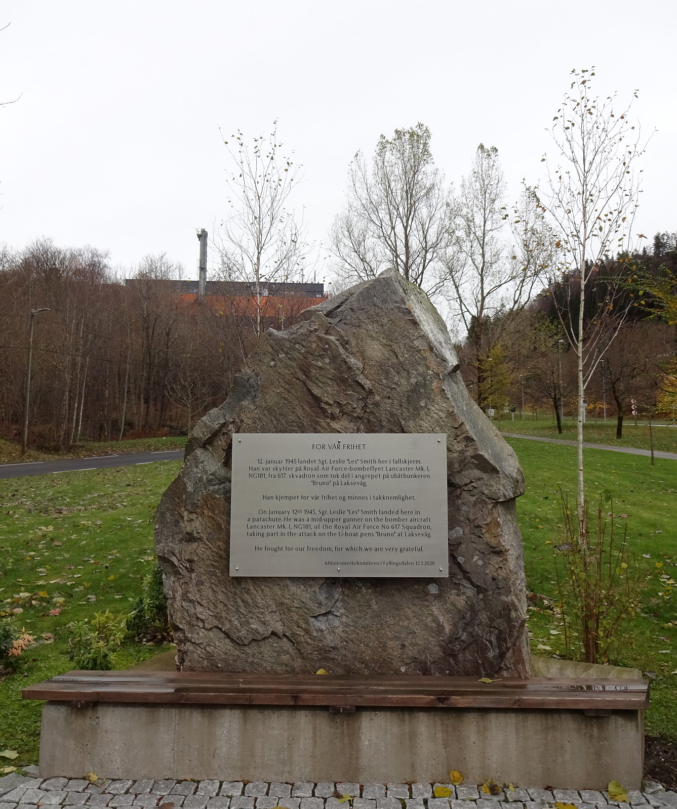 Instead of biking directly to the shop, I decided to make a little detour towards upper Fyllingsdalen. Before the rain started, I took a look at the place, where in 2020 a stone was erected in memory of three British soldiers, who had jumped out of their aircraft on January 12, 1945, then coming down on parachutes, before eventually being captured and detained. First, I had considered to include also a short hike up to Løvstakken, but since it already started to rain, my motivation degraded and I instead returned back towards more southern grounds in Fyllingsdalen (and to the shop, of course).
Selected photos are available as Google photo album .
See also the related FB-page Hiking around Bergen, Norway .
Instead of biking directly to the shop, I decided to make a little detour towards upper Fyllingsdalen. Before the rain started, I took a look at the place, where in 2020 a stone was erected in memory of three British soldiers, who had jumped out of their aircraft on January 12, 1945, then coming down on parachutes, before eventually being captured and detained. First, I had considered to include also a short hike up to Løvstakken, but since it already started to rain, my motivation degraded and I instead returned back towards more southern grounds in Fyllingsdalen (and to the shop, of course).
Selected photos are available as Google photo album .
See also the related FB-page Hiking around Bergen, Norway .
Biking around Nordåsvatnet
- Date:
- 29.08.2021
- Characteristic:
- Bike trip - road
- Duration:
- 1:30h
- Distance:
- 24.6km
 To get to a suitable starting location for my Helldal hike today, I took my eBike and made it a (mixed) double round. Starting from Varden in the south of Fyllingsdalen, Bergen, I first biked along Sælenvatnet towards Nordåsvatnet. At Straume, I crossed over to the southern side, and from Søreide, I basically followed Steinsvikvegen in southeastern direction (mostly to get around Steinsvik and over to Nordås). Since my plan was to come by Skjoldabukta on my way to Nesttun, I left Steinsvikvegen near Dortledhaugen (towards the north), finding a connection that led me up to Nordåsvegen. Instead of following Nordåsvegen right away, however, I made a little extra-detour over Nordåshøgda before getting down to Nordåsvegen (a bit further north) again. I then followed Nordåsvegen until I turned >>>
Middendelfland
- Date:
- 12.02.2018
- Characteristic:
- Bike trip - road
- Duration:
- 4:00h
- Distance:
- 43.4km
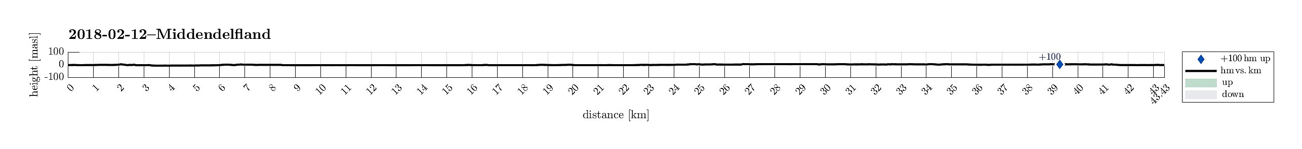 We started from nearby the main train station in Rotterdam, where we rented a bike. We then headed into northwestern direction in order to get outside of the city. We passed by Vroesenpark and continued further towards the airport of Rotterdam. We crossed through the Park de Buitenplaats and passed by the airport on its southwestern side. Once we arrived at Doenkade, we used the bridge to get over both the highway A13 and the canal Delftsche Schie. On the other (western) side, we got down from the bridge, then following the canal Delftsche Schie northwards in its western side. Near Kandelaar we turned towards the west, heading into Middendelfland. We then surrounded the more urban area in its north, following some very nice little roads through a nice rural area. Shortly, after crossing >>>
