Archive - Date
Archive - Activity
-
Bike trip (137)
- Bike trip - mixed (51)
- Bike trip - road (9)
-
Other trip (1)
- Kayaking (1)
-
Other winter trip (4)
- Snowshoe trip (4)
- Ski trip (4)
- Trip by foot (740)
Archive - Geography
Peakbook-Friends


Collected lists
-
Bergen ≥ 50m pf. og ≥ 100 m.o.h.
(87/89)
 97%
97% -
Most dominating tops of the Bergen peninsula
(68/75)
90%
-
Utvalgte topper og turmål i Bergen
(316/350)
90%
-
Alle topper i Bergen
(357/398)
89%
-
Opptur Bergen
(100/113)
88%
-
De syv fjell rundt Bergen
(6/7)
85%
-
Sund ≥ 50m pf.
(14/18)
77%
-
Os ≥ 50m pf.
(25/34)
73%
-
Søyler (fastmerker) i Bergen
(68/100)
68%
-
Fjell ≥ 50m pf.
(21/32)
65%

Bergens lengste bakke, one of the classics near Bergen!
- Date:
- 09.09.2023
- Characteristic:
- Hike
- Duration:
- 5:15h
- Distance:
- 12.8km
 For a while, already, we had discussed that it absolutely was high time, again, for one of the nice classics in the vicinity of Bergen: up to Sydpolen from Brekkedalen! Since the weather seemed to hold throughout the day, we were quick to choose this hike for the day! :-) Driving into Hausdalen from E39 (south of Bergen), we aimed at the parking place at the very end of the road (basically where Brekkedalen splits off from Hausdalen). Hoping that we would not be too late to also find a free spot for our car, we then were relieved to actually find the parking place "only" half full (at about 11h). We quickly got started, heading into Brekkedalen along the gravel road. As soon as we approached Sandane, we also could look up to Sydpolen, already (always an impressive sight). Continuing >>>
Eldsfjellet from the north
- Date:
- 20.08.2023
- Characteristic:
- Hike
- Duration:
- 4:00h
- Distance:
- 8.0km
 We had not been on Eldsfjellet for a while -- not the two of us, at least! Eldsfjellet is -- for good reasons -- a relatively popular hiking destination (it's not really high, as a mountain, but since it's standing out of its surrounding quite a bit, one can expect quite nice views from its heights). Here on Peakbook, as well as on other hiking platforms, one can easily get the impression that everyone (or "everyone") hikes up to Eldsfjellet from its south, either from the parking spot near Alvhøyen along Skjelangervegen, or from Skurtveit via Skurtveitvegen. Harald 's approach from the northwest is a notable exception, of course! :-) Even though it looked like off-trail a lot, we made a plan to approach Eldsfjellet from the north, instead. The idea was to follow Skjelangervegen further and around Eldsfjellet, >>>
Liatårnet from Liaskjeret
- Date:
- 11.08.2023
- Characteristic:
- Hike
- Duration:
- 4:30h
- Distance:
- 9.1km
 We took the car from Bergen towards the west, crossing over Sotrabrua. In the west of Bildøya, we turned south (onto Døsjevegen), driving to Liaskjeret in the east of Liatårnet. From Liaskjærshallen, we then started our hike with our first goal being the trail that leads up to Liatårnet from Hølo. To get there, we had the choice between walking along Liaskjervegen for a good stretch and the alternative of following a simple trail above (in the west) of the houses. Choosing the latter, we first walked up Elvabakkvegen to get to the nearest trail head near house #11. A few hundred meters further west (and up a little), we then turned right (northwards), aiming for Skoradalen via a simple trail. West of Skogsbrekko, however, we did not really find a good way to continue further to >>>
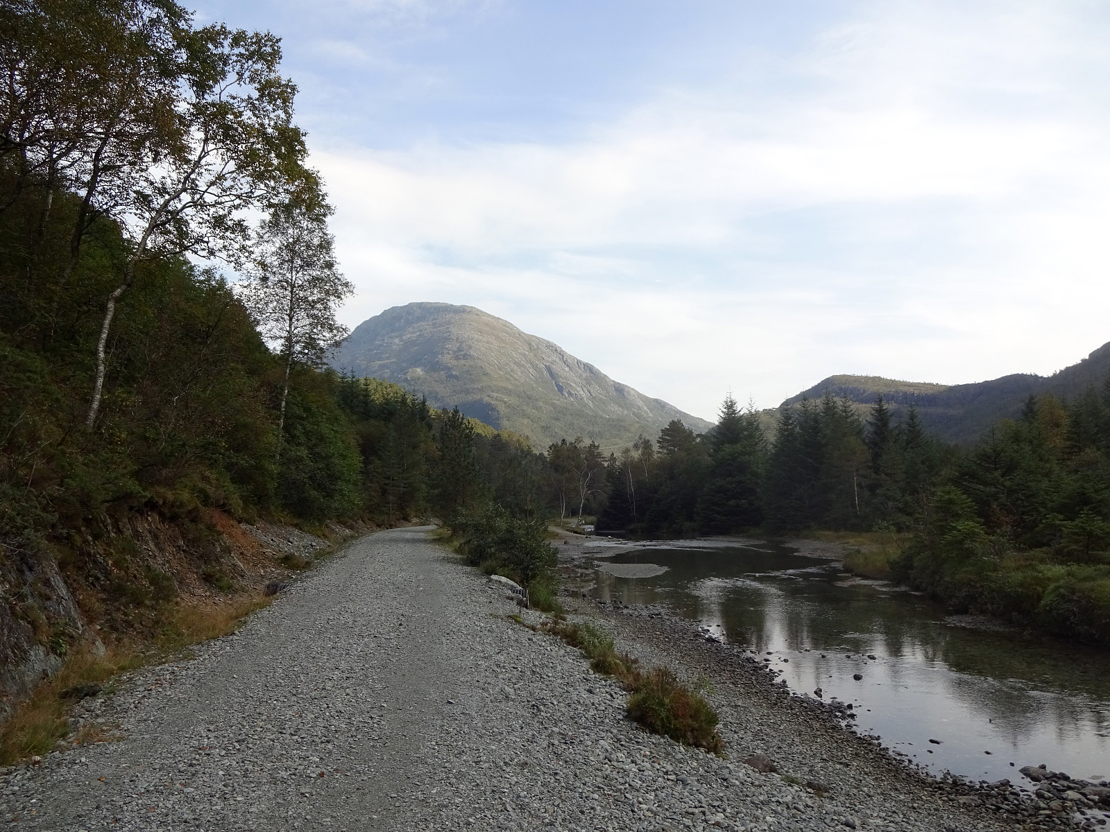
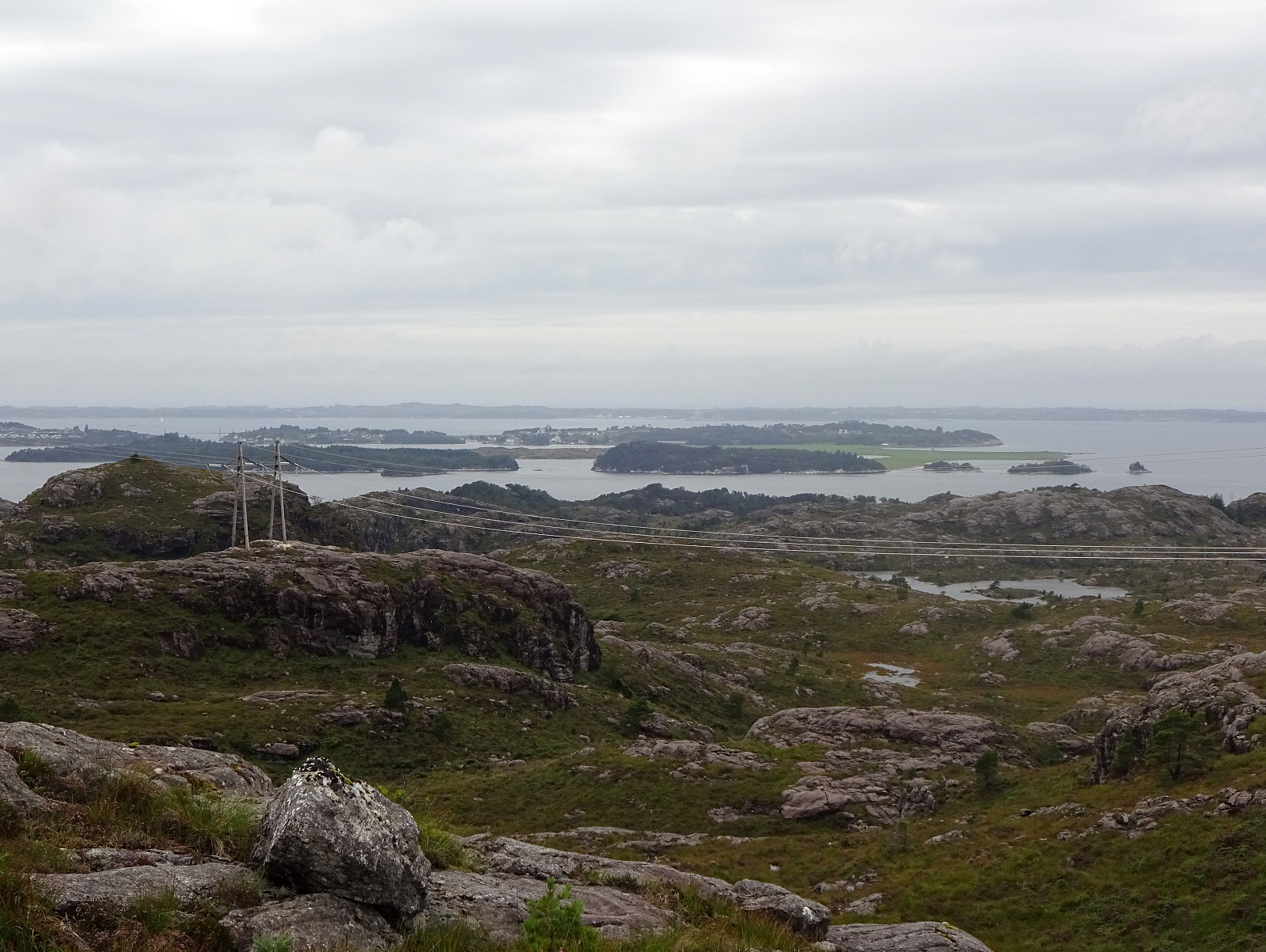
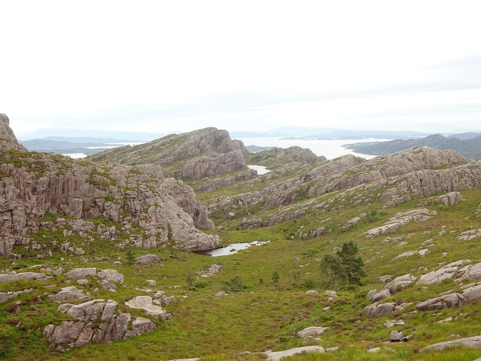
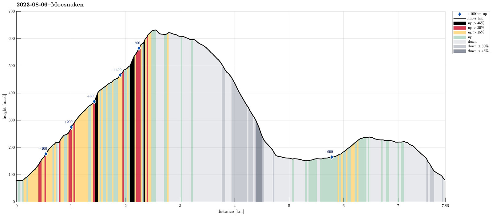
Møsnuken from Heggeland and Gjemdalsskaret
- Date:
- 06.08.2023
- Characteristic:
- Hike
- Duration:
- 3:00h
- Distance:
- 7.9km
 We thought that crossing over Møsnuken from Gjemdal / Heggeland (in the east) to Krokvatnet (in the north) and then returning via Gjemdalsskaret back to the starting point sounded like a nice idea. :-) Accordingly, we took the new E39 connection from Bergen to Osøyro, just to continue into Hegglandsdalen from there (road 579). After passing by Tveitavatnet, we found a place to leave our car (quite near to where Spannsteigselva comes down from Gjemdalsskaret). Instead of following the gravel road up to Gjemdalsskaret from Gjemdal (to then connect to the trail that leads up to Tveitaskaret), we aimed at an ascent route through the forest in the west of Spannsteigselva (without trail). Near house #659 along Hegglandsdalsvegen we stepped onto a simple field road, leading steeply upwards into >>>
Solbakkafjellet from Hausdalen
- Date:
- 05.08.2023
- Characteristic:
- Hike
- Duration:
- 3:00h
- Distance:
- 9.1km
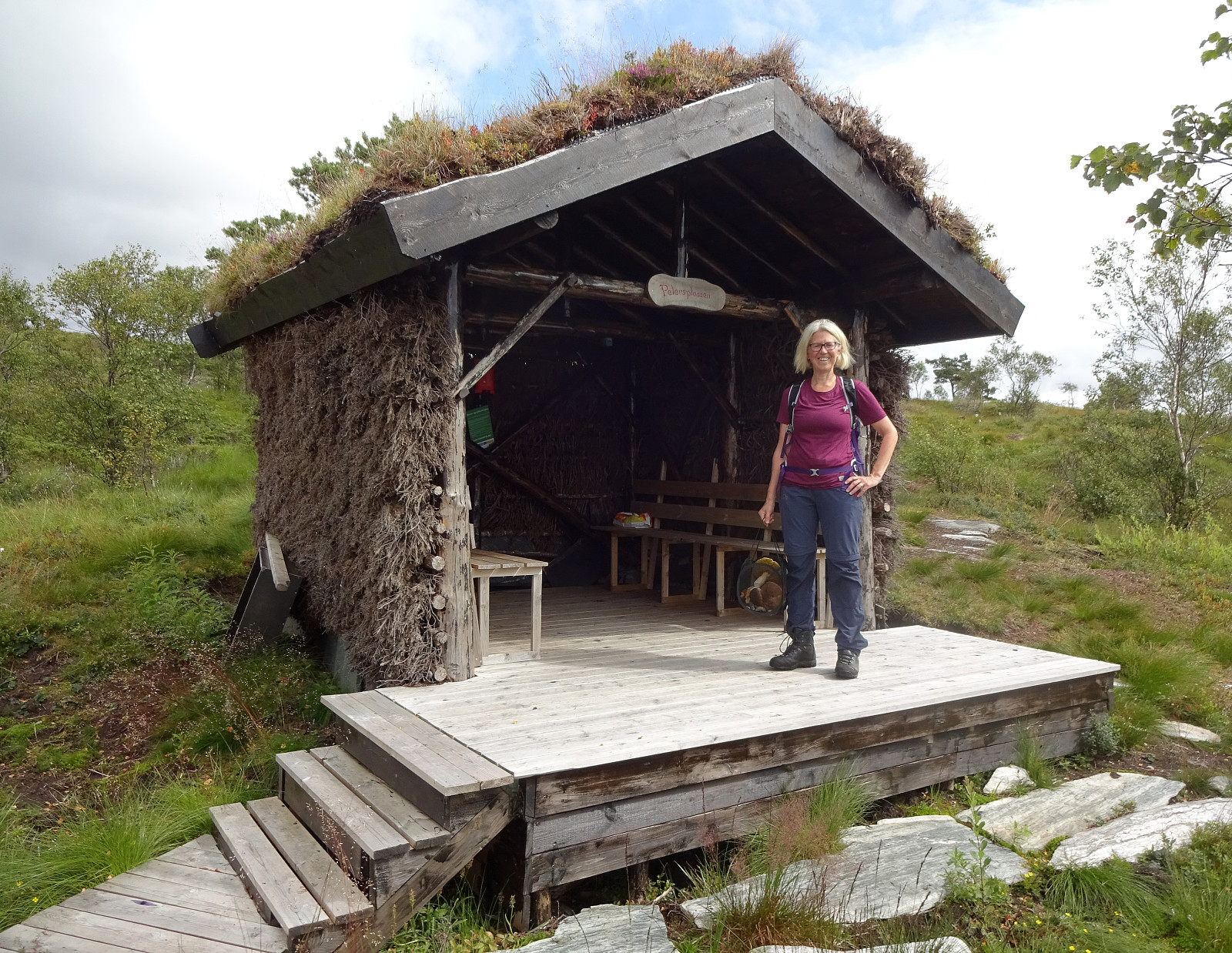 Since we had not been there for a while, we thought that hiking up to Solbakkafjellet once again may nice. This time, however, we decided to approach it from Hausdalen near Haugland. Driving into Hausdalen, we found a place near Haugland, where we could leave the car for a few hours. From there, we started to approach Solbakkafjellet "straight up" (without any trail). The southeastern flank of Solbakkafjellet (Skoralia) is steep and occasionally one needs to find a way around some obstacles on the way up. Still, ascending "straight up" is not really difficult. Within not too long, we accordingly arrived at the top of Solbakkafjellet, paying Petersplassen a short visit (we could not remember this place from our last visit). We then crossed over the long top-ridge of >>>
Round on Runde
- Date:
- 11.07.2023
- Characteristic:
- Hike
- Duration:
- 2:30h
- Distance:
- 7.4km
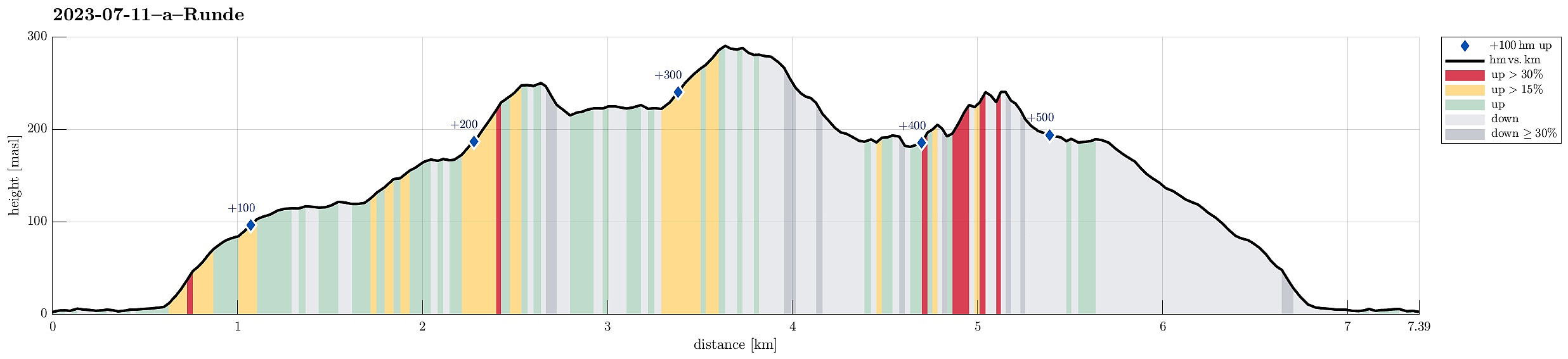 After taking the ferry to Gurskøya, we drove north to Runde to make an excursion to the birds there. Before getting all the way to Goksøyr, we found the last public parking spot. From there, it's then just to follow the marked trails. From Goksøyr upwards to the heights above the bird cliffs (in the northwest of Runde), they even paved the trail for a good stretch -- what a service?! :-) Once up on Myrane, we first headed north (to Raudetinden). There, we got some nice views down to Kvalnes (where also Runde Fyr is). After stepping up to Rongabakkane, we then traversed Storemyr to get to Raudnipa (in the north of Rundabranden). From there, we had our first amazing views down to Hjorthaugsmåla, where a large number of gannets have their nesting spots. For looking down to this gannet >>>
Stålet from Ytre Honningsvåg
- Date:
- 10.07.2023
- Characteristic:
- Hike
- Duration:
- 2:00h
- Distance:
- 4.0km
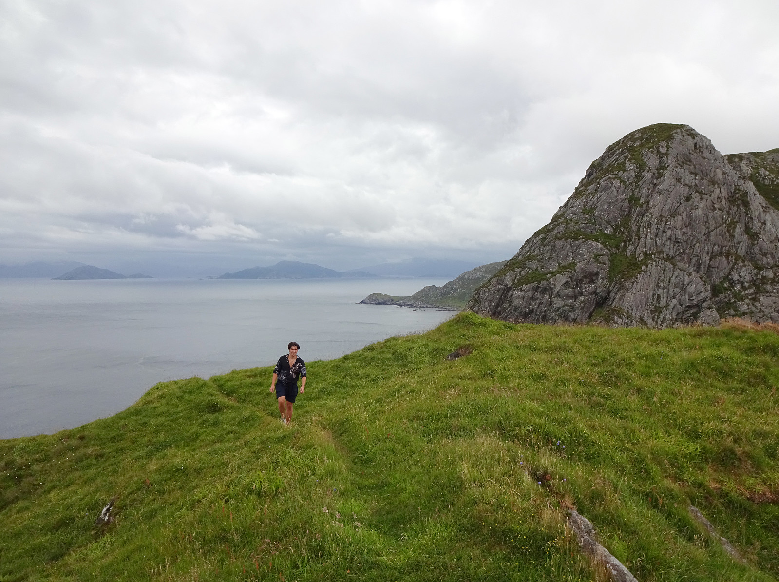 After not seeing much on Vestkapp , we continued to Honningsvågen to make an attempt at Stålet (as far north as you can get on Stadlandet, or so). We found a convenient place to park in Ytre Honningsvåg, right next to the trail head (place for about two cars). From there, we followed a marked trail that extends northwards from Ytre Honningsvåg, traversing the quite steep western slopes of Storebruna, Storeknausen, and Stålsegga at "half height" (or so). While this hike is not long and you also don't have to make many height meters, just the matter of fact that you traverse a relatively steep mountain side (basically all the way out and in), requires a bit of extra care. Also, if the condition should be wet, there may be risks to slip, which could be quite bad in the steepest sections. >>>
Vasstinden from Lauklineset
- Date:
- 02.07.2023
- Characteristic:
- Hike
- Duration:
- 4:00h
- Distance:
- 8.1km
 We estimated that there was enough time for another hike (before reaching our flight back from Tromsø). We drove towards Lauklineset on the north of Nordfjorden and parked a bit off from Lauklineset, where some parking place is set off for hikers (you pay a little for parking there, also). From this parking place, there's a marked trail up to Vasstinden. While still close to the road and Lauklineset, this trail is not very good (and one may prefer to walk the first meters along the road, instead). Once directly above Lauklineset, however, the trail is good, leading steeply upwards between the trees. At about 150masl, the trail levels out for a few meters before it gets steep again. At about 440masl, there's a sign that shows the hikers where the marked trail continues (towards the east, >>>
Buren (and an attempt to Rødtinden)
- Date:
- 01.07.2023
- Characteristic:
- Hike
- Duration:
- 4:30h
- Distance:
- 9.6km
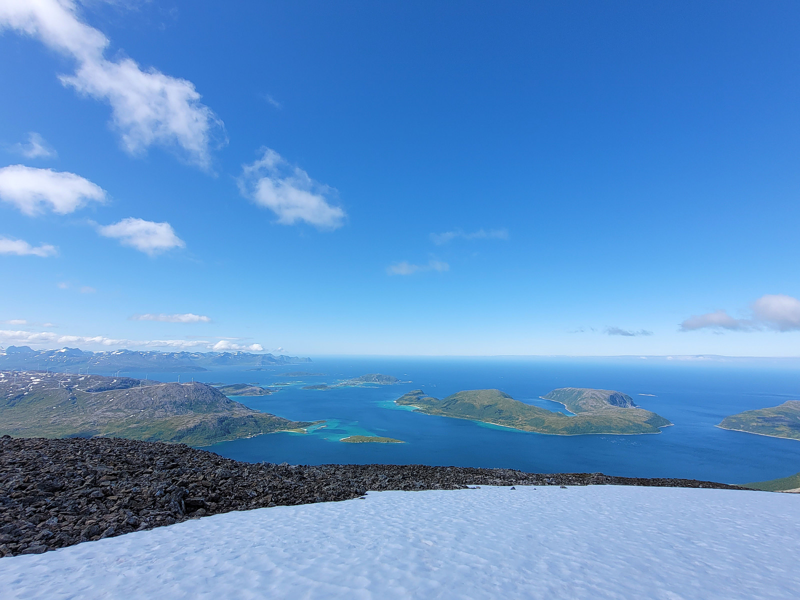
 We had relocated ourselves from Senja to Kvaløya (to Ersfjordbotn -- as if there wasn't any Ersfjorden on Senja!). Also this day looked very promising and with wonderful mountains just "around the corner", the plan was to hike up to Buren (without driving). The hidden agenda for this hike was to also try an ascent to Rødtinden, if possible. Starting along Naustbuktvegen, I first walked along the coast into the direction of Gottberget. There, I found a trail that lead me up to a simple ridge which comes down from Skålhammaren (further up in the northeast of Gottberget). Also along this ridge, I could find a simple trail, leading me up to a nice viewpoint at about 200masl (also with a small cairn there). From there, however, I could not find any trail that would lead further >>>
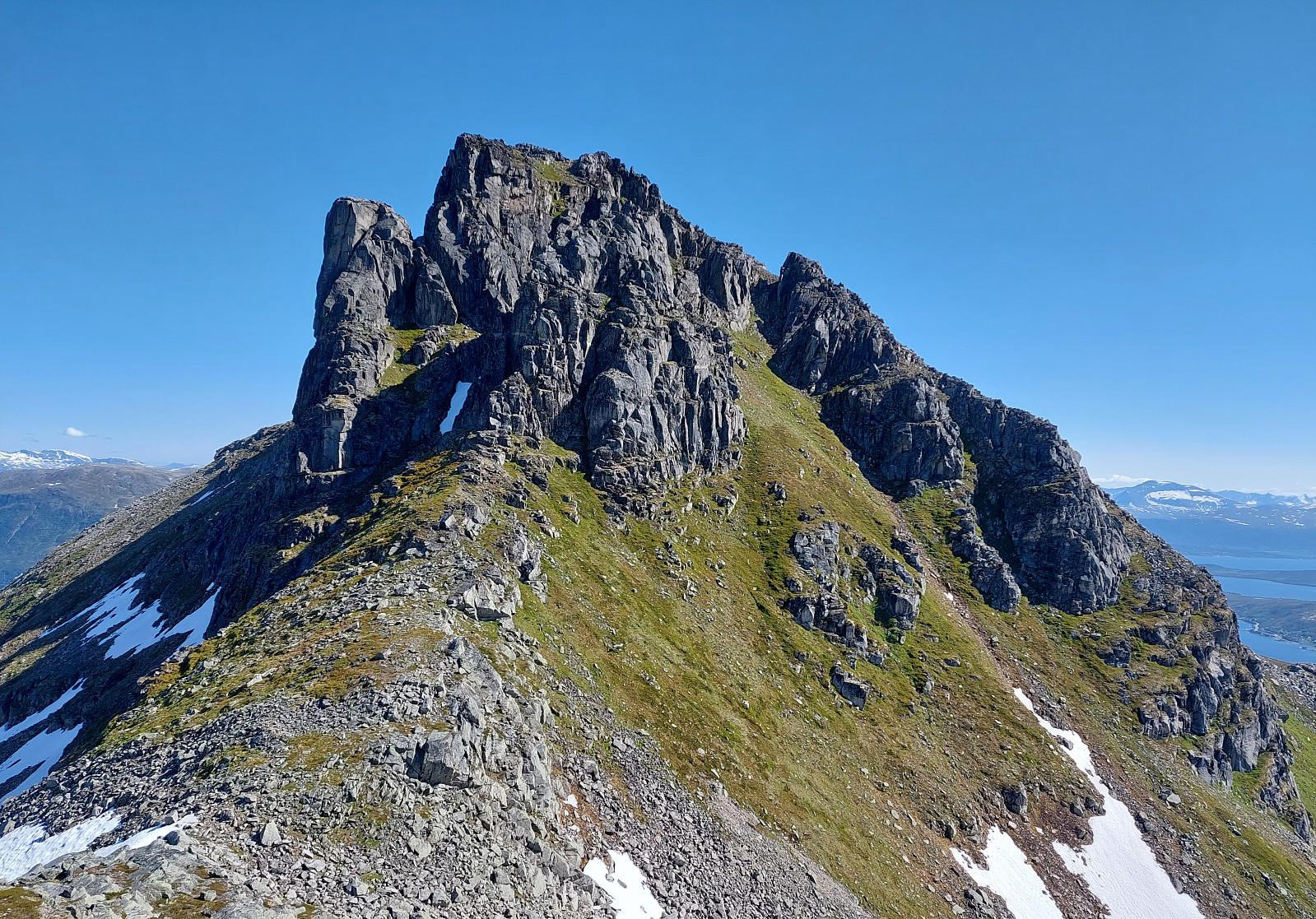
Astritinden from Botnhamn
- Date:
- 30.06.2023
- Characteristic:
- Hike
- Duration:
- 4:00h
- Distance:
- 12.7km
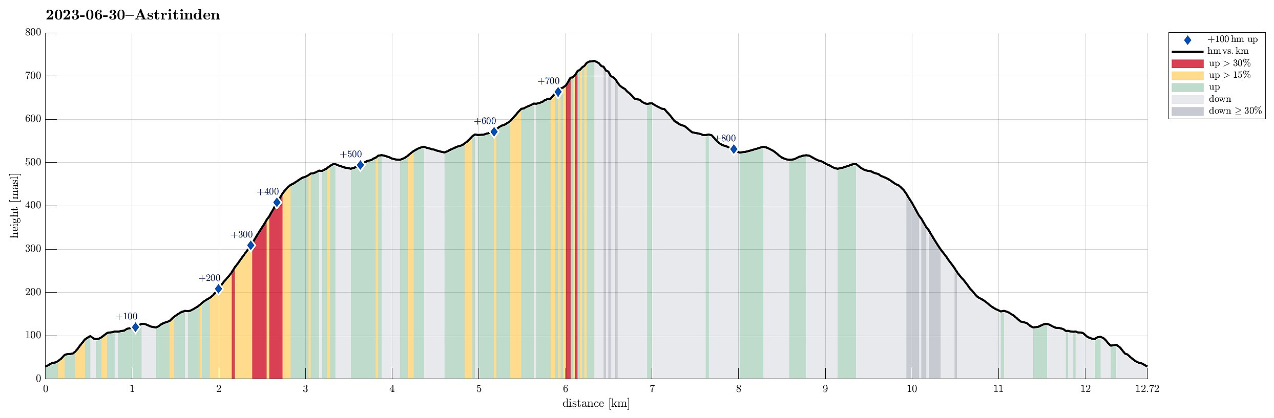 We had to catch a ferry from Botnhamn to Kvaløya and thus planned to hike Astritinden in the time given before the departure of "our" ferry. Right next to the soccer field of Botnhamn (near Mølnneset) we could park the car. The hike then starts with getting up to Sandbakkveihøgda, following one of the marked trails (eventually up right underneath the power line). Once up there, it's then "just" to follow the (long) ridge to Astritinden (steadily in northern / northwestern direction). Only a few kilometers into this hike, one puts in a significant ascent (up to Kvannaksla at about 500masl). There, the hike levels out, again, a little, before the actual ascent up to Astritinden follows a little later. While all of the hike to Astritinden is not really difficult, the >>>
