Archive - Date
Archive - Activity
-
Bike trip (137)
- Bike trip - mixed (51)
- Bike trip - road (9)
-
Other trip (1)
- Kayaking (1)
-
Other winter trip (4)
- Snowshoe trip (4)
- Ski trip (4)
- Trip by foot (740)
Archive - Geography
Peakbook-Friends


Collected lists
-
Bergen ≥ 50m pf. og ≥ 100 m.o.h.
(87/89)
 97%
97% -
Most dominating tops of the Bergen peninsula
(68/75)
90%
-
Utvalgte topper og turmål i Bergen
(316/350)
90%
-
Alle topper i Bergen
(357/398)
89%
-
Opptur Bergen
(100/113)
88%
-
De syv fjell rundt Bergen
(6/7)
85%
-
Sund ≥ 50m pf.
(14/18)
77%
-
Os ≥ 50m pf.
(25/34)
73%
-
Søyler (fastmerker) i Bergen
(68/100)
68%
-
Fjell ≥ 50m pf.
(21/32)
65%

Hesjadalsnovene from Øyadalen
- Date:
- 21.07.2022
- Characteristic:
- Hike
- Duration:
- 5:00h
- Distance:
- 14.8km
 With quite some cloud cover predicted, we decided for a medium-high hike on our way back to Bergen. Driving out Eksingedalen to Eidslandet and then further along Eidsfjorden, we came to Kalland shortly after. Rounding Stamnesfjellet on the road brought us to the narrow road up from Vik to Vikadalen. Turning right right after the bridge over Vikavatnet, we arrived at the lower end of Øyadalen and parked there at a proper parking place. The map had indicated that one could choose from walking into Øyadalen either on its northwestern side, or on its southeastern one. To see it all, we decided to walk into Øyadalen on its northwestern side, first. Given the substantial amounts of rain on the day before, we quickly learned that this would turn into a very (very!) wet hike soon! :-) Yes, >>>
Exploring Høvik
- Date:
- 20.07.2022
- Characteristic:
- Walk
- Duration:
- 1:00h
- Distance:
- 3.0km
 To get a bit of fresh air in the evening, we decided to explore Høvik in Eksingedalen. After first walking along the few roads in Høvik, we started a short ascent to Svedgjeli in northeasern direction (below Åsen), following a stretch of old Reitlevegen through Eksingedalen. From there, we then had some nice overview of Høvik. When walking back, we also explored the wide bend of the Ekso river (in the south of Høvik) that probably is responsible for the suffix of name Høvik.
Selected photos are available as Google photo album .
See also the related FB-page Hiking around Bergen, Norway .
On the Web Archive , one can still find information about Reitlevegen .
To get a bit of fresh air in the evening, we decided to explore Høvik in Eksingedalen. After first walking along the few roads in Høvik, we started a short ascent to Svedgjeli in northeasern direction (below Åsen), following a stretch of old Reitlevegen through Eksingedalen. From there, we then had some nice overview of Høvik. When walking back, we also explored the wide bend of the Ekso river (in the south of Høvik) that probably is responsible for the suffix of name Høvik.
Selected photos are available as Google photo album .
See also the related FB-page Hiking around Bergen, Norway .
On the Web Archive , one can still find information about Reitlevegen .
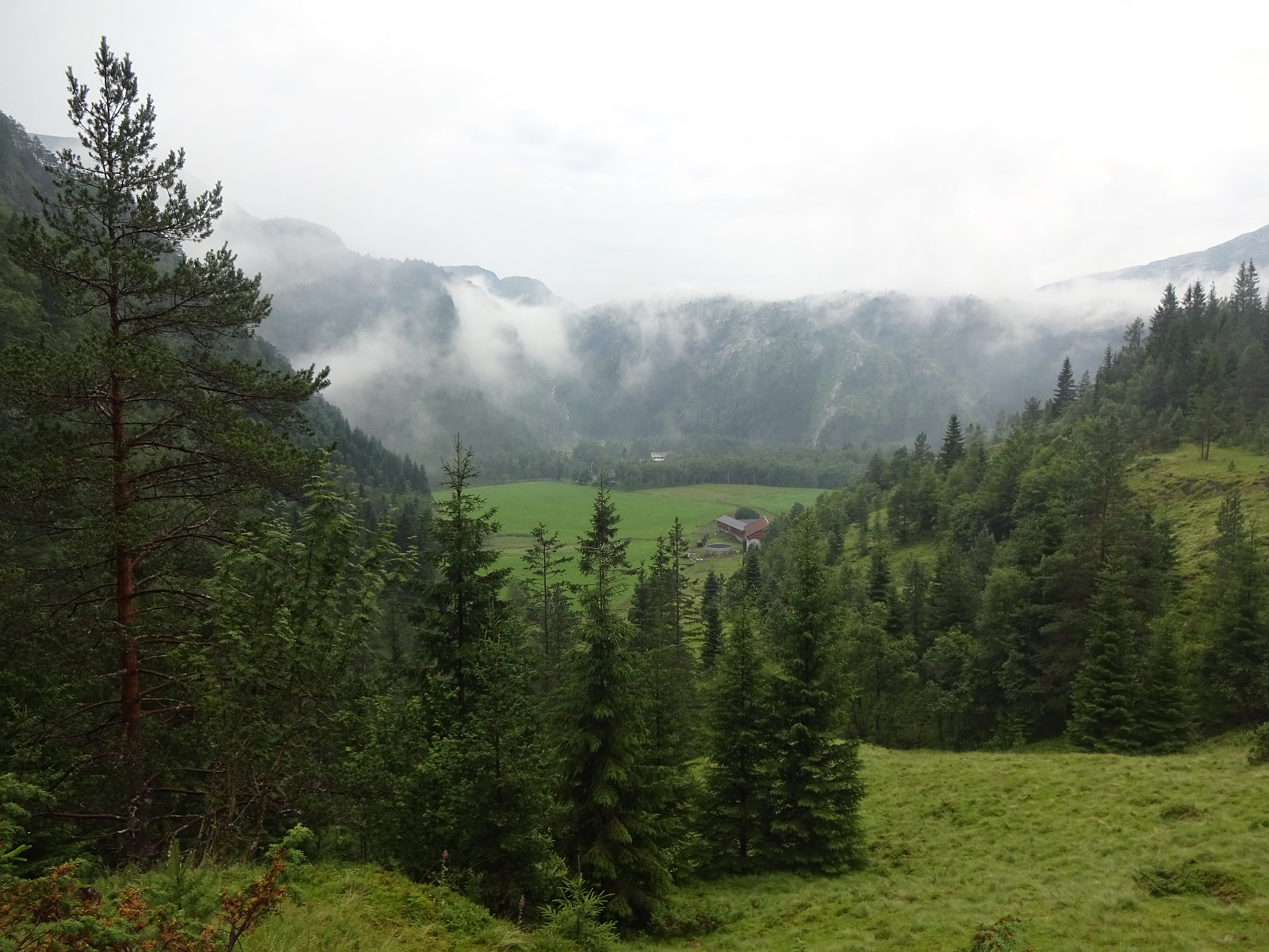
An attempt to Slettefjellet via Eikemostølen
- Date:
- 20.07.2022
- Characteristic:
- Hike
- Duration:
- 2:00h
- Distance:
- 4.4km
 The weather forecast was not really promising, but we decided to still give it a chance. Driving down Eksingedalen and passing by the tunnel to Modalen, we soon came to Treshaugen near Eikemo, where we parked the car right next to the road. We had read up front that we should be able to locate a (steep) trail up to Eikemostølen from there and indeed we could find some blue marks on a couple of trees right next to the road near the northern bend of Ekso (in the northeast of Eikemo). Still, finding the "trail" did then require a lot of imagination (yes, a good number of trees were marked on the way up to Eikemostølen, but the "trail" was hard to see, or not, and partially covered fully with vegetation like high grass or farns). Nonetheless, it was then without major >>>
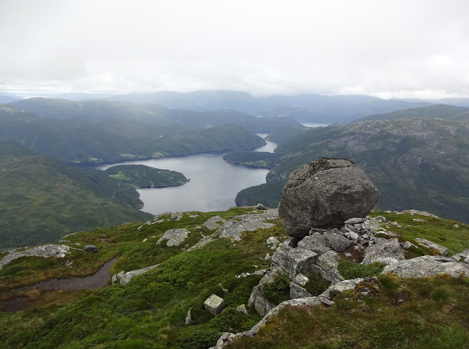
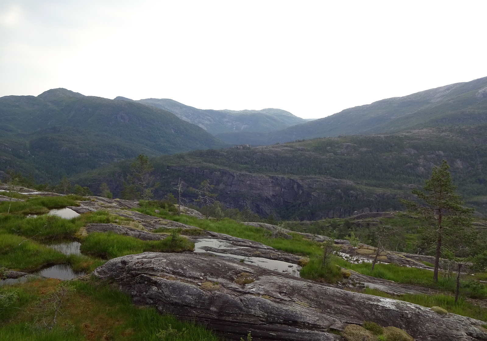
Saudalsnovi from Flatekvål in Eksingedalen
- Date:
- 19.07.2022
- Characteristic:
- Hike
- Duration:
- 6:00h
- Distance:
- 16.4km
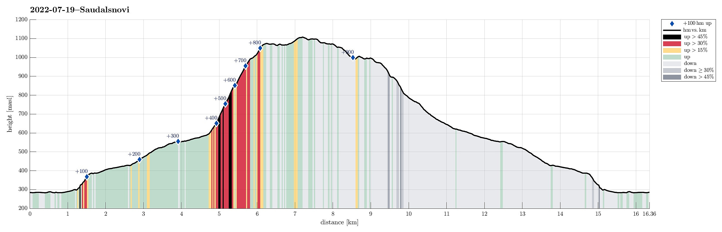 Expecting a nice day, we aimed at Saudalsnovi in the southwest of Lavik in Eksingedalen. We drove to Flatekvål, a short stretch down Eksingedalen from Lavik, and parked at the parking place for the church, Eksingedalen Kyrkje, right next to Eksingedalsvegen. From there, we walked along Sørdalsvegen, passing by the church and crossing over river Ekso close to where Sørdalen comes down on the other, southern side. After crossing the flat spot at Øyna and entering Sørdalen, we came to a few (commercial?) buildings. There, on the back-side of these buildings, we found a simple pedestrians' bridge that lead us over to the other, western side of the Sørdalselvi. There, we quickly found a marked trail that would lead us (steeply) up to the ridge above Furneslii. Once up there, at about >>>
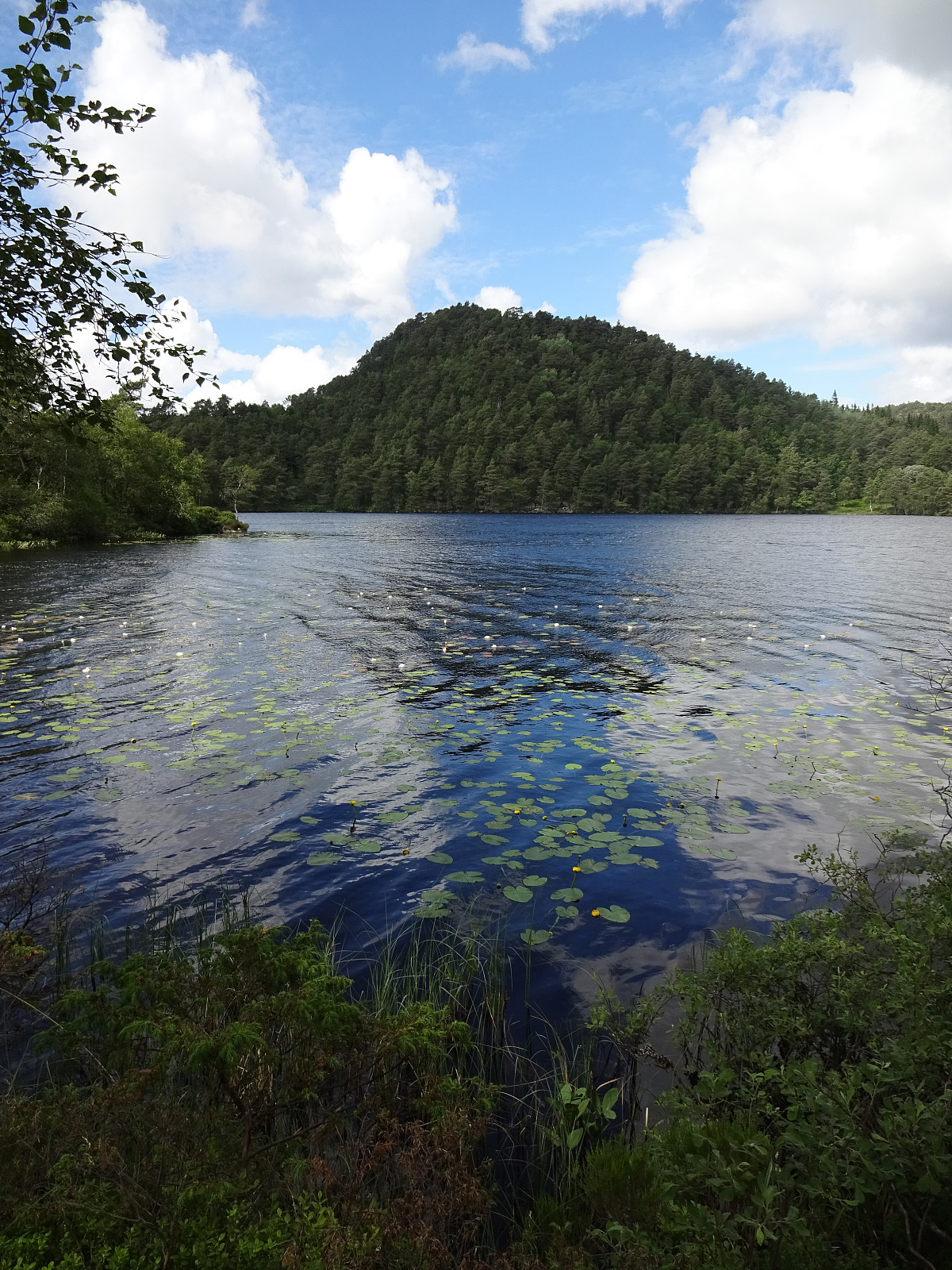
Det Høga Bungane from Haugen
- Date:
- 18.07.2022
- Characteristic:
- Hike
- Duration:
- 2:00h
- Distance:
- 6.5km
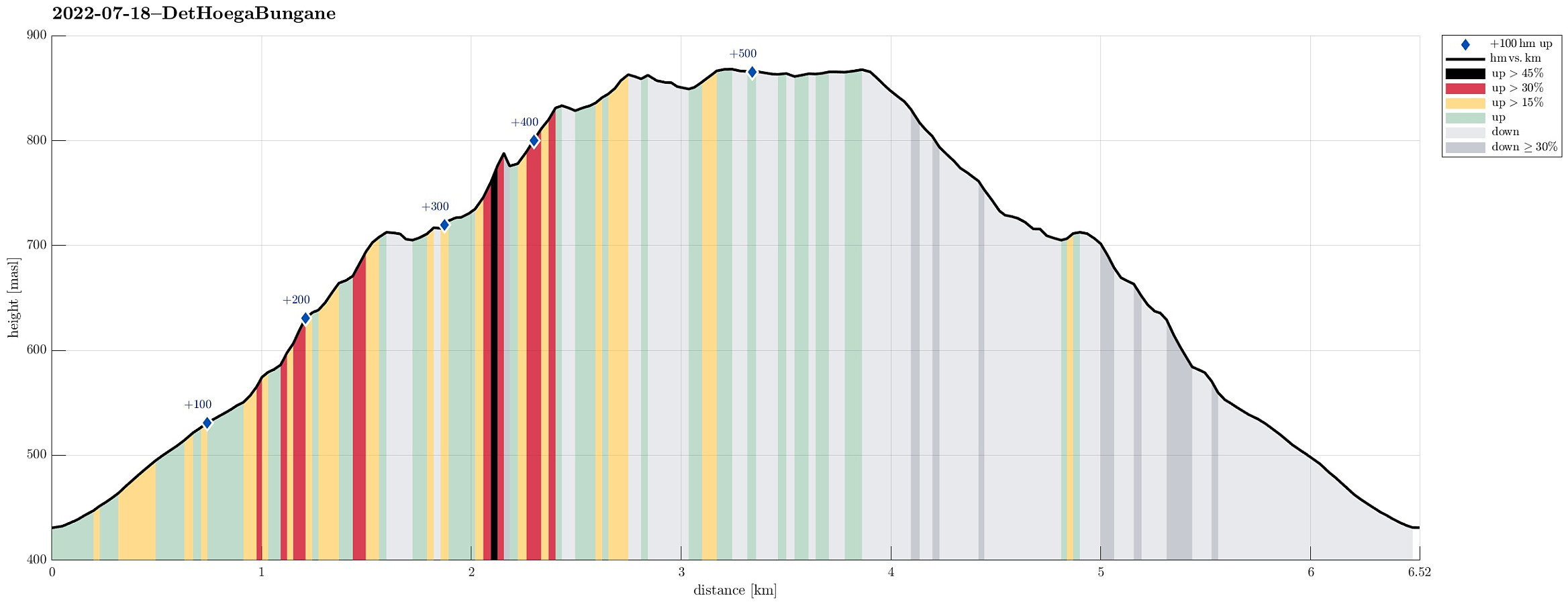 After some driving, we ended up in Lavik, Eksingedalen, in the early evening. We decided that it was still enough time for a short walk and followed a recommendation from one we had talked to in Lavik, driving up to Haugen in Fagerdalen, just northeast of Lavik. From there, we started walking, reaching Lavikstølen at the end of the gravel road leading up there from Haugen. At Lavikstølen, we still wished to include a bit more and so we continued along a trail that leads upwards (in western direction) from Lavikstølen. First, we thought that this trail would lead up to Nipa, just to find out rather quickly that the trail tended more and more into southwestern direction, instead. Once above 700mosl, it became clear that this trail would lead around some pronounced cliffs in the south >>>
Kanadaskogen with Storhovden
- Date:
- 02.07.2022
- Characteristic:
- Walk
- Duration:
- 2:30h
- Distance:
- 8.0km
 One of many rounds through Kanadaskogen, starting along Gjeddevatnet, also including Fureneset, this time, and then continuing to Bjørndalsvatnet and further to Svartatjørna. On our way back, we included Storhovden and Syningen, then passing by Stora Krokatjørna.
Selected photos are available as Google photo album .
See also the related FB-page Hiking around Bergen, Norway .
One of many rounds through Kanadaskogen, starting along Gjeddevatnet, also including Fureneset, this time, and then continuing to Bjørndalsvatnet and further to Svartatjørna. On our way back, we included Storhovden and Syningen, then passing by Stora Krokatjørna.
Selected photos are available as Google photo album .
See also the related FB-page Hiking around Bergen, Norway .
Søtefjellet from Hausdalen via Åsen
- Date:
- 25.06.2022
- Characteristic:
- Hike
- Duration:
- 4:00h
- Distance:
- 10.4km
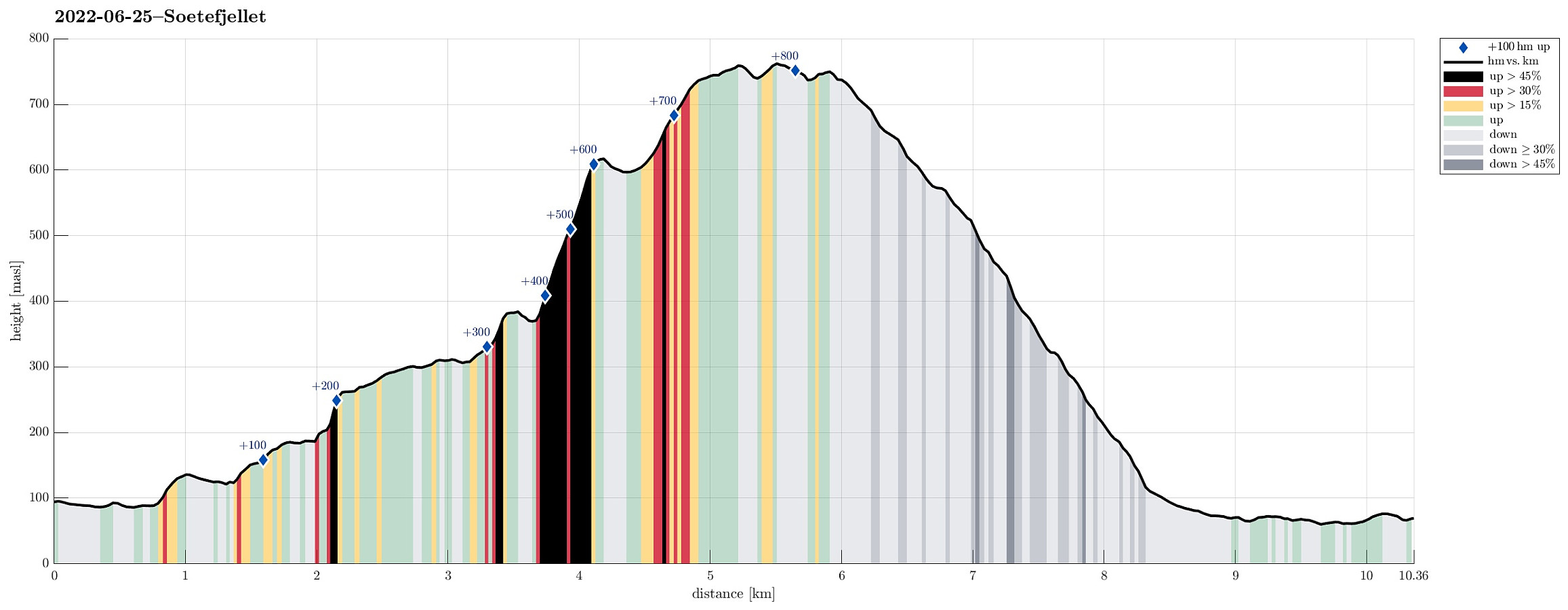 We exploited the situation of having two cars to cut short a few kilometers on the road through Samdalen. After passing by Kalandsvatnet along E39 in the south of Bergen, we turned left at Kalandseidet to continue further into Hausdalen. Right before coming to Tømmervika of Samdalsvatnet, we left one car where a forest road comes down to Hausdalsvegen. With the other car, we then continued all the way in to the end of Hausdalsvegen, where we parked at the parking spot. Given our plan to ascend Søtefjellet via Åsen, we had planned to cross Hausdalselva using a simple bridge at Hausdalen, just a few meters back along the "main road". Getting there, however, we found a sign that informed us that crossing over there was only possible with the consent of the land owner. Luckily, >>>
Høgafjellet (and Hikletten) from Lonadalen
- Date:
- 05.06.2022
- Characteristic:
- Hike
- Duration:
- 5:30h
- Distance:
- 17.7km
 Very nice round including Høgafjellet on Osterøy, starting from its south, i.e., Lonadalen. Using Osterøybrua to conveniently cross over to Osterøy, we turn right before entering the tunnel, driving to Bruvik from there. Leaving the fjord there, we ascended to the saddle in the north of Bruvik (and in the east of Brøknipa) to connect to the interior of Osterøy along road 5418. Before getting all the way down to the large lakes in the middle of Osterøy, we turned right, entering a gravel road that would bring us to Lonadalen, passing by Sagatjørna, Midtvatnet, and Blomdalsvatnet. Near the saddle in Lonadalen, where also the trail from Høgafjellet comes down, we parked and started our hike in northeastern direction, following Lonadalen a bit further, first. At Midttun, we passed >>>
Kanadaskogen from Varden
- Date:
- 28.05.2022
- Characteristic:
- Hike
- Duration:
- 1:30h
- Distance:
- 4.6km
 Walk through Kanadaskogen from Varden, including Hesjaholten. After first passing by Gjeddevatnet at Skaget, we crossed over some minor hills in northern direction, coming close to Bjørndalsvatnet (but not descending all the way down to it, this time). North of Hesjaholten, we then ascended to one of the small cliffs using a narrow gully in southwards direction. We then included also a neighboring cliff (a little further towards the northeast), before heading back into the direction of Varden, including Hesjaholten along the way. It's definitely possible to experience small but nice micro-adventures in Kanadaskogen! :-)
Selected photos are available as Google photo album .
See also the related FB-page Hiking around Bergen, Norway .
Walk through Kanadaskogen from Varden, including Hesjaholten. After first passing by Gjeddevatnet at Skaget, we crossed over some minor hills in northern direction, coming close to Bjørndalsvatnet (but not descending all the way down to it, this time). North of Hesjaholten, we then ascended to one of the small cliffs using a narrow gully in southwards direction. We then included also a neighboring cliff (a little further towards the northeast), before heading back into the direction of Varden, including Hesjaholten along the way. It's definitely possible to experience small but nice micro-adventures in Kanadaskogen! :-)
Selected photos are available as Google photo album .
See also the related FB-page Hiking around Bergen, Norway .
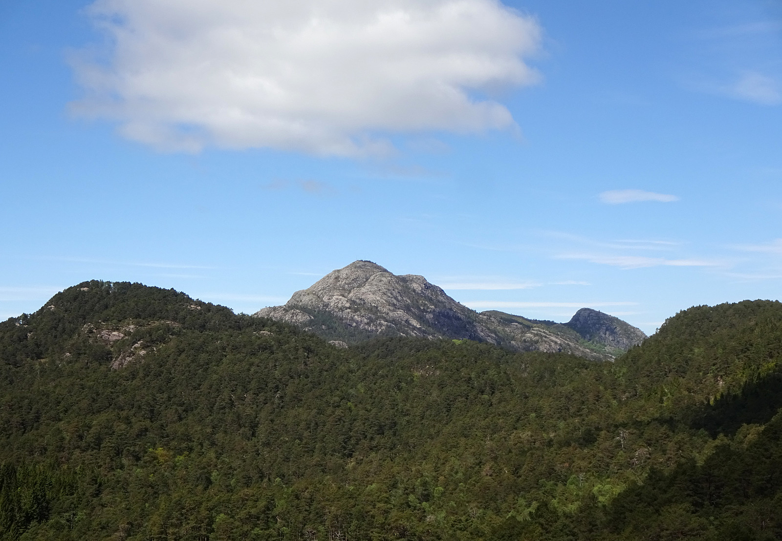
Knappen from Varden
- Date:
- 21.05.2022
- Characteristic:
- Walk
- Duration:
- 1:30h
- Distance:
- 4.6km
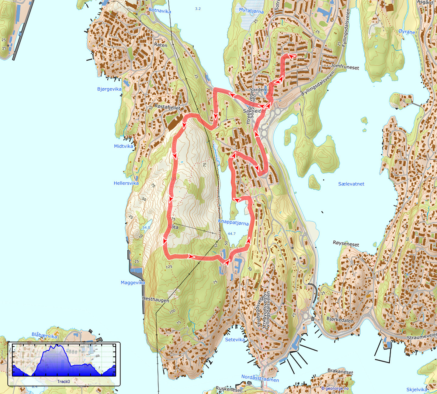 Just a standard walk over Knappen from Varden.
See also the related FB-page Hiking around Bergen, Norway .
Petter Bjørstad has a useful page about Knappen .
Web page UT.no from the Norwegian Trekking Association recommends another hike to Knappen .
Just a standard walk over Knappen from Varden.
See also the related FB-page Hiking around Bergen, Norway .
Petter Bjørstad has a useful page about Knappen .
Web page UT.no from the Norwegian Trekking Association recommends another hike to Knappen .
