Archive - Date
Archive - Activity
-
Bike trip (137)
- Bike trip - mixed (51)
- Bike trip - road (9)
-
Other trip (1)
- Kayaking (1)
-
Other winter trip (4)
- Snowshoe trip (4)
- Ski trip (4)
- Trip by foot (740)
Archive - Geography
Peakbook-Friends


Collected lists
-
Bergen ≥ 50m pf. og ≥ 100 m.o.h.
(87/89)
 97%
97% -
Most dominating tops of the Bergen peninsula
(68/75)
90%
-
Utvalgte topper og turmål i Bergen
(316/350)
90%
-
Alle topper i Bergen
(357/398)
89%
-
Opptur Bergen
(100/113)
88%
-
De syv fjell rundt Bergen
(6/7)
85%
-
Sund ≥ 50m pf.
(14/18)
77%
-
Os ≥ 50m pf.
(25/34)
73%
-
Søyler (fastmerker) i Bergen
(68/100)
68%
-
Fjell ≥ 50m pf.
(21/32)
65%

Katlaberget
- Date:
- 21.10.2017
- Characteristic:
- Hillwalk
- Duration:
- 2:00h
- Distance:
- 4.5km
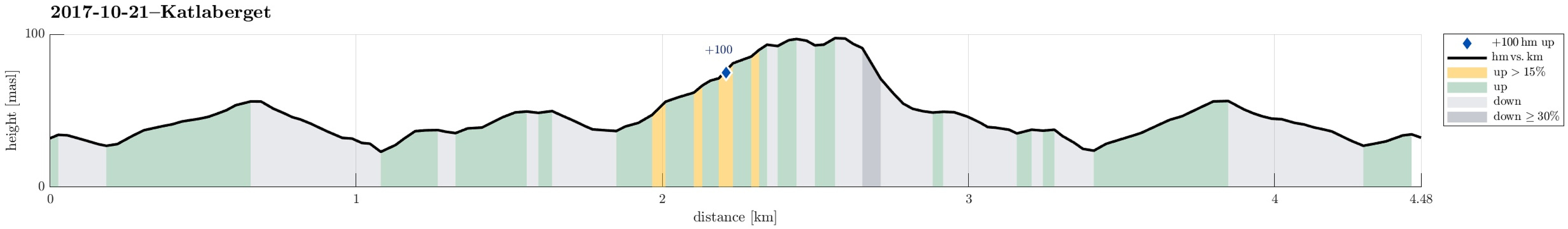 We started this little hike on Ferstadvegen in Os, south of Bergen. First we followed the road, which winds left and right into an overall southeastern direction. After a few turns of the road, one can find the first sign, which invites to leave the road and ascend to Katlaberget on a proper path. After all, this would be the spot, where we later come back to the road after our little round over Katlaberget. To actually make this a round, we first continued on the road even further, now going a bit down towards the sea. About two major turns later, we eventually left the road and followed another path, which also leads to the top of Katlaberget. On Katlaberget, we first enjoyed some views from the actual top, before we then followed "the other" path back. This, actually, brought >>>
Ørnafjellet and Lyderhorn on a lovely autumn day!
- Date:
- 18.10.2017
- Characteristic:
- Hillwalk
- Duration:
- 3:00h
- Distance:
- 7.2km
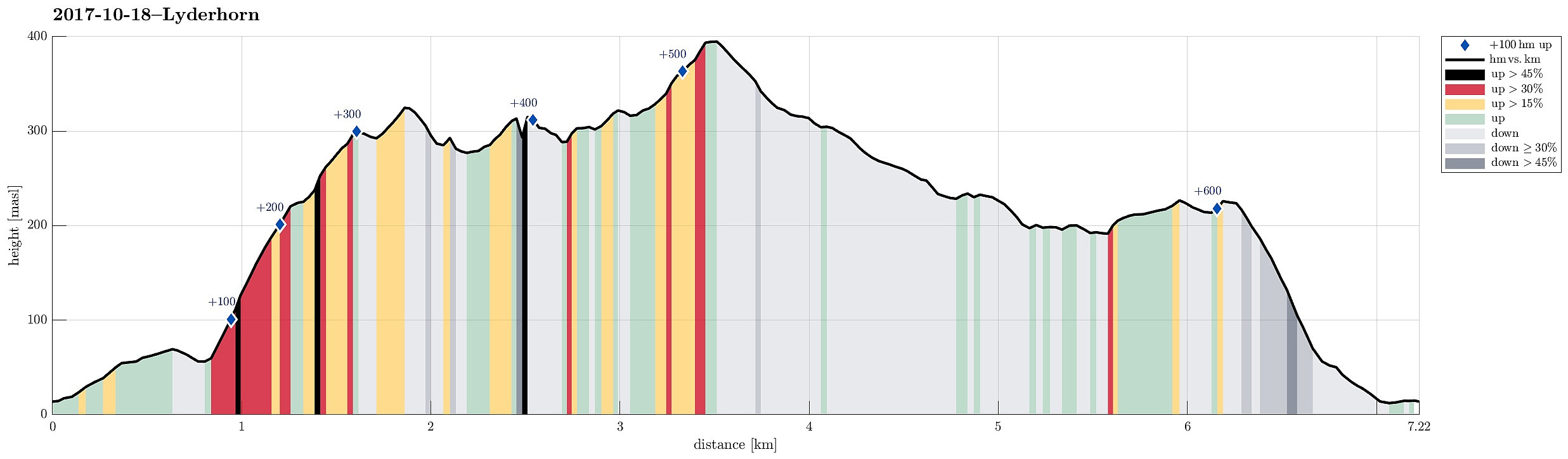 We started at the parking area right next to Gravdalsvatnet and followed first Gravdalsveien upwards in order to find the path that would bring us to Ørnafjellet. After having passed a few new buildings (with an amazing view!), we crossed over some intermediate height to connect to a small place, where a little football field is established. From there, the path upwards to Ørnafjellet starts (in its middle then called "Mørdarbakke"). This path is not used a lot and it is generally wet (and also a bit steep). Quickly, we arrived at the saddle, where we turned left in order to continue to Ørnafjellet. We first crossed over a little hill in front of Ørnafjellet, before we switched over to the northern ridge of Ørnafjellet, ascending to its top along it. Even though Ørnafjellet >>>
