Archive - Date
Archive - Activity
-
Bike trip (137)
- Bike trip - mixed (51)
- Bike trip - road (9)
-
Other trip (1)
- Kayaking (1)
-
Other winter trip (4)
- Snowshoe trip (4)
- Ski trip (4)
- Trip by foot (740)
Archive - Geography
Peakbook-Friends


Collected lists
-
Bergen ≥ 50m pf. og ≥ 100 m.o.h.
(87/89)
 97%
97% -
Most dominating tops of the Bergen peninsula
(68/75)
90%
-
Utvalgte topper og turmål i Bergen
(316/350)
90%
-
Alle topper i Bergen
(357/398)
89%
-
Opptur Bergen
(100/113)
88%
-
De syv fjell rundt Bergen
(6/7)
85%
-
Sund ≥ 50m pf.
(14/18)
77%
-
Os ≥ 50m pf.
(25/34)
73%
-
Søyler (fastmerker) i Bergen
(68/100)
68%
-
Fjell ≥ 50m pf.
(21/32)
65%

Knappen and Løvstakken
- Date:
- 02.06.2016
- Characteristic:
- Hillwalk
- Duration:
- 3:08h
- Distance:
- 17.4km
 I started from Varden and went up Knappen, first. From there, I connected to Bønes, and from up there, further to Gullstølen and Gullsteinen. I then decided to also continue to Løvstakken, before descending back to Fyllingsdalen.
Selected photos are available as Google photo album .
See also the related FB-page Hiking around Bergen, Norway .
Web page WestCoastPeaks.com provides useful information about Løvstakken and also Petter Bjørstad has a useful page about Knappen .
Web page UT.no from the Norwegian Trekking Association recommends this hike (part of it), too.
On Bergentopp 200 there is a page (in Norwegian) about Løvstakken .
I started from Varden and went up Knappen, first. From there, I connected to Bønes, and from up there, further to Gullstølen and Gullsteinen. I then decided to also continue to Løvstakken, before descending back to Fyllingsdalen.
Selected photos are available as Google photo album .
See also the related FB-page Hiking around Bergen, Norway .
Web page WestCoastPeaks.com provides useful information about Løvstakken and also Petter Bjørstad has a useful page about Knappen .
Web page UT.no from the Norwegian Trekking Association recommends this hike (part of it), too.
On Bergentopp 200 there is a page (in Norwegian) about Løvstakken .
Kanadaskogen with Knappen, Svartaberget, etc.
- Date:
- 28.05.2016
- Characteristic:
- Hillwalk
- Duration:
- 3:00h
- Distance:
- 12.6km
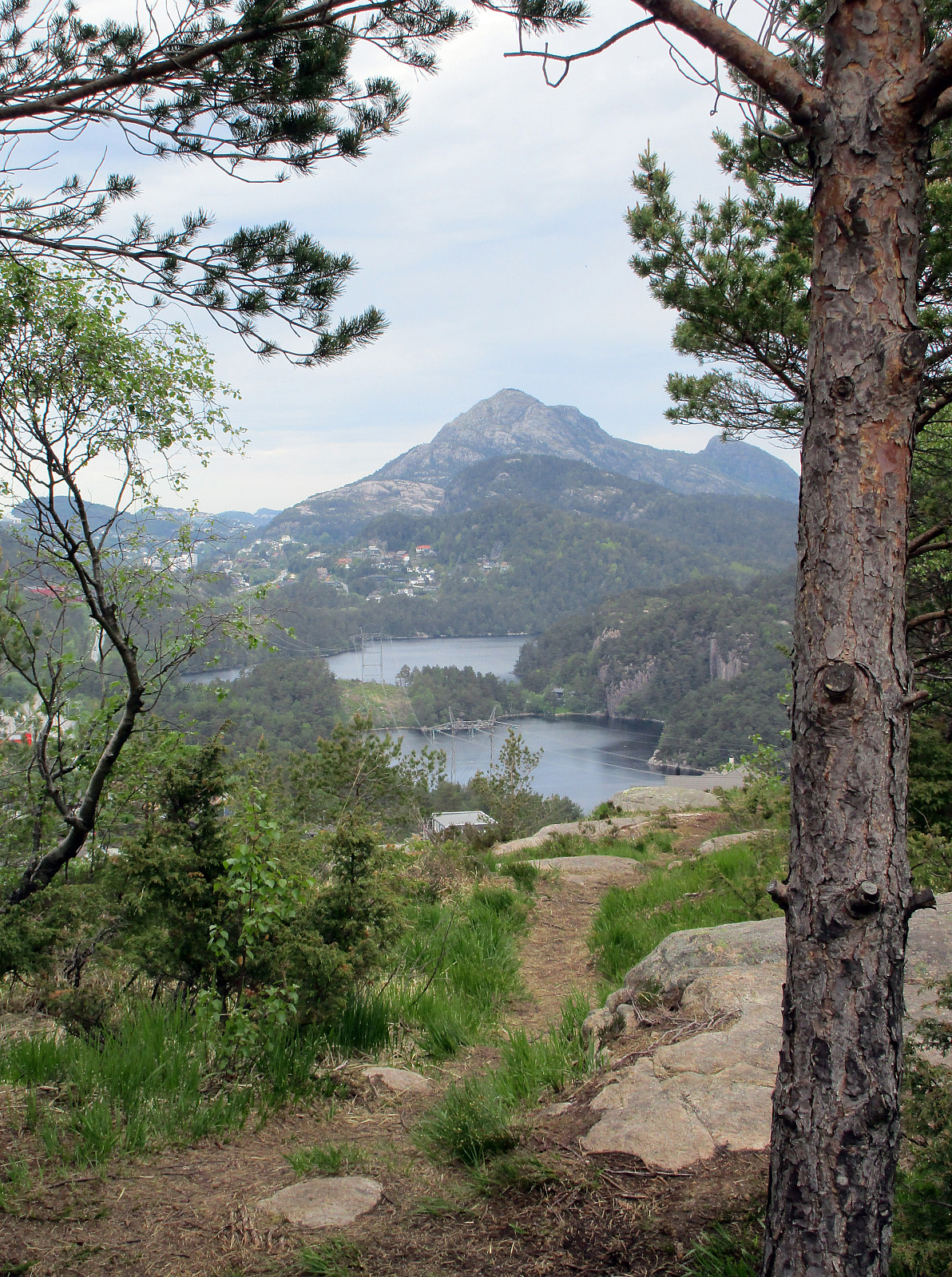 Starting at Varden in Fyllingsdalen, I first got over and up to Knappen (around Knappatjørna). From Knappen, I continued to Eldtona and further over the top and down again to Bjørgelien. Following that street downwards, I got to Bjøgeveien in order to cross over Kjerreidvika to Bjørndalsskogen (right behind the supermarked along Kjerreidvika there is a steep path that leads up to Bjørndalsskogen). I then crossed the living area at Bjørndalsskogen, before ascending to Straumsfjellet, right north of Bjørndalsskogen. From Straumsfjellet, I found a path down to Bjørndalsbrotet, where I crossed underneath Bjørgeveien over to Kanadaskogen. I continued towards Bjørndalsvatnet, first, getting into the green area as soon as possible. Without really entering the path that rounds about >>>
Kristinuten
- Date:
- 16.05.2016
- Characteristic:
- Hillwalk
- Duration:
- 4:00h
- Distance:
- 8.3km
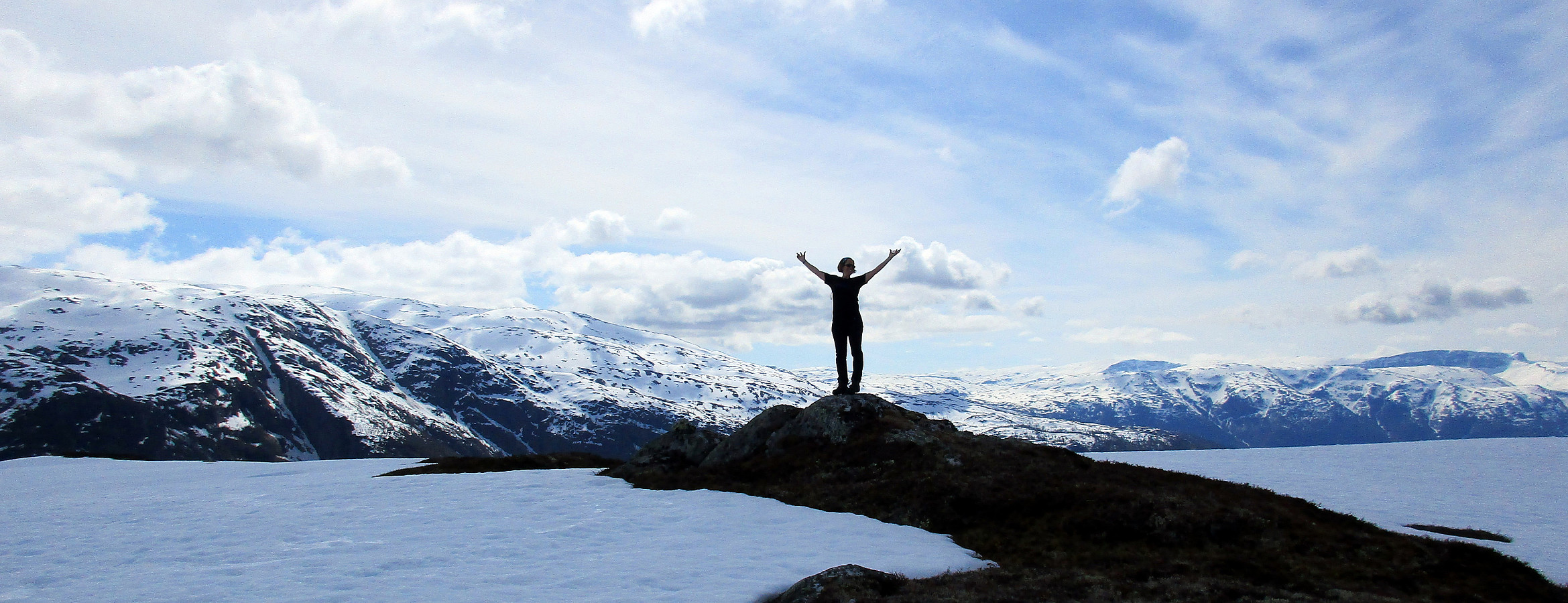 We started from the road between Ulvik and Osa, driving basically to the top of the saddle (between Ulvikafjorden and Osafjorden). There, we continued a little bit further on a side road the passes by Øydve. When getting close to the forrest, we parked and started hiking. The first 300 height meters are convenient on a forrest road that winds back and forth towards Liastølane. Then, one needs to pay attention. A sign ("Kleppe", I think) tells to leave the forrest road and continue along a minor path. This trail is really hard to find---the best tip is to look out for small stones that mark the path. One first ascends further through the forrest before reaching the tree line very soon. From there, it is basically straight up to the top of Kristinuten. It is recommended to >>>
Oksen
- Date:
- 15.05.2016
- Characteristic:
- Hillwalk
- Duration:
- 5:00h
- Distance:
- 9.3km
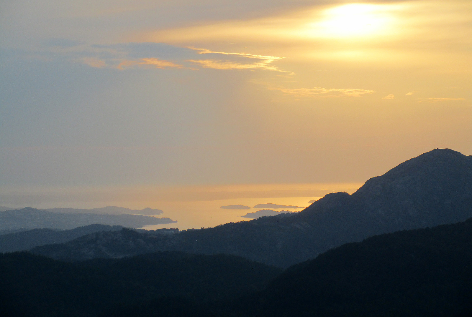
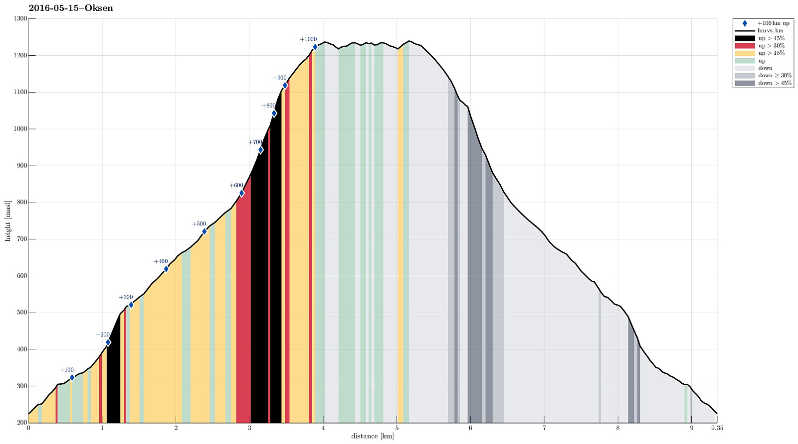 We drove the beautiful road no. 7 into Hardangerfjorden. At Granvin, we connected to the road that comes down from Voss, turning right (into the direction of the new Hardanger-bridge and Ulvik, etc.). We passed the long tunnel (about 8 km), continued towards Ulvik (not up to the bridge) and turned right into a small road right after the tunnel (this place is not completely obvious and paying a little extra attention right after the tunnel helps). From there, we drove (in a way back ) all the way out to the tip of the peninsula on which Oksen is the last mountain. The end of the road (and the starting point for hiking) is Tjoflot. There, one can drive a bit up (passing the farms there) and find a parking spot right after entering the forrest. From there (at about 230 meters over the sea >>>
Ulriken via Isdalen
- Date:
- 14.05.2016
- Characteristic:
- Hillwalk
- Duration:
- 3:30h
- Distance:
- 10.2km
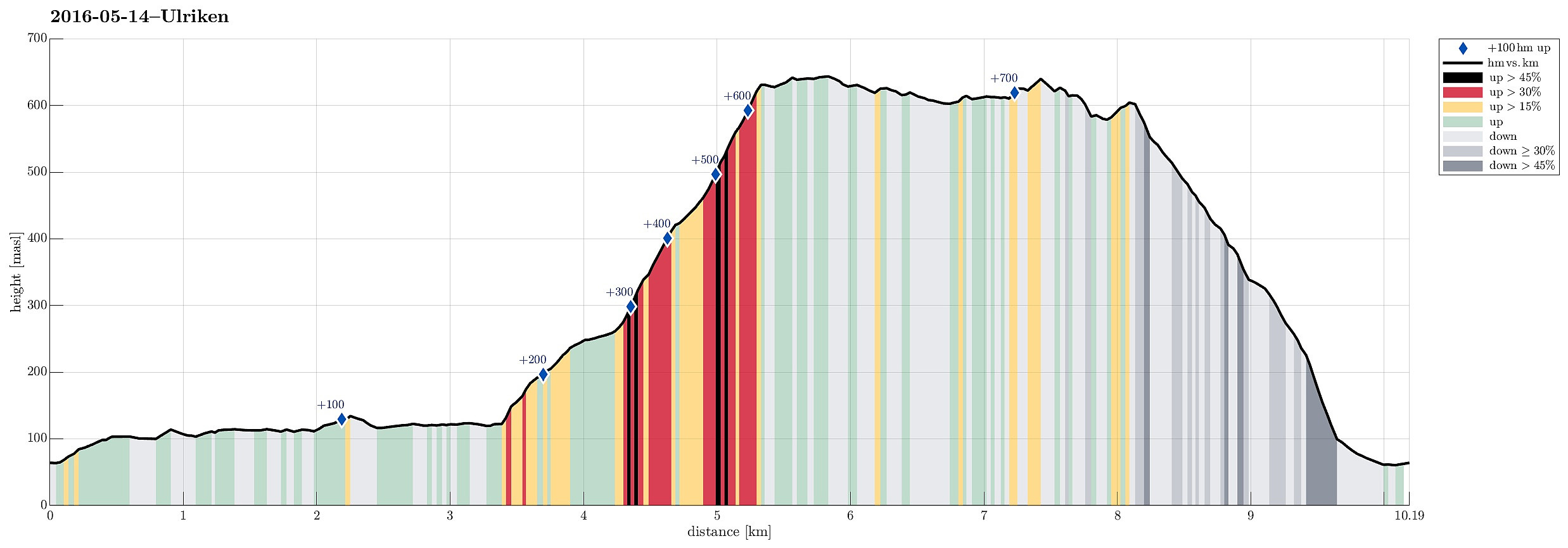 We parked right next to the big dam that holds Svartediket back and started walking along the northern side of Svartediket from there. Instead of following the main trail (up to the left) at the end of Svartediket, we continued along Tarlebøveien, crossing a small stream at the very back of the valley and turning right (in southern direction) there. Following the forrest road further, one starts to circle around Svartediket. After a short stretch, one comes to another small bridge, which crosses the stream that jumps down through Isdalen. Right there, not very well visible, though, one needs to turn left (steeply up) and find the trail that then continues through Isdalen. While the trail head (next to the bridge) is not easy to see, the path then becomes very well visible and easy to >>>
Liatårnet
- Date:
- 13.05.2016
- Characteristic:
- Hillwalk
- Duration:
- 2:00h
- Distance:
- 5.1km
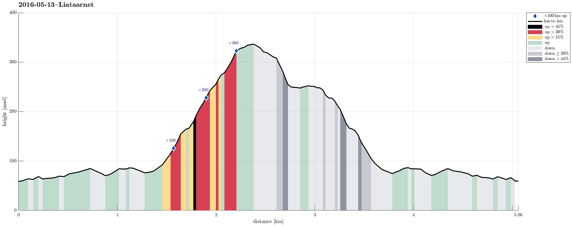 We parked on the western side of Liatårnet, a few kilometers south of Fjell, where one is also informed about nearby Fjellfestningen. From there, one first follows a paved forrest road towards Liatårnet, passing by Bålesteinen, then turning right. The trail to Liatårnet leave the paved road (to the right) near a shooting arena and right next to a simple building. Then the path leads (more or less) straight up to Liatårnet (easy to find). It was a nice evening, but quite a bit windy (especially on the top)! To get back, we continued from Liatårnet southwards, descending steeply into a wet area about 100 height meters below Liatårnet. In order to get back to the paved road (further down and to the northwest from this place), one needs to look very carefully for a trail (if there >>>
Cycling around Copenhagen
- Date:
- 06.05.2016
- Characteristic:
- Bike trip
- Duration:
- 6:00h
- Distance:
- 63.6km
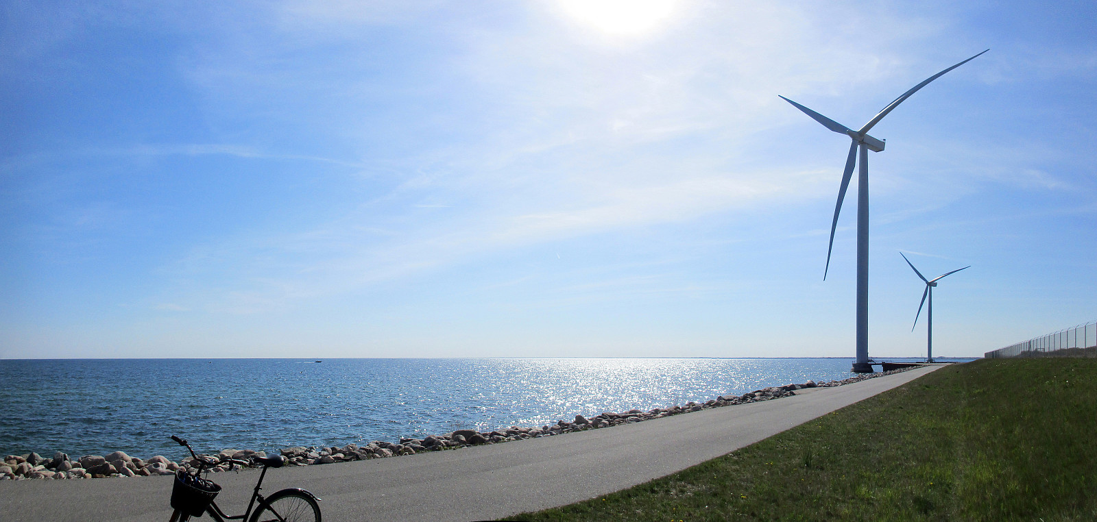 We started directly from WakeUpCopenhagen with the bikes that we had rented from there the day before. Our first goal, Utterslev Mose, is towards the northwest from Copenhagen center, so we cycled towards Nørreport, first. At Søerne (The Lakes!), we cycled them up and down once---more, because we were unsure, first, of where to continue, but then also to enjoy this nice area! :-) After that, we followed Tagensvej towards Bispebjerg. At the graveyard of Bispebjerg, we got to see the impressive church Grundtvigskirken, reminding us strongly of the also impressive church in Reykjavík, Iceland. From there, we continued towards Utterslev Mose, a nice recreational area, previously part of the defense system of Copenhagen. There, we met the cycling path #9, which continues along Vestvolden---an >>>
Copenhagen-Humlebæk-Copenhagen
- Date:
- 05.05.2016
- Characteristic:
- Bike trip
- Duration:
- 6:00h
- Distance:
- 71.8km
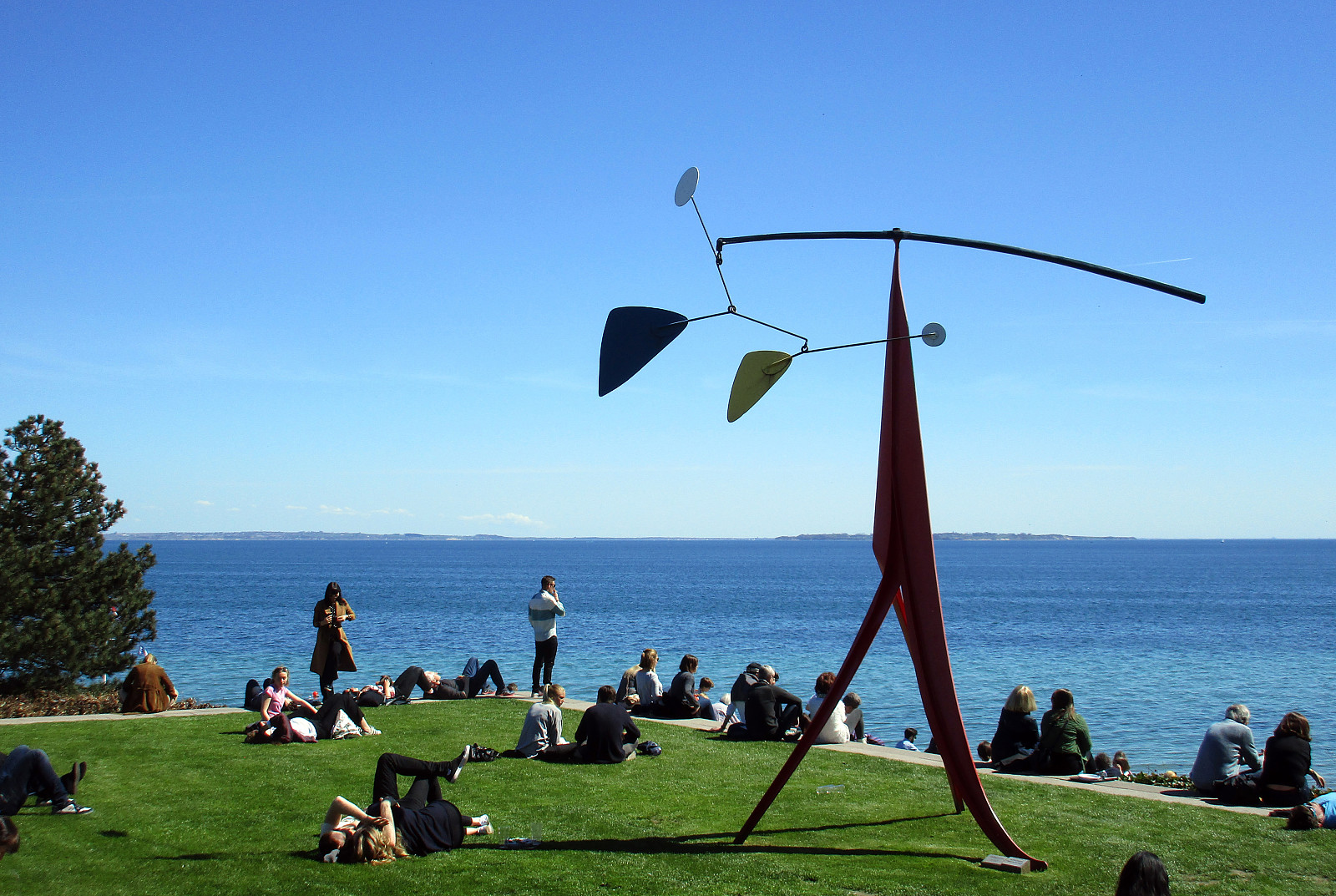 We had a room in WakeUpCopenhagen (Borgergade) and rented bikes---typical Danish bikes with three gears---from there. We headed first towards Kastellet and aimed then at Strandvejen, which leads all the way towards the north. Cycling in Copenhagen, Denmark, is really great: lots of space for cyclists, not much up and down---nice and easy! :-) Near the Tuborg factory, we met the cycling path #9, which connects to the north along Strandvejen. Cycling along Strandvejen is nice with lots of great views over the sea to the east. At Skodsborg, we should have understood that cycling path #9 is continuing in parallel to Strandvejen---a little further away from the sea. Instead, we continued along Strandvejen, which was OK, but a little less fun, since no cycling path is available at this stretch. >>>
Møsnuken
- Date:
- 17.04.2016
- Characteristic:
- Hillwalk
- Duration:
- 5:00h
- Distance:
- 11.8km
 We took road E39 southwards from Bergen, passing by Kalandsvatnet and driving all the way to Ulven (near Os), where we turned left (right next to a gas station), finding the small road connecting to Tyssdal. On the other side of Oselva, near the point, where Tyssdalselva is coming down from Møsnuken, we found a parking place and started to hike from there. Since we wished to start with Borgafjellet, this time, we first tried to connect to the gravel road that connects Tyssdal with Os (right next to Oselva, on its eastern side). We could have done this "the easy way" :-) -- instead, we walked up to the houses on the hillside south of Tyssdal. Up there, we understood that we were too high and descended the few meters down to the gravel road through the forest. Following the gravel >>>
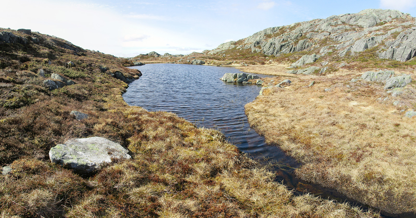
Tveitafjellet
- Date:
- 16.04.2016
- Characteristic:
- Hillwalk
- Duration:
- 2:00h
- Distance:
- 6.3km
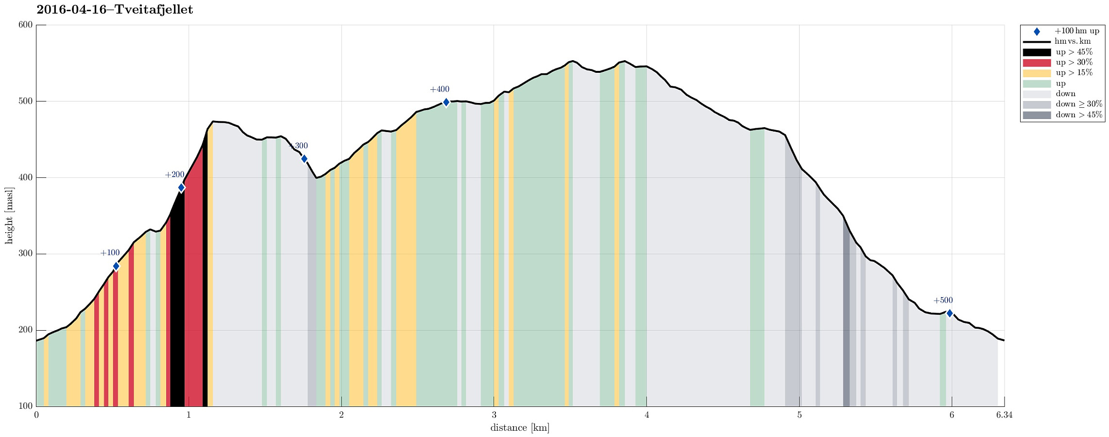 We were driving to Osterøy near Bergen and on Osterøy further, first to Lonevåg and then to Hosanger. There, we turned right (into the direction of Kossdalen, actually!), but continued a small road upwards on the Eastern side of the valley until we came to the junction, where one road continues to the left (up to Åsheim) and the other goes to the right (up to Tveiten). From there, we started hiking, first following the road up to Åsheim. The path up to Åsheimveten leaves from the road to the right (near the houses of Åsheim)---it's good to not follow the temptation of hiking along the path to Tveitafjellet, which is well marked a little underneath the houses. Once on the right path, it's quick and straight-forward to hike up Åsheimveten, which offers fantastic views of Osterfjorden >>>
