Archive - Date
Archive - Activity
-
Bike trip (137)
- Bike trip - mixed (51)
- Bike trip - road (9)
-
Other trip (1)
- Kayaking (1)
-
Other winter trip (4)
- Snowshoe trip (4)
- Ski trip (4)
- Trip by foot (740)
Archive - Geography
Peakbook-Friends


Collected lists
-
Bergen ≥ 50m pf. og ≥ 100 m.o.h.
(87/89)
 97%
97% -
Most dominating tops of the Bergen peninsula
(68/75)
90%
-
Utvalgte topper og turmål i Bergen
(316/350)
90%
-
Alle topper i Bergen
(357/398)
89%
-
Opptur Bergen
(100/113)
88%
-
De syv fjell rundt Bergen
(6/7)
85%
-
Sund ≥ 50m pf.
(14/18)
77%
-
Os ≥ 50m pf.
(25/34)
73%
-
Søyler (fastmerker) i Bergen
(68/100)
68%
-
Fjell ≥ 50m pf.
(21/32)
65%

Liatårnet
- Date:
- 09.05.2013
- Characteristic:
- Hillwalk
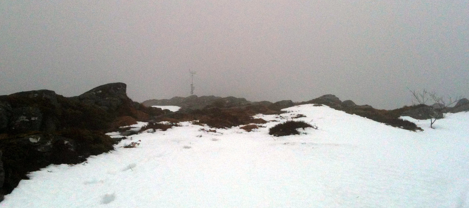
 Starting from Nordre Ekrhovda, it's easy and straight-forward -- for almost everyone! -- to get up Pyttane, following the access road to the radar stations.
Web page WestCoastPeaks.com provides useful information about Liatårnet
and also Petter Bjørstad has a useful page about Liatårnet .
Starting from Nordre Ekrhovda, it's easy and straight-forward -- for almost everyone! -- to get up Pyttane, following the access road to the radar stations.
Web page WestCoastPeaks.com provides useful information about Liatårnet
and also Petter Bjørstad has a useful page about Liatårnet .
Hike around Fyllingsdalen
- Date:
- 05.05.2013
- Characteristic:
- Hillwalk
- Duration:
- 5:00h
- Distance:
- 21.7km
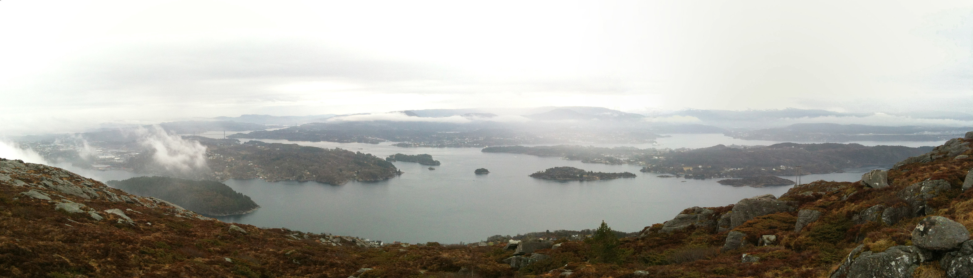
 In not the very best weather, a longer tour all around Fyllingsdalen!
Selected photos are available as Google photo album .
Web page WestCoastPeaks.com provides useful information about Løvstakken as well as useful information about Olsokfjellet, Gravdalsfjellet, and Damsgårdsfjellet .
In not the very best weather, a longer tour all around Fyllingsdalen!
Selected photos are available as Google photo album .
Web page WestCoastPeaks.com provides useful information about Løvstakken as well as useful information about Olsokfjellet, Gravdalsfjellet, and Damsgårdsfjellet .
Liatårnet
- Date:
- 01.04.2013
- Characteristic:
- Hillwalk
 Quick and nice hike up Pyttane -- Liatårnet is always good for a nice hike! :-)
Web page WestCoastPeaks.com provides useful information about Liatårnet
and also Petter Bjørstad has a useful page about Liatårnet .
Quick and nice hike up Pyttane -- Liatårnet is always good for a nice hike! :-)
Web page WestCoastPeaks.com provides useful information about Liatårnet
and also Petter Bjørstad has a useful page about Liatårnet .
Jogging around Nordåsvatnet
- Date:
- 24.03.2013
- Characteristic:
- Jogging
- Duration:
- 2:23h
- Distance:
- 22.3km
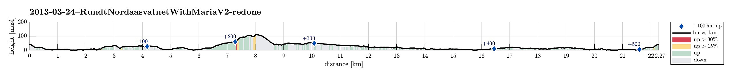 Jogging around Nordåsvatnet -- a longer round!
Varden-Sælen jogging
- Date:
- 17.03.2013
- Characteristic:
- Jogging
- Duration:
- 0:30h
- Distance:
- 4.8km
 Short jogging round with kids! :-)
Fyllingsdalen jogging
- Date:
- 16.03.2013
- Characteristic:
- Jogging
- Duration:
- 1:40h
- Distance:
- 14.8km
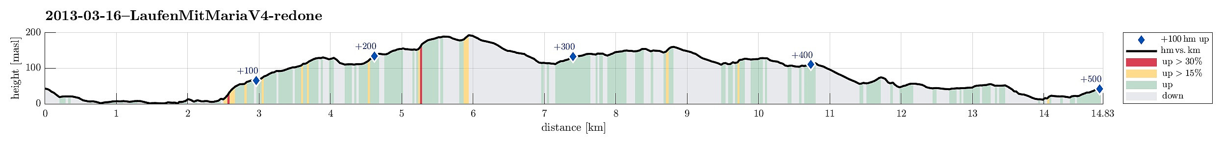 Jogging around Fyllingsdalen (middle-long).
Lyderhorn
- Date:
- 10.03.2013
 Nice hike up and down Lyderhorn.
Selected photos are available as G+ photo album .
Nice hike up and down Lyderhorn.
Selected photos are available as G+ photo album .
Hausdalshorga and Austefjellet
- Date:
- 24.02.2013
- Characteristic:
- Hillwalk
- Duration:
- 3:00h
- Distance:
- 9.8km
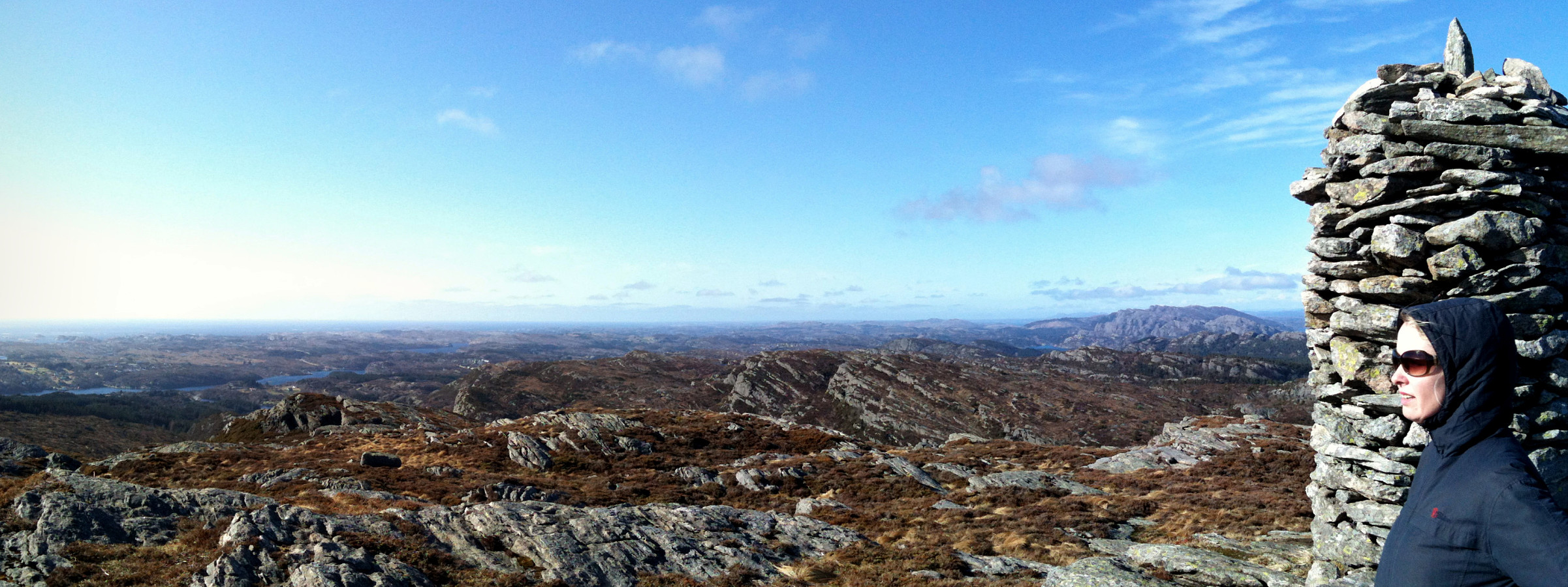
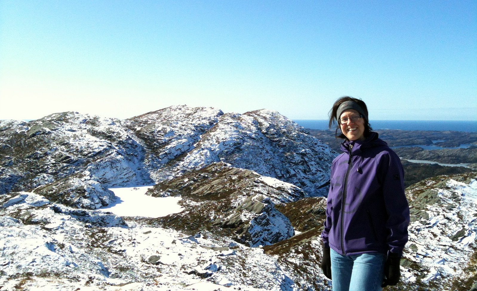
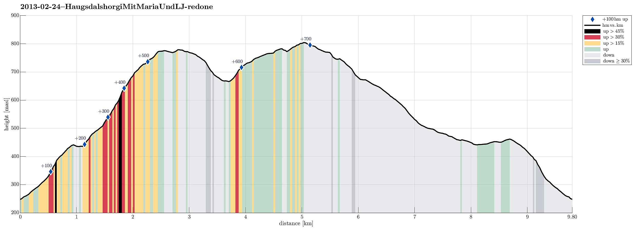 Starting from Stallen (after having driven there via Bontveit from Bergen), we first went up towards Dyrdalsvatnet. After having reached the height of it (~435moh), we crossed the little stream which comes down from Dyrdalsvatnet and continued up towards Hausdalshorgi. It's a really nice hike over the ridge with great views towards West, but in Winter it was non-trivial (quite steep, very hard snow -- not ideal!). From Hausdalshorgi, we continued towards Austefjellet -- a really nice hike! From Austefjellet, we went first towards north-west, before turning back left and down (towards Dyrdalsvatnet). Passing by it, we get back to our starting point.
Selected photos are available as Google photo album .
Web page WestCoastPeaks.com provides useful information about Hausdalshorga
and also Petter Bjørstad has a useful page about Hausdalshorga .
Starting from Stallen (after having driven there via Bontveit from Bergen), we first went up towards Dyrdalsvatnet. After having reached the height of it (~435moh), we crossed the little stream which comes down from Dyrdalsvatnet and continued up towards Hausdalshorgi. It's a really nice hike over the ridge with great views towards West, but in Winter it was non-trivial (quite steep, very hard snow -- not ideal!). From Hausdalshorgi, we continued towards Austefjellet -- a really nice hike! From Austefjellet, we went first towards north-west, before turning back left and down (towards Dyrdalsvatnet). Passing by it, we get back to our starting point.
Selected photos are available as Google photo album .
Web page WestCoastPeaks.com provides useful information about Hausdalshorga
and also Petter Bjørstad has a useful page about Hausdalshorga .
Lyderhorn
- Date:
- 23.02.2013
- Characteristic:
- Hillwalk
- Duration:
- 1:30h
- Distance:
- 5.6km
 Nice winter hike up Lyderhorn! :-)
Web page WestCoastPeaks.com provides useful information about Lyderhorn and Ørnafjellet
and also Petter Bjørstad has a page about Lyderhorn .
Nice winter hike up Lyderhorn! :-)
Web page WestCoastPeaks.com provides useful information about Lyderhorn and Ørnafjellet
and also Petter Bjørstad has a page about Lyderhorn .
