Archive - Date
Archive - Activity
-
Bike trip (137)
- Bike trip - mixed (51)
- Bike trip - road (9)
-
Other trip (1)
- Kayaking (1)
-
Other winter trip (4)
- Snowshoe trip (4)
- Ski trip (4)
- Trip by foot (740)
Archive - Geography
Peakbook-Friends


Collected lists
-
Bergen ≥ 50m pf. og ≥ 100 m.o.h.
(87/89)
 97%
97% -
Most dominating tops of the Bergen peninsula
(68/75)
90%
-
Utvalgte topper og turmål i Bergen
(316/350)
90%
-
Alle topper i Bergen
(357/398)
89%
-
Opptur Bergen
(100/113)
88%
-
De syv fjell rundt Bergen
(6/7)
85%
-
Sund ≥ 50m pf.
(14/18)
77%
-
Os ≥ 50m pf.
(25/34)
73%
-
Søyler (fastmerker) i Bergen
(68/100)
68%
-
Fjell ≥ 50m pf.
(21/32)
65%

Sydpolen
- Date:
- 23.08.2013
- Characteristic:
- Hillwalk
- Duration:
- 3:00h
- Distance:
- 13.3km
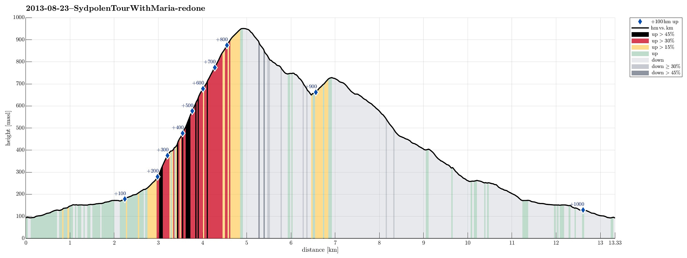 Great quick evening walk from Brekkjedalen, up Sydpolen and then down again (via Toro) -- great walk-out in fantastic nature! :-)
Selected photos are available as Google photo album .
Web page WestCoastPeaks.com provides useful information about S. Gullfjellstoppen (Sydpolen)
and also Petter Bjørstad has a useful page about Sydpolen .
Great quick evening walk from Brekkjedalen, up Sydpolen and then down again (via Toro) -- great walk-out in fantastic nature! :-)
Selected photos are available as Google photo album .
Web page WestCoastPeaks.com provides useful information about S. Gullfjellstoppen (Sydpolen)
and also Petter Bjørstad has a useful page about Sydpolen .
Olsokfjellet
- Date:
- 17.08.2013
- Characteristic:
- Hillwalk
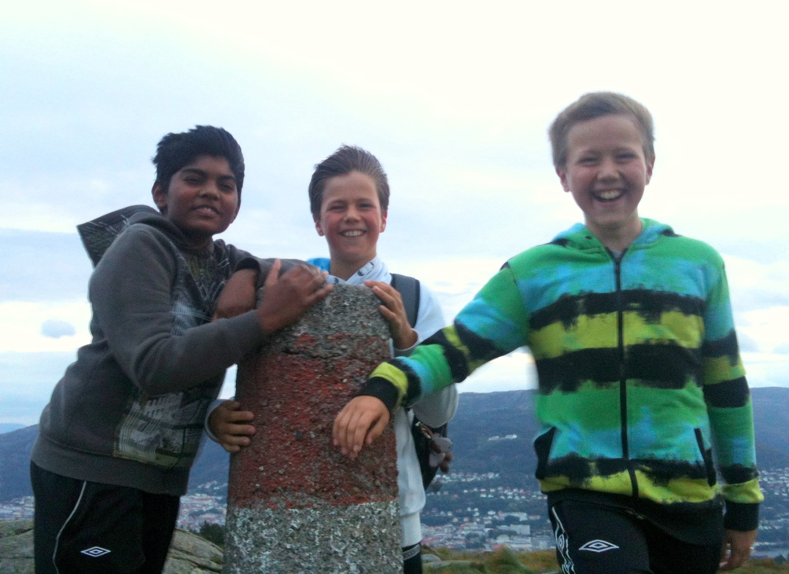 Quick hike with three boys in rough weather -- was that even at a storm's strength on the top? :-)
Ustetinden
- Date:
- 15.08.2013
- Characteristic:
- Hillwalk
- Duration:
- 4:00h
- Distance:
- 12.0km
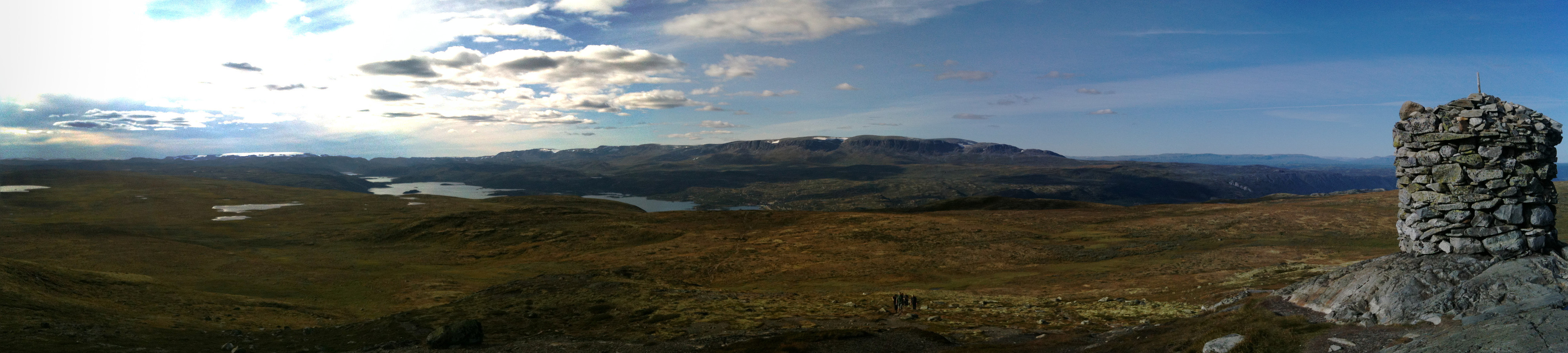 Nice and easy tour from Ustaoset to Ustetinden (and back) -- the top stands out surprisingly from its surrounding, still this enjoyable hike is very easy!
Brekkedalen
- Date:
- 19.07.2013
- Characteristic:
- Hike
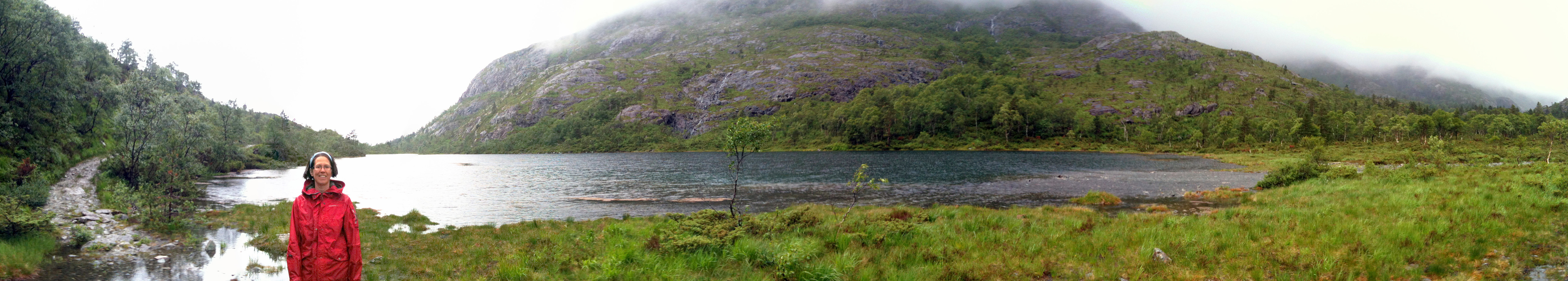 Training walk (after my knee operation) up and down Brekkedalen (turning around at Stora Brekkevatnet) -- not really a hillwalk, this hike, but good for a first training (Brekkedalen is really a nice place to visit, so or so)!
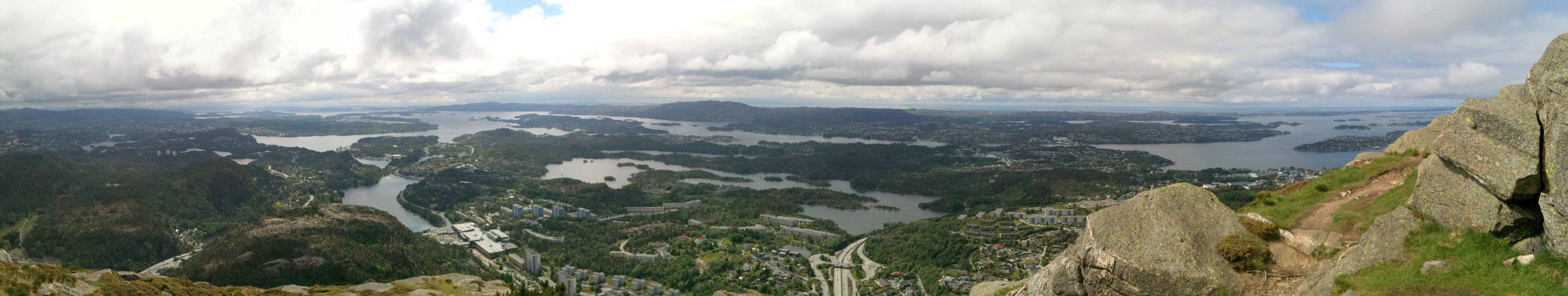
Gullfjellet
- Date:
- 09.06.2013
- Characteristic:
- Hillwalk
- Duration:
- 4:30h
- Distance:
- 13.8km
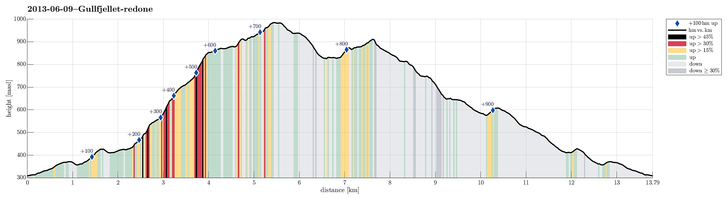 Great hike from Osavatnet (315m) to Gullfjelltoppen (987m) with the boys and then down, again, via Redningshytten. The ascent via Ronamanen (leaving the main track, which would connect to Redningshytten from Osacatnet, a few meters above Svartavatnet to the left, then along Småhaugane and up the ridge, passing Markskilfossen) is really a good alternative to the main "Autobahn" up Gullfjellet! :-)
Lyderhorn
- Date:
- 08.06.2013
- Characteristic:
- Hillwalk
 Quick and rewarding hike up and down Lyderhorn (from Kjøkkelvik skole) -- not the "main" route, but right north of it, quite steeply (the starting point if behind the higher buildings up in Olderdalen).
Web page WestCoastPeaks.com provides useful information about Lyderhorn and Ørnafjellet
and also Petter Bjørstad has a page about Lyderhorn .
Quick and rewarding hike up and down Lyderhorn (from Kjøkkelvik skole) -- not the "main" route, but right north of it, quite steeply (the starting point if behind the higher buildings up in Olderdalen).
Web page WestCoastPeaks.com provides useful information about Lyderhorn and Ørnafjellet
and also Petter Bjørstad has a page about Lyderhorn .
Jogging in Hordnesskogen and then up Stendafjellet
- Date:
- 01.06.2013
- Characteristic:
- Jogging
- Duration:
- 1:30h
- Distance:
- 13.2km
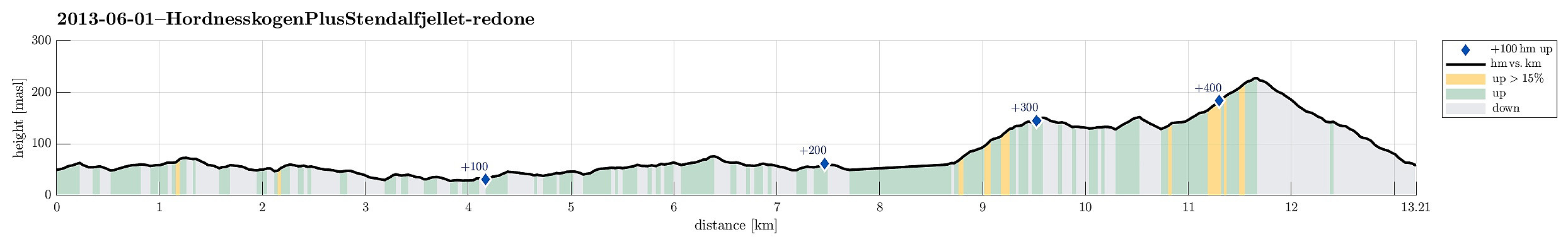 Jogging in Hordnesskogen and then up Stendafjellet -- not the shortest run! :-)
Sydpolen
- Date:
- 26.05.2013
- Characteristic:
- Hillwalk
- Duration:
- 3:00h
- Distance:
- 12.0km
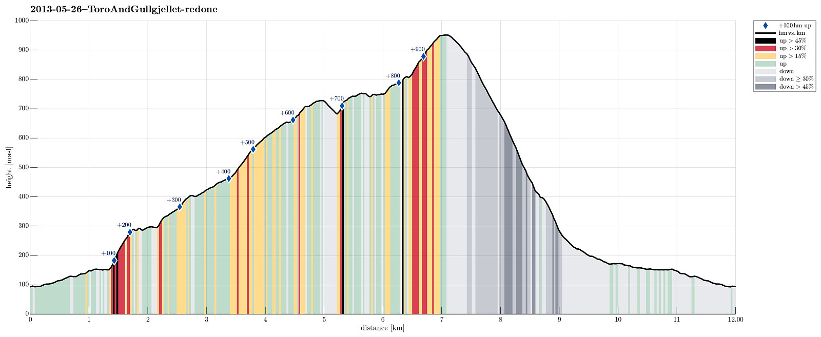 Starting from the end of Hausdalen, first a bit through Brekkedalen, then up to Toro, before continuing to Sydpolen -- a really great tour!
Web page WestCoastPeaks.com provides useful information about S. Gullfjellstoppen (Sydpolen)
and also Petter Bjørstad has a useful page about Sydpolen .
Starting from the end of Hausdalen, first a bit through Brekkedalen, then up to Toro, before continuing to Sydpolen -- a really great tour!
Web page WestCoastPeaks.com provides useful information about S. Gullfjellstoppen (Sydpolen)
and also Petter Bjørstad has a useful page about Sydpolen .
Siggjo
- Date:
- 20.05.2013
- Characteristic:
- Hillwalk
- Duration:
- 2:00h
- Distance:
- 5.1km
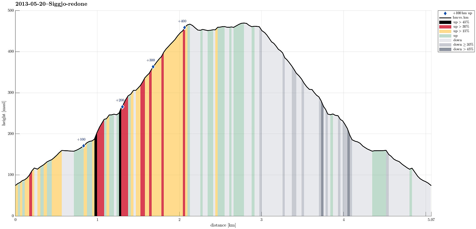 Very nice morning hike (from Idlestigen up Siggjo and down again) -- really a nice mountain (standing quite alone and prominent)!
Stovegolvet
- Date:
- 19.05.2013
- Characteristic:
- Hillwalk
- Duration:
- 2:30h
- Distance:
- 6.9km
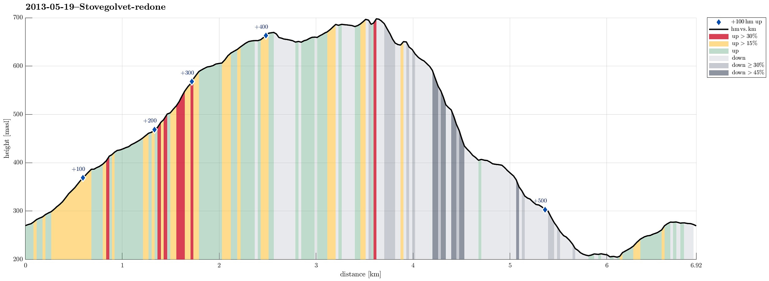 Very nice hike, starting from Lundastølen, first parallel to the road which leads up to Kattnakken, then to the left and up (to the saddle), before turning left (and west), again, and continuing to Stovegolvet. Down via a step descent to the west and through Tyseskaret, before connecting back to the parking at Lundastølen.
