Skåldalsfjellet (01.05.2014)

| Start point | Arna (Hølbekken) (110m) |
|---|---|
| Endpoint | Arna (Hølbekken) (110m) |
| Characteristic | Hillwalk |
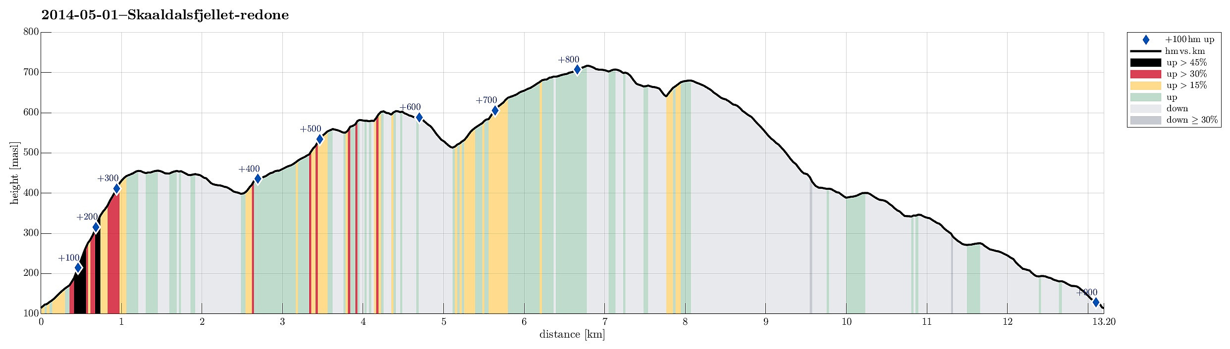
| Duration | 4h 00min |
| Distance | 13.2km |
| Vertical meters | 895m |
| GPS |
|
| Ascents | Repparåsen (609m) | 01.05.2014 |
|---|---|---|
| Skåldalsfjellet (718m) | 01.05.2014 | |
| Storhaugen (567m) | 01.05.2014 | |
| Sælinga (682m) | 01.05.2014 | |
| Ådnanipa (456m) | 01.05.2014 | |
| Åsheimsvarden (459m) | 01.05.2014 | |
| Visits of other PBEs | Einhovden (272m) | 01.05.2014 |
| Garnesrinden (621m) | 01.05.2014 | |
| Repparåsen utsiktspunkt (605m) | 01.05.2014 |
Note that this track has been created a posteriori, i.e., from memory, not automatically recorded.
Trip Summary
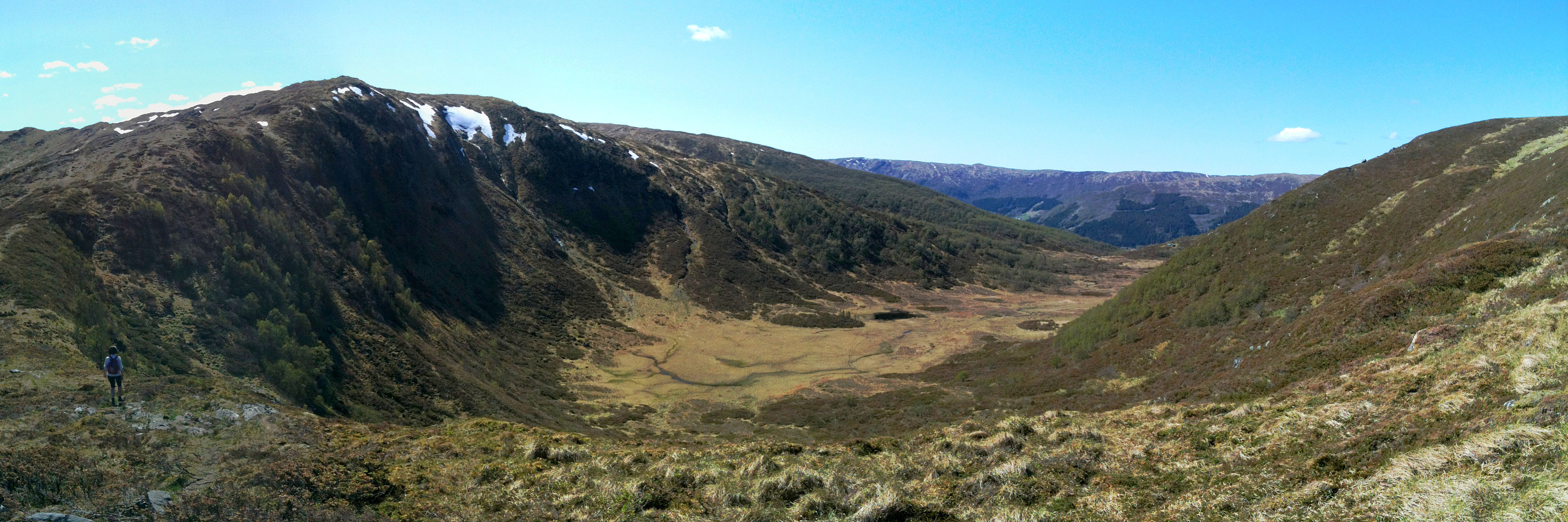
Starting from Arna, first up Ådnanipa, then around Reppadalen, and finally up Skåldalsfjellet -- a really nice hike! :-)
Photos
Selected photos are available as Google photo album.
Useful Resources
Web page WestCoastPeaks.com provides useful information about Skåldalsfjellet, Herlandsfjellet, Repparåsen, and Arnanipa
and also Petter Bjørstad has a useful page about Skåldalsfjellet.

User comments