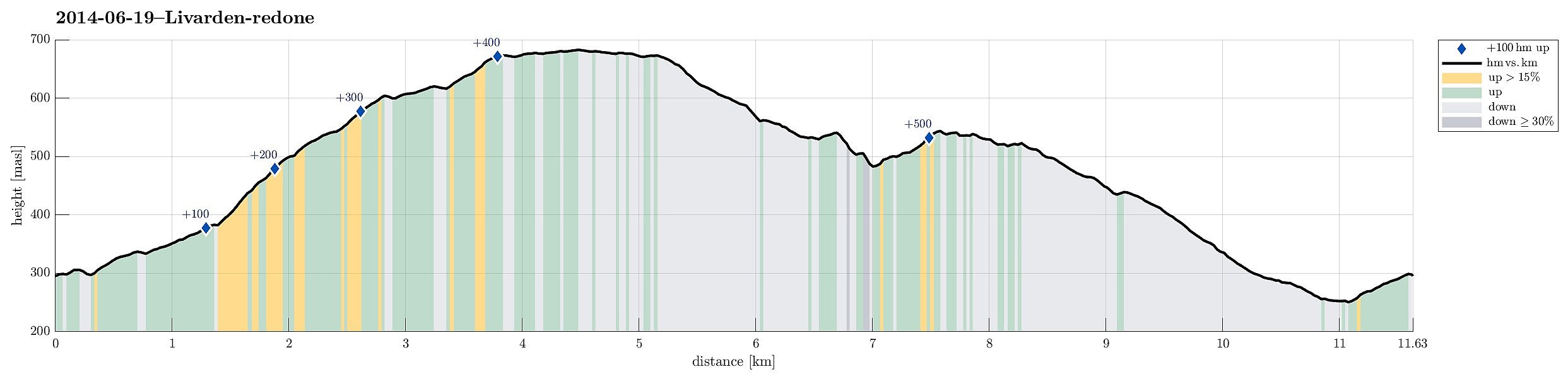
Livarden (19.06.2014)

| Start point | Krekjebærhaugen (290m) |
|---|---|
| Endpoint | Krekjebærhaugen (290m) |
| Characteristic | Hillwalk |
| Duration | 4h 00min |
| Distance | 11.6km |
| Vertical meters | 593m |
| GPS |
|
| Ascents | Livarden (683m) | 19.06.2014 |
|---|---|---|
| Totlandsfjellet (546m) | 19.06.2014 | |
| Visits of other PBEs | Birkehaug (privat) (281m) | 19.06.2014 |
| Laksevåg Røde Kors Hjelpekorps' hytte (556m) | 19.06.2014 | |
| Totland p-plass (287m) | 19.06.2014 | |
| Ulvursfjellet (606m) | 19.06.2014 | |
| Ulvursvarden (677m) | 19.06.2014 | |
| Øvre Totland parkering (280m) | 19.06.2014 |
Note that this track has been created a posteriori, i.e., from memory, not automatically recorded.
Trip Summary
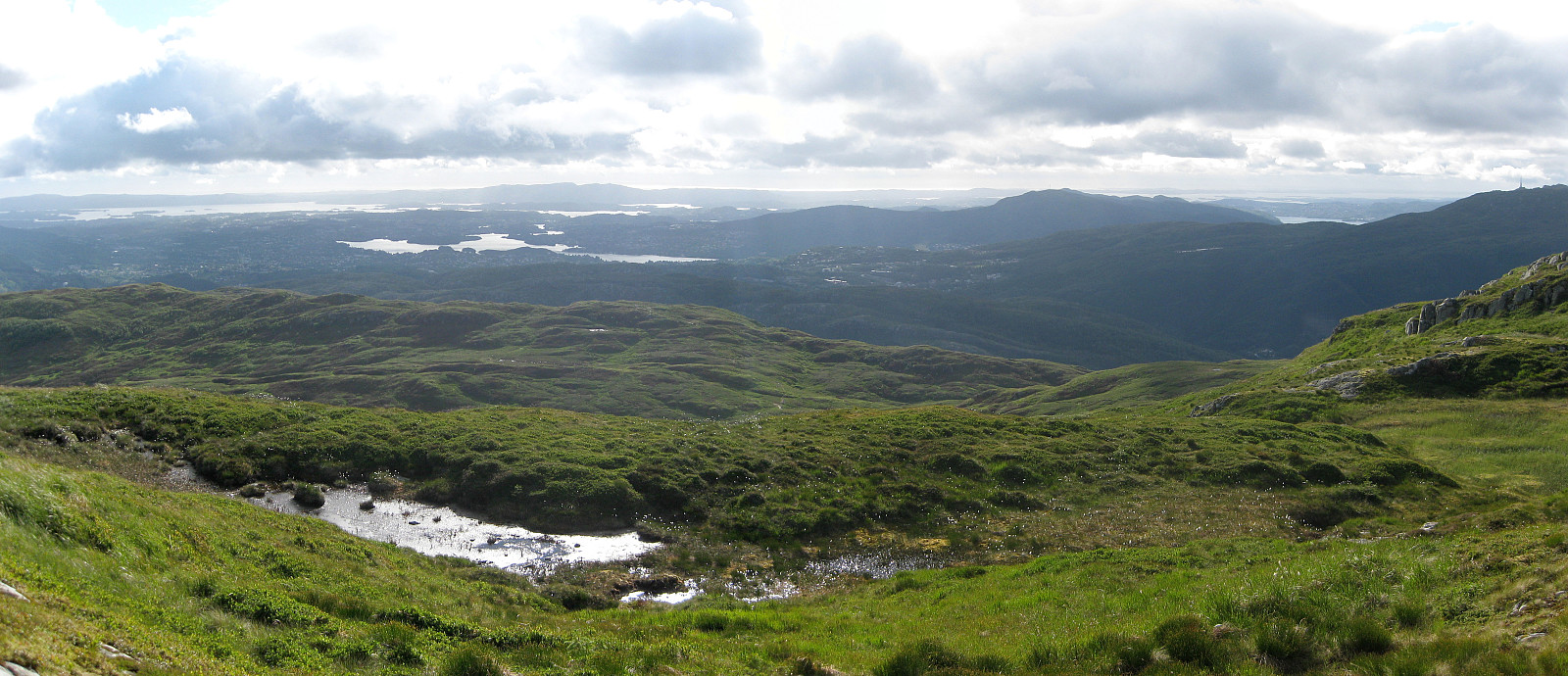
Livarden is a nice walk (from Totland), especially when walking down later the day (into the evening sun -- if there is any, of course)!
Photos
Selected photos are available as Google photo album.

User comments