Local exploration in Kanadaskogen (31.01.2026)

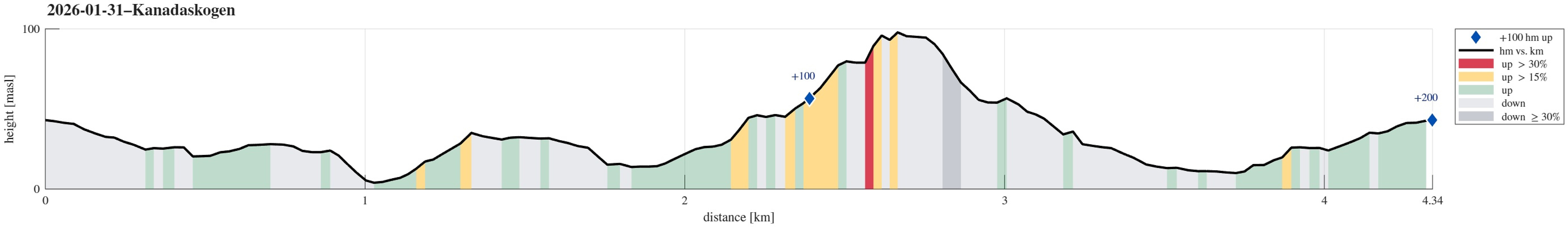
| Start point | Varden (45m) |
|---|---|
| Endpoint | Varden (45m) |
| Characteristic | Hillwalk |
| Duration | 1h 30min |
| Distance | 4.3km |
| Vertical meters | 200m |
| GPS |
|

Trip Summary
We wished to get some fresh air around our heads. After first heading towards the soccer fields north of Varden, we then decided to visit Gjeddevatnet, also. On the way down to Skogadotten, we came across a part of the forest with lots of ice -- interesting! :-) We then headed towards Skaget, just a few meters further north, where also the terrain -- otherwise very wet -- was deeply frozen. This gave us the opportunity to have a quick look at some new construction there (it seems as if the area is prepared for visitors there). After then walking back up to the sports arena, we still wished to do a bit more. Walking further north, we ended up exploring the hills between Hesjakollen and Krokatjønnveien. Once satisfied there, we then headed back to Varden.
Photos
Selected photos are available as Google photo album.
Useful Resources
See also the related FB-page Hiking around Bergen, Norway.

User comments