Round around Sælenvatnet with Barhaugen (20.12.2025)

| Start point | Varden (45m) |
|---|---|
| Endpoint | Varden (45m) |
| Characteristic | Hillwalk |
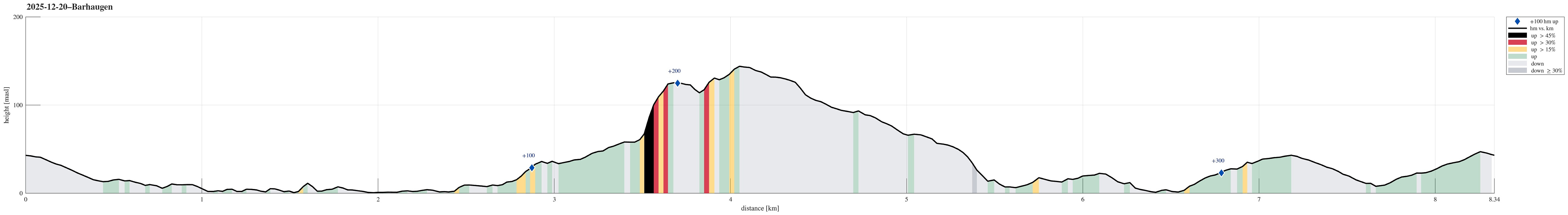
| Duration | 2h 00min |
| Distance | 8.3km |
| Vertical meters | 370m |
| GPS |
|
| Visits of other PBEs | Barhaugen (146m) | 20.12.2025 |
|---|---|---|
| Neset (5m) | 20.12.2025 |
Trip Summary
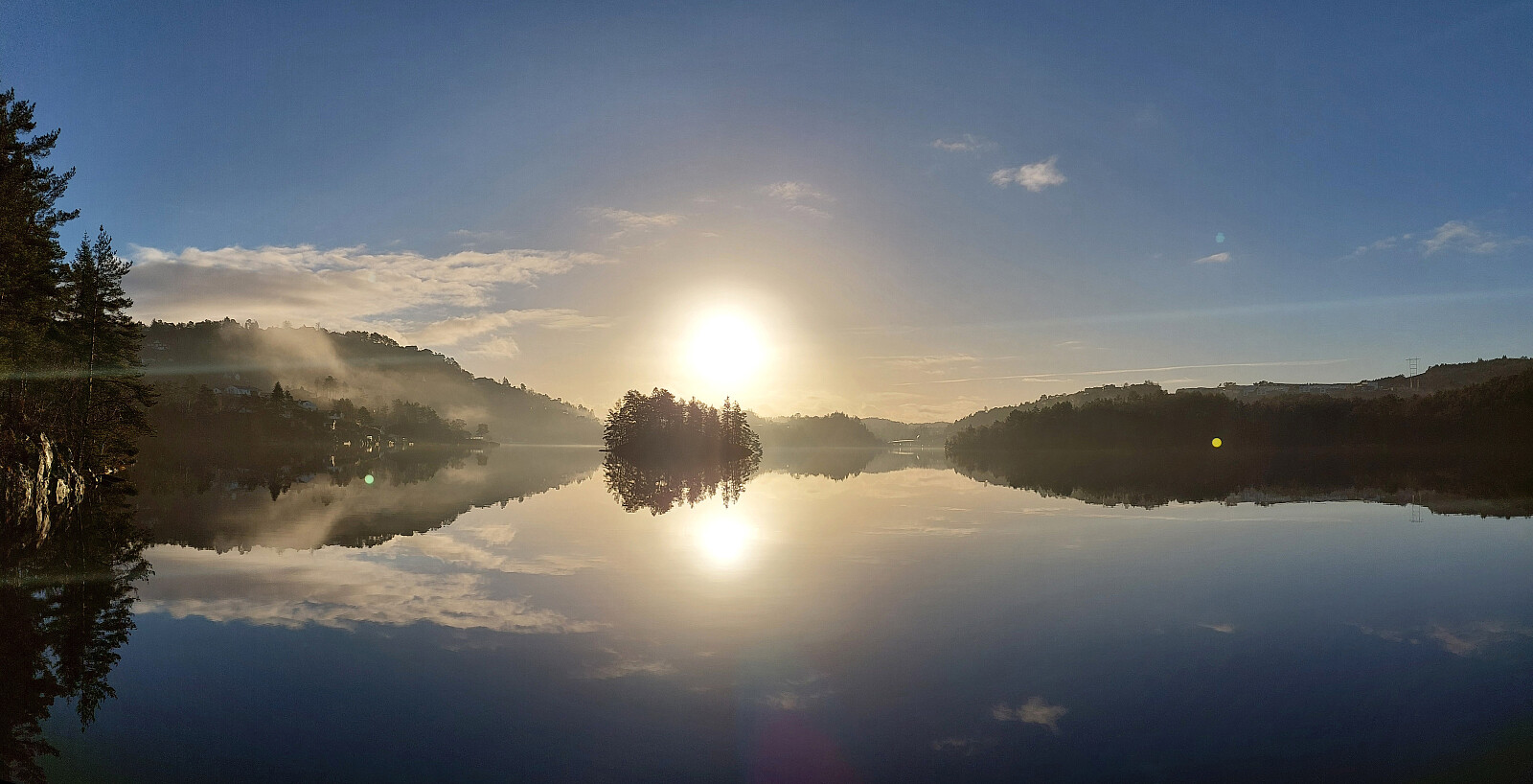
We wished to get some fresh air, or so, and thus headed out to a short round around Sælenvatnet. The first goal was to walk around Bondegården along the northern shore of Sælenvatnet (even though it gets quite a bit wet on the southeastern side of Bondegården). After crossing the bridge north of Øyrane, we then continued along Sælenveien, before finding a connection up to Stokkedalen. There, we then scaled the rather steep hillside up to the upper stretch of Rekdalsveien. From there, it was then over to Barhaugen and back down towards Straumshaugen. While all of this round was not really spectacular, we did catch some nice winter light. :-)
Photos
Selected photos are available as Google photo album.
Useful Resources
See also the related FB-page Hiking around Bergen, Norway.

User comments