Herlandsfjellet via Geitaryggen (04.05.2025)

| Start point | Osterøybrua (45m) |
|---|---|
| Endpoint | Osterøybrua (45m) |
| Characteristic | Hike |
| Duration | 3h 15min |
| Distance | 7.9km |
| Vertical meters | 743m |
| GPS |
|
| Ascents | Herlandsfjellet (695m) | 04.05.2025 |
|---|---|---|
| Visits of other PBEs | Geitaryggen (436m) | 04.05.2025 |
| Krosskaret (431m) | 04.05.2025 |
Trip Summary
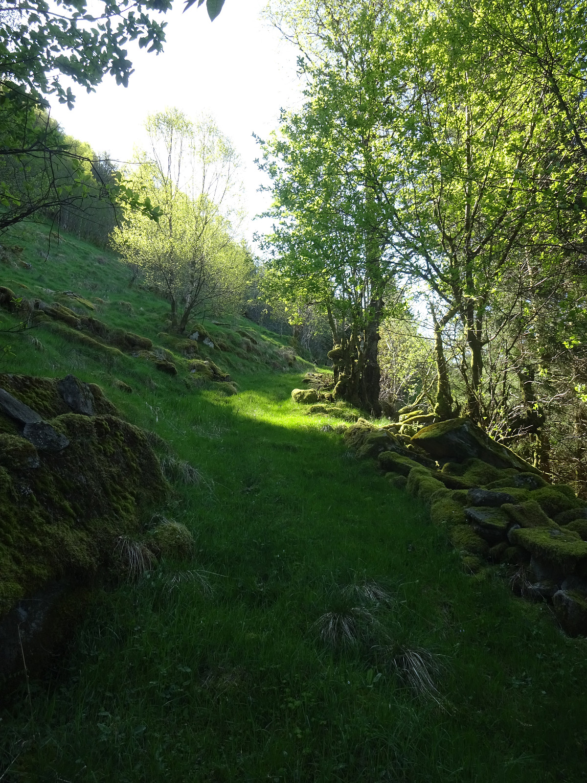
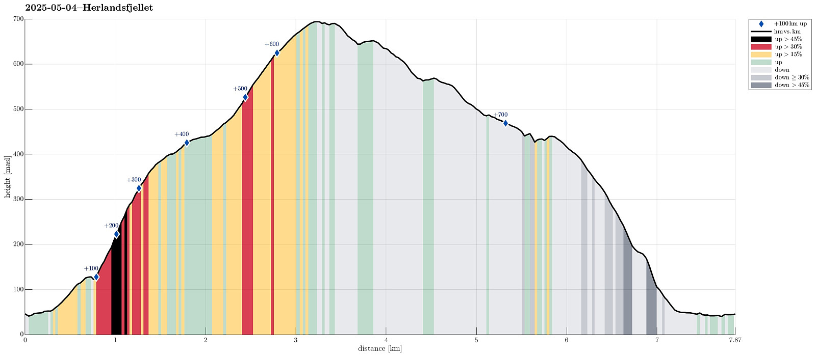
I wished to explore a new ascent route to Herlandsfjellet, as well as a new descent route, also. I drove eastwards out of Bergen to connect with E16 at Indre Arna. Right next to the large bridge to Osterøy, I parked the car and started my hike. After only walking a few meters in westerly direction, I passed a few houses at Geila in order to find a connection to Geitaryggen. Indeed, it was well possible and quite enjoyable to cross over to Tverrelva, basically following the traverse where also a water pipe is laid for the houses at Geila. Quickly, I had made it to Tverrelva and crossing over it was also no problem at all. In the southwest of Tverrelva, I then started my ascent to Geitaryggen "for real" (no trail, but very well possible to ascend via this ridge -- yes, it's a bit steep, but all fine!). A bit higher up, then, Geitaryggen "flattens out" and continuing further southwards becomes less straining, again. While it was very clear that I was not the only one, who used this nice ridge for a hike, all others, as it seemed, did that on four legs, instead. Once at about 500 masl, Geitaryggen starts to blend into the northern ridge of Herlandsfjellet. While completing the ascent to Herlandsfjellet is then a bit steep, again, it's all fine and no problem. On Herlandsfjellet, I enjoyed very nice views in all directions, but since the wind blew pretty chilly up there, I did not make any break. Instead, I headed immediately for the targeted new descent route (new to me, at least). The goal was to try walking down the ridge that is separated from Saurinden by Paddedalen. To get there, I first made descent towards the east (yes, Herlandsfjellet is a bit steep there, but with a bit of care, this descent is no problem, neither). Once on the targeted ridge, I just had to walk it down. It should be mentioned, however, that there's no trail on this ridge and it's not 100% smooth, neither (nothing really problematic, but a few times, I used my hands to secure my descent a bit more). Also, there are a few stretches, where the grass is very uneven, requiring some slightly slower stepping and a bit more care to not fall over accidentially. The one point along this ridge, which I was looking forward to, is Krosskaret, a bit below 450 masl. Before getting there, I already had stepped into the forest and up there, stepping through the forest required a tiny bit of care (lots of large spruce trees, standing relatively close to each other, without any obvious "tunnel" from previous "traffic"). Once I approached Krosskaret, the terrain also got a bit steep (and maybe I should have tried my luck on the eastern side, instead). Carefully navigating round some cliffs in the south of Krosskaret, I then made it to Krosskaret (I must say that I expected something slightly more interesting, given that it has been named -- at first, I did ot even recongize that I was standing right at the saddle! :-)). Only after walking around the northern side of Krosskaret, I understood the topography and gave Krosskaret a second chance -- this time from above (again, it did not impress my particularly, I should admit). After this exploration of Krosskaret, I then found something that looked like a trail, leading down from Krosskaret along Songstadåsen. Once a bit below 300 masl, I followed the trail further, even though it departed from the actual ridge -- there, quite a large number of large spruce trees had been blown over by some storm, not looking like an "easy way down". A bit below 200 masl, as I think, I then crossed a fence and only a bit further down, I ended up on a forest road, which brought me down to Ytre Songstad. From there, it was then only a few meters back to the car. All in all, a nice hike on a nice (but cold) day! While the ascent via Geitaryggen was a full success, in my opinion, the descent via Songstadåsen is maybe not a variant, which I will aim to repeat very often.
Photos
Selected photos are available as Google photo album.
Useful Resources
See also the related FB-page Hiking around Bergen, Norway.
Web page WestCoastPeaks.com provides useful information about Skåldalsfjellet, Herlandsfjellet, Repparåsen, and Arnanipa.
Web page UT.no from the Norwegian Trekking Association recommends a "more standard" hike to Herlandsfjellet (from Osavatnet).

User comments