Brøknipa from Båtaleitet (back via Borgasætra) (20.04.2025)

| Start point | Båtaleitet P (350m) |
|---|---|
| Endpoint | Båtaleitet P (350m) |
| Characteristic | Hike |
| Duration | 4h 00min |
| Distance | 8.8km |
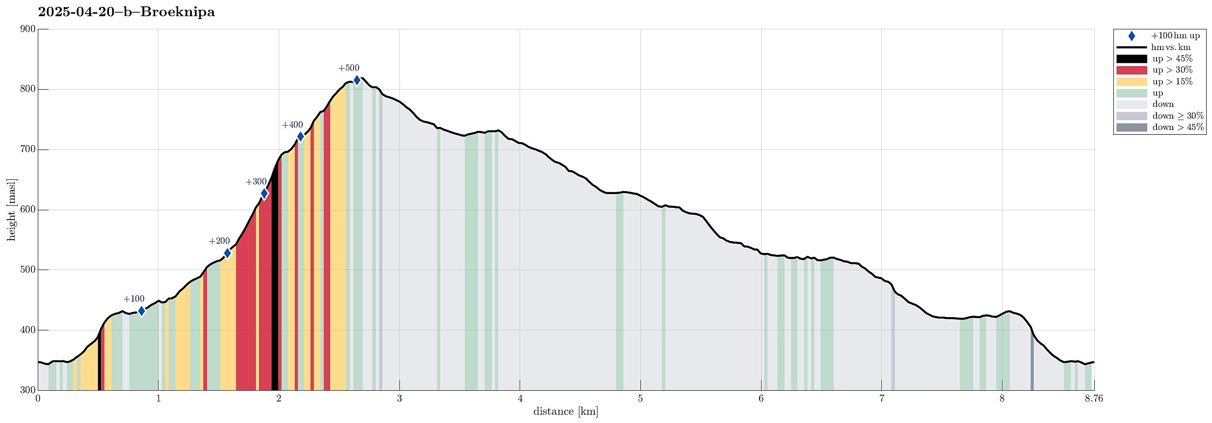
| Vertical meters | 593m |
| GPS |
|
| Ascents | Bruviknipa (822m) | 20.04.2025 |
|---|---|---|
| Visits of other PBEs | Borgasætra (516m) | 20.04.2025 |
| Båtaleitet p-plass (350m) | 20.04.2025 |
Trip Summary
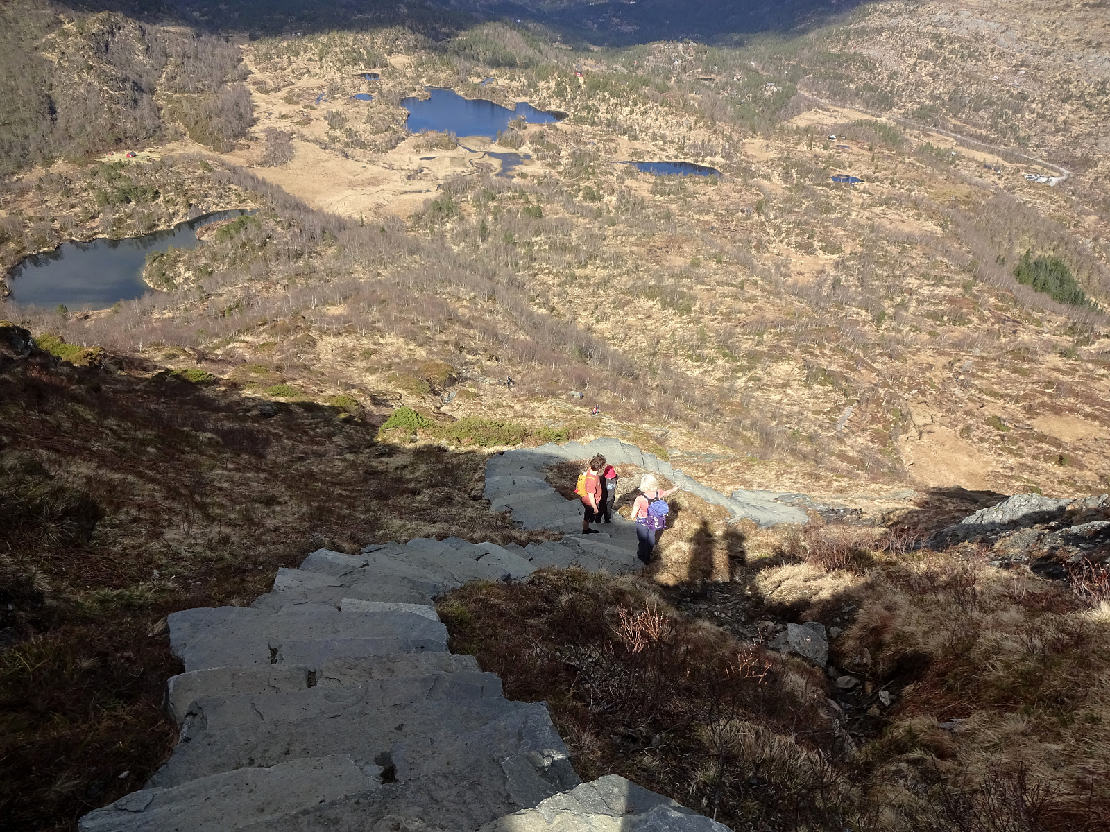
Probably it was about time to explore the new stone steps that had been laid down along the ascent path to Brøknipa (from Båtaleitet). We parked at the (now large) parking place at Båtaleitet (and paid our fee -- also that's new, as it seems). We then followed the main trail towards Brøknipa and the full parking lot had not fooled us: lots of others were on this trail, as well. While the project seems to be still ongoing, at least to some degree, significant parts of the ascent trail are now covered by impressive stone steps. Especially in the steepest section, up to Middagshaugen, this massively upgraded trail is now very impressive for sure! Enjoying the excellent views, already on our way up, we then made the "obligatory" short break on the top of Brøknipa, also taking quite a few pictures! :-) To get back down to Båtaleitet, we had decided to "walk around" (via Borgasætra). This involves a not exactly short walk over the heights of Flatafjellet to get to Borgasætra. There, after just a few steps down on the norther side of the stream, one then turns back (and into the direction of Brøkbotnen) to find a convenient trail that leads "back" to Brøkbotnen "diagonally" across the northeastern flank of Flatafjellet. The last stretch (southwest of Botnavatnet) before reaching Varmavatnet is then quite wet as one traverses the relatively flat meadows north of Brøknipa. From the northeast of Varmavatnet, we then were back on the main trail and within a few more minutes back to the parking place. Clearly, the character of this trail up to Brøknipa has significantly changed, now also inviting an apparently much larger audience to explore the outstanding views from Brøknipa.
Photos
Selected photos are available as Google photo album.
Useful Resources
See also the related FB-page Hiking around Bergen, Norway.
Petter Bjørstad has a a useful page about Brøknipa; and also web page WestCoastPeaks.com provides useful information about Brøknipa (he writes "In my personal opinion, Brøknipa is one of Hordaland's finest mountains").
Web page UT.no from the Norwegian Trekking Association recommends a similar hike.

User comments