Utapåeggi from Indre Songstad, down Innapåeggi (18.04.2025)

| Start point | Romslo (60m) |
|---|---|
| Endpoint | Romslo (60m) |
| Characteristic | Hike |
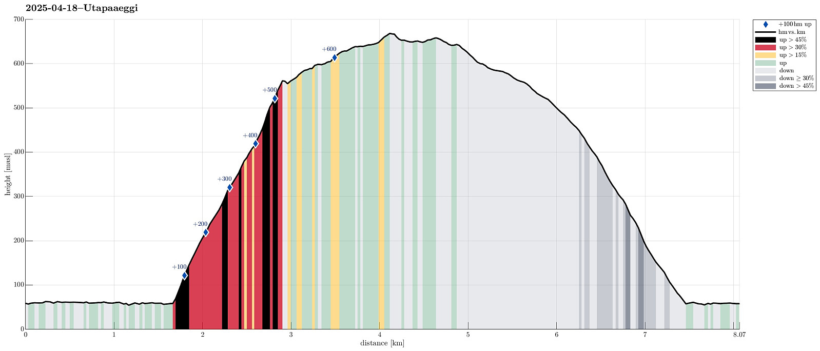
| Duration | 3h 30min |
| Distance | 8.1km |
| Vertical meters | 693m |
| GPS |
|
| Ascents | Utapåegga (599m) | 18.04.2025 |
|---|---|---|
| Visits of other PBEs | Skylefonnstølen (641m) | 18.04.2025 |
| Utapåegga p-lomme (61m) | 18.04.2025 |
Trip Summary
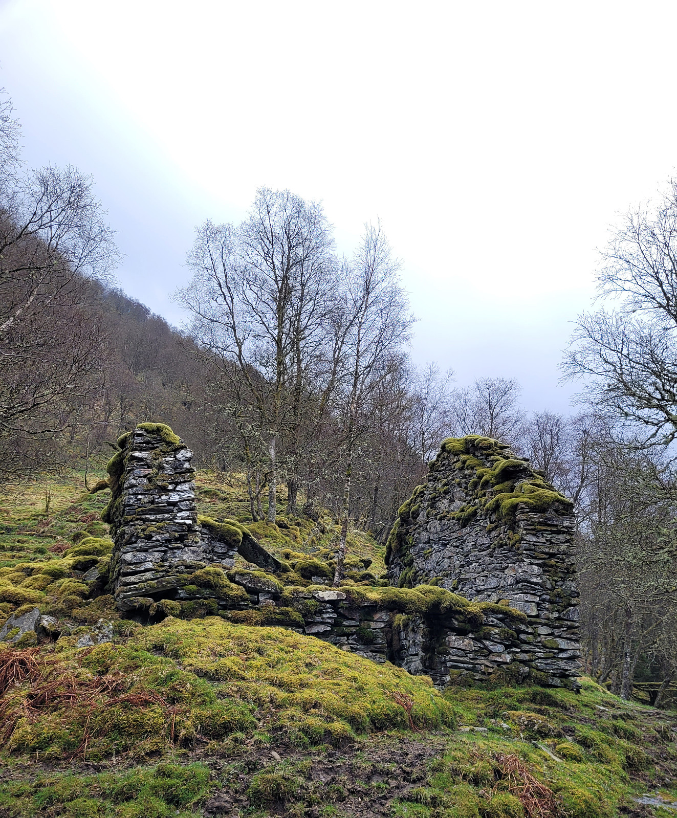
We expected some nice weather and thus thought that we could do a short hike, exploring a new way up to Utapåeggi (via Indre Songstad). We thus headed east from Bergen in order to get to road E16, which would bring us to our starting point near Sørfjorden. Instead of sunshine, however, we drove through some light rain on our way there, questioning our weather information! :-) Near Romslo, we left road E16 and parked right next to Romslo, expecting that we would come down there later. To get to Indre Songstad, where we wanted to start the ascent to Utepåeggi, we first needed to walk a bit along Romslovegen (the old road, parallel to E16). Just before coming to Indre Songstad, however, we thought that we could already start our ascent (quite a bit steep there, however). Our first goal was to get up to a place with the name Nystølen. This worked very well and we found an interesting looking ruin with impressive stone walls up there. Next, we had thought, when reading the map at home, that we would first continue "diagonally upwards", before eventually turning a bit more eastwards to make the last bit up to Utapåeggi. This plan was mostly motivated to avoid the rather very steep looking northwestern flank of Nipa. We even found some traces of a trail (not used much, but still!), which suggested that our plan was just right. Once abouve 400 masl, or so, we then took a more direct approach to the western side of Utapåeggi. Even though it got a bit steep, also up there, we still managed to ascend all the way up to Utapåeggi without any real difficulties. Once on the heights of Utapåeggi, we then hiked further upwards, passing by Skylefonnstølen. Given the not really warm and also a bit wet weather, we then decided that we would immediately cross over to Innapåeggi (for our descent), instead of walking all the way up to Vossavardane (which were in the clouds, anyway). Crossing over Gullvellmyrane to get to Innapåeggi was then also quite a bit wet, but worked out without problems. Walking down the long ridge of Innapåeggi was then very nice, offering a lot of great views! At the very end, we then walked down where the power lines cross over to Osterøy. Back down on Romslovegen, we then had only a few steps back to the car. While the weather was not what we originally had expected, we still returned very satisfied -- also with the new ascent option!
Photos
Selected photos are available as Google photo album.
Useful Resources
See also the related FB-page Hiking around Bergen, Norway.

User comments