From Bergen to Varden via Løvstakken (15.04.2024)

| Start point | Høyteknologisenteret (5m) |
|---|---|
| Endpoint | Varden (45m) |
| Characteristic | Hike |
| Duration | 4h 00min |
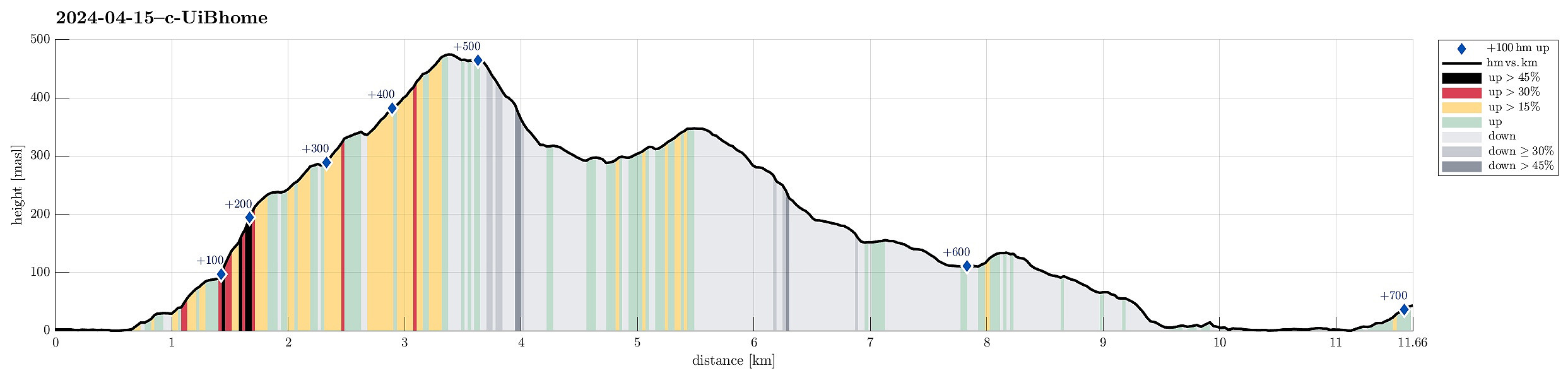
| Distance | 11.7km |
| Vertical meters | 705m |
| GPS |
|
| Ascents | Gullsteinen (352m) | 15.04.2024 |
|---|---|---|
| Løvstakken (478m) | 15.04.2024 | |
| Storhaugen 470 (470m) | 15.04.2024 | |
| Visits of other PBEs | Bøneshallen p-plass (110m) | 15.04.2024 |
| Gullsteinen utsiktspunkt (341m) | 15.04.2024 | |
| Gullstølen (ruin) (282m) | 15.04.2024 | |
| Speiderly (285m) | 15.04.2024 |
Trip Summary
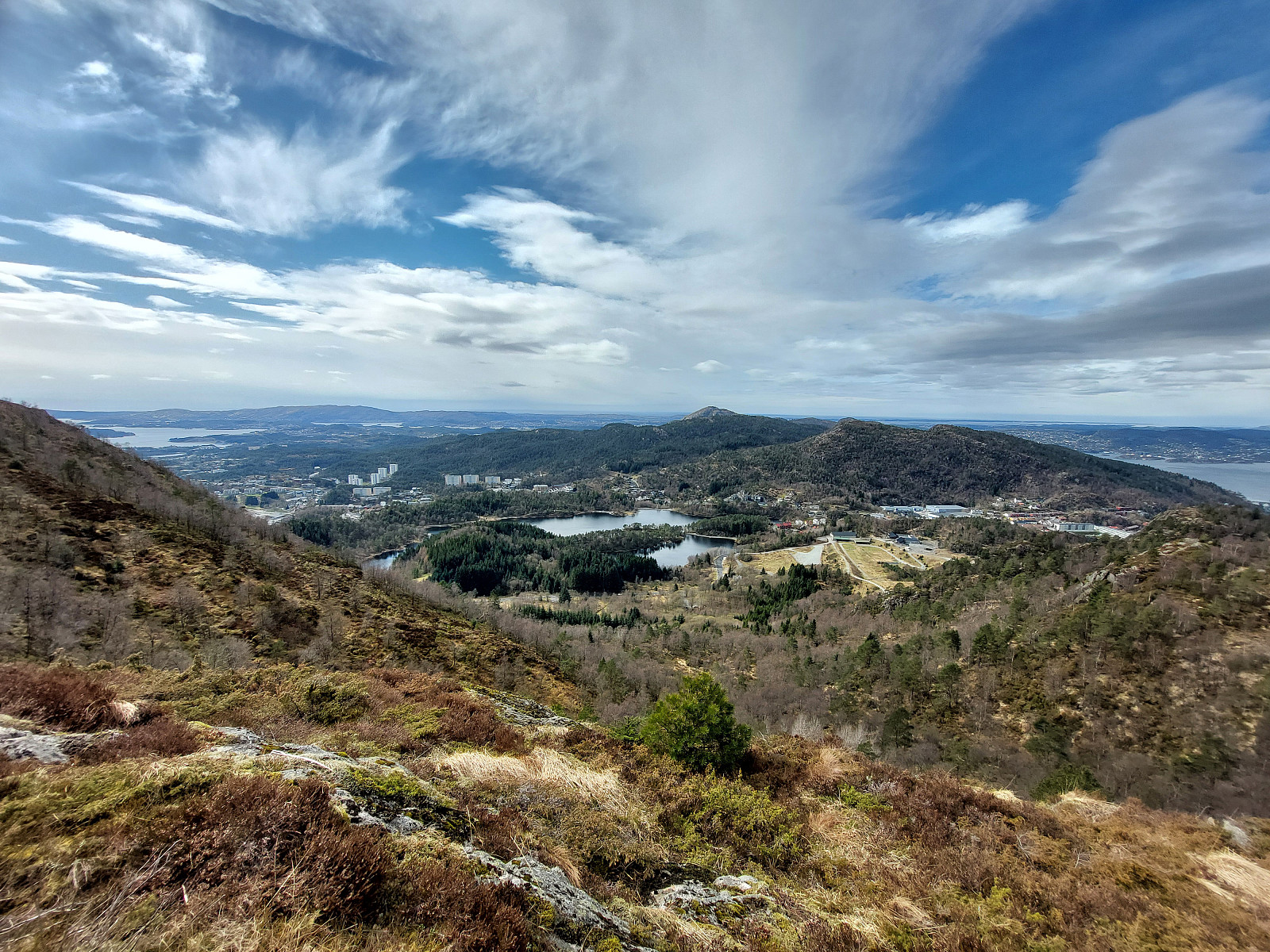
After work, I decided to move my body a little and walk home via Løvstakken. I crossed Puddefjorden via Småpudden and then ascended towards Juvdalen via Solheimslien. Right next to Strandafjellet, this brought me up to the heights north of Løvstakken. Following one of the main trails, there, I then continued to the top of Løvstakken. Continuing along the main trail southwards, I then crossed over Gulsteinen to get down to Bønes. Walking through Fjellsdalen and following some more roads I arrived at Nordåsvatnet. From there, it was then only back northwards to Varden along Sælevatnet.
Photos
Selected photos are available as Google photo album.
Useful Resources
See also the related FB-page Hiking around Bergen, Norway.
Web page WestCoastPeaks.com provides useful information about Løvstakken.

User comments