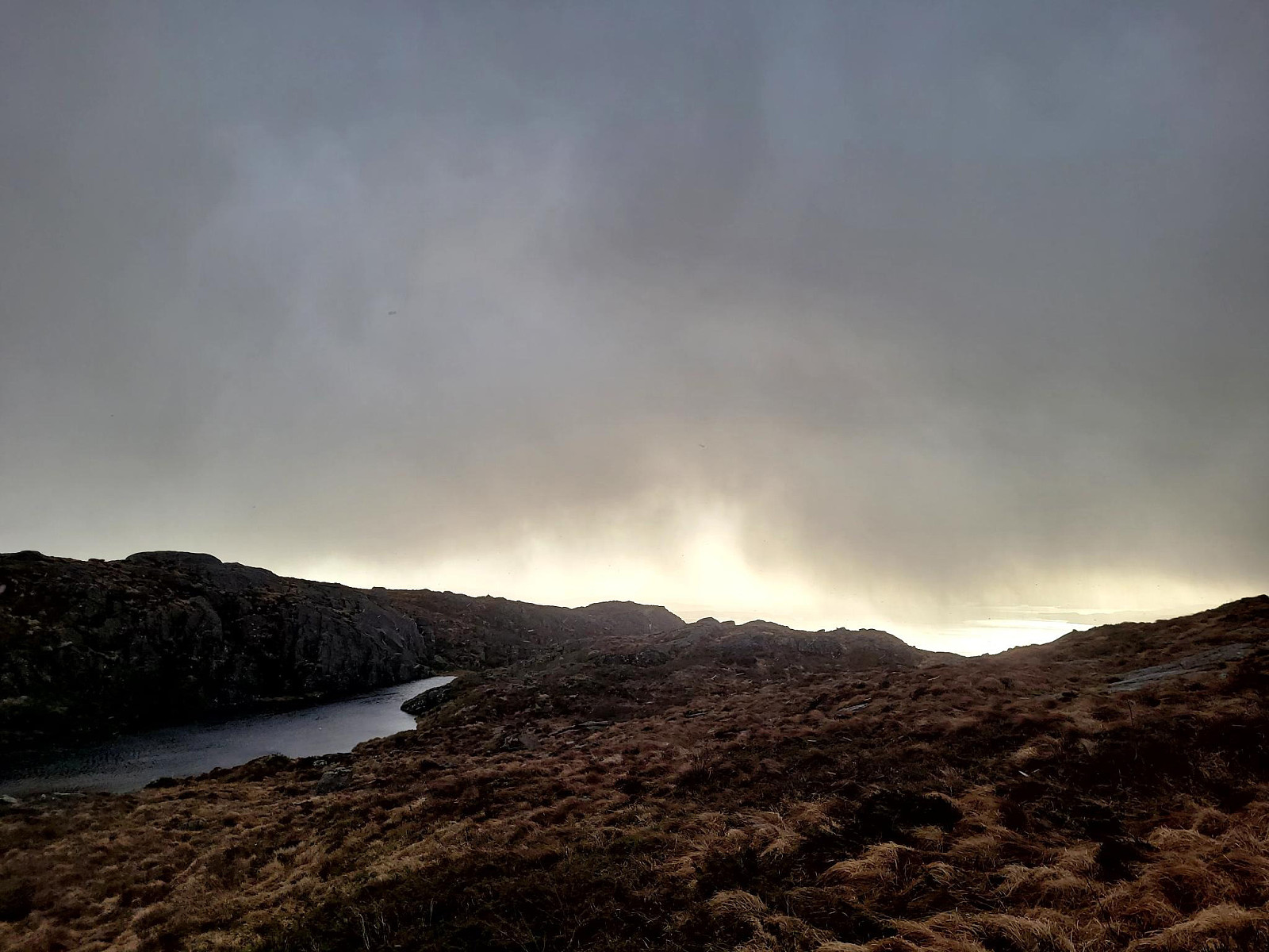
Pyttane in windy weather (03.02.2024)

| Start point | Nordre Stølen (40m) |
|---|---|
| Endpoint | Nordre Stølen (40m) |
| Characteristic | Hillwalk |
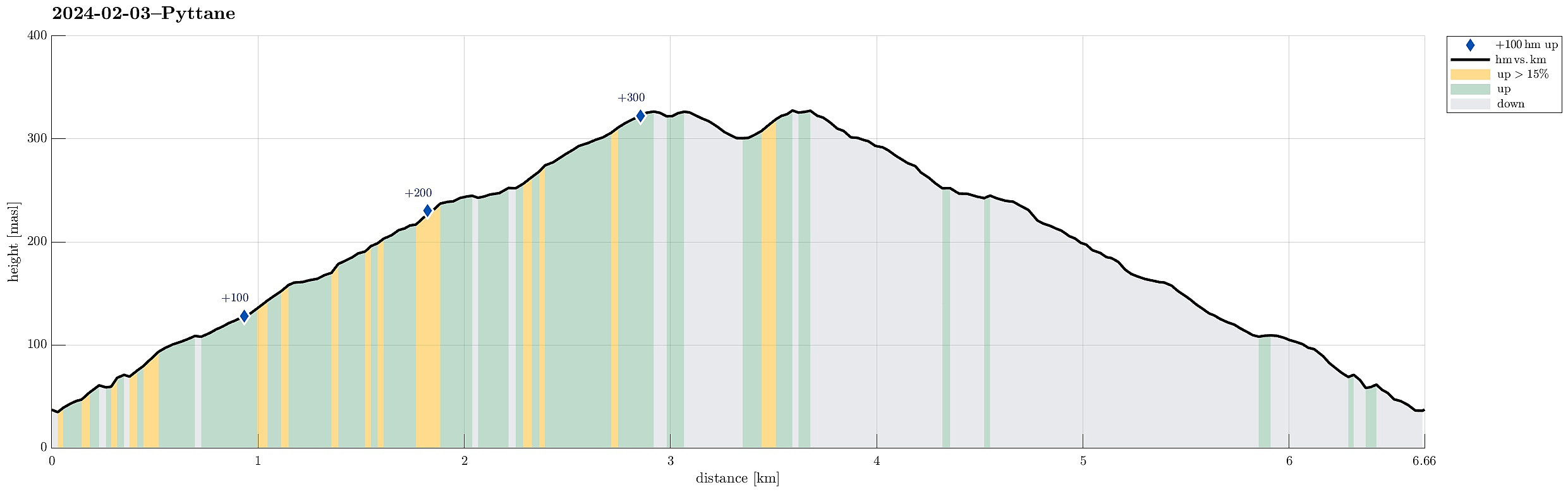
| Duration | 1h 30min |
| Distance | 6.7km |
| Vertical meters | 357m |
| GPS |
|
| Ascents | Pyttane nordre (329m) | 03.02.2024 |
|---|---|---|
| Pyttane søndre (330m) | 03.02.2024 | |
| Visits of other PBEs | Pyttane/Nordre Stølen p-lomme (40m) | 03.02.2024 |
Trip Summary
With quite a bit of weather outside, we decided to "just" go up and down Pyttane on Sotra. We took the car to Ekrhovdvegen in the very east of Sotra and parked near Nordre Stølen, where the service road up to Pyttane starts. We then walked up to the radar stations, experiencing significant weather on the top (strong winds, some precipitation). While it was nice to get out into the fresh air, we still did not feel like staying up there "in the elements" for any prolonged time, thus walking back down more or less immediately, again. All in all, this walk up to Pyttane is always nice (and easy), lending itself well to getting some fresh air without an all-too-long trip.
Photos
Selected photos are available as Google photo album.
Useful Resources
See also the related FB-page Hiking around Bergen, Norway.
Web page WestCoastPeaks.com provides useful information about Liatårnet
and also Petter Bjørstad has a useful page about Liatårnet.

User comments