Round around Ono (04.06.2023)

| Start point | Onevegen (10m) |
|---|---|
| Endpoint | Onevegen (10m) |
| Characteristic | Hike |
| Duration | 3h 00min |
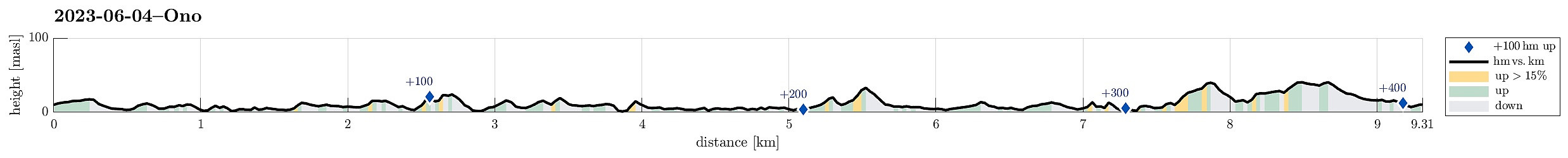
| Distance | 9.3km |
| Vertical meters | 403m |
| GPS |
|
| Ascents | Arseto (35m) | 04.06.2023 |
|---|---|---|
| Brattlivarden (43m) | 04.06.2023 | |
| Dyrneshaugane (29m) | 04.06.2023 | |
| Toppen av Ono (45m) | 04.06.2023 | |
| Visits of other PBEs | Dethloffhytta (21m) | 04.06.2023 |
| Kvitingsneset (16m) | 04.06.2023 | |
| Ono parkering (13m) | 04.06.2023 |
Trip Summary
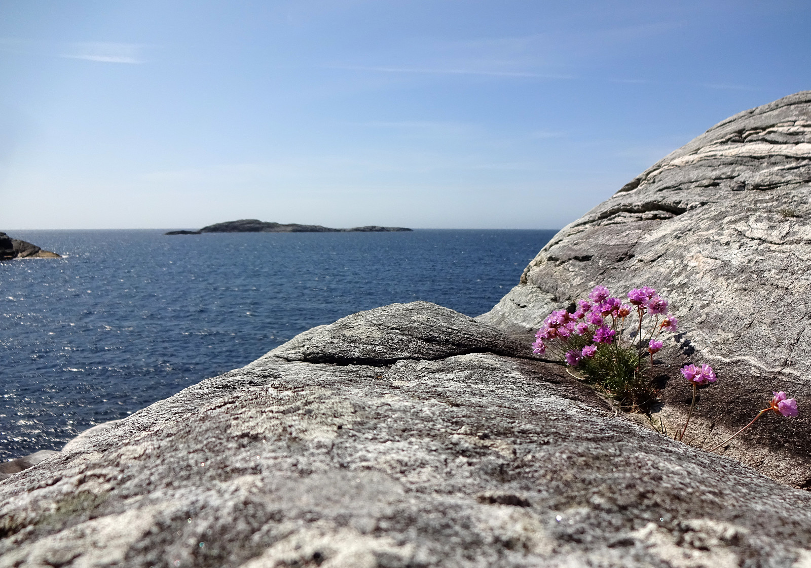
While checking for new places in Øygarden that we had not visited so far, we found Ono and decided to make a hike there. After driving first westwards out of Bergen (towards Sotra), we then turned right (in northern direction) near Kolltveit, following then road #561. At Rong, we then turned left (westwards, again) in order to get over to Ono (passing the school of Rong along Svartevikvegen). After crossing two small bridges, we had arrived at Ono. There, we parked "at once" next to the road Onevegen. The southern part of Ono is well marked for hikers -- especially those, who wish to visit Dethloffhytta in the southwest of Ono. We followed first this main trail (in southwestern direction) until we crossed over the inner end of Stekkane. On the other, southern side, we then deviated from the trail, paying Makrellavågen a visit from the north. Surrounding Makrellavågen, we then crossed over the ridge in its south to the next bay (where also a little building is at the seaside). Heading further southwards, we ended up in Breivikskogen, i.e., a little patch of some (low) trees north of Mosevågen. Getting through this rather thick patch of forest was not 100% easy and can be avoided by following the marked trail a bit further south/southwest. Once at Mosevågen, we stepped down a little cliff. We then followed the shore to get around Mosevågen. Also here, we had to test a little before finding a reasonable way to get past Breivikskogen. Once on the inner side of Mosevågen, we recognized that we had reconnected with the marked trail. From there, we (mostly) followed a marked trail that leads those, who wish to extend their hike a little, around much of the southern part of Ono. This trail is easy to follow and offers some very nice views. Near Stigen, one even finds a resting area with two benches and tables. Then, we continued our "round" around the southern part of Ono to get to Kvitingsneset (south of Dethloffhytta). From there, it was then just to follow the shoreline around Søre Rekebogen to get to Dethloffhytta. Then, after first crossing of the little hill northeast of Dethloffhytta, we took the marked trail back to where it crosses Stekkane. After a short deliberation (were we up for more, or not?), we decided to head out for a short excursion into the northern part of Ono, also. This brought us first northwards along Kvernepollen, before we also crossed over to Brattlivarden in the northwest of Ono. Compared to the south of Ono, this northern part of Ono is much less "nice and easy", but more rugged and also without clear trails. On Brattlivarden, also, some fires had ravaged the most northwestern part not too long ago, adding a partially morbid touch to the Brattlivarden. From Brattlivarden, we then headed back, following first the hills in the east of Brattlivarden, before eventually finding a simple trail that connects the buildlings in the northeast of Ono with the street. Altogether, and especially in the south of Ono, this really was a very nice hike! :-)
Photos
Selected photos are available as Google photo album.
Useful Resources
See also the related FB-page Hiking around Bergen, Norway.
Web page UT.no from the Norwegian Trekking Association recommends another, though shorter hike on Ono.

User comments