Gullsteinen from Varden (28.05.2023)

| Start point | Varden (45m) |
|---|---|
| Endpoint | Lyshovden (95m) |
| Characteristic | Hike |
| Duration | 1h 30min |
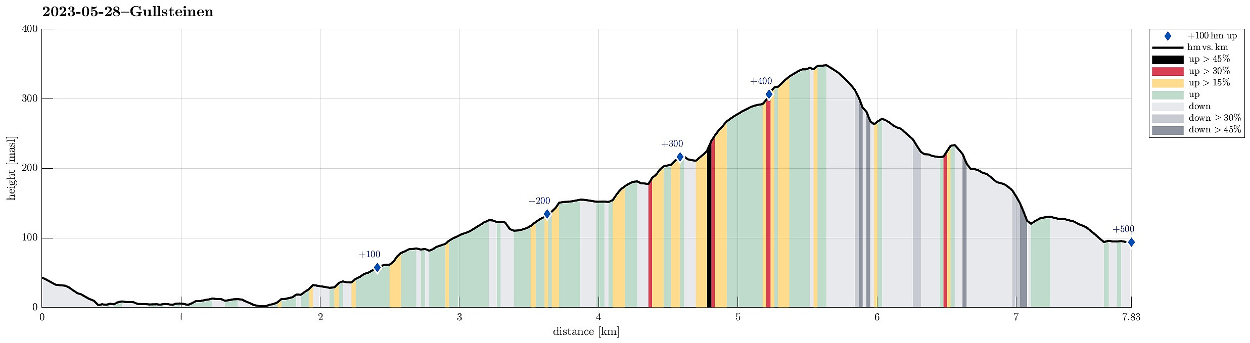
| Distance | 7.8km |
| Vertical meters | 499m |
| GPS |
|
| Ascents | Gullsteinen (352m) | 28.05.2023 |
|---|---|---|
| Visits of other PBEs | Gullsteinen utsiktspunkt (341m) | 28.05.2023 |
| Gullstølen (ruin) (282m) | 28.05.2023 | |
| Gulsteinen (305m) | 28.05.2023 | |
| Speiderly (285m) | 28.05.2023 |
Trip Summary
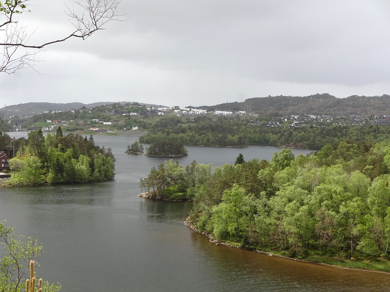
We wished to get some fresh air and thus headed for Gullsteinen (from Varden). We first descended from Varden to Sælevatnet, before then surrounding Bondegården in its north. Via Ture Nermans vei we then connected to Rekdalsveien, which we then followed "all the way up" to the point, where one can step down some stairs to the sports area in Fjellsdalen. We then stepped up Hattedalen to get to Bråtet. From there, we then started our ascent to Gullsteinen. While one of us found a way (more a "way"!) up to Knultrane, the other one continued along the gravel road to Nils Langhellesvei (where we met, again, then). From there, it was then up via the southern ridge to Gullsteinen, mostly following the nice trails along this ridge. From the top of Gullsteinen, however, we had different plans, i.e., to descend via its steep western flank (without trail). Studying the map prior to leaving Varden had helped to have a reasonable plan up in our heads: first northwards from Gullsteinen (but leaving the main trail almost instantly north of the top of Gullsteinen), then aiming at the somewhat flatter spot at about 275masl (in the NNE of Gullsteinen), before then stepping down "diagonally" (and towards Renneberget), following a valley (or so) at kind of half the height between Nils Langhellesvei and the top of Gullsteinen. This worked out as planned and we arrived at Renneberget without difficulties (yes, this side of Gullsteinen is steep, but, when choosing one's route carefully, it's clearly possible to descend there). At Renneberget, we first had descended a bit too much, already; but with a bit of stepping up, again, we soon were "back on track" at about 230masl. There, one can find a simple trail that leads down (mostly northwards) to Nils Langhellesvei (house #84). Instead, however, we found the other simple trail there, which brought us down to the place, where Nils Langhellesvei is closed for cars (south of the last house, #73). From there, it was then just following another trail down to C. J. Hambros vei. Even though the weather was not perfect, this still was a nice and refreshing stroll through "good old Fyllingsdalen"! :-)
Photos
Selected photos are available as Google photo album.
Useful Resources
See also the related FB-page Hiking around Bergen, Norway.

User comments