Hovdane from Brattholo (08.08.2020)

| Start point | Brattholo (250m) |
|---|---|
| Endpoint | Brattholo (250m) |
| Characteristic | Hillwalk |
| Duration | 4h 00min |
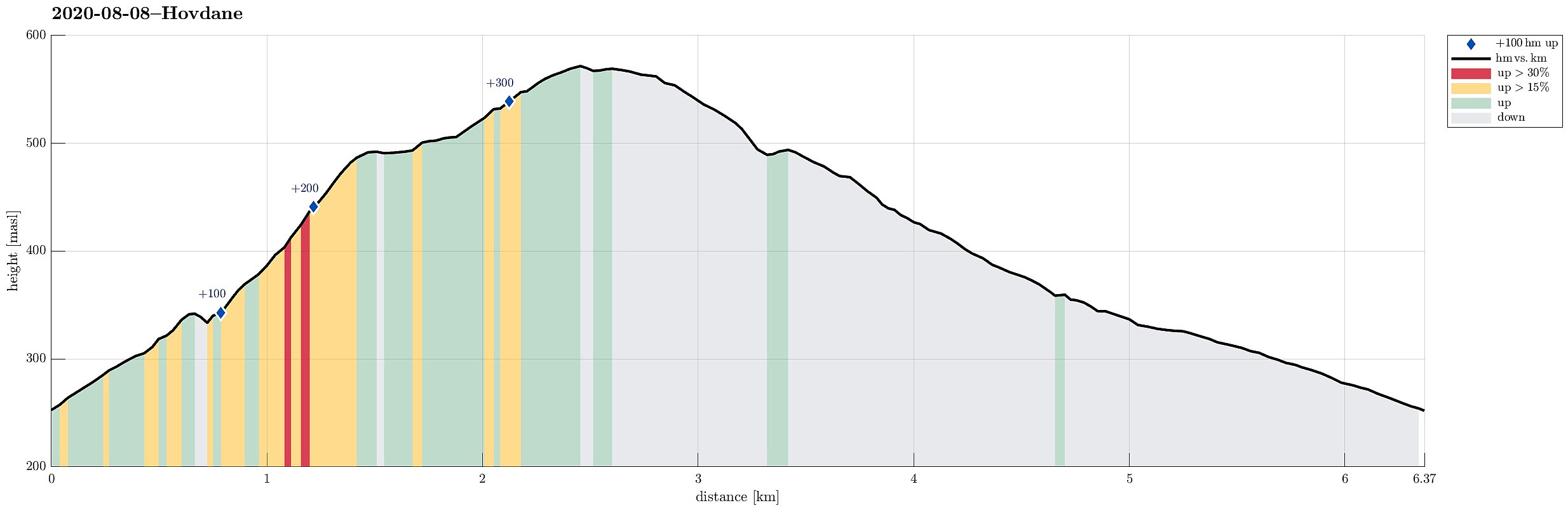
| Distance | 6.4km |
| Vertical meters | 342m |
| GPS |
|
| Visits of other PBEs | Hovdane gapahuk (490m) | 08.08.2020 |
|---|
Trip Summary
With a somewhat unclear weather forecast, we aimed at something gentle, not too far up. Driving along E16 (into the direction of Voss), we left the main road a little southwest of Vinje, contiuning for bit into the direction of Hommedalen. Driving up Holbygdvegen to about 250mosl, we found a suitable place near Brattholo to park right next to the road. From there, we started walking along a minor road that winds up towards the eastern flank of Hagahovden. A little over 300mosl then, we left the road (basically where it ends) and continued along a trail that continues further upwards. At about 335mosl, we briefly explored a flag post with some view, before soon returning to the trail and following further upwards. At about 500mosl we then arrived at a nice shelter at Hovdane, enjoying a little break there. Before later turning back in a round via Arnetveit and Holbygdvegen, we first enjoyed an excursion via some very nice heights in northwestern direction from Hovdane -- really nice up there! :-)
Photos
Selected photos are available as Google photo album.
Useful Resources
See also the related FB-page Hiking around Bergen, Norway.

User comments