Eikhaugen (07.11.2020)

| Start point | Varden (45m) |
|---|---|
| Endpoint | Varden (45m) |
| Characteristic | Hillwalk |
| Duration | 3h 30min |
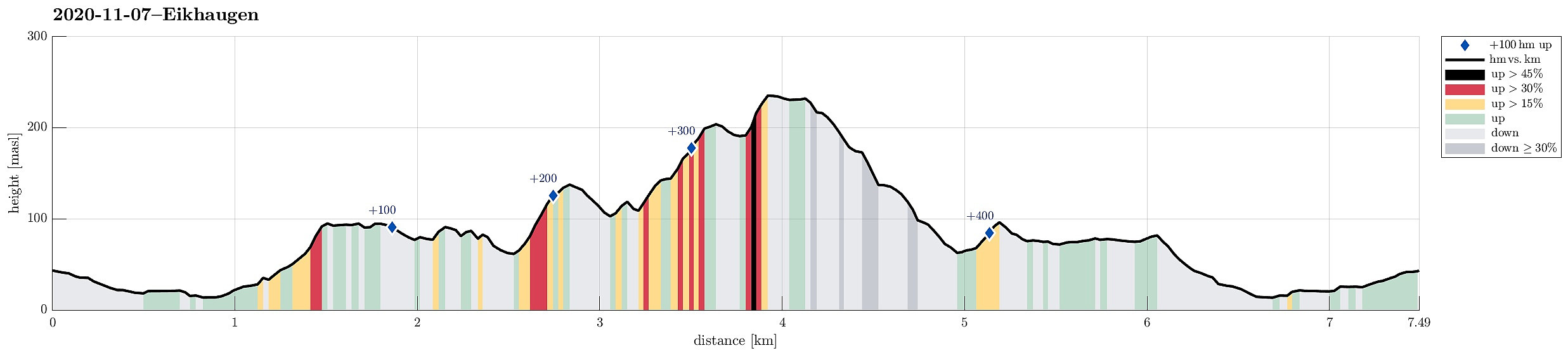
| Distance | 7.5km |
| Vertical meters | 471m |
| GPS |
|
| Ascents | Eikhaugen (207m) | 07.11.2020 |
|---|---|---|
| Visits of other PBEs | Småhytten (ruin) (200m) | 07.11.2020 |
| Spelhaugen p-plass (60m) | 07.11.2020 |
Trip Summary
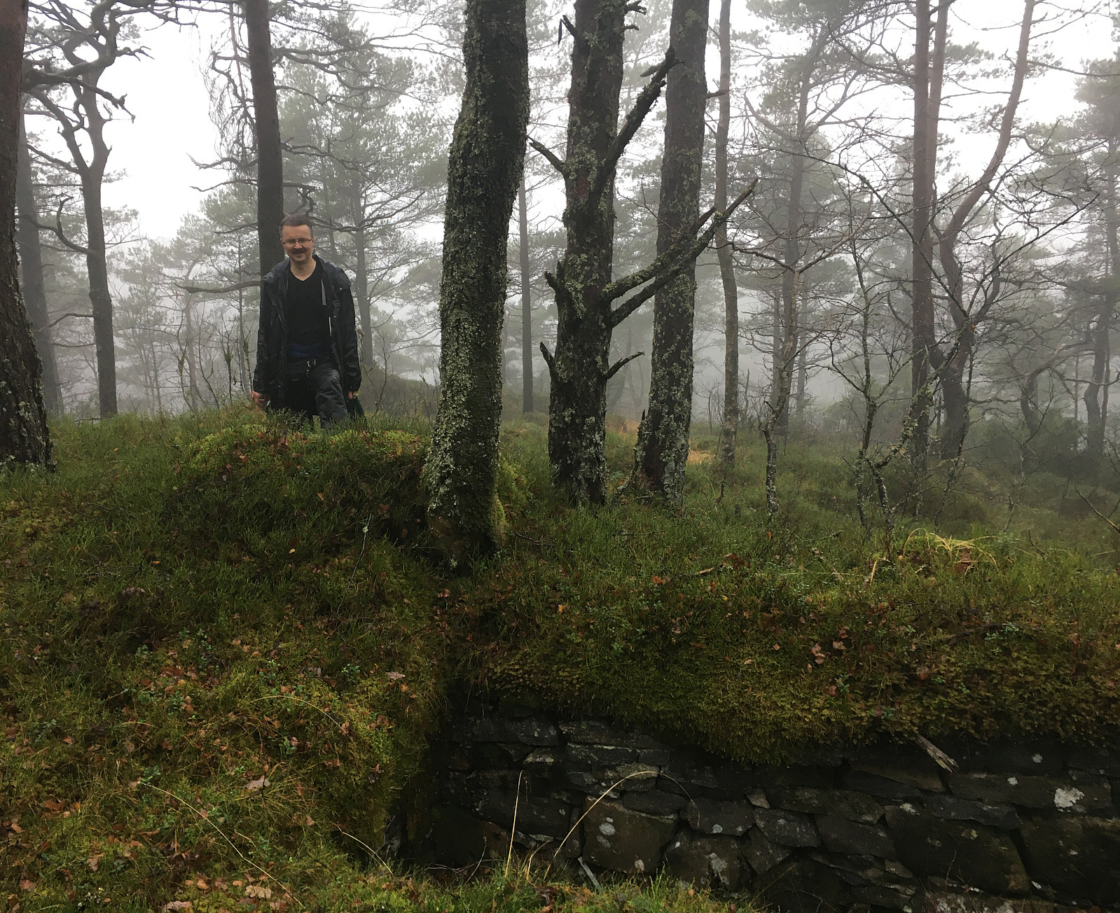
A quite wet day invited to engage with some local exploration. After some short planning, Eikhaugen was identified as the overall goal, this afternoon. Starting from Varden, we headed north, first. At Askeladdveien, we decided to ascend relatively steeply to some minor heights west of Peer Gyntsvei. Crossing over this ridge south--north, we connected to the east-facing hillside in the west of Spelhaugen. At the northern end of Spelhaugen, where the Kindergarden and the parking place for Tennebekk-hikers is, we crossed over to the other, northeastern side of Spelhaugen, ascending relatively steeply up to the (also minor) heights north of Barliveien (Lurane). Rounding the southern end of Eikelifjellet on its southeastern side (northwest of Løvås), we entered a nice valley with a little north--south flowing stream (north of the westernmost end of Løvås). First following this valley northwards on its smooth western side, we then crossed over to its eastern side. There, the terrain is a little bit wilder (with some minor cliffs etc.). Continuing further northwards, we thn ascended to Eikhaugen via its southern end, where it appeared possible (for a step, or two, we needed to help us with our hands -- it's a bit steep there in selected places). Already before getting to Eikhaugen, we had found the day more than just a little wet -- we thus decided to had back more or less directly from Eikhaugen. In order to make this excursion into Kanadaskogen at least somewhat "a round", we first headed up neighboring Eikelifjellet (in the west of Eikhaugen), connecting to the very nice trail that leads up and down Eikelifjellet on its southern ridge. Following this trail (most of the time), we soon later arrived at Spelhaugen, again (via Mørkebotn). Walking back via Krokatjørna (in the west of Spelhaugen) was then a nice alternative trail to take back. All in all, while indeed quite a bit wet, both from beneath as well as from above, it was still good to get some fresh air! :-)
Photos
Selected photos are available as Google photo album.
Useful Resources
See also the related FB-page Hiking around Bergen, Norway.

User comments