Exploring Eidsvågsneset (12.01.2020)

| Start point | Sandviken (60m) |
|---|---|
| Endpoint | Eidsvåg (20m) |
| Characteristic | Hillwalk |
| Duration | 3h 00min |
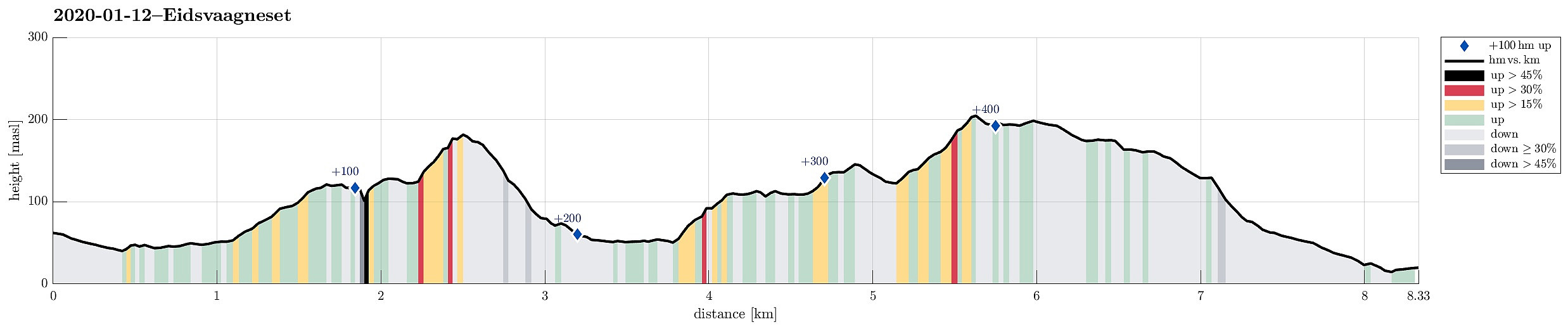
| Distance | 8.3km |
| Vertical meters | 430m |
| GPS |
|
| Ascents | Fagerdalsfjellet (150m) | 12.01.2020 |
|---|---|---|
| Hellefjellet (135m) | 12.01.2020 | |
| Ørneberget NV (209m) | 12.01.2020 | |
| Visits of other PBEs | Hellegrind (199m) | 12.01.2020 |
| Hellen festning (131m) | 12.01.2020 |
Trip Summary
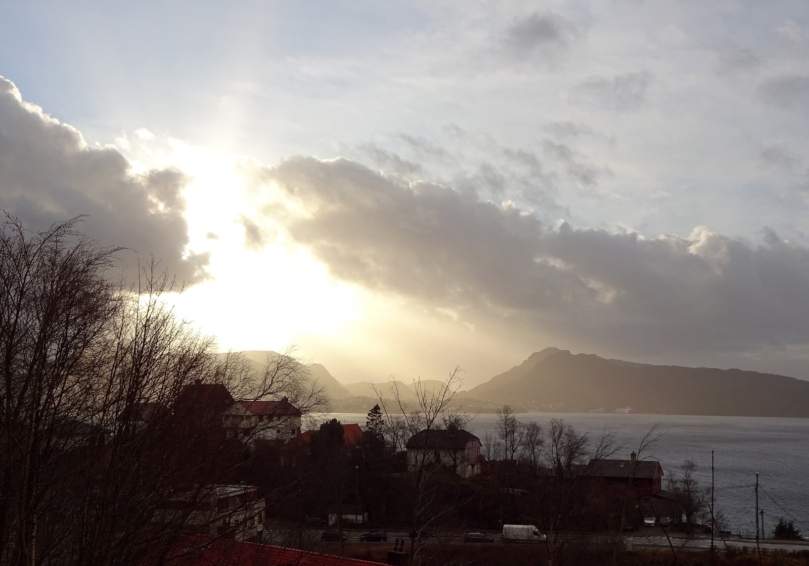
We took bus #4 to Sandviken (the last stop before the bus drives through the tunnel to Eidsvåg, i.e., Handelshøyskolen) and started to first walk along Helleveien towards the northern end of Eidsvågsneset. Near Hellen school, we made a little excursion onto a small hill top and could see Byfjorden from there. We then continued along Helleveien, before we turned half-right in order to take a pedestrian "road", which leads diagonally upwards towards Hellen festning (one leaves Helleveien shortly before getting to Eikevikstjernet). At Hellen festning, we explored what remains from the fortifications and also enjoyed some good views over Byfjorden. Originally, we had thought that we would continue from there towards Eidsvågsfjellet via Furekammen, but once at Hellen festning, we got the impression that a more direct route should be possible, also. In fact, we then found a way of ascending (quite steeply) north of Trollbotn to a little top (very near to the point, where Hellemyrstien comes down to Øyjordsveien). From there, instead of continuing further up to Eidsvågsfjellet, we descended again (in northern direction) towards and along Lønborglien. Near Helvetesvatnet, we were back down at Helleveien (with Fagerbakken as our next goal). Instead of trying the most likely wild and very steep direct ascent, we continued firth a little along Eidsvågveien, before we found a little road, Fagerbakken, which we walked up, then. Up there, we first explored a little vista point (with views towards the north) near Lyngveien, before we turned into southeastern direction in order to get up to Fagerdalsfjellet. From there, we crossed Fagerdalsskaret, following the heights, and ascended further upwards to a little hill right west of the northermost end of Hellemyrstien. From there, we then followed the new Hellemyrstien in order to connect to Munkebotn, just to follow this road down towards Eidsvåg, where we caught a bus home.
Photos
Selected photos are available as Google photo album.
Useful Resources
See also the related FB-page Hiking around Bergen, Norway.
Web page UT.no from the Norwegian Trekking Association recommends a similar but shorter hike.

User comments