Short round on Bjorøyna (31.12.2019)

| Start point | Bjorøy school (70m) |
|---|---|
| Endpoint | Bjorøy school (70m) |
| Characteristic | Hillwalk |
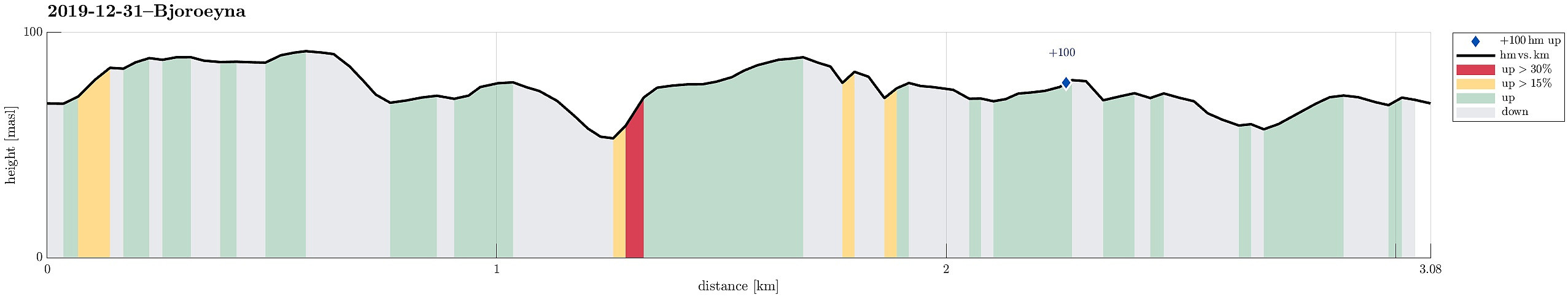
| Duration | 1h 30min |
| Distance | 3.1km |
| Vertical meters | 127m |
| GPS |
|
| Ascents | Nibben (93m) | 31.12.2019 |
|---|---|---|
| Rundelen (95m) | 31.12.2019 |
Trip Summary
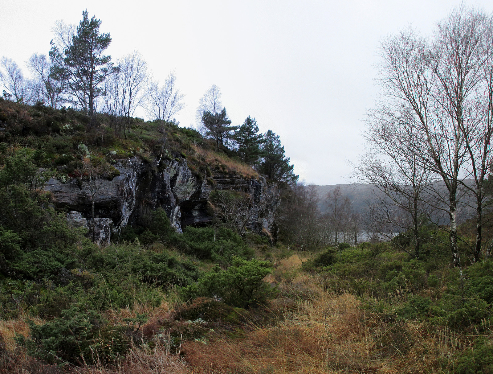
We took the car to the west of Bergen and from Loddefjord along Hillerenveien to get to the undersea tunnel, which connects to Bjorøyna. There, we continued along the "main road" across Bjorøyna (Fv207) until we parked next to the school of Bjorøy. From there, we first ascended to Rundelen across its northern ridge, Bjorøyna's highest hill, right in the east of the school. Once up there -- it's only a few meters above the school --, we continued in southern direction across the north-south going heights. Before eventually turning westwards, we first included a smaller hill in the southeast of the heights of Rundelen. From there, we then descended in western direction (northwest of Stokkhaugen) until we crossed some minor swamp to get over to another hill on the other (western) side. Quickly, we also reached the top of this hill (they are all not very high!) and enjoyed some nice views in the direction of Liatårnet on Sotra. From there, we wanted to continue in northern direction towards Langafjellet, but needed to walk a little detour, since a several meters high cliff made it too dangerous to continue directly towards Langafjellet. After a few additional minutes, however, we stood on Langafjellet and liked the views from there, as well! :-) From Langafjellet, we then returned to the school of Bjorøy and our car more or less directly. Given that we did not have much time altogether, this little round on Bjorøyna was nicer than anticipated (quite some nice views, actually!).
Photos
Selected photos are available as Google photo album.
Useful Resources
See also the related FB-page Hiking around Bergen, Norway.

User comments