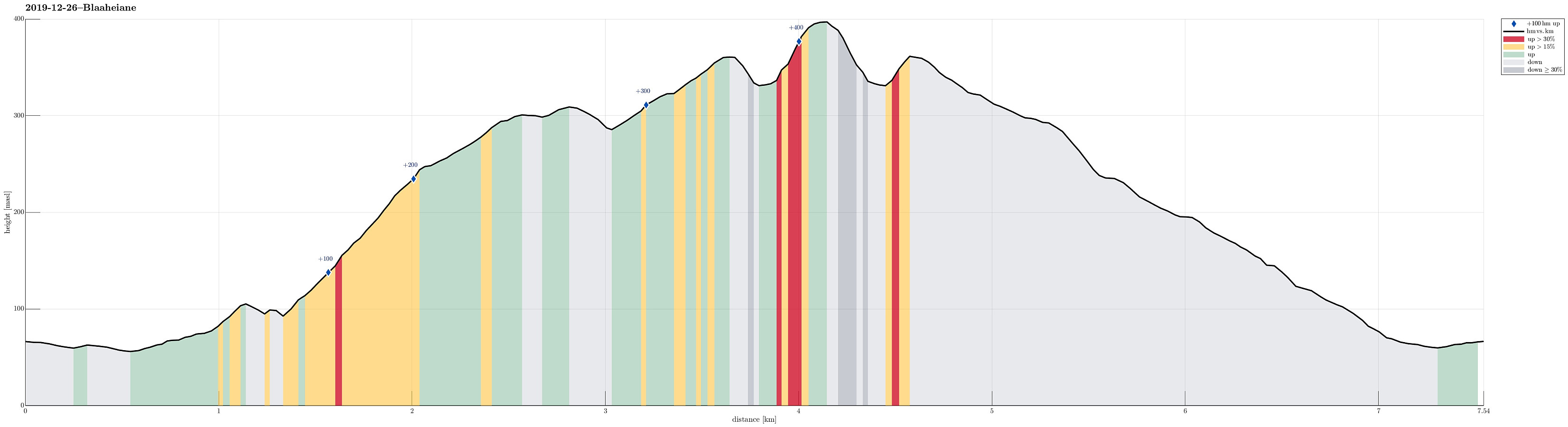
Lyshornet from Bahus via Blåheiane (26.12.2019)

| Start point | Bahus (65m) |
|---|---|
| Endpoint | Bahus (65m) |
| Characteristic | Hillwalk |
| Duration | 2h 00min |
| Distance | 7.5km |
| Vertical meters | 463m |
| GPS |
|
| Ascents | Blåheiane (310m) | 26.12.2019 |
|---|---|---|
| Lyshornet (405m) | 26.12.2019 | |
| Vetla Lyshornet (366m) | 26.12.2019 |
Trip Summary
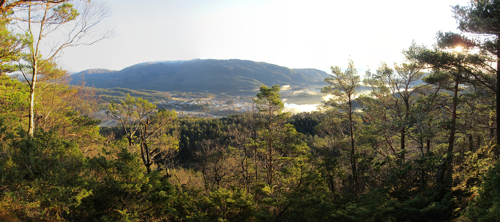
For some time, we had discussed a hike via Blåheiane to Lyshornet from Osvegen. After earlier having rejected this idea several times, this day seemed to be right for trying this idea! :-) We took the car to E39, passing by Kalandsvatnet, and parkd near Fortunet/Bahus. We first walked along the street southwards for a short stretch, before then turning right (and upwards) near house 623 on the opposite side of Vedavika. After having walked passed the house and a gravel place on our right, we turned left (and steeply upwards) at about 75mosl in order to shift over to yet another valley (one further to the south). This brought us to another gravel road at about 100mosl, leading southwards along the hillside, with some nice views over Røyknesvatnet in the east (and further into the direction of Sveningen and Gullfjellet). Shortly after, we eventually arrived at the gravel road, which leads steeply upwards through Fiskedalen, and which should take us into the direction of Blåheiane. At about 200mosl, this gravel road ends (at the very border between Bergen kommune and Os kommune!), and one needs to find a continuation across Storemyråsen without any trail. Altogether, this was easier than expected and within short time we arrived at Blåheiane. Soon, we also identified a nice vantage point at the southern "edge" of Blåheiane, significantly high above Rennedalen, offering a nice view in southeastern direction (across Søfteland and towards Møsnuken). From Blåheiane, we then started to search a connection to Lyshornet, aiming at Vetla Lyshornet first. Crossing Jordkuledalen, we quickly connectd to a nice trail that leads up to Vetla Lyshornet from its eastern side. Vetla Lyshornet, standing somehow "in the shadow" of Lyshornet, is actually worth visiting, offering some nice views from the top! We then continued in western direction, descending steeply from Vetla Lyshornet into Lyshornskaret. There, we connected to the main trail up to Lyshornet. Even though it was only a question of minutes to get up to the top (of Lyshornet), and then back down again, we still met a significant number of people there (while we did not see a single soul all of the rest of this hike). Altogether, we only spent two or three minutes on the top of Lyshornet, before seeking more quite stretches again. :-) Back via Lyshornskaret and Vetla Lyshornet, we first went back the trail, which we had taken to Lyshornet just before. Shortly after the main descent from Vetla Lyshornet, at about 350mosl, we came to a trail fork, which is important (the higher route, straight ahead, takes one into the direction of Kalandsvatnet, while the lower route, to the right, is the one that connects back to Bahus and Osvegen). Following the lower route, and appreciating a dense sequence of yellow markers, we easily found the trail across Drogemyra and Kvernhusbekken towards Bahus. We came back down to Osvegen only meters from where we had parked. Altogether, this hike turned out to be much more enjoyable than originally expected! :-)
Photos
Selected photos are available as Google photo album.
Useful Resources
See also the related FB-page Hiking around Bergen, Norway.
Petter Bjørstad has a useful page about Lysehornet and also web page WestCoastPeaks.com provides useful information about Lysehornet.
Web page UT.no from the Norwegian Trekking Association shows the marked trail on their map.

User comments