Sauafjellet from Rolvsvåg (29.09.2019)

| Start point | Rolvsvåg (30m) |
|---|---|
| Endpoint | Rolvsvåg (30m) |
| Characteristic | Hike |
| Duration | 4h 00min |
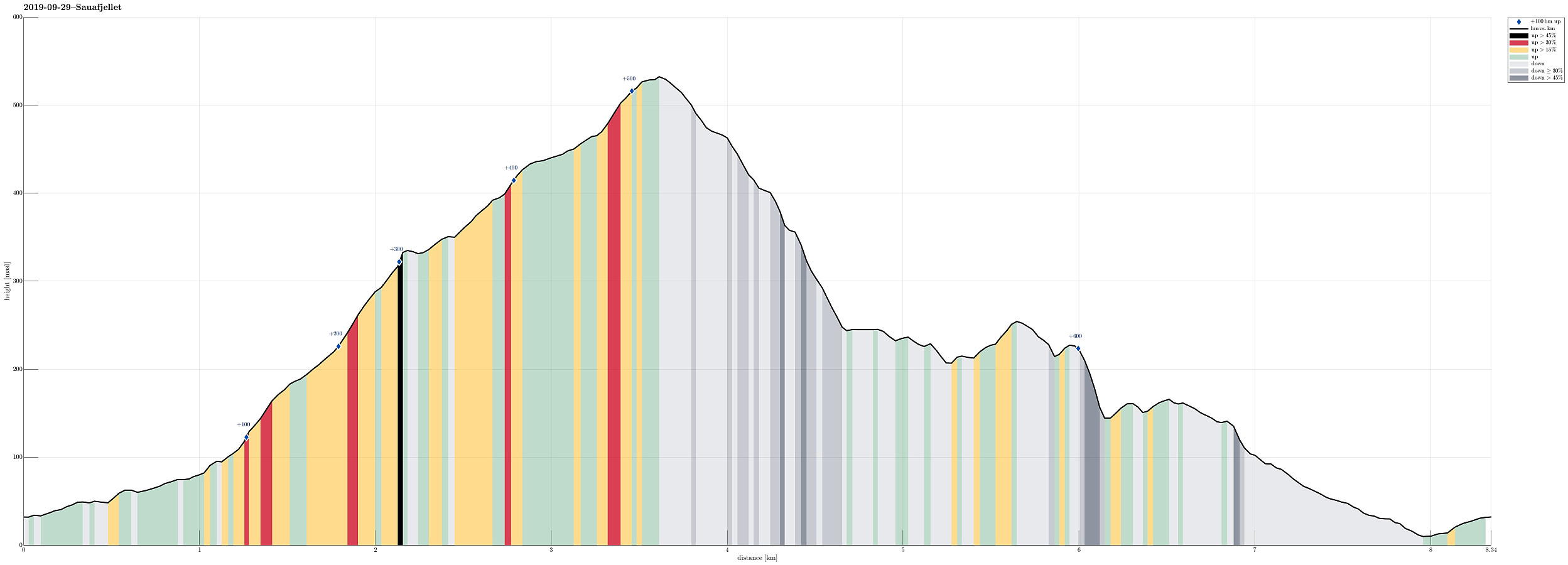
| Distance | 8.3km |
| Vertical meters | 660m |
| GPS |
|
| Ascents | Heiane (257m) | 29.09.2019 |
|---|---|---|
| Sauafjellet (538m) | 29.09.2019 |
Most of this hike is without any trail. The ascent to Sauafjellet, as described, is fine. The descent, as described, is partially steep and can be too wild for those, who aren't used to such hiking.
Trip Summary
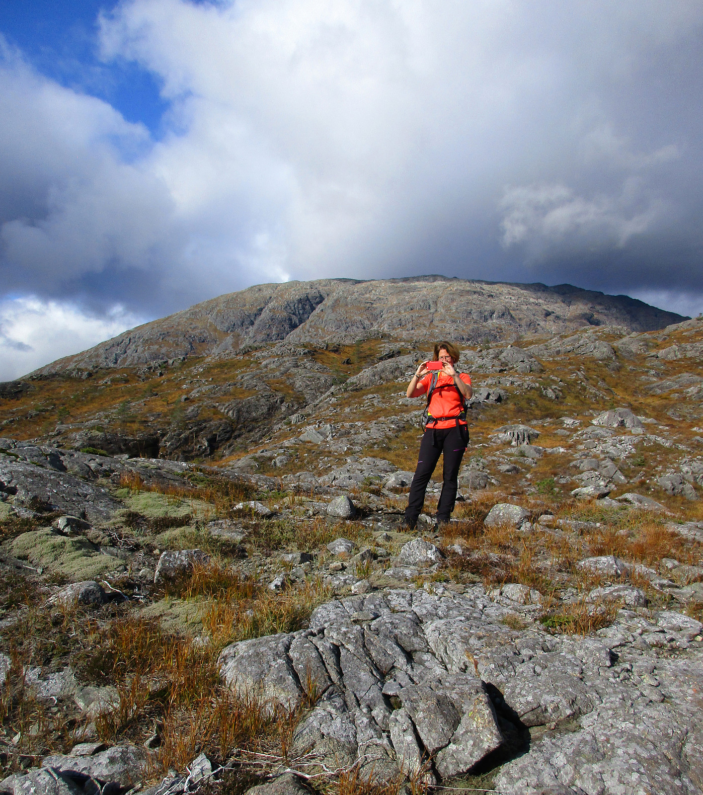
For a long time, we had set Sauafjellet aside, keeping it for "another day". Today, we decided to give Sauafjellet a try. To make this a proper hike, we discussed several variants, eventually arriving at the plan to approach Sauafjellet from its south (from Rolvsvåg). Driving northwards on the western side of Samnangerfjorden (following road 579), we parked where Setravegen meets Solbjørgvegen and started our hike along Setravegen until we had passed the industrial area at Rolvsvåg. There we found a forest road that rounds Raudsteinshaugen before then leading northwards into the direction Øykjadalen. At about 110mosl, where the forest road ascends on the eastern side of the valley, we left the forest road and continued upwards to reach the ridge in the east of Øykjadalen, also called Halsane. Hiking northwards over this ridge proved to be easily possible and straight-forward, even though we could not find any trail there. Near a place called Hildersbotnen, at about 300mosl, we stayed at the eastern side of the ridge, finding a suitable (while steep) opportunity for getting up to a little pre-top (about 340mosl). From there, the further ascent to Sauafjellet was nice and straight-forward, following its long southern ridge. At about 500mosl, very near to the top of Sauafjellet already, we then got to see to the other side with a great view to Sydpolen and Kofta (and Purkedalsgjelet in the middle). From the top of Sauafjellet we then descended into northeastern direction along the relatively steep ridge in this direction. Even though this ridge is steep, one can find suitable spots for stepping down (a bit of extra care is nonetheless recommended). At about 400mosl, we then decided to deviate from the ridge and turned right into southern direction, descending steeply to a little lake at about 360mosl. From there, we aimed to get around some very steep terrain by continuing for a bit in northeastern direction. At about 250mosl, we eventually arrived in the area below Sauafjellet, where one can find a number of small lakes (north/northwest of Heiane). We first continued into the direction of Lomahaugen, before then heading towards Heiane. From there, we headed further southwards (to get back to our car). We started this descent in southwestern direction with the goal to get to the other side of Stordalen. The descent from Heiane into Stordalen, however, proved to be steeper than expected (still possible). On the map we had seen that on the west of Mørkedalen we should find another forest road. After a short further descent we eventually found this forest road and followed it further down towards Rolvsvåg. All in all, we enjoyed this hike which mostly was without any trail and especially the ascent via the southern ridge of Sauafjellet was nice!
Photos
Selected photos are available as Google photo album.
Useful Resources
See also the related FB-page Hiking around Bergen, Norway.
Petter Bjørstad has a useful page about Sauafjellet and also web page WestCoastPeaks.com provides useful information about Sauafjellet.

User comments