Blægja (29.07.2019)

| Start point | Blægja parking (43m) |
|---|---|
| Endpoint | Blægja parking (43m) |
| Characteristic | Hike |
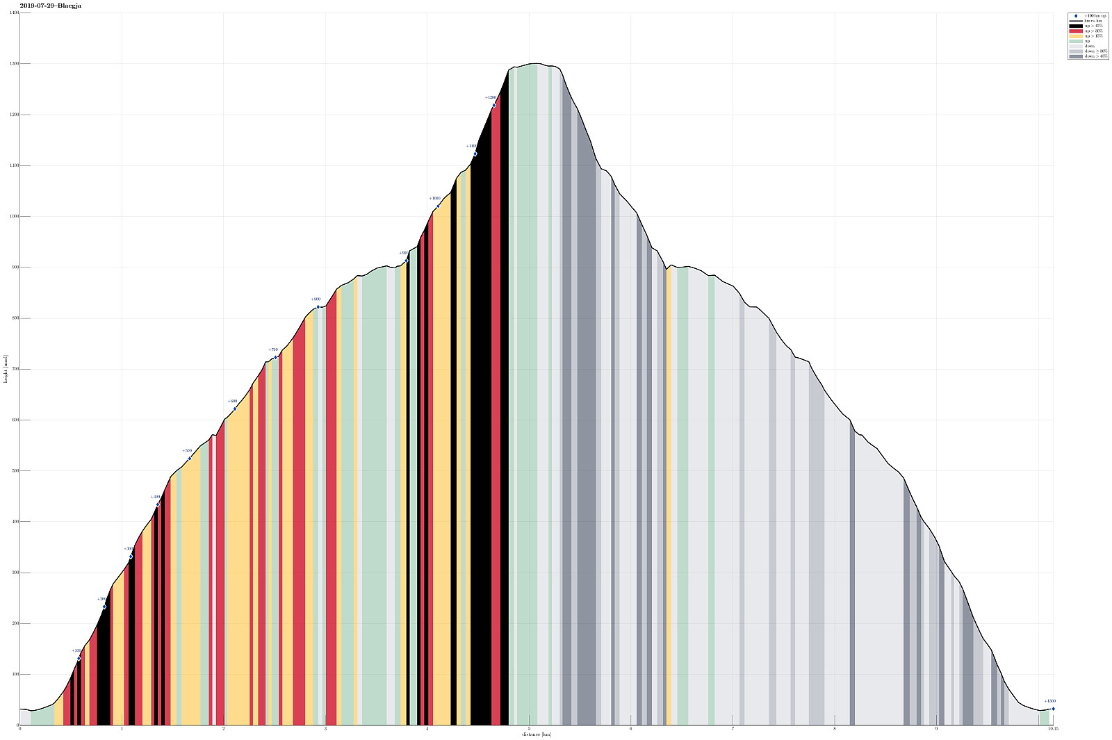
| Duration | 7h 00min |
| Distance | 10.1km |
| Vertical meters | 1,300m |
| GPS |
|
| Ascents | Blægja (1,304m) | 29.07.2019 |
|---|---|---|
| Visits of other PBEs | Blægja parkering (43m) | 29.07.2019 |
Trip Summary
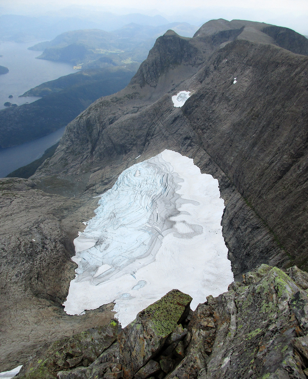
After day #5 of our five days hike through Breheimen, we decided to a "bonus hike". After driving mostly westwards from Breheimen, we stayed in Førde for the night (our goal was to hike up Blægja the next day). The next morning, after driving further westwards from Førde, following road #609 along the southern coast of Førdefjorden, we parked between Hestvika and Rørvika near an information board, right next to the road. After walking down the road for a short stretch, we easily found the trail-head, leading southwards from the road. After first following a forest road for a short distance, the trail leaves to the right and into the forest (once you find it, it's then easy to follow). The path leads upwards, through the forest, staying on the eastern side of a valley, where water from Nipevatnet and Tobbedalsvatnet comes down. At about 400mosl, the trail forks into a smaller one (continuing to the left), leading to Hengenipa, and the main trail (continuing to the right), leading further up (and eventually to Blægja). At about 550mosl, or so, one passes the tree line and looking back is rewarded with nice views of Førdefjorden. At about 650mosl, the path turns a bit left (in southeastern direction) and upwards into the direction of Rørvikenipa (at this stage of the hike, one does not really see much of Blægja as its hidden behind Rørvikenipa, which is very impressive to look up to from below!). At about 800mosl, the path starts to round Rørvikenipa in its south, leading diagonally into the valley south of Rørvikenipa, where also Nipevatnet is located. Here, the terrain becomes rocky and at times it is necessary to step over (large) stones in order to proceed. Once one gets close to Nipevatnet (at about 900mosl), the mountain turns into a huge pile of stones. All the rest of the hike up to Blægja is then stepping from stone to stone. The trail then leads diagonally upwards from Nipevatnet to the saddle between Blægja and Rørvikenipa and from there to the top of Blægja. Since all of these last 400 height meters are basically stones to step over, one needs to be well-concentrated (both on the way up and down). The top of Blægja is then "surprisingly" flat and one isn't even quite sure where the "top" really is (it makes sense, though, to assume that the big cairn is marking the actual top of Blægja and one reaches it easily by walking the last meters across the large, flat mountain top). Once at the cairn, one also gets to enjoy great views to Førdefjorden and also down to Blåfonna, i.e., a small glacier that is tucked to Blægja on its northeastern side. After a short break, we then turned back, following the same path down that we had taken up first. Even though it was not a problem at all, we still got a bit releaved when we had passed the long stretch with just stones underneath. It's simply good to not twist an ankle there! :-) All in all, Blægja really is a very nice mountain, offering nice views in all directions!
Photos
Selected photos are available as Google photo album.
Useful Resources
See also the related FB-page Hiking around Bergen, Norway.
Petter Bjørstad has a useful page about Blægja and also web page WestCoastPeaks.com provides useful information about Blægja.
Web page UT.no from the Norwegian Trekking Association recommends basically the same hike.

User comments