Vasslifjellet via Soleibakkane (25.11.2018)

| Start point | Sædalen (150m) |
|---|---|
| Endpoint | Sædalen (150m) |
| Characteristic | Hillwalk |
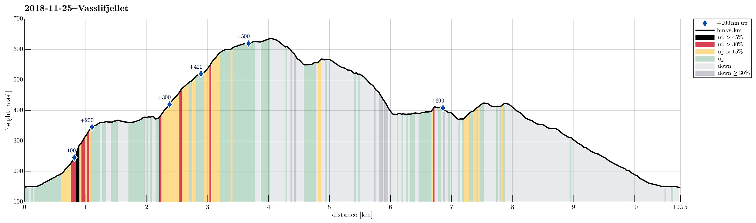
| Duration | 3h 00min |
| Distance | 10.8km |
| Vertical meters | 679m |
| GPS |
|
| Ascents | Landåsfjellet (428m) | 25.11.2018 |
|---|---|---|
| Landåsfjellet trigpunkt (427m) | 25.11.2018 | |
| Storhaugen (419m) | 25.11.2018 | |
| Vasslifjellet (629m) | 25.11.2018 | |
| Visits of other PBEs | Gløvrehaugen søyle (378m) | 25.11.2018 |
| Indianerstien (561m) | 25.11.2018 | |
| Indre Sædal p-plass (165m) | 25.11.2018 | |
| Lidskjalv (625m) | 25.11.2018 | |
| Noreg (634m) | 25.11.2018 | |
| Soria Moria (ruin) (610m) | 25.11.2018 | |
| Soriabakken (585m) | 25.11.2018 | |
| Turnerhytten d.e. (ruin) (550m) | 25.11.2018 | |
| Ørneredet (ruin) (443m) | 25.11.2018 |
Trip Summary
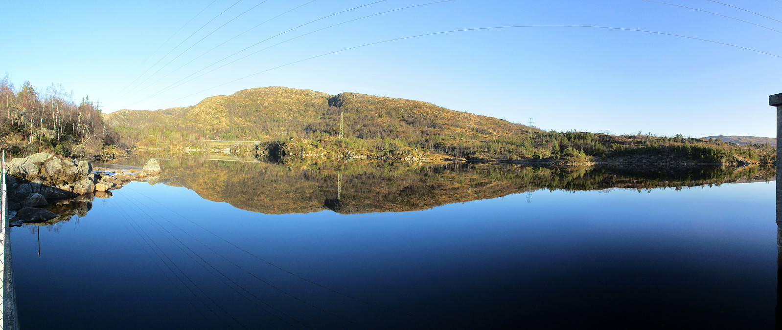
We took the car to Sædalen, behind Nattlandsfjellet, and parked it at the lower end of Indre Sædal. From there, we first followed street Sædalssvingane upwards (in northeastern direction, towards Løypingsberget). But instead of following the road all the way to its highest point, we on the eastern side of the valley and ascended (mostly without a path there) further up there. Shortly before reconnecting with the road (at its highest point), we aligned with the water that is coming down from Søre Gløvrevatnet. We climbed further up, first on the water's eastern side, before then crossing it and ascending to the ridge that leads further up from there. There, we also found a nice path, which was easy and straight-forward to follow further upwards. Soon after, we came to Søre Gløvrevatnet and surrounded it in its south (walking over several dams there). Once we got around there, we enjoyed some nice views into the south (over Grimsdalen). We then followed a small ridge on the southeastern side of Søre Gløvrevatnet, passing by Gløvrehaugen, and crossing over to Soleibakkane. While stepping up this mountainside, we very much enjoyed some nice winter sun! Our ascent lead us up to Vasslifjellet and we shared this nice afternoon with quite a number of others, who seemingly had had the same or a similar idea! :-) We then crossed Vasslifjellet in northern direction in order to get to Soriabakken, where we then started our descent. At Vassdalvatnet, we crossed over (now in western direction) to Vassdalshaugen, which we then followed downwards (in southern direction). At about 550 mosl, we left the ridge and descended into the valley, which runs down (in southern direction) in the east of Vassdalshaugen. There, after a few steps without a path, we quickly reconnected with a proper path that brought us down to Stemmevatnet. We surrounded Stemmevatnet then in its northwest, before making a short detour up to Storhaugen. Since it was unclear for us, how steep Storhaugen would be on its southern flank, we decided to go back instead and walk around it. From there, we then decided to also include Landåsfjellet, before finding the road Indre Sædal and following this one all the way back to our car. Altogether, this was a beautiful hike in best-possible winter weather! :-)
Photos
Selected photos are available as Google photo album.
Useful Resources
See also the related FB-page Hiking around Bergen, Norway.
Web page WestCoastPeaks.com provides useful information about Ulriken, Vasslifjellet, Storfjellet, and Altfjellet.
Web page UT.no from the Norwegian Trekking Association recommends a similar hike.

User comments