Storhovden in Kanadaskogen (12.12.2015)

| Start point | Varden (45m) |
|---|---|
| Endpoint | Varden (45m) |
| Characteristic | Hike |
| Duration | 1h 30min |
| Distance | 7.1km |
| Vertical meters | 414m |
| GPS |
|
| Ascents | Hesjaholten (106m) | 12.12.2015 |
|---|---|---|
| Storhovden (174m) | 12.12.2015 | |
| Visits of other PBEs | Storhovden utsiktspunkt (172m) | 12.12.2015 |
| Sælen kirke p-plass (15m) | 12.12.2015 |
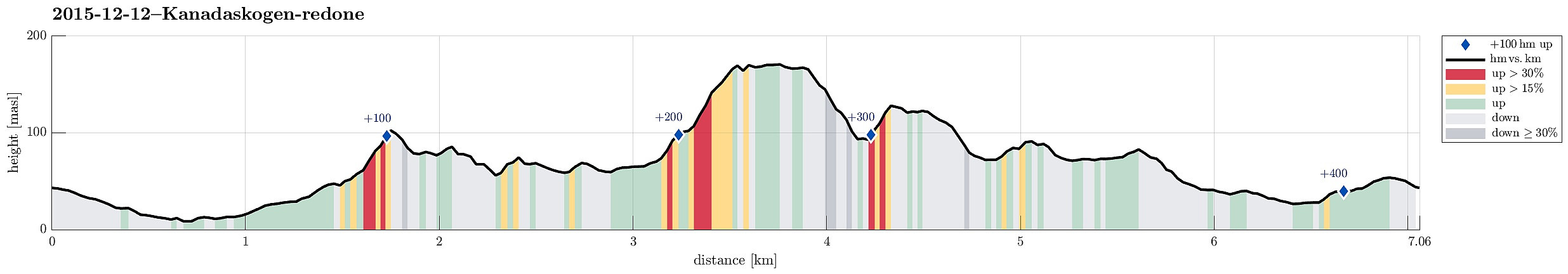
Note that this track has been created a posteriori, i.e., from memory, not automatically recorded.
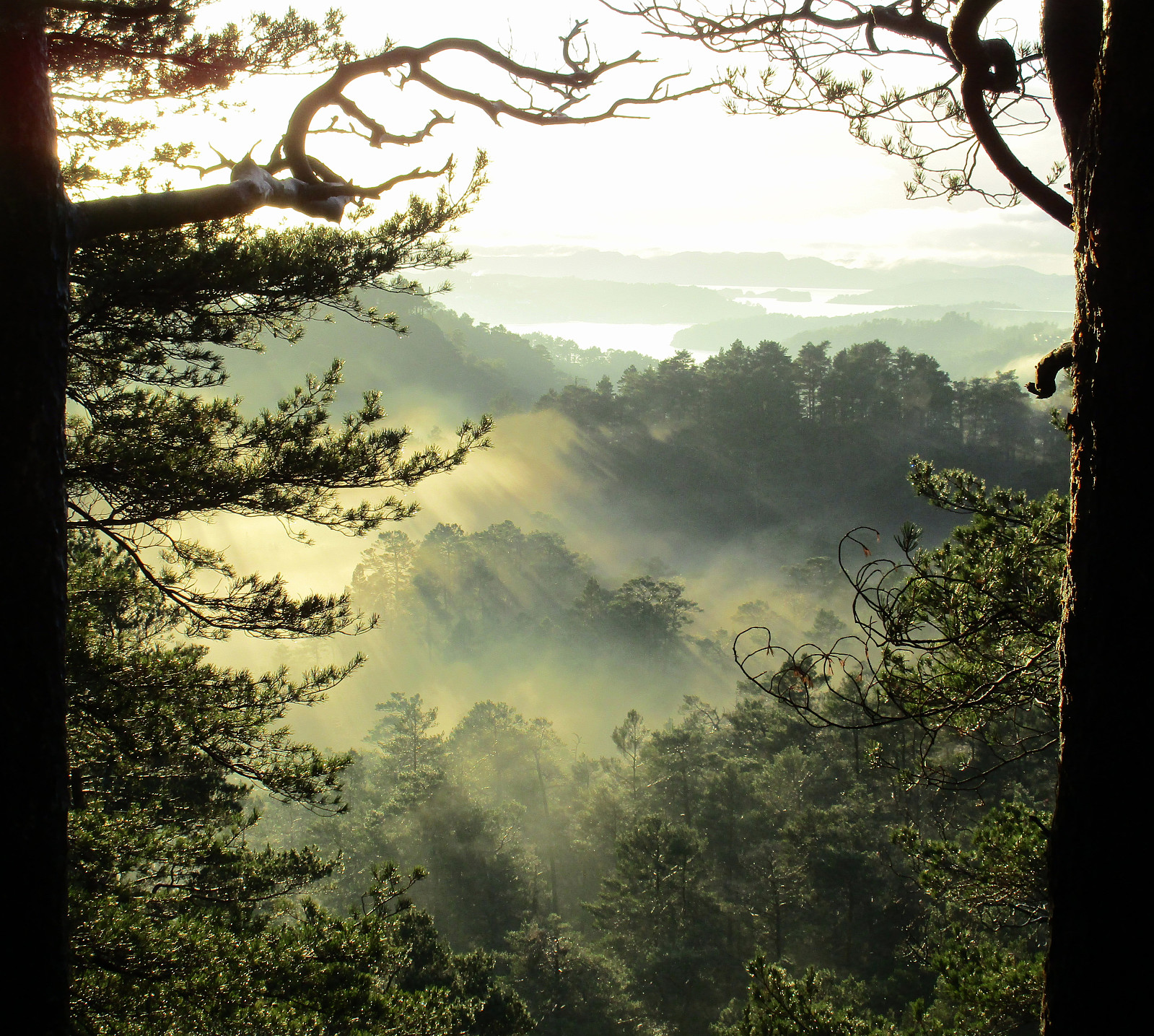
Trip Summary
We started from Varden, entering Kanadaskogen near Hesjaholten. From there, we mostly followed small paths---if paths at all---approaching and ascending to Storhovden. Back, we first descended a little wilder from Storhovden than what would have been necessary---not recommended, actually. We then connected back to Syningen and from there we reached Stora Krokatjørna on a nice path. From there, we connected back to Hesjaholten, passing by Litla Krokatjørna, also.
Photos
Selected photos are available as Google+ photo album.

User comments