Le Mai (13.07.2015)

| Start point | Route du Mai (135m) |
|---|---|
| Endpoint | Route du Mai (135m) |
| Characteristic | Hillwalk |
| Duration | 2h 00min |
| Distance | 6.1km |
| Vertical meters | 273m |
| GPS |
|
| Visits of other PBEs | Notre Dame du Mai (356m) | 13.07.2015 |
|---|
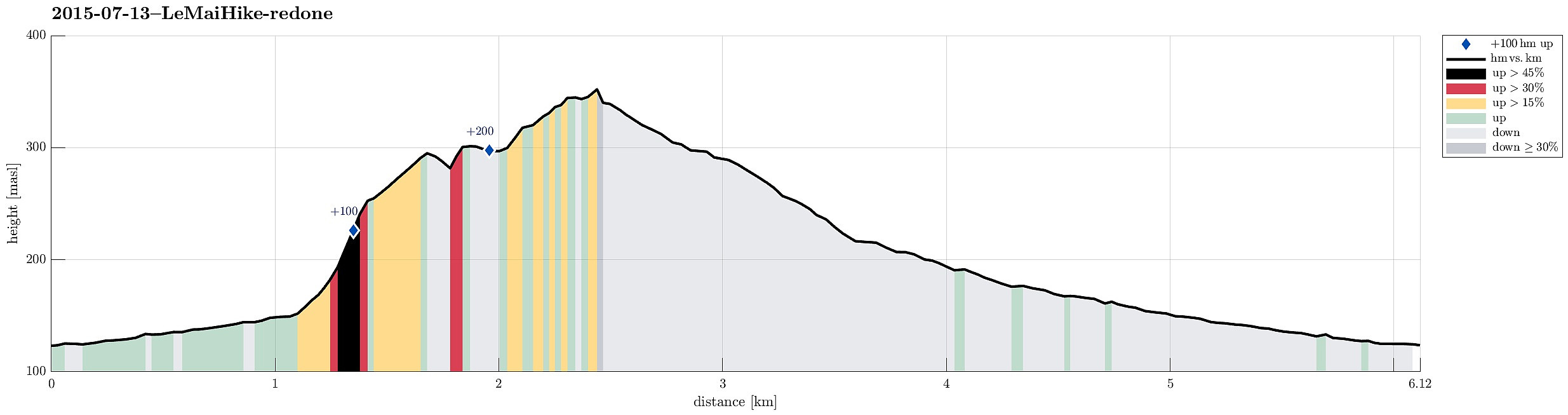
Note that this track has been created a posteriori, i.e., from memory, not automatically recorded.
Trip Summary
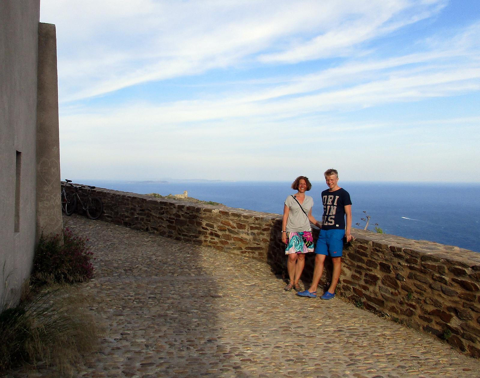
Quick evening hike on Le Mai with outstanding views over both the south (The Mediterranean Sea) and the north (Toulon).
Photos
Selected photos are available as Google+ photo album.

User comments