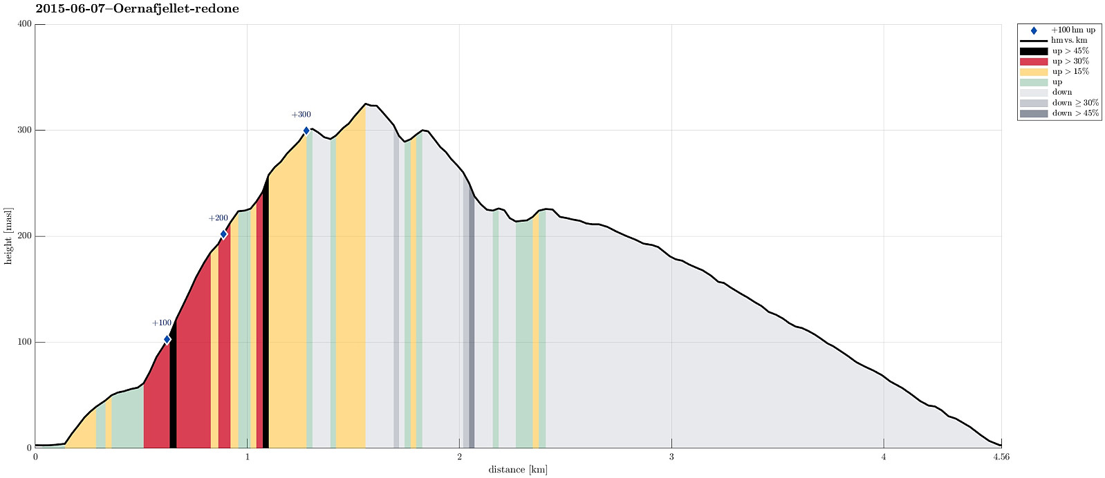
Ørnafjellet (07.06.2015)

| Start point | NUTEC (5m) |
|---|---|
| Endpoint | NUTEC (5m) |
| Characteristic | Hillwalk |
| Duration | 1h 06min |
| Distance | 4.6km |
| Vertical meters | 370m |
| GPS |
|
| Ascents | Ørnafjellet (329m) | 07.06.2015 |
|---|---|---|
| Ørnafjellet Nord (304m) | 07.06.2015 |
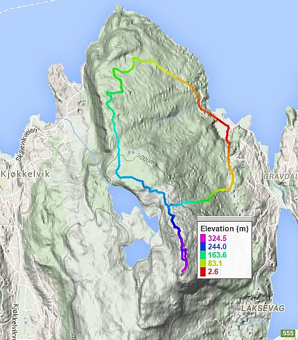
Note that this track has been created a posteriori, i.e., from memory, not automatically recorded.
Trip Summary
Starting from NUTEC, we first connected (via some stairs in the back of Hesteviken and through the forest along a simple path) to the path (called Mørderbakken!), which leads up to Ørnafjellet from the east (quite steep, but not as bad as the name would suggest). Once on the ridge, we turned left to quickly ascend to Ørnafjellet, where we turned. Back, we took the path that connects to the road, which we then descended back to NUTEC.
Useful Resources
Web page WestCoastPeaks.com provides useful information about Lyderhorn and Ørnafjellet.
Web page SpillBy.com describes Ørnafjellet and
web page FotTurer.com describes a tour up Ørnafjellet.

User comments