Sandviksfjellet (29.12.2014)

| Start point | Eidsvåg (20m) |
|---|---|
| Endpoint | Mulen (80m) |
| Characteristic | Hillwalk |
| Duration | 3h 00min |
| Distance | 10.3km |
| Vertical meters | 501m |
| GPS |
|
| Visits of other PBEs | Aasebu (370m) | 29.12.2014 |
|---|---|---|
| Fløyen stasjon (313m) | 29.12.2014 | |
| Fløypilen (299m) | 29.12.2014 | |
| Grindarasten (375m) | 29.12.2014 | |
| Ishuset ved Langevatnet (127m) | 29.12.2014 | |
| Regnhytten (359m) | 29.12.2014 | |
| Vannverkshus i Skiveien (244m) | 29.12.2014 |
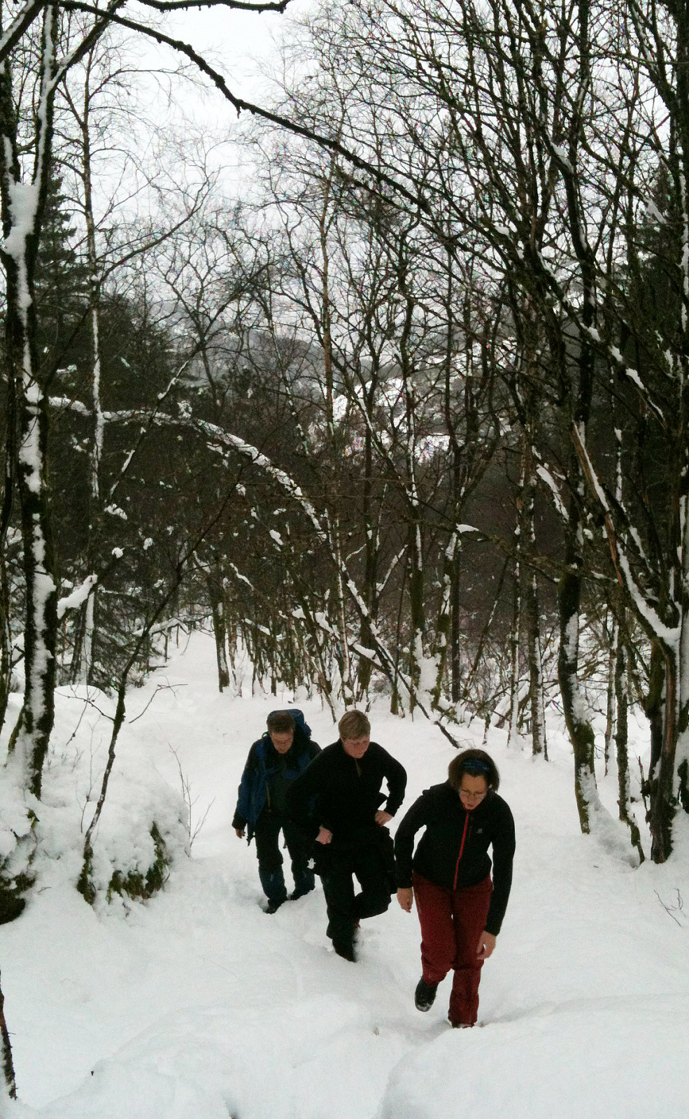
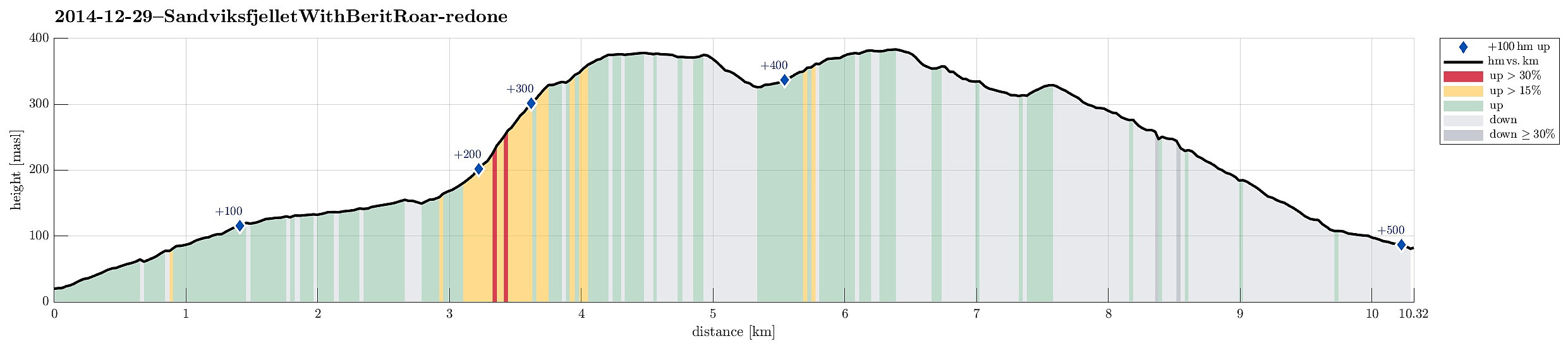
Note that this track has been created a posteriori, i.e., from memory, not automatically recorded.
Trip Summary
Starting from Eidsvåg, following the street up to Munkebotn and then further up Sandviksfjellet. After a short break in the small hut at Aasebu, we continued to Fløyen and from there back down towards Mulen. Even though the weather was pretty wet, we still enjoyed some snow and a good hike! :-)
Useful Resources
Web page UT.no from the Norwegian Trekking Association recommends a similar hike up Sandviksfjellet.

User comments