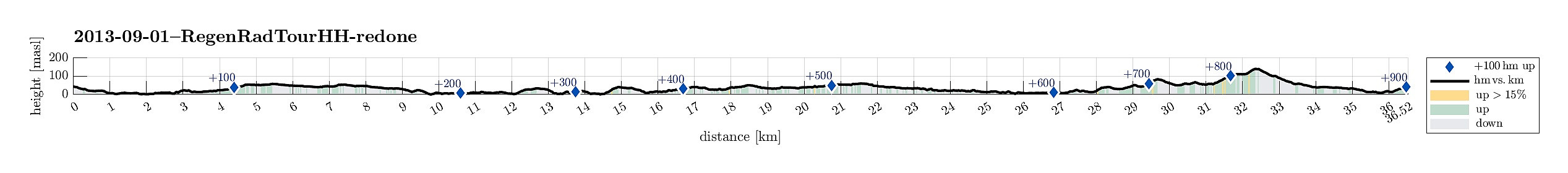
South-of-Fyllingsdalen cycling (01.09.2013)

| Start point | Einerhaugen (45m) |
|---|---|
| Endpoint | Einerhaugen (45m) |
| Characteristic | Bike trip |
| Duration | 2h 00min |
| Distance | 36.5km |
| Vertical meters | 906m |
| GPS |
|
| Visits of other PBEs | Bøneshallen p-plass (110m) | 01.09.2013 |
|---|---|---|
| Casperkollen turparkering (48m) | 01.09.2013 | |
| Straume bro (5m) | 01.09.2013 | |
| Sælen kirke p-plass (15m) | 01.09.2013 |
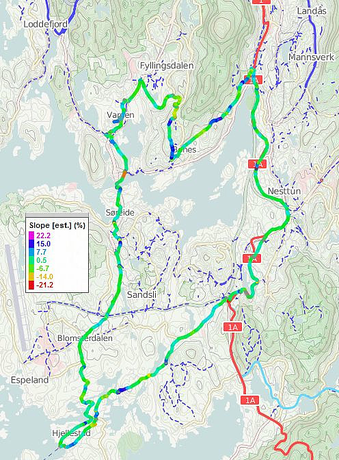
Note that this track has been created a posteriori, i.e., from memory, not automatically recorded.
Trip Summary
Moderately long cycling tour around Nordåsvatnet.

User comments