Kanadaskogen jogging (01.01.2013)

| Start point | Einerhaugen (45m) |
|---|---|
| Endpoint | Einerhaugen (45m) |
| Characteristic | Jogging |
| Duration | 1h 06min |
| Distance | 10.0km |
| Vertical meters | 325m |
| GPS |
|
| Visits of other PBEs | Spelhaugen p-plass (60m) | 01.01.2013 |
|---|---|---|
| Sælen kirke p-plass (15m) | 01.01.2013 | |
| Tennebekktjernet (95m) | 01.01.2013 | |
| Tennebekktjørna p-plass (100m) | 01.01.2013 | |
| Tjørnagrind (96m) | 01.01.2013 |
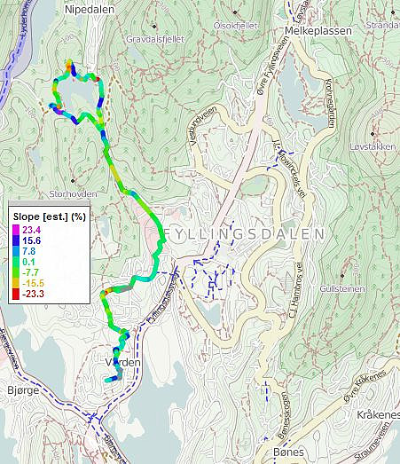
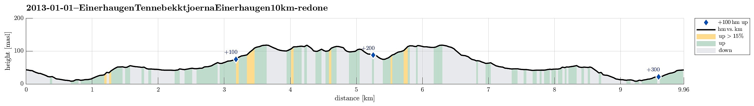
Note that this track has been created a posteriori, i.e., from memory, not automatically recorded.
Trip Summary
New-year jogging around Tennebekkvatnet in Kanadaskogen. :-)

User comments