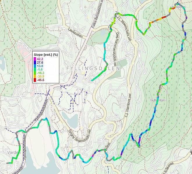
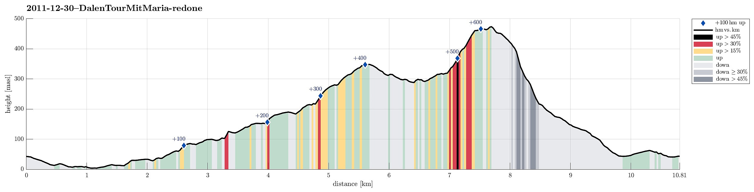
Løvstakken (30.12.2011)

| Start point | Einerhaugen (45m) |
|---|---|
| Endpoint | Oasen (45m) |
| Characteristic | Hillwalk |
| Duration | 1h 30min |
| Distance | 10.8km |
| Vertical meters | 639m |
| GPS |
|
| Ascents | Gullsteinen (352m) | 30.12.2011 |
|---|---|---|
| Løvstakken (478m) | 30.12.2011 | |
| Storhaugen 470 (470m) | 30.12.2011 | |
| Visits of other PBEs | Gullsteinen utsiktspunkt (341m) | 30.12.2011 |
| Gullstølen (ruin) (282m) | 30.12.2011 | |
| Speiderly (285m) | 30.12.2011 | |
| Sælen kirke p-plass (15m) | 30.12.2011 |
Note that this track has been created a posteriori, i.e., from memory, not automatically recorded.
Trip Summary
Walk via Gullsteinen to Løvstakken and retour.
Useful Resources
Web page WestCoastPeaks.com provides useful information about Løvstakken.

User comments