Ulriken (21.02.2013)

| Start point | Haukeland hospital (50m) |
|---|---|
| Endpoint | Haukeland hospital (50m) |
| Characteristic | Hillwalk |
| Duration | 1h 30min |
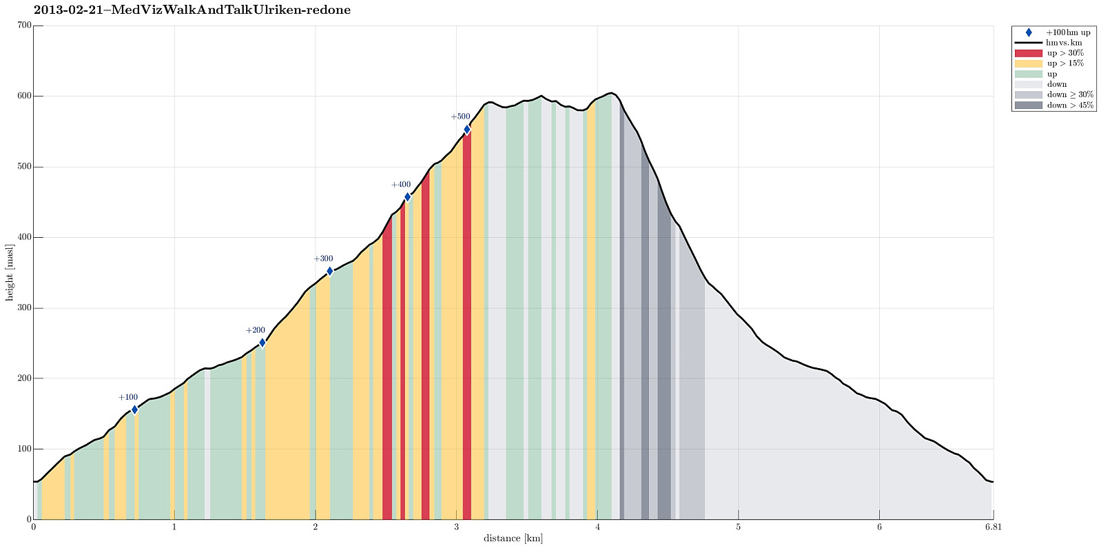
| Distance | 6.8km |
| Vertical meters | 588m |
| GPS |
|
| Ascents | Ulriken Vest (607m) | 21.02.2013 |
|---|---|---|
| Visits of other PBEs | Lorthaughytten (ruin) (570m) | 21.02.2013 |
| Nødkjelke, Oppstemten (442m) | 21.02.2013 | |
| Nødkjelke, Ulriken (586m) | 21.02.2013 | |
| Ravnegrind (228m) | 21.02.2013 | |
| Stormfuglen (592m) | 21.02.2013 | |
| Ulriksbanen (99m) | 21.02.2013 |
Note that this track has been created a posteriori, i.e., from memory, not automatically recorded.
Trip Summary
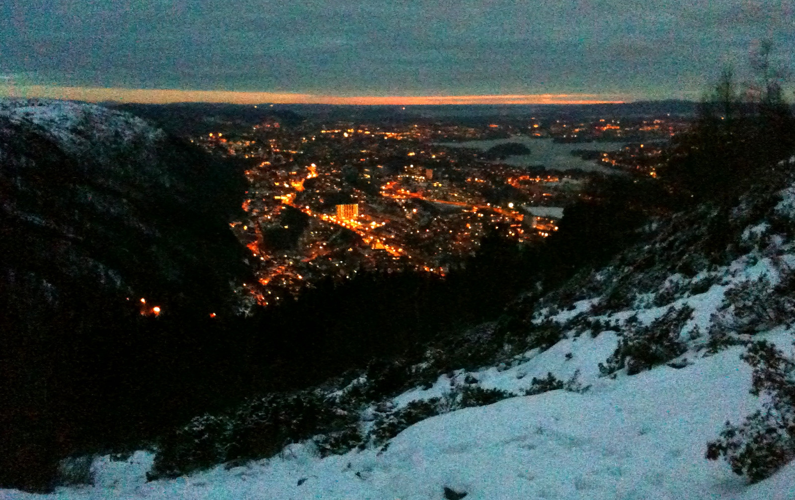
Late afternoon / early night walk up and down Ulriken!
Useful Resources
Web page WestCoastPeaks.com provides useful information about Haugavarden, Ulriken, Storfjellet, and Landåsfjellet
and also Petter Bjørstad has a useful page about Ulriken.
Web page UT.no from the Norwegian Trekking Association recommends a similar hike up Ulriken.

User comments