Archive - Date
Archive - Activity
-
Other trip (2)
- Expedition (2)
-
Other winter trip (4)
- Snowshoe trip (4)
- Ski trip (2)
- Trip by foot (220)


Favourite trips
Ben More og Stob Binnein
- Date:
- 12.05.2018
- Characteristic:
- Hillwalk
- Distance:
- 10.7km
 Vakker maidag åpenbarte seg, og vi turet til Benmore Farm for oppstigning.
Lett langs vei litt i overkant av 1 km, for så å bryte av med nesen rett mot toppen, gode 1000 hm og toppvarden er nådd.
Etter en matbit og nytelse av utsikt i godværet, bærer det ned vell 300 hm, for så å stige tilsvarende, men da er også Stob Binnein, med sine 1165 meter inntatt. Synes av Stob Binnein er en penere fjelltopp en den litt høyere Ben More.
Returnerte etter en grei travers ned i dalen til veien. Fulgte denne tilbake til utgangspunktet.
Definitivt en tabbe å ikke komplettere med Stob Coire an Lochain.
Ben More, sett fra turstart.
Utsikt ned til Benmore Farm og Loch Lubhair
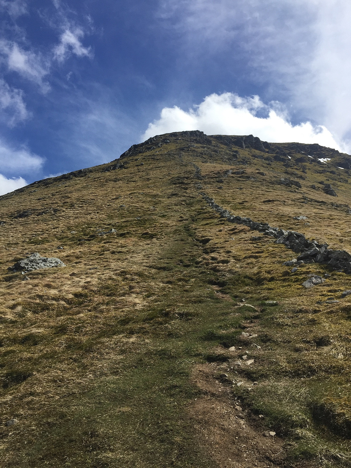
Fortsatt noen hm før oppe
Toppvarde Ben More
Toppvarde Ben More med Stob Binnein i bakgrunnen
Ben More fra oppstigning Stob Binnein
Vakker maidag åpenbarte seg, og vi turet til Benmore Farm for oppstigning.
Lett langs vei litt i overkant av 1 km, for så å bryte av med nesen rett mot toppen, gode 1000 hm og toppvarden er nådd.
Etter en matbit og nytelse av utsikt i godværet, bærer det ned vell 300 hm, for så å stige tilsvarende, men da er også Stob Binnein, med sine 1165 meter inntatt. Synes av Stob Binnein er en penere fjelltopp en den litt høyere Ben More.
Returnerte etter en grei travers ned i dalen til veien. Fulgte denne tilbake til utgangspunktet.
Definitivt en tabbe å ikke komplettere med Stob Coire an Lochain.
Ben More, sett fra turstart.
Utsikt ned til Benmore Farm og Loch Lubhair
Fortsatt noen hm før oppe
Toppvarde Ben More
Toppvarde Ben More med Stob Binnein i bakgrunnen
Ben More fra oppstigning Stob Binnein
Meall Ghaordaidh
- Date:
- 21.05.2015
Fra arngeir (Arngeir Syversen) rapport: Start measuring from Killin, at the west end of Loch Tay. Find the exit towards "Moirlanich Longhouse", on the south side of the river, and follow it past the Longhouse and up to where it meets another road. Turn left and follow this merged road a total of 2.6 km (1.6 mi). Note the exit towards Meall Ghaordaidh approximately 100 metres before you get to the only car park opportunity, which is where you need to park (on the right hand side of the road, where it's slightly wider). Start your hike by walking 100 metres back towards the exit to Meall Ghaordaidh and turn left through a gate. Follow the clear dirt road a few hundred metres, cross another gate, and head uphill towards another fence. Cross this fence and now take on the long hill going towards the summit. When you >>>
Dumyat
- Date:
- 03.05.2014
Fra Arngeir sin log: From the round-about where road A91 turns east, north-east of Stirling, drive 1.2 km (0.75 mi) east on A91 to where it's signed for parking on the left hand side of the road. Park here. Start your walk by crossing the gate at the far end of the car park and then turn left onto a wide path. Follow this path 180 metres, to a gate, and turn right and walk up along a fence. Follow this path up to 175m, approximately 90 metres after you've crossed a gully. Instead of following the path 90° right continue straight ahead on a vague path, towards a wooden gate. Cross the gate and continue straight ahead up to the ridge. At the ridge turn right and follow the well defined path 1.2 km east to the summit, which is marked by a large cairn. Descend by reversing your ascent route. 03. >>>

