Archive - Date
Archive - Activity
- Bike trip (2)
-
Climbing (5)
- Alpine climbing (1)
-
Drive (1)
- Car drive (1)
-
Other trip (18)
- Expedition (1)
- Kayaking (12)
-
Other winter trip (125)
- Skating (5)
- Snowshoe trip (120)
-
Ski trip (474)
- Backcountry skiing (114)
- Cross-country skiing (6)
- Randonnée/Telemark (350)
-
Trip by foot (2121)
- Alpine trip (8)
- Hike (1223)
- Hillwalk (254)
- Jogging (472)
- Walk (10)
-
Workout (10)
- Treadmill (4)
Archive - Geography
Collected lists
-
Sogn og Fjordane ≥ 250m pf.
(317/320)
 99%
99% -
Sogn og Fjordane ≥ 100m pf.
(1152/1169)
98%
-
Sogndal ≥ 100m pf.
(78/81)
96%
-
Hurrungane > 2000 moh pf 30.
(22/23)
95%
-
Vanylven ≥ 100m pf.
(38/40)
95%
-
Herøy ≥ 100m pf.
(17/18)
94%
-
Ålesund ≥ 100m pf.
(57/61)
93%
-
Opptur i Sogn og Fjordane peaks
(147/177)
83%
-
Osterøy ≥ 100m pf.
(19/23)
82%
-
Opptur Indre Sunnfjord
(77/97)
79%
-
Stord ≥ 100m pf.
(7/9)
77%
-
Fitjar ≥ 100m pf.
(5/7)
71%
-
Masfjorden ≥ 100m pf.
(39/56)
69%
-
Alver ≥ 100m pf.
(38/55)
69%
-
Vestland kommunetopper
(27/41)
65%
-
Møre og Romsdal ≥ 500m pf.
(100/161)
62%
-
Volda ≥ 100m pf.
(55/90)
61%
-
Lindås ≥ 100m pf.
(26/43)
60%
-
Jotunheimen ≥ 100m pf.
(100/171)
58%
-
Sør-Norge ≥ 500m pf
(236/404)
58%


Eikåsnipa og alltid ein først!
- Date:
- 17.01.2026
- Distance:
- 5.2km
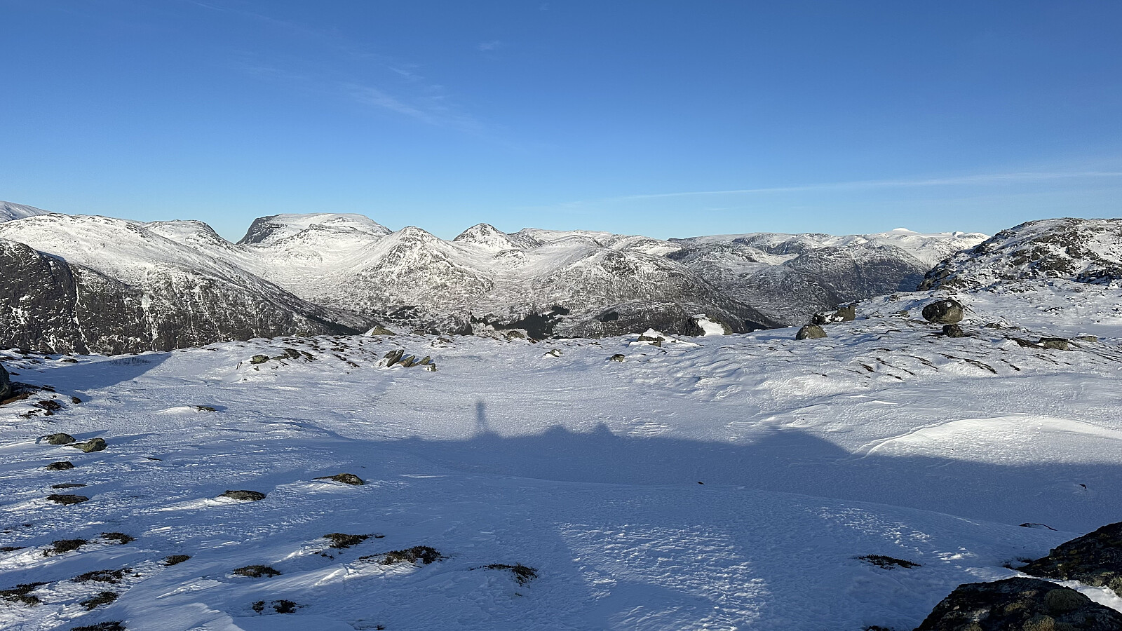
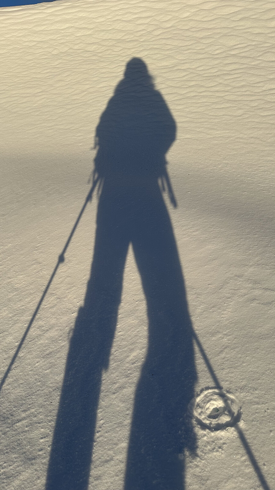
 Eit håp om å svette ut siste influensa symptoma i roleg tempo! Kjente sola varma og det kjennast befriande å være i eige selskap åleine mot toppen av Eikåsnipa.
Så er det alltid like artig å kike på harepus sine spor som førstemann til toppen!
Eit håp om å svette ut siste influensa symptoma i roleg tempo! Kjente sola varma og det kjennast befriande å være i eige selskap åleine mot toppen av Eikåsnipa.
Så er det alltid like artig å kike på harepus sine spor som førstemann til toppen!

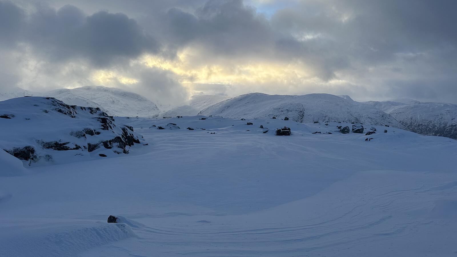
Orkja - Jølster - Vind påvirka snø!
- Date:
- 02.01.2026
- Distance:
- 6.4km
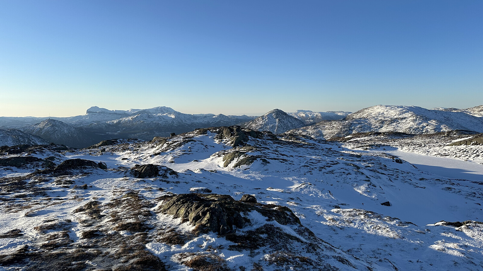
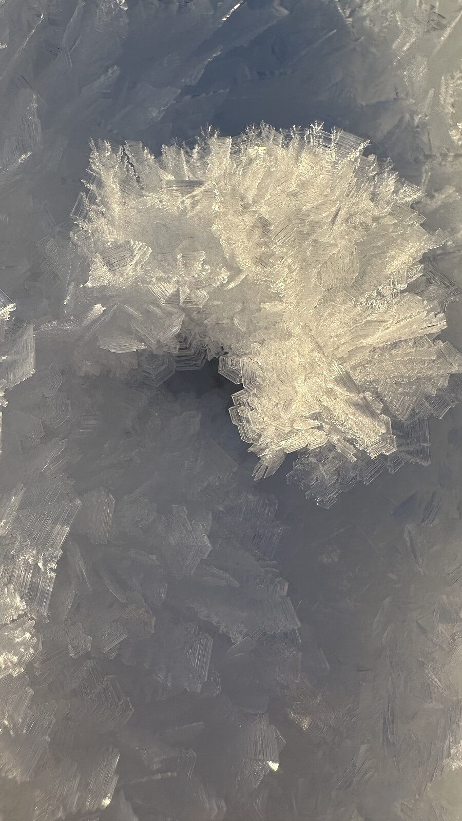
 Strålande ver og tur til Orkja på truger. Ganske så vindpåvirka snø og dårlig skiføre med forlite snø. Likevel var det mykje folk på parkeringa til Olahansfjellet som ville teste ski lykka!
Ganske fascinerende å studere snødetaljer når vinden har herja!
Strålande ver og tur til Orkja på truger. Ganske så vindpåvirka snø og dårlig skiføre med forlite snø. Likevel var det mykje folk på parkeringa til Olahansfjellet som ville teste ski lykka!
Ganske fascinerende å studere snødetaljer når vinden har herja!
Eikåsnipa siste dag i 2025
- Date:
- 31.12.2025
- Characteristic:
- Hike
- Distance:
- 5.2km
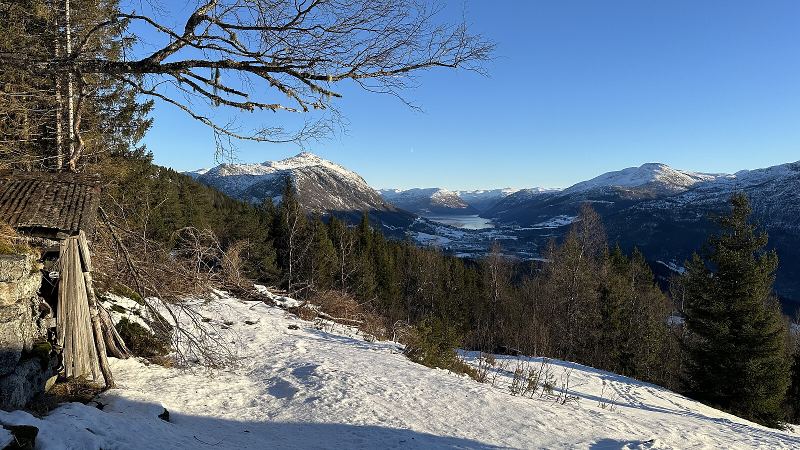
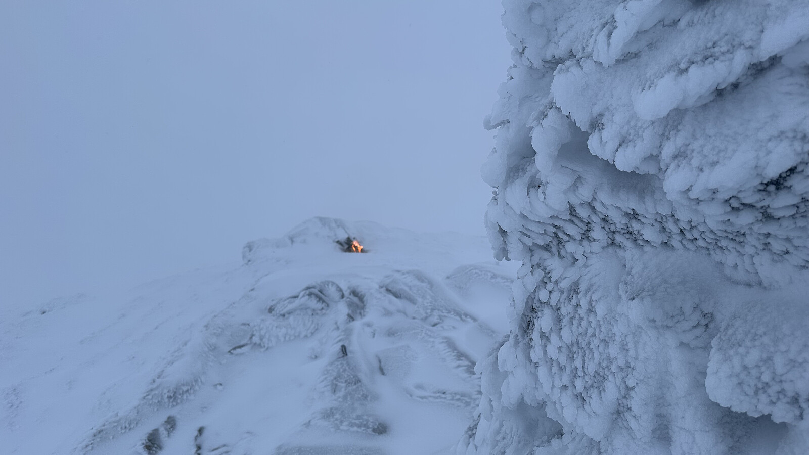 Etter halv dag på jobb var det fint å luffe opp på Eikåsnipa ein tur! Plukka med ved ifrå støylen og kjekt å lage nyttårsbålet på favoritt fjellet. Lite sikt men like fint er det! Eg kjenner utsikta og det vart bålet som gav magien i akkurat denne stunda på toppen! :)
Godt Nyttår 2026
Etter halv dag på jobb var det fint å luffe opp på Eikåsnipa ein tur! Plukka med ved ifrå støylen og kjekt å lage nyttårsbålet på favoritt fjellet. Lite sikt men like fint er det! Eg kjenner utsikta og det vart bålet som gav magien i akkurat denne stunda på toppen! :)
Godt Nyttår 2026
Orkja - Jølster
- Date:
- 29.12.2025
- Distance:
- 6.4km
 Tur på Orkja til fots ilag med Inge. Komt noko nysnø på toppen, men forlite snø til ski på Olahansfjellet.
Tur før kveldsvakt
Tur på Orkja til fots ilag med Inge. Komt noko nysnø på toppen, men forlite snø til ski på Olahansfjellet.
Tur før kveldsvakt
