
Mýtikas - high point of Greece (14.07.2013)


| Startpunkt | Prionia (1.100m) |
|---|---|
| Endpunkt | Prionia (1.100m) |
| Tourcharakter | Hochtour |
| Tourlänge | 6h 37min |
| Entfernung | 19,0km |
| Höhenmeter | 2.146m |
| GPS |
|
| Besteigungen | Mýtikas (2.918m) | 14.07.2013 |
|---|---|---|
| Skala (2.866m) | 14.07.2013 |
Prologue
The idea of this trek was born shortly after I and my family had booked a two week holiday in Kassandra, one of the three fingers of the Halkidiki peninsula on the Greek mainland. Being a newly born "peak bagger" (I got into the concept of peak bagging only last year) I searched the web for prominent peaks within a reasonable driving distance from our hotel in the small town of Hanioti. Mount Olympus (or Oros Olympos on some Greek maps) quickly became the main objective even though this involved a three hour drive from the hotel. The 11th most prominent peak in Europe and the high point of Greece was too much to refuse. After doing some research online I found that it should be possible to make this trek in one day and that an exciting semi-exposed traverse was required to reach the summit - so my mind was set.
After we arrived in Hanioti, the plan was to monitor the weather forecasts to find a decent weather window which would allow me to book a rental car at least two days in advance (which was the minimum advance booking time recommended by the local car rental agency). I never expected the weather to be an issue in Greece in July, however for the Olympus massif this turned out to be a challenge. When monitoring various online weather sites it became apparent that typically each noon, clouds would roll in from the ocean and more often than not bring rain and thunder storms with them. Because of the three hour drive from Hanioti to the trailhead it would be difficult for me to reach the summit before noon, so afternoon rain definitely worried me; both because of the traverse to the summit which would be much more demanding in wet conditions and also because I would hate to miss the view from the summit.
After 5 days in Greece the forecast finally promised two clear afternoons in a row - Saturday and Sunday - so I called the car rental agency and booked a car for the weekend. The idea was that I would do the climb on Saturday and then take the rest of the family on sightseeing on Sunday. This also gave me some flexibility in case the weather forecast should prove unreliable (we could simply switch arrangements). Late Friday night the forecast had worsened slightly with some light clouds arriving in the afternoon, but I still deemed it acceptable. I set my alarm at 4:45am, planning to drive off at 5am to reach the trail head at 8am and the summit around noon. I got up as planned, poured down a cup of coffee and got in the car. Just before starting the engine I checked the weather once more… and...; overnight the forecast had changed from light afternoon clouds to heavy rain showers and thunderstorms. What a huge disappointment! Luckily I had rented the car for two days, so I decided to try again the day after.
The next night was not a very good one. I checked the weather forecast pretty much every hour during the night and when the alarm went off at 4:45am I was so tired that I seriously considered if this trek really could be worth the effort. But I pulled myself out of bed, had my cup of coffee, sat in the car and was finally on my way.
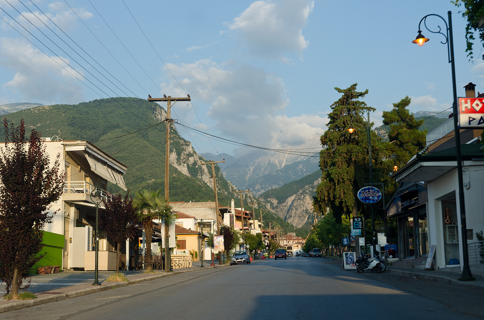
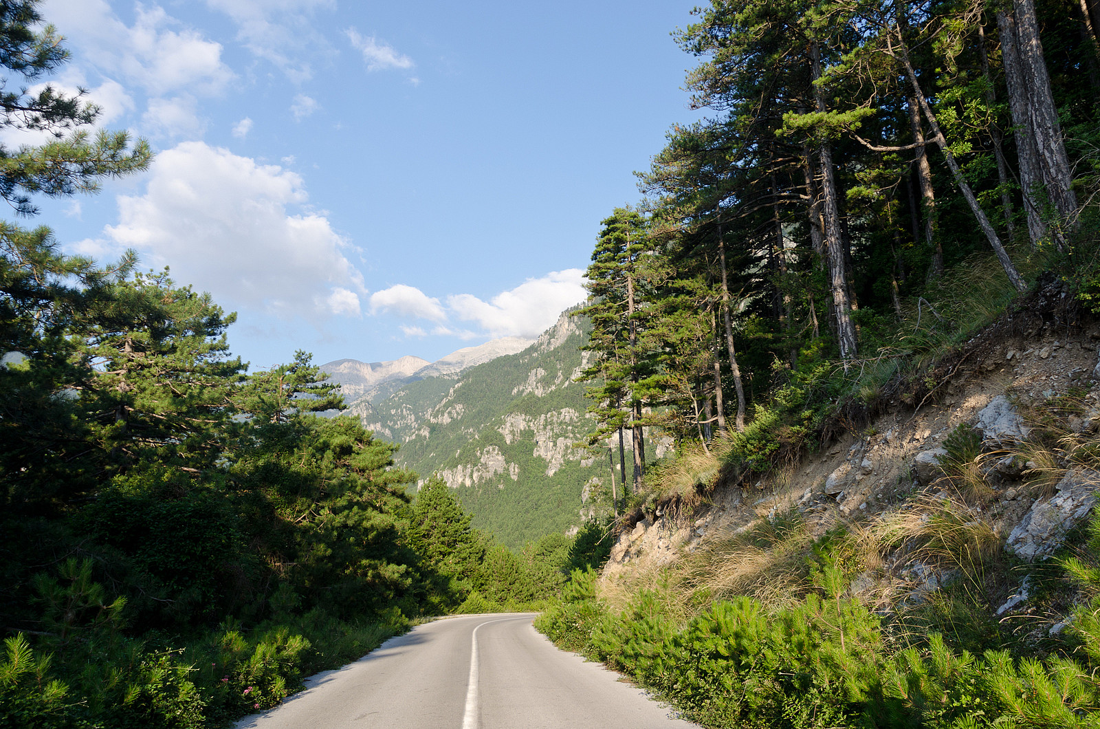
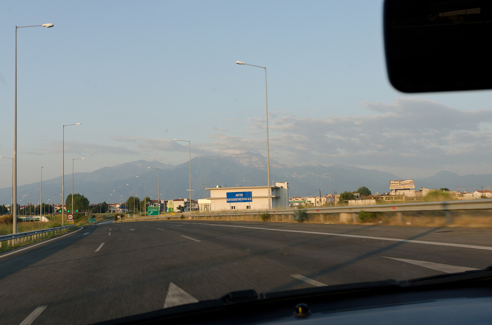
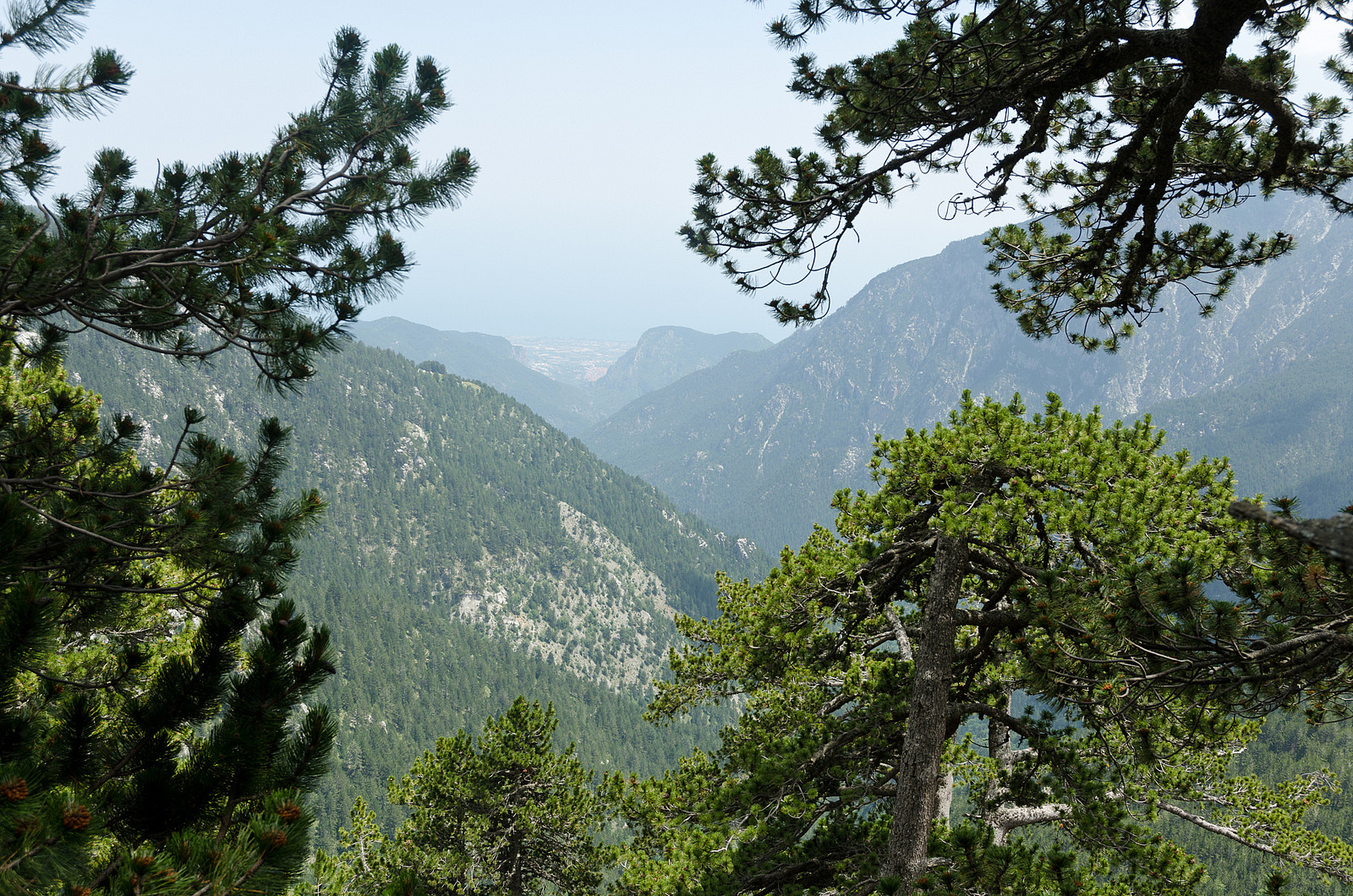
From Thessaloniki I followed E75 on the west side of the Aegean Sea. After about an hour I reached the charming village of Litochoro just a few kilometers off the highway. From the main road there is a sign towards Olympus and from here a narrow and curvy mountain road leads the 18 kilometers up to the trailhead.
The trek from Prionia to Skala
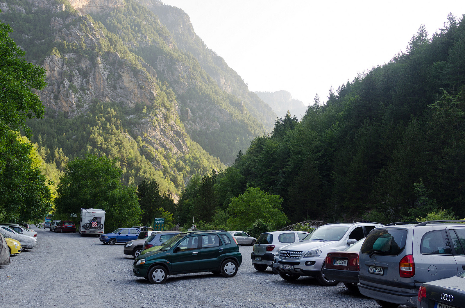
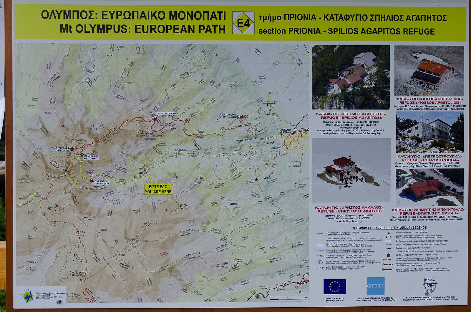
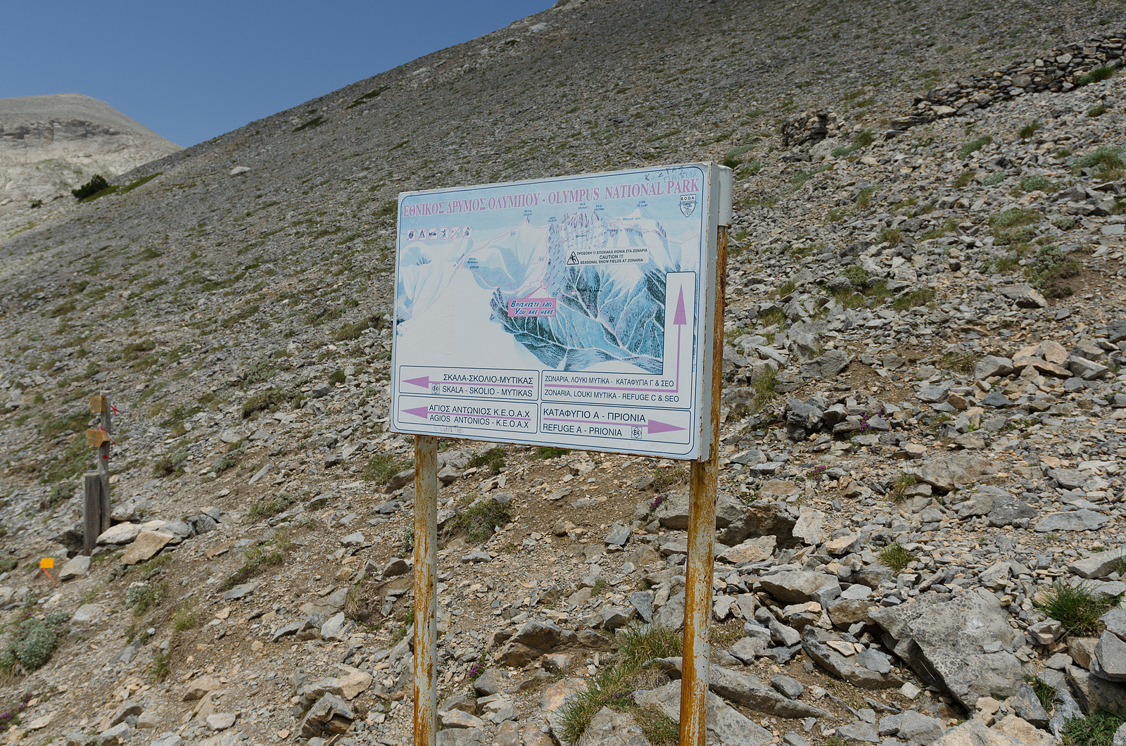
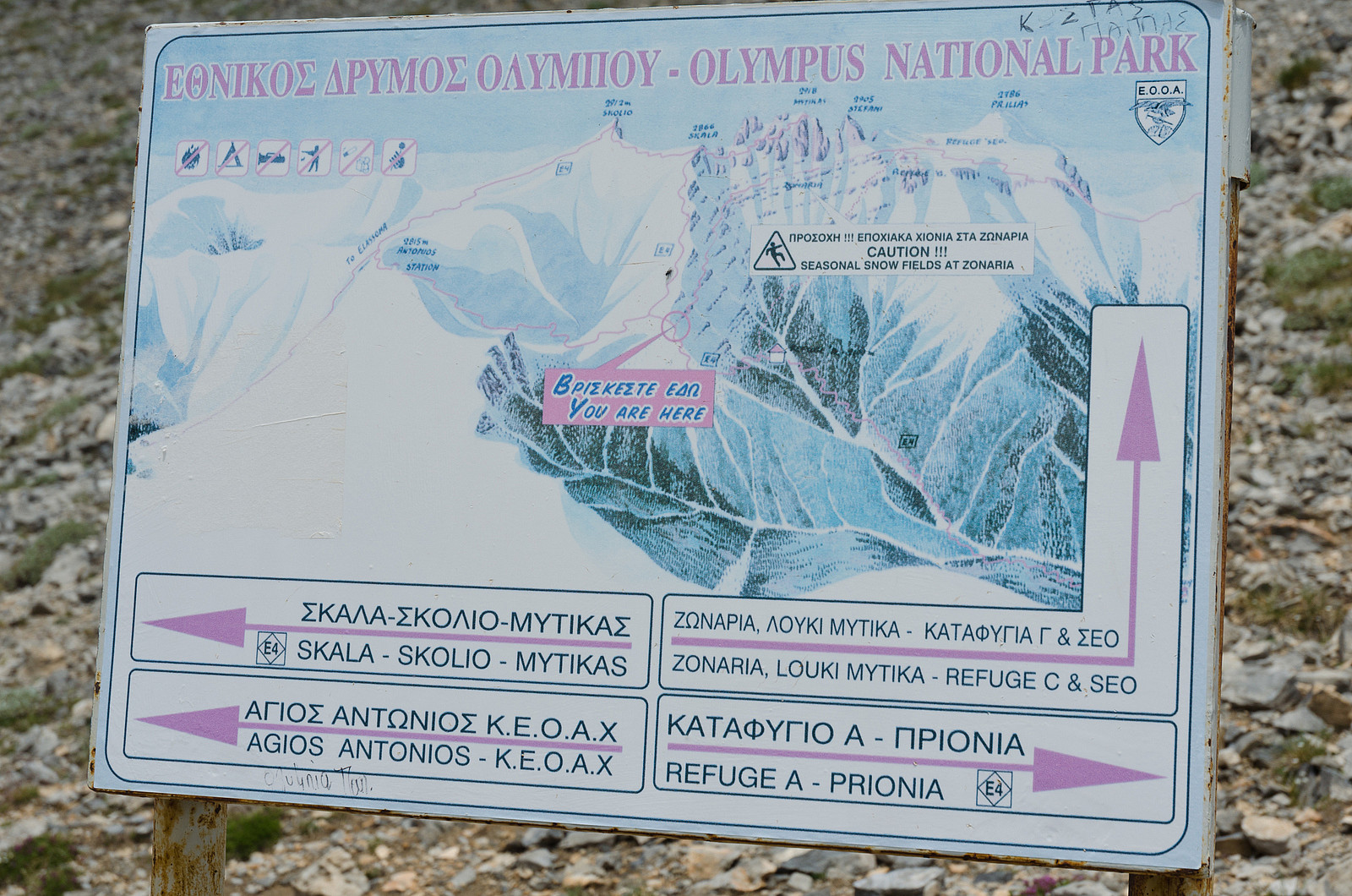
The most frequented hiking path to Mount Olympus, which is part of the E4 trail, starts at a small place called Prionia at 1100m altitude. Prionia consists of no more than a café and a parking lot in addition to the trailhead. I arrived in Prionia just before 8am as planned and was surprised to see that the parking lot was almost full already. After a quick look at the very descriptive information board I started towards the first destination of the day; Spilios Agapitos or simply Refuge A.
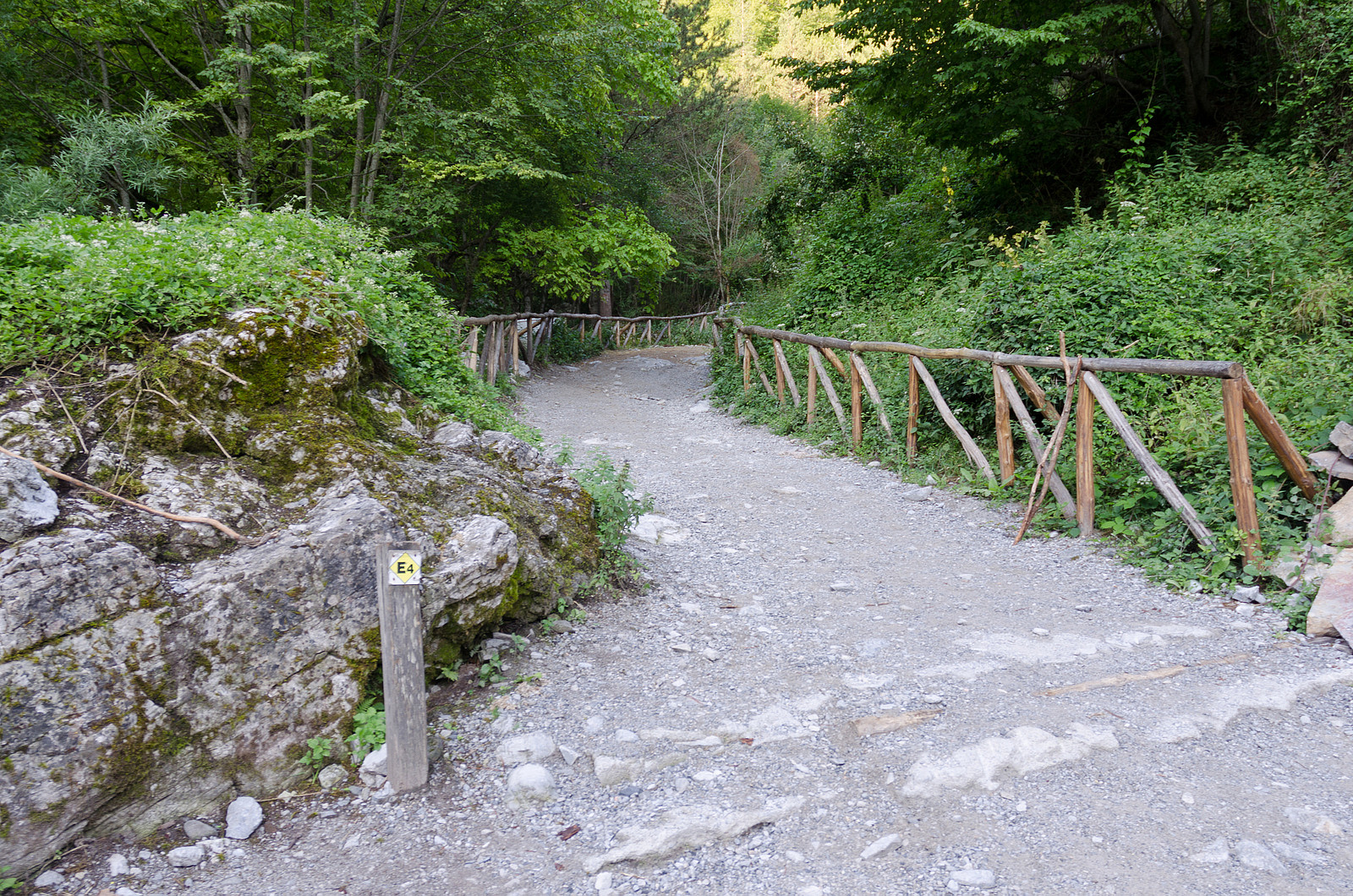
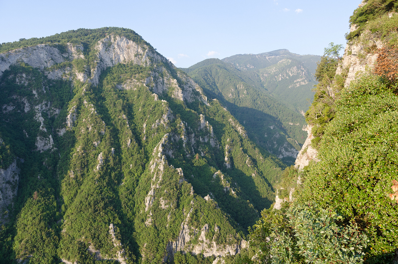
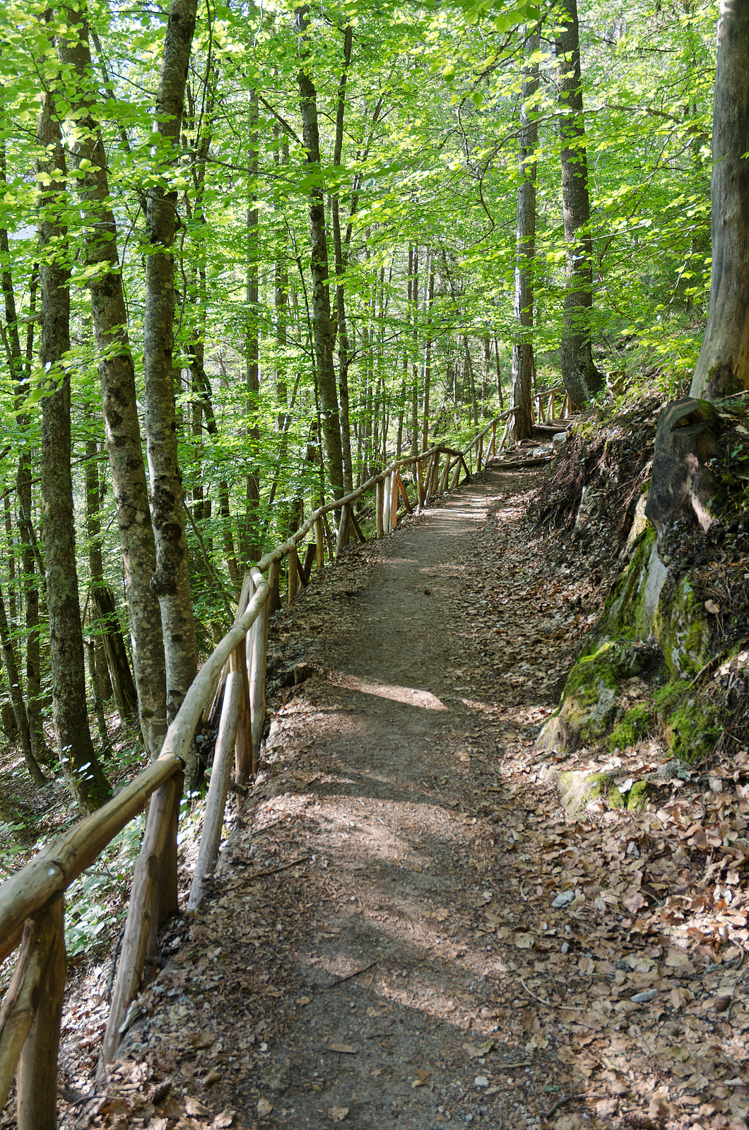
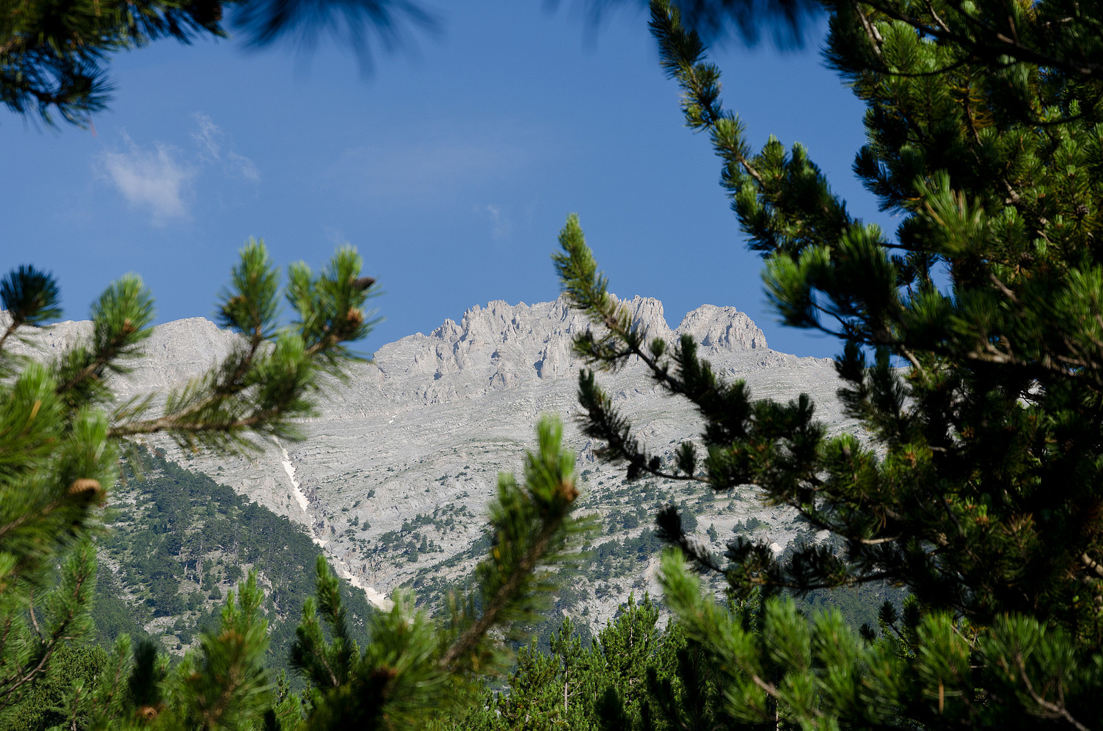
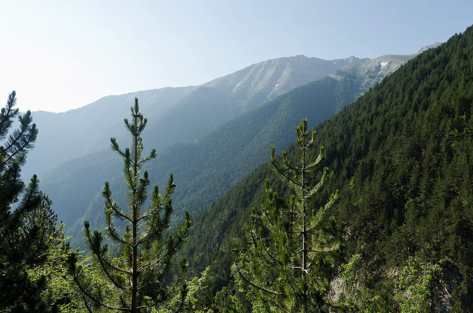
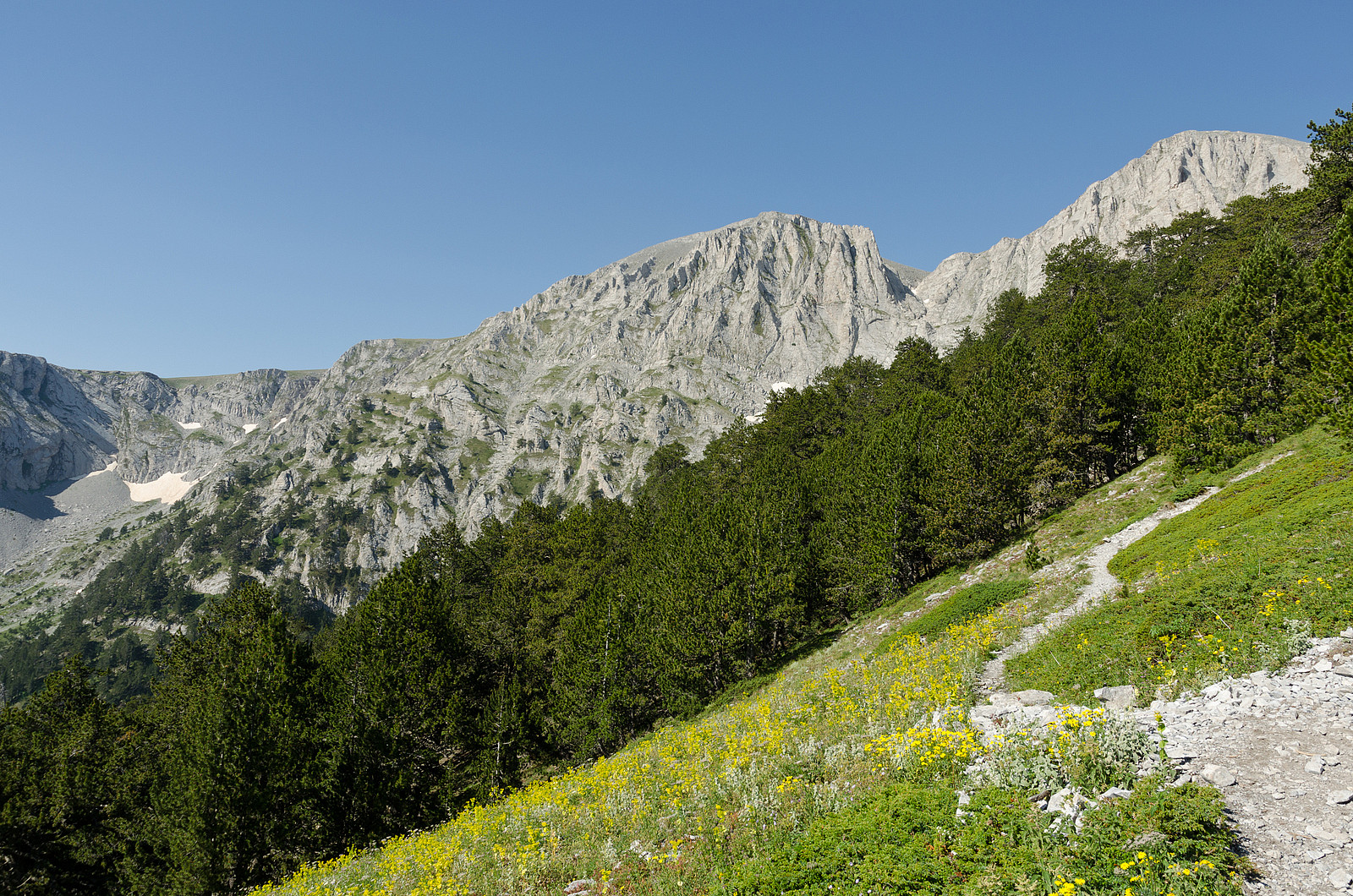
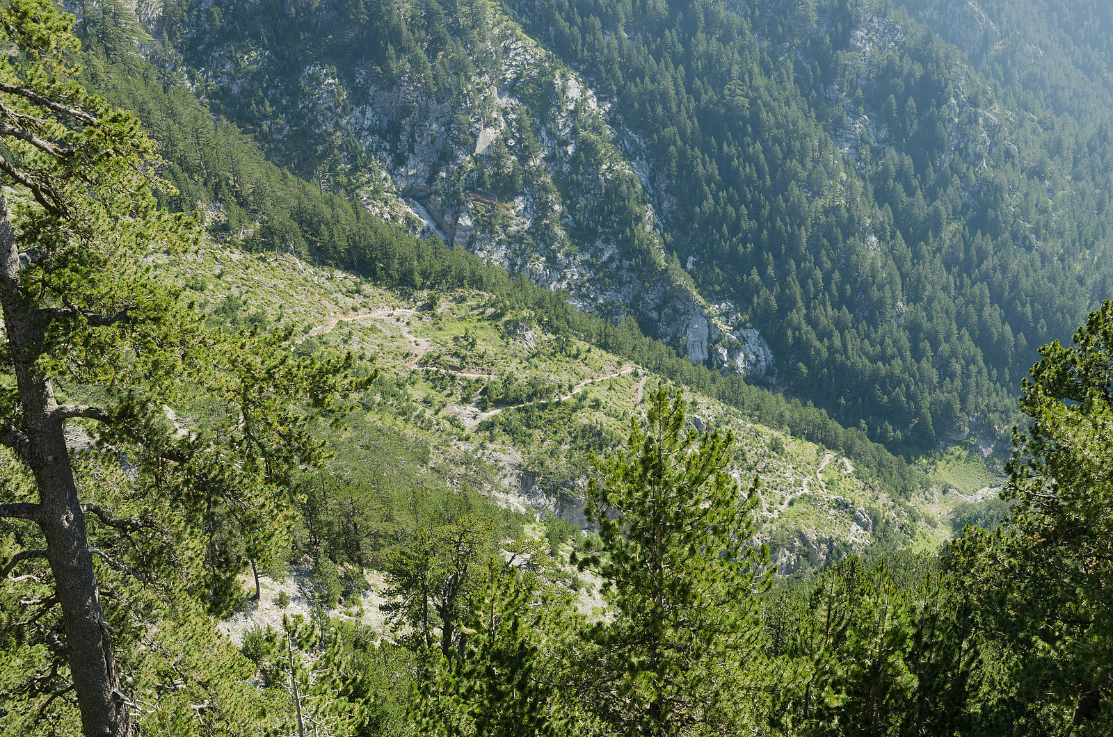
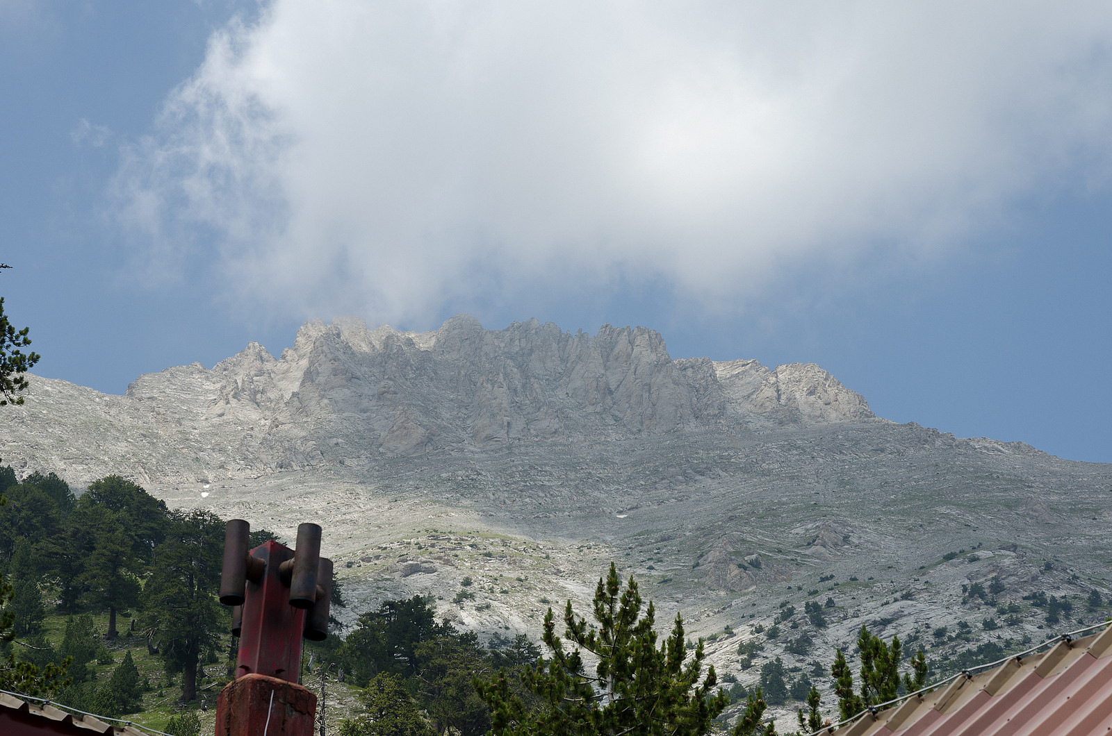
The trail out of Prionia was very well maintained with wooden fences here and there and lots of small timber steps to stabilize the gravel in the steepest parts of the trail. I started off in a fairly quick pace and based on the amount of cars in the parking lot I expected to catch up with other trekkers. However all the people I met were heading downwards, so I realized that most of these had been higher on the mountain the day before and spent the night in the refuge on the way down. The majority of the hike up to Refuge A goes through a pine and fur forrest with a limited view, but with a nice atmosphere and cool temperatures. After 4-5 km the trail climbs out of the densest part of the forrest and the summit finally displays itself high above (at least in clear weather conditions).
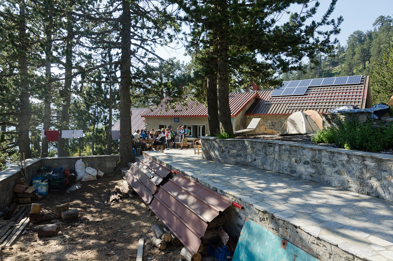
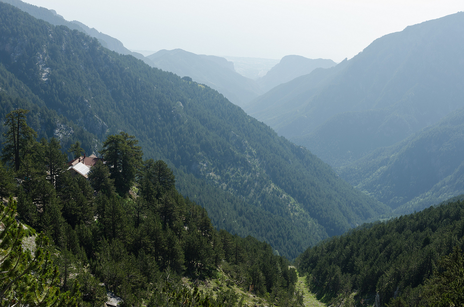
At 09:30am, 1 h 45 min after I left the car, I arrived at the refuge at 2060 m altitude. Here I took a short break to have some breakfast and also to perform some preventive maintenance on my feet (I could already feel a blister developing on my left heel). Spilios Agapitos was built in 1931 and has beds for 110 people, water from a spring, electricity and a telephone. Here you can buy snacks, bottled water and even order hot meals. There was a lot of activity here this morning. Most of the people heading upwards seemed to have left the refuge already, however quite a few campers were packing their things and preparing to go back down.
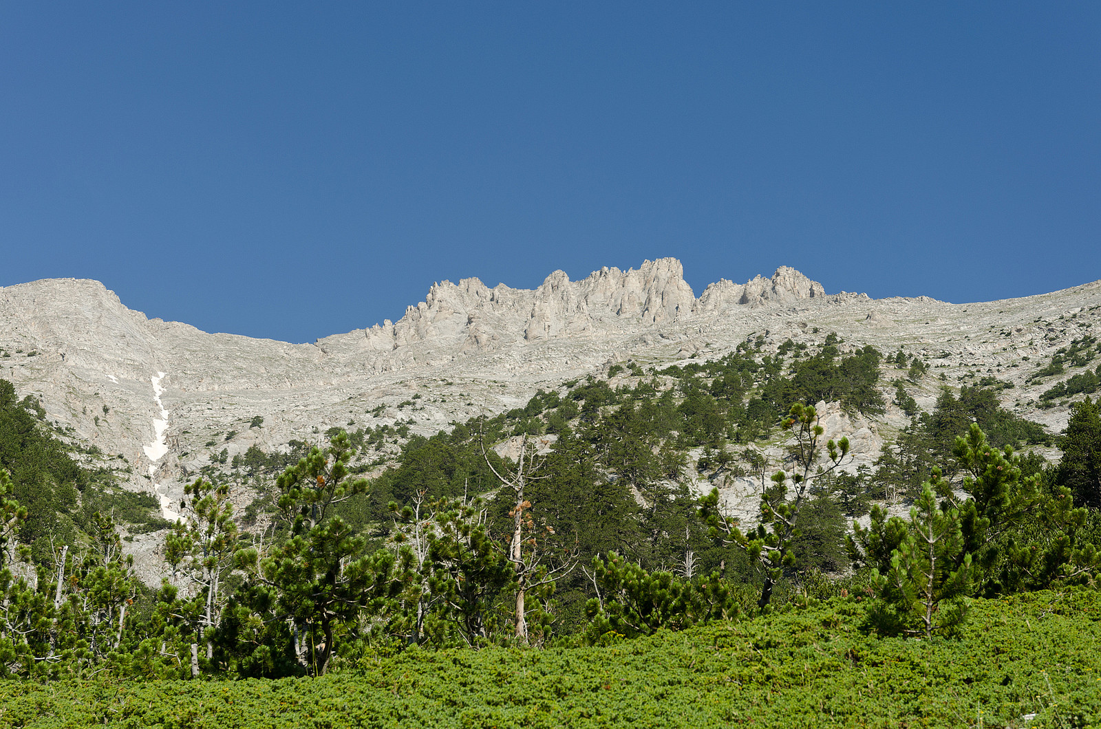
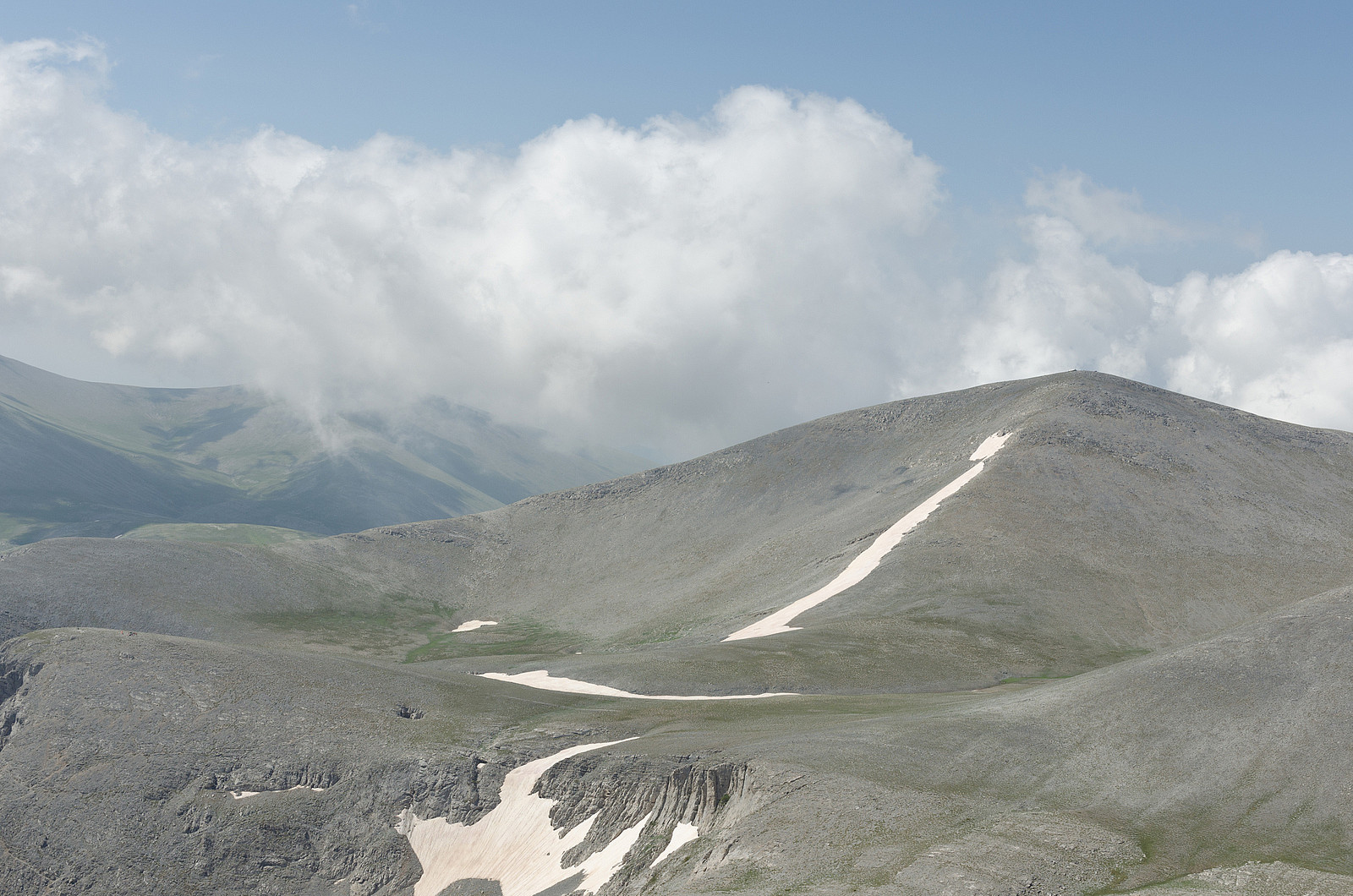
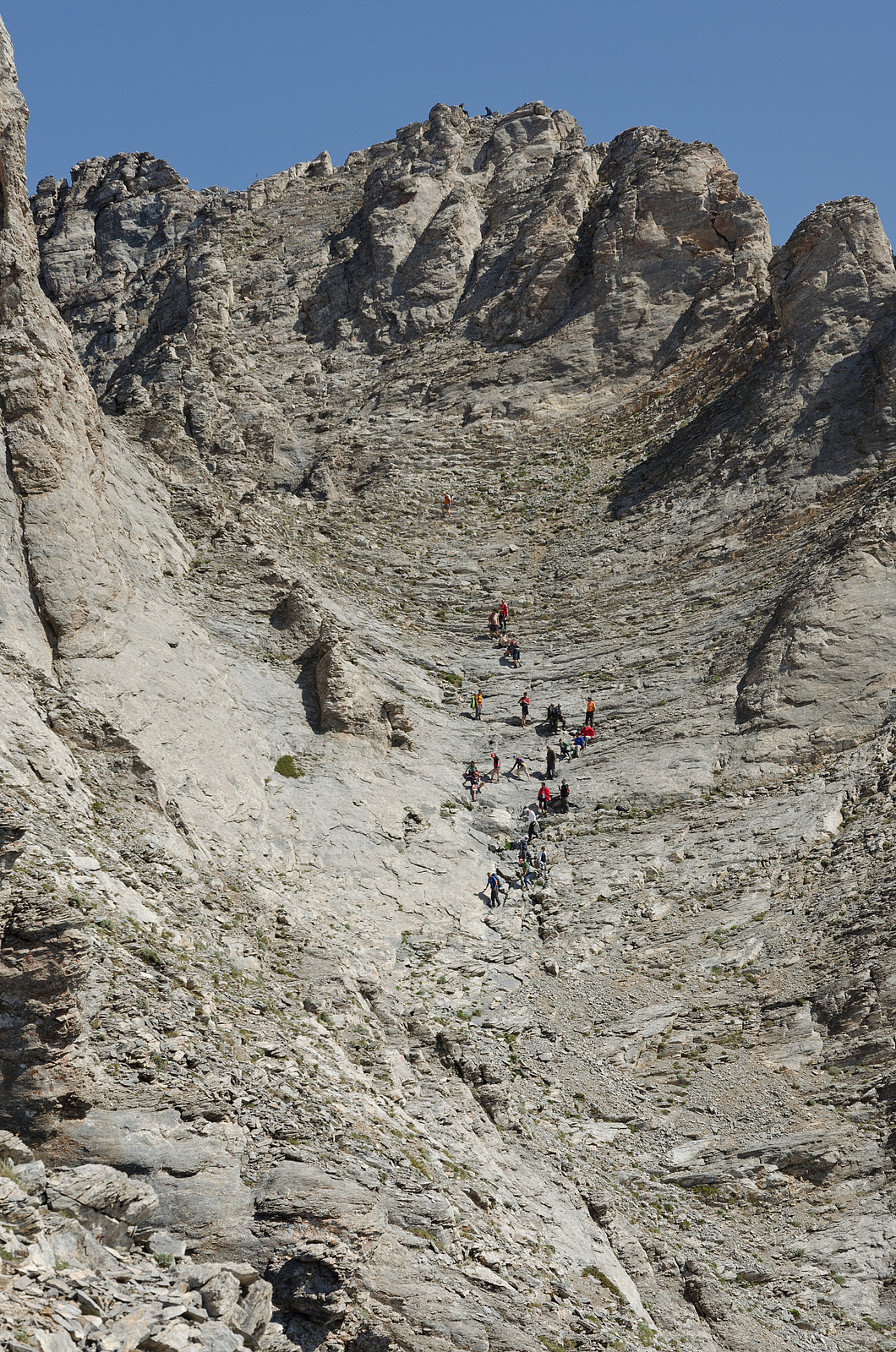
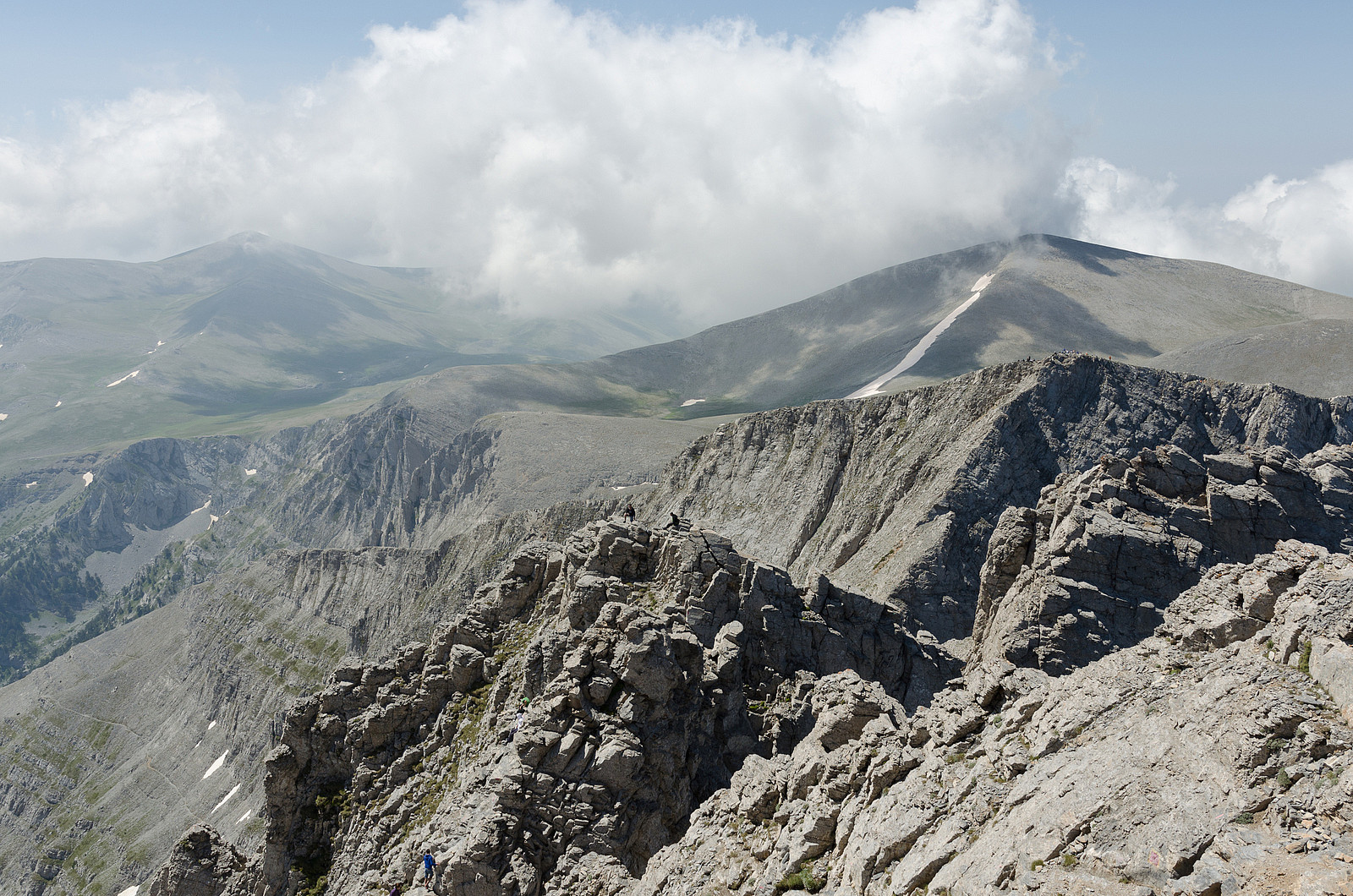
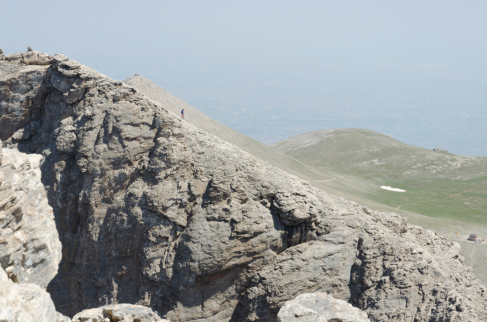
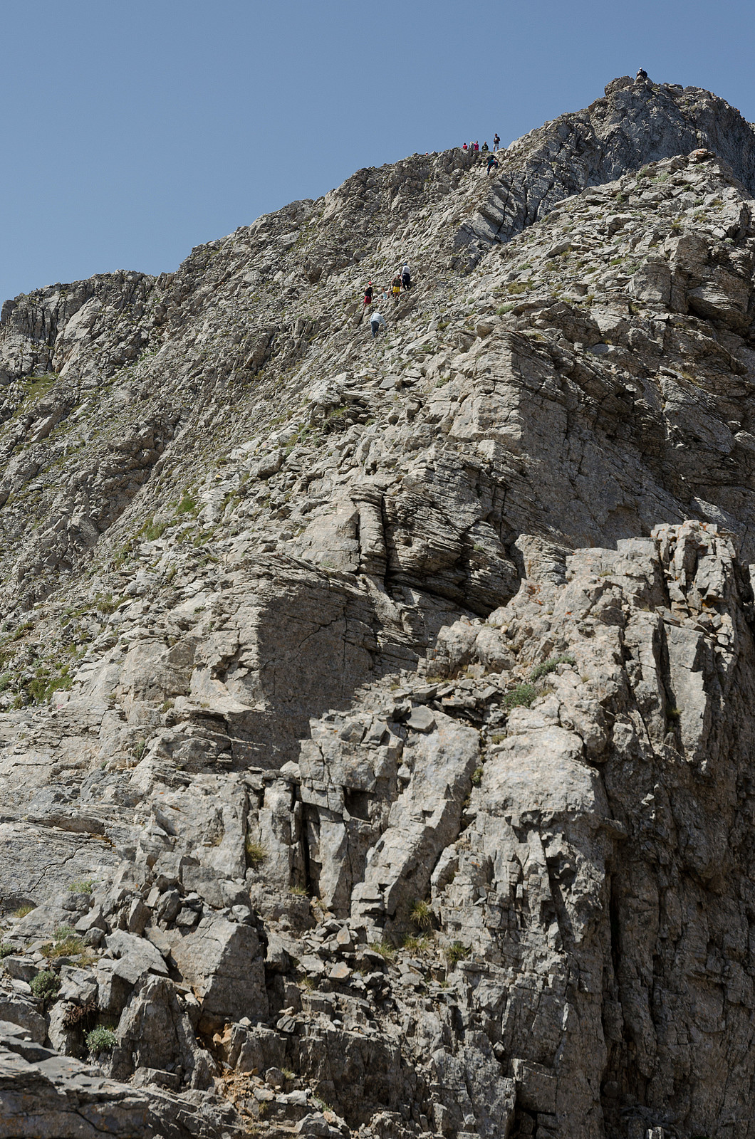
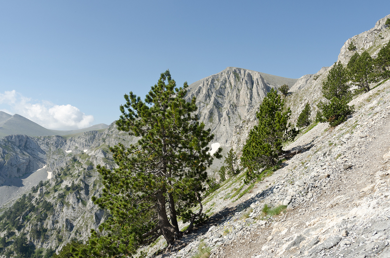
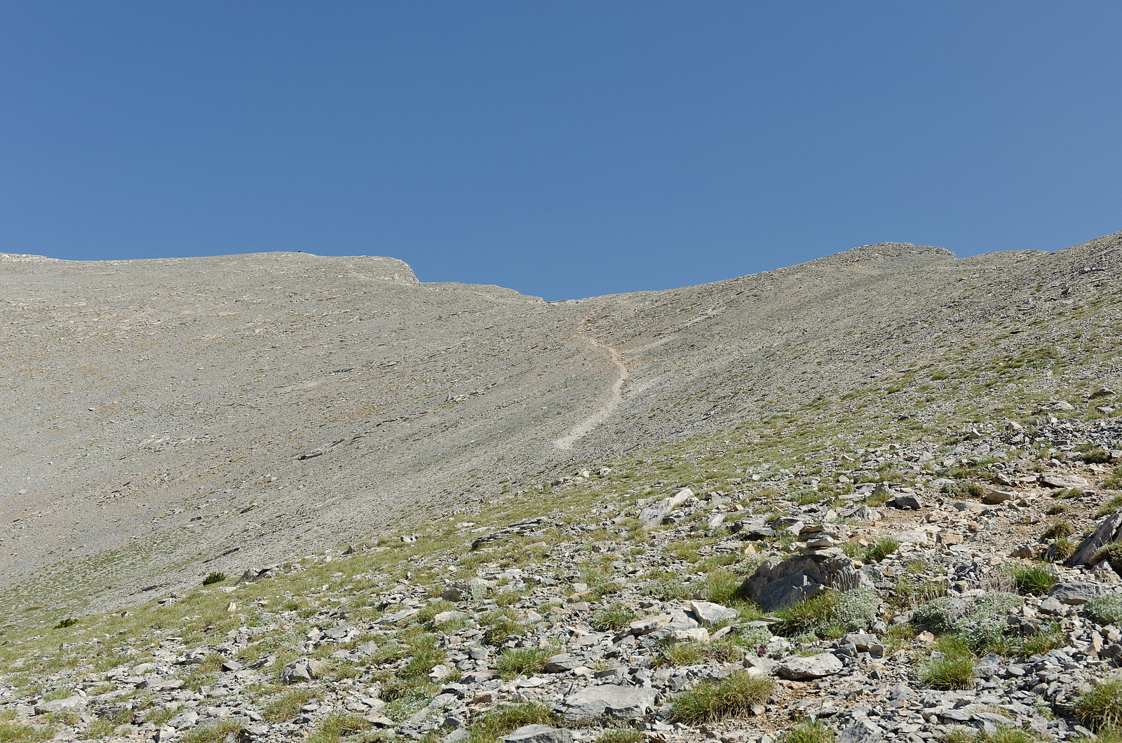
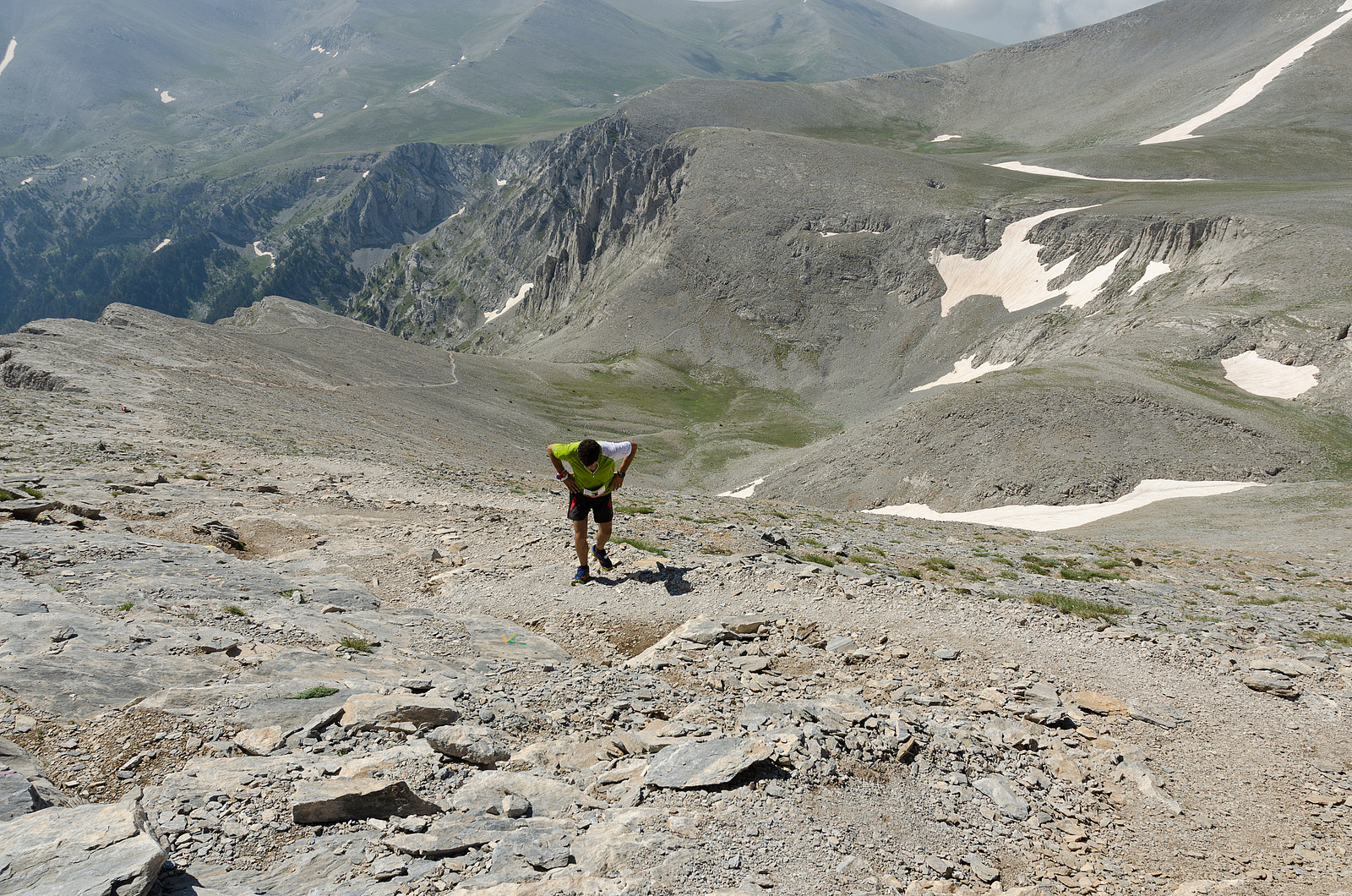
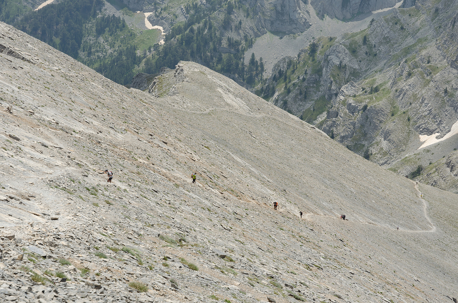
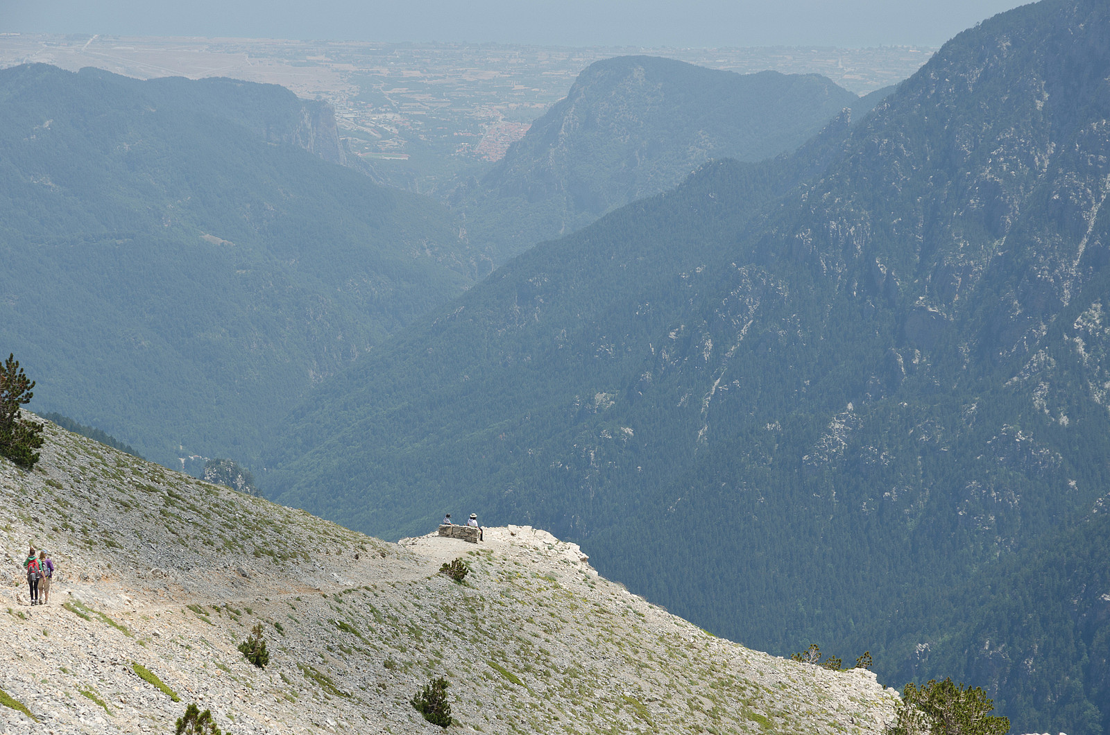
After about 15 minutes I got back on the trail, still eager to make it to the summit well ahead of any afternoon clouds that might be drifting in from the ocean. Above the refuge, the trail quickly reaches the first of two pronounced ridges leading up to Skala. Here the landscape gradually turns more and more barren, and the green is replaced by grey. When the first ridge reaches the second ridge at roughly 2400 m elevation the trail forks. The right fork leads to Refuge C via a path that traverses far below the summit ridge, whereas the left fork leads to the the summit of Skala, Skolio and the highest point Mytikas. Here I finally started to catch up with other trekkers who had started from the refuge a few hours earlier. I had to slow down in this part of the trek both due to the steep and loose nature of the trail, but also because I started to feel some effects of the slightly thinner air at this altitude.
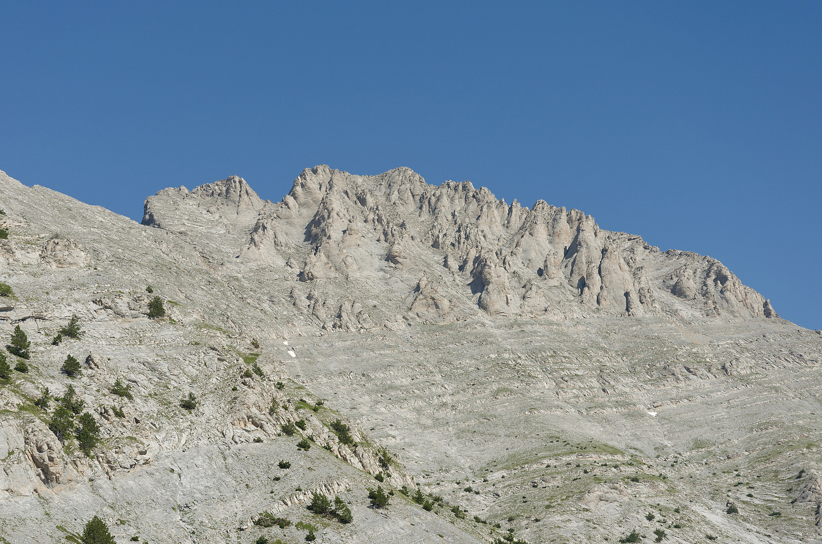
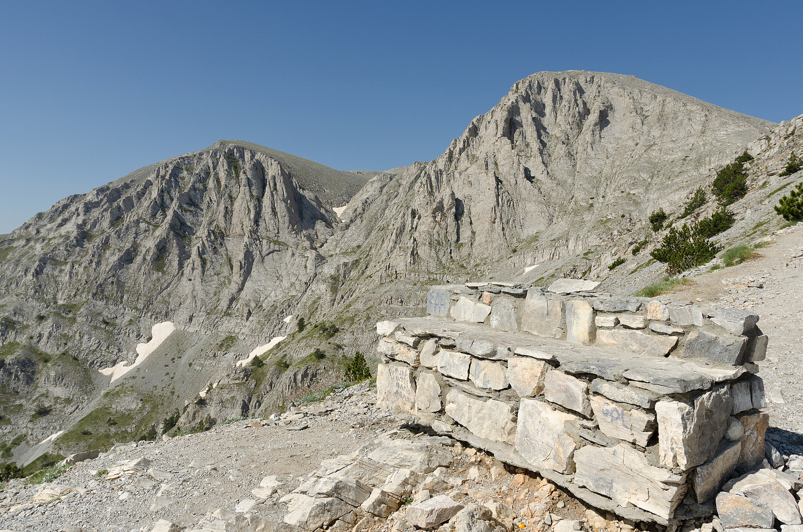
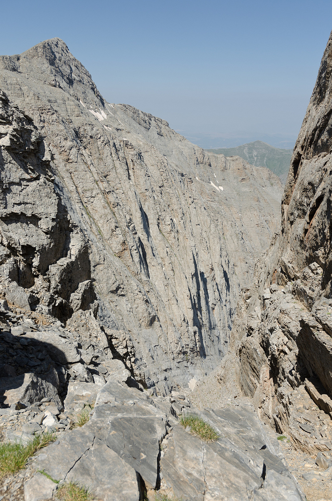
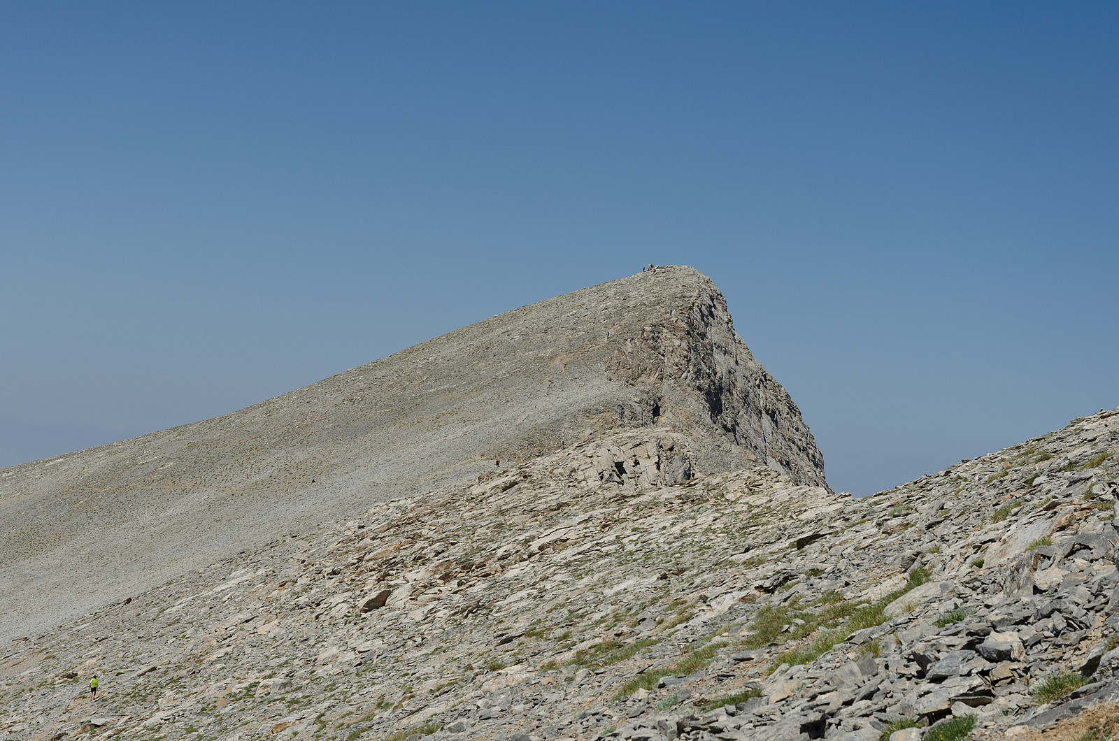
At 11 am I reached the summit of Skala at 2866 m of elevation 3 h 15 min after I left the car. I could finally get a good look at the path leading to Mytikas, the so called "Evil Staircase". It looked steep and quite exposed in some areas, but not too scary in the nice and dry conditions I had enjoyed so far this day. To the south I could see some clouds starting to accumulate, so I didn't allow myself more than a few minutes break before starting on the traverse.
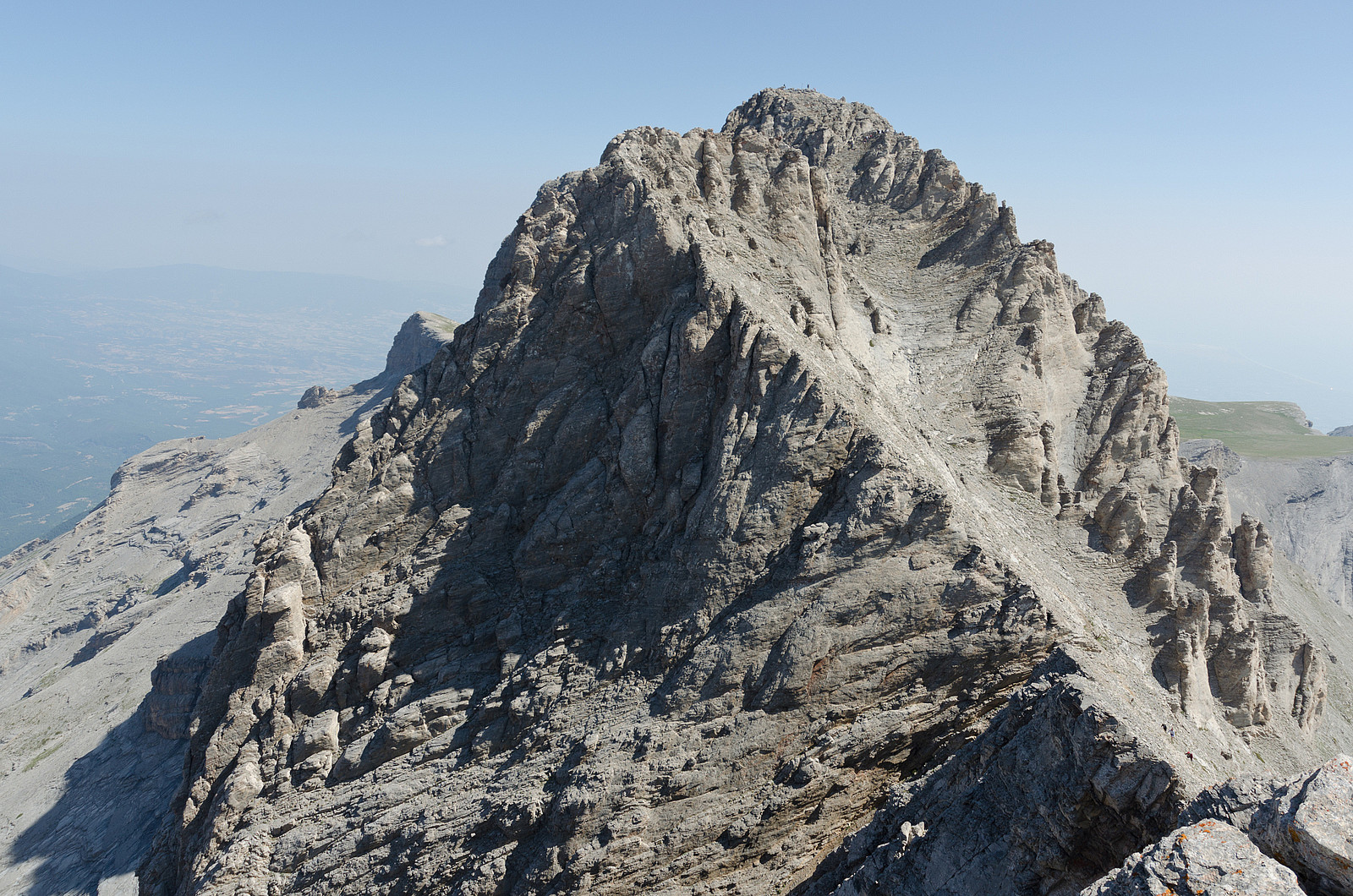
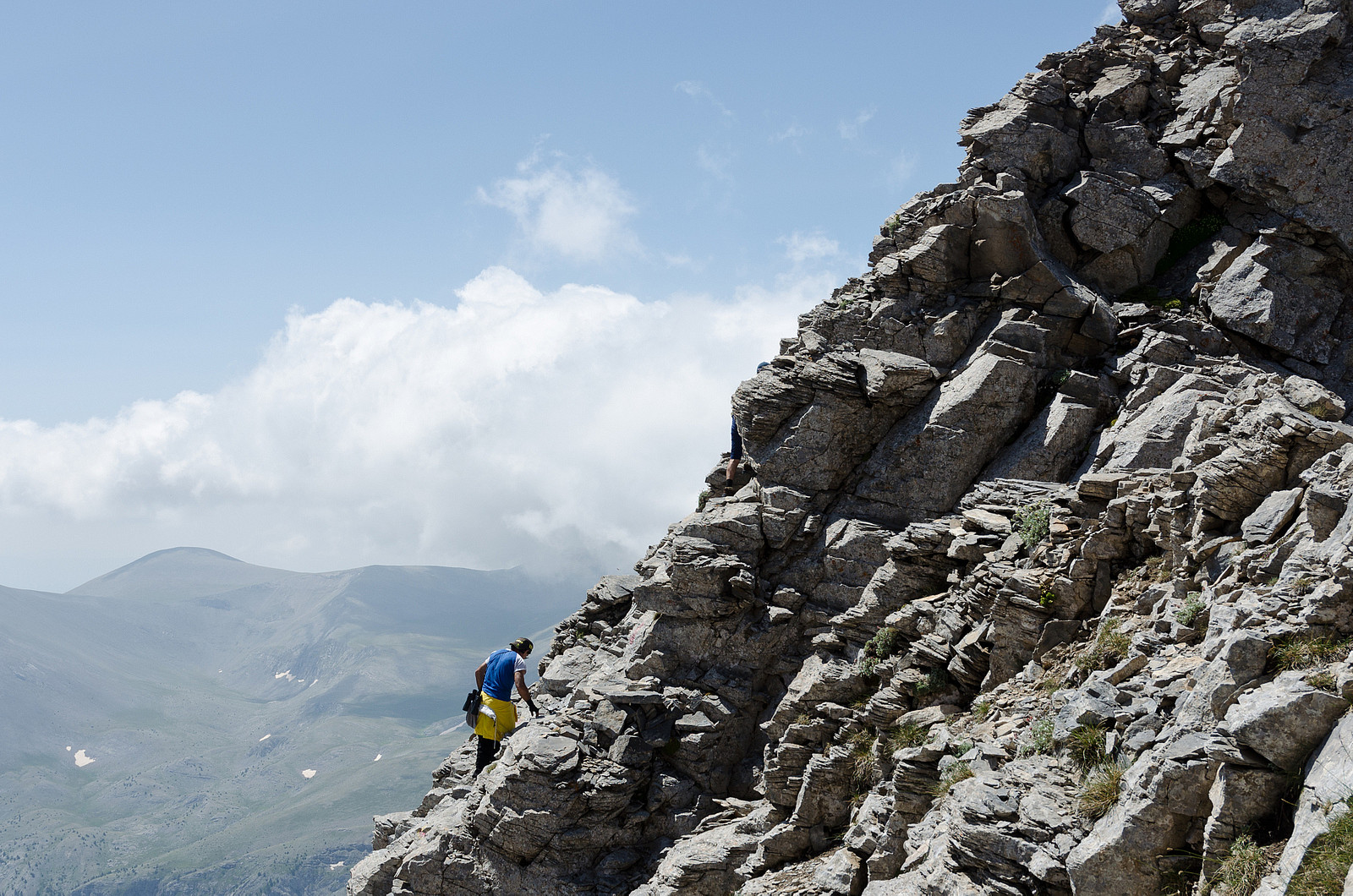
The Evil Staircase
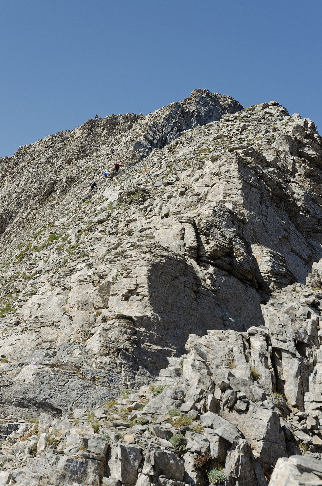
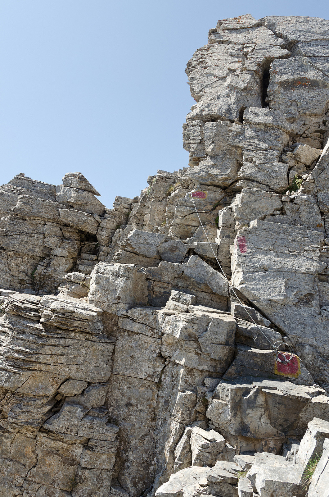
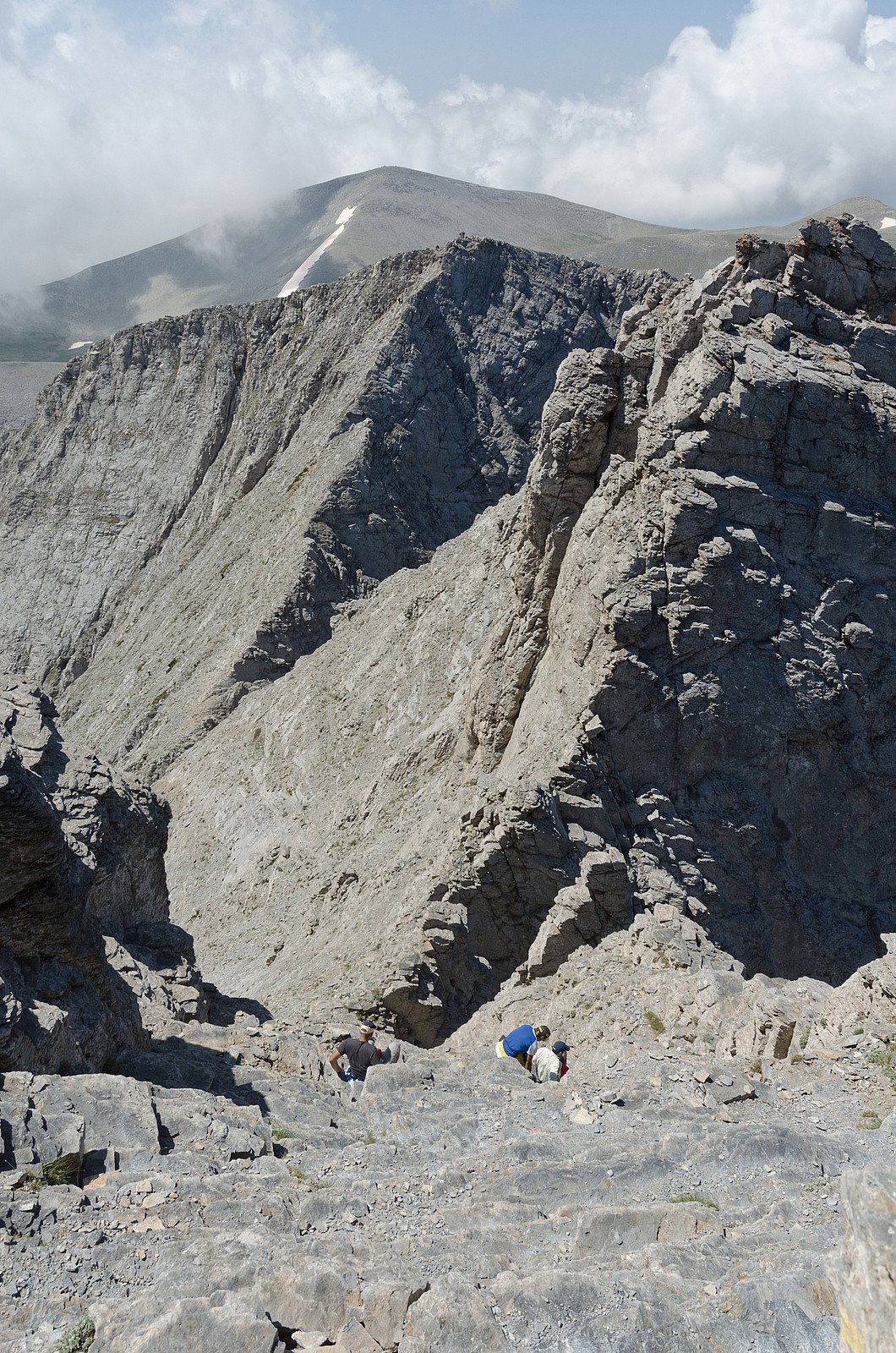
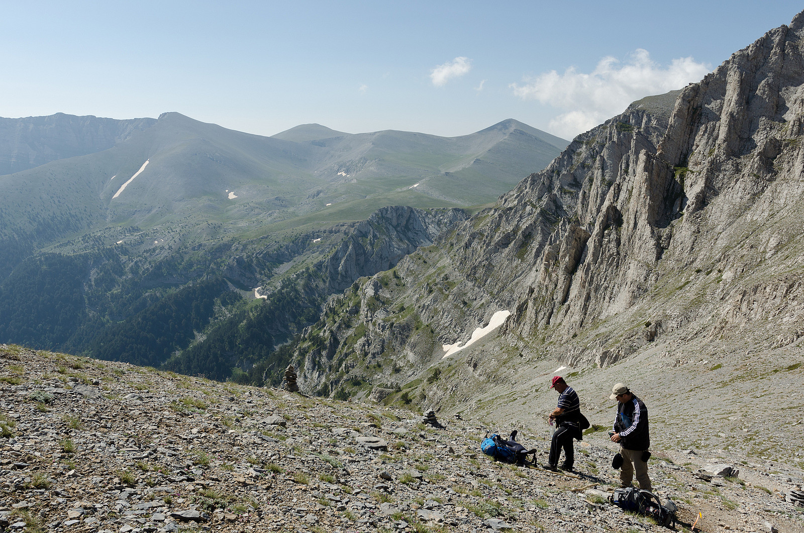
The traverse from Skala to Mytikas starts with a steep downwards scramble to the saddle between the two summits. This part felt surprisingly exposed, but I think this was mainly because I was not fully acclimatized to such surroundings yet. It was steep, but with plenty of handholds all the way down. Also, the recommended path was clearly marked with red and yellow paint marks, so route finding was not and issue. I met several groups of people heading back to Skala, and even some groups that were roped up. From the saddle the path continues through a long and steep scramble to a sub-peak close to the main summit. This part did not feel very exposed, but the path was quite crowded and small rocks kept tumbling down from above which was a slight concern. Especially one large guided group of about 15 inexperienced young people who were just leaving the sub-summit heading back to Skala was challenging getting past. Some of them seemed quite scared and they were making very slow progress.
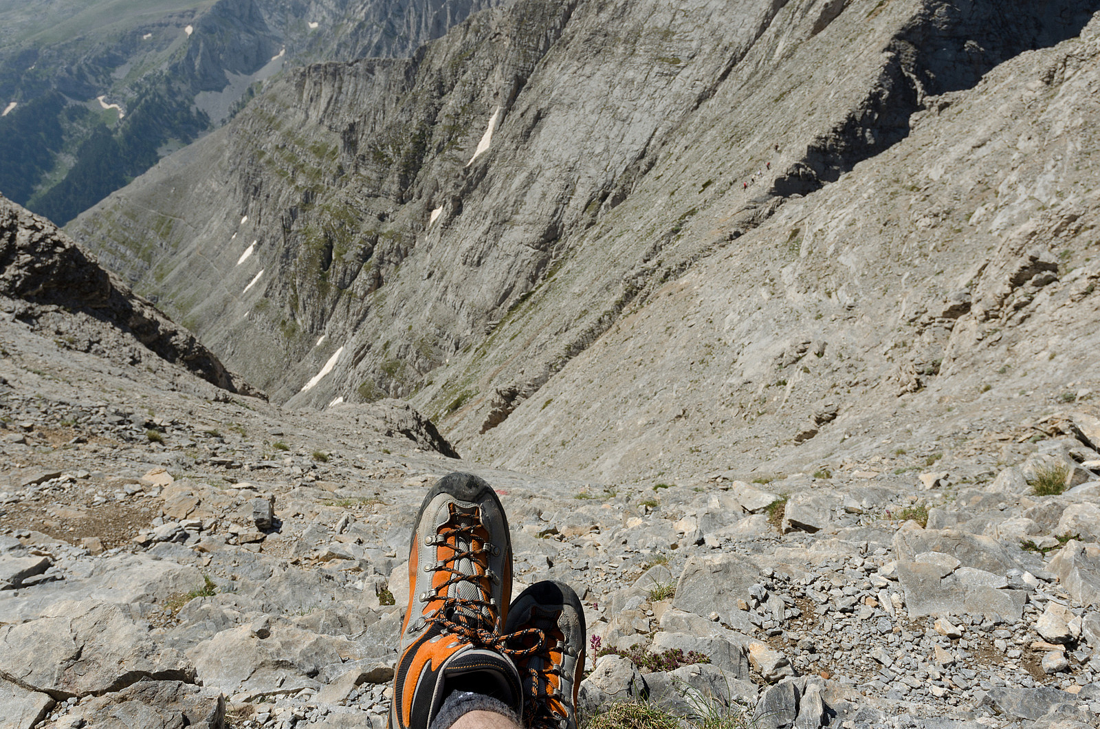
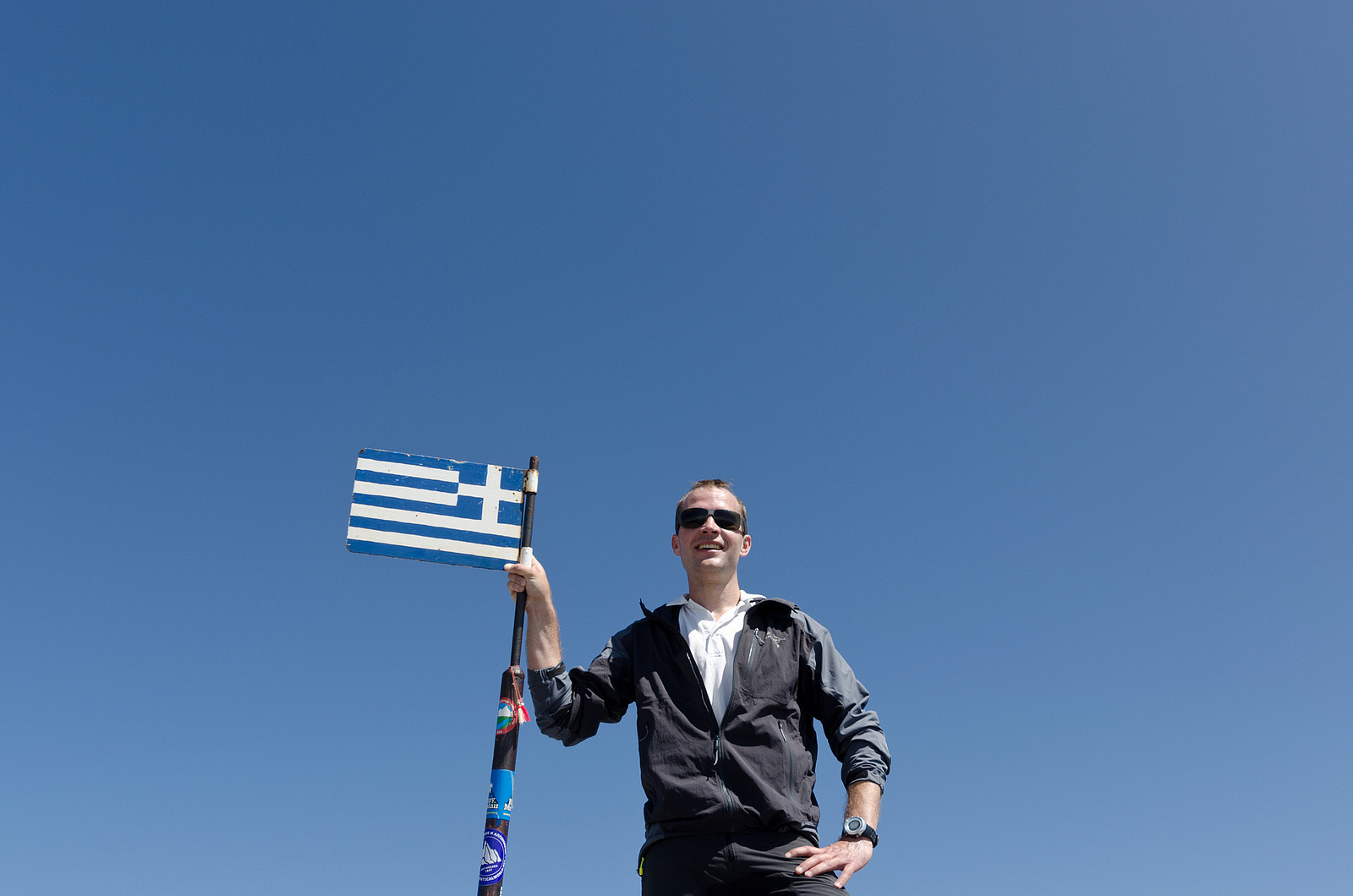
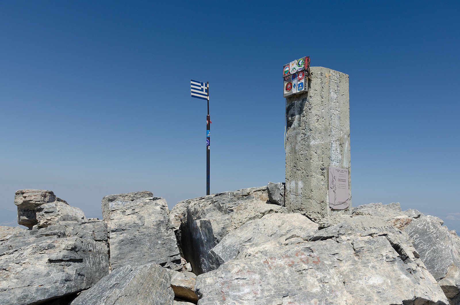
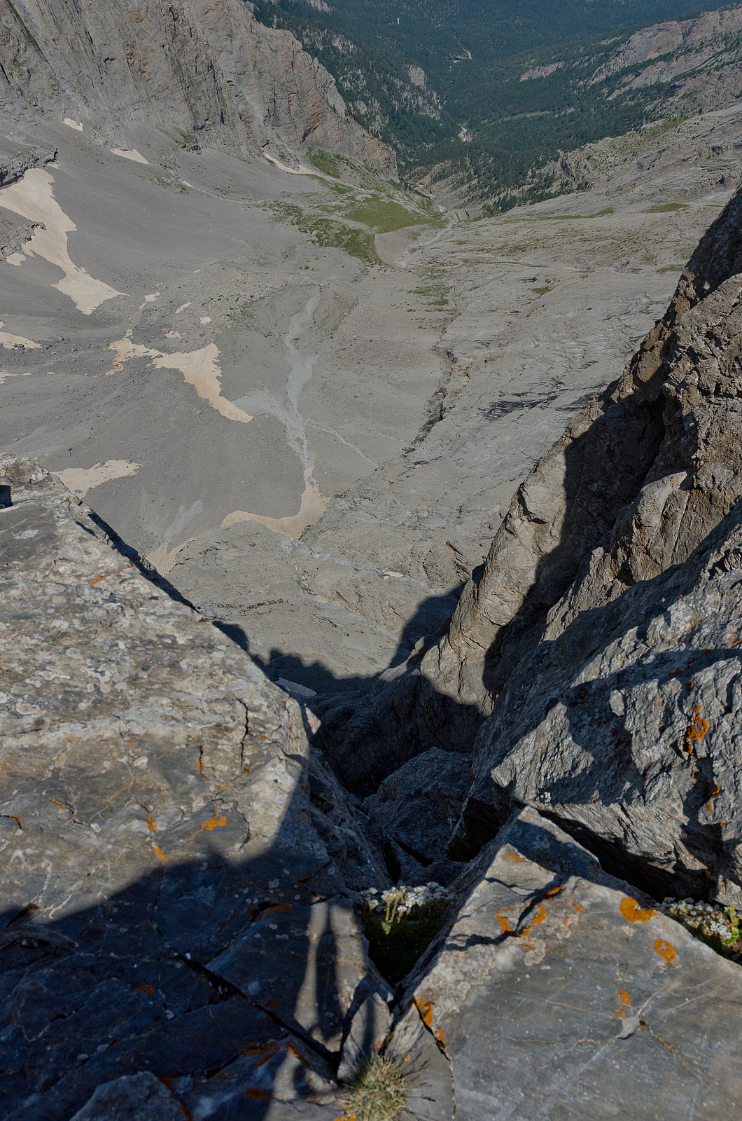
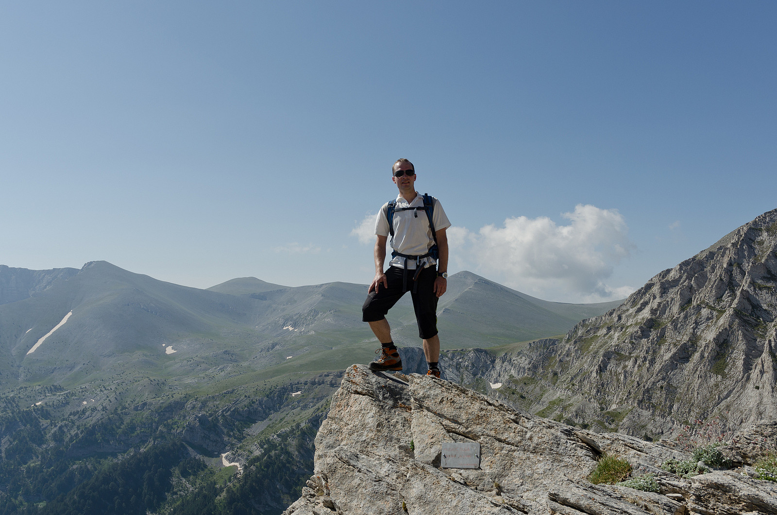
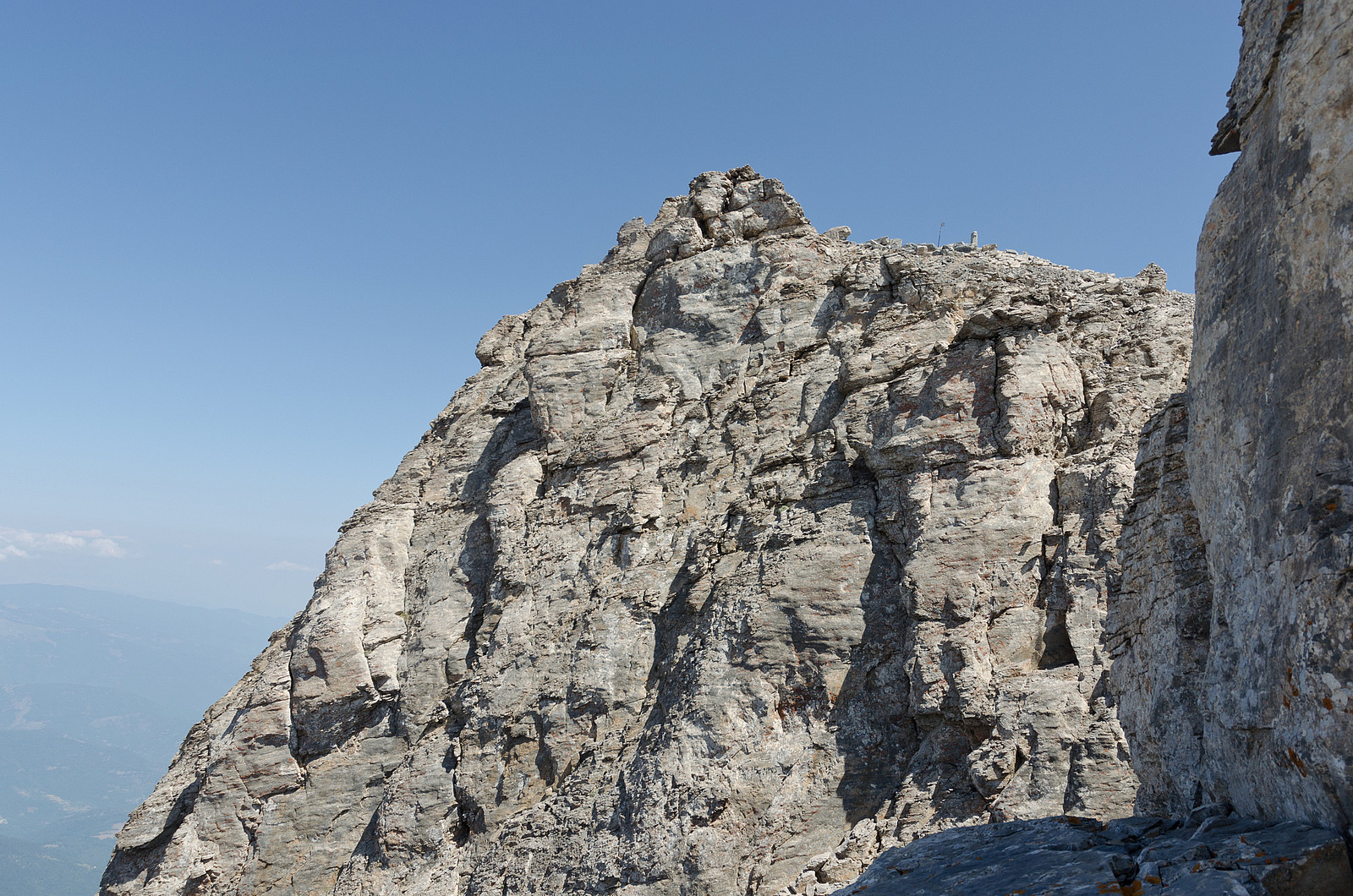
The "crux" of the route came immediately after the sub-peak. From here the route goes down a steep and exposed section to a V-shaped col between the sub-summit and main summit. A steel wire was installed to facilitate this part of the route, however being (perhaps overly) conservative I relied only on natural handholds. Again, the scrambling was not technically difficult at all (YDS class 3), however people with a tendency towards acrophobia might find this part scary. The rest of the scramble up to the main summit was easy and finally I reached the high point of Greece at 11:30 am. The view was simply breathtaking. With all the traffic on the traverse I feared the summit to be crowded, however I was pleased to find that there were only three other trekkers left on the summit when I arrived. As these were making ready to leave I quickly asked one of them to take a summit photo of me (the "creative" result can be seen below). And then I had the summit all to myself! I sat down to absorb the view while enjoying some lunch. Even the greek chocolate filled croissants I had brought by a mistake tasted wonderful under such conditions!

The descent
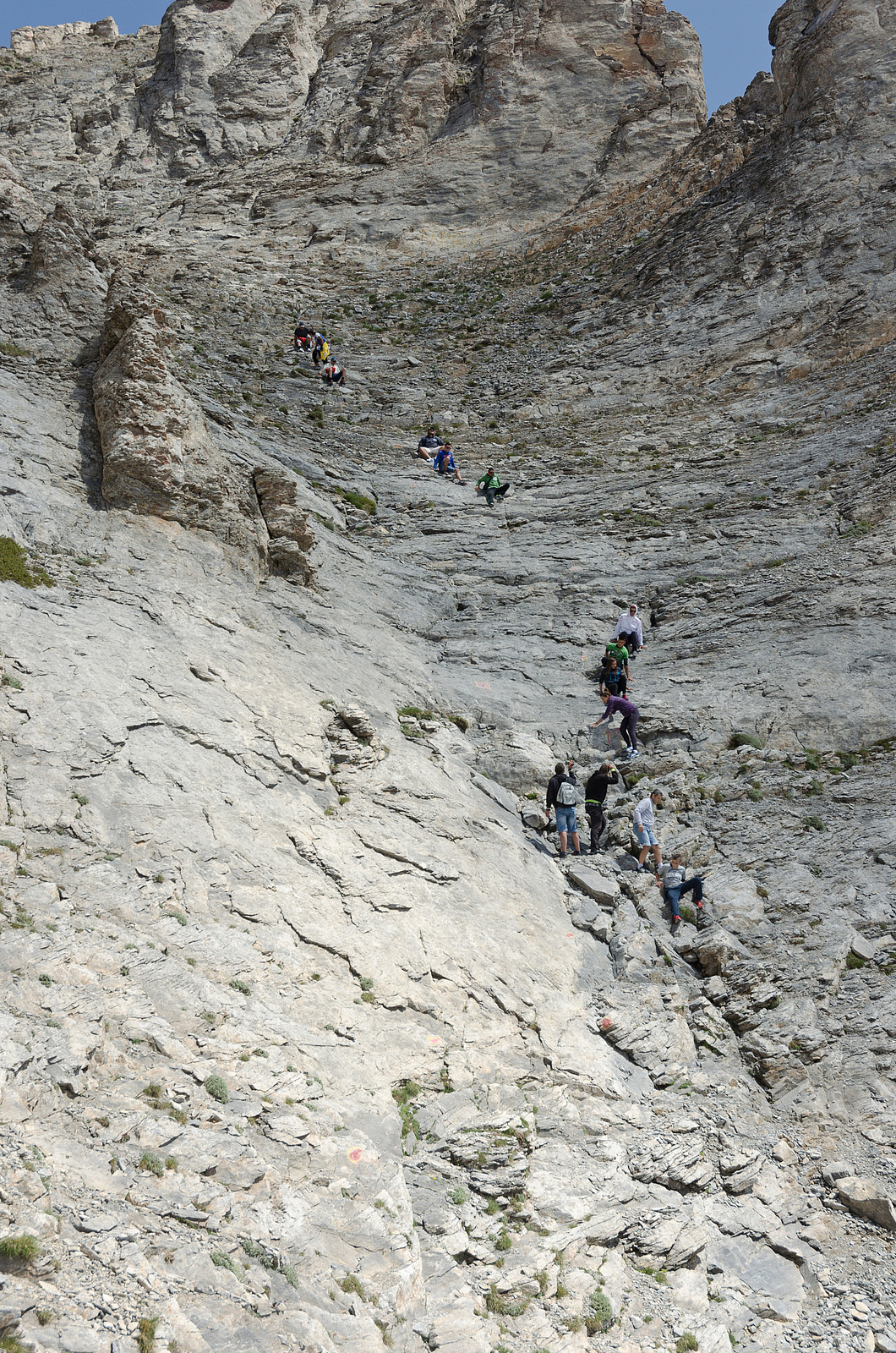
After a wonderful break on the summit I got ready to head back down. I assumed that the other groups would have a sufficient head start so I wouldn't have the problem of getting past them again. But I had grossly overestimated the abilities of the other groups. Just below the sub-summit I caught up with the small group I had met on the summit. As these were only three people getting past them was not a problem. But a few minutes later I saw that the large group of youngsters were still struggling down the long scramble from the sub-summit. They were all sitting down in a long row and very slowly sliding downwards while all the time kicking loose small rocks on each other. During the 45 minutes since our last encounter they had descended a mere 20 vertical meters. The "guide" was scrambling up and down to give detailed instructions to each and every one about were they should place their feet and yelled at them every time a rock came tumbling down. First I decided to stay behind them to avoid getting hit by a rock, but I quickly realized that this would take hours. So I started to pass them one by one, keeping a healthy distance wherever I could. I had almost completed overtaking the entire group when, without warning, a medium sized rock came tumbling by in shoulder height! I very much regretted not bringing a helmet, but I was lucky this time.
The climb back up to Skala was easy and uneventful and did not feel exposed at all when going up. Soon I was back to Skala where I took one last look at the view before heading down towards the refuge. Having the long drive back to the hotel in mind I kept a good pace. Other than a short stop at the refuge to apply another blister bandaid I did not have any breaks on the descent. It spent slightly less than 2 hours from Skala to Prionia. The parking lot in Prionia was now completely full and cars were parked along the side of the road for several hundred meters towards Litochoro. I was in a perfect mood, so the 3 hour drive back to the hotel went surprisingly well. It had been a perfect day at the mountain of the Gods.
More pictures

GPS summary
| Startzeitpunkt | 14.07.2013 06:45 (UTC+01:00 SZ) |
| Endzeitpunkt | 14.07.2013 13:22 (UTC+01:00 SZ) |
| Gesamtzeit | 6h 37min |
| Zeit in Bewegung | 5h 58min |
| Pausenzeit | 0h 39min |
| Gesamtschnitt | 2,9km/h |
| Bewegungsschnitt | 3,2km/h |
| Entfernung | 19,0km |
| Höhenmeter | 2.146m |


Benutzerkommentare