
Fyllingsdalen round with Gullsteinen (04.01.2026)

Geschrieben von HHauser (Helwig Hauser)

| Startpunkt | Varden (45m) |
|---|---|
| Endpunkt | Varden (45m) |
| Tourcharakter | Bergtour |
| Tourlänge | 4h 00min |
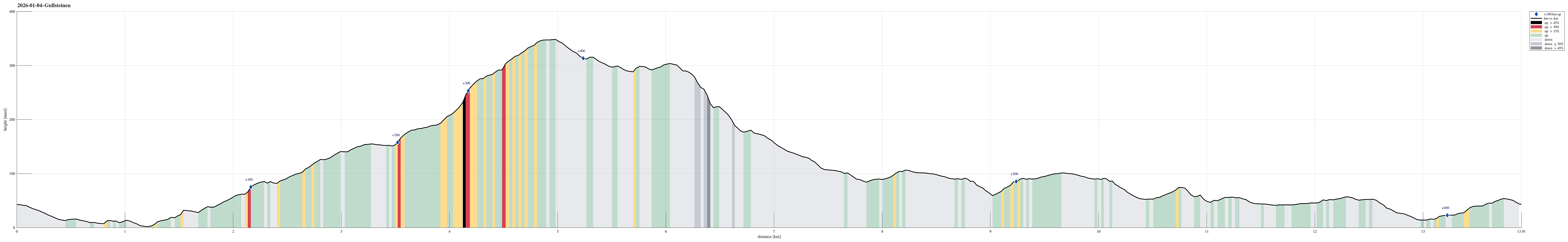
| Entfernung | 13,9km |
| Höhenmeter | 628m |
| GPS |
|
| Besteigungen | Gullsteinen (352m) | 04.01.2026 |
|---|---|---|
| Besuche anderer PBE | Gullsteinen utsiktspunkt (341m) | 04.01.2026 |
| Gullstølen (ruin) (282m) | 04.01.2026 | |
| Gulsteinen (305m) | 04.01.2026 | |
| Minnesmerke bomberaid 1945 (180m) | 04.01.2026 | |
| Speiderly (285m) | 04.01.2026 |
Trip Summary
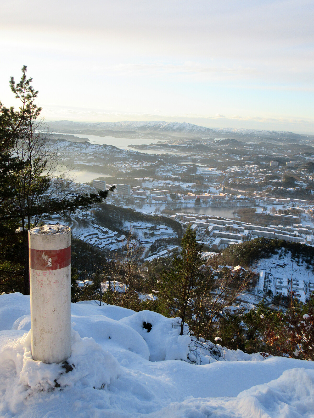
We were up for a Fyllingsdalen round and even though it was already a bit late we still thought that including Gullsteinen was doable (and so it was). From Varden, we first surrounded Bondegården at Sælehaugen before then aiming at Rekdalsveien. After connecting to Hattedalen, we then walked up to Bråtet in order to get started with our ascent to Gullsteinen. Even though it was icy in a few places, we still enjoyed the walk over the ridge very much. After passing over Gullsteinen, we then took a trail to Rosenlund, which only was a little bit of a challenge in the slight steeper sections due to the snow and ice. The way back towards the south of Fyllingsdalen was then on roads, mostly, given that it had turned into a dark night by then.
Photos
Selected photos are available as Google photo album.
Useful Resources
See also the related FB-page Hiking around Bergen, Norway.


Benutzerkommentare