
Through Val Resia to Moggio (from Bovec) (21.10.2025)

Geschrieben von HHauser (Helwig Hauser)

| Startpunkt | Bovec (460m) |
|---|---|
| Endpunkt | Moggio di Sotto (355m) |
| Tourcharakter | Fahrradtour |
| Tourlänge | 6h 00min |
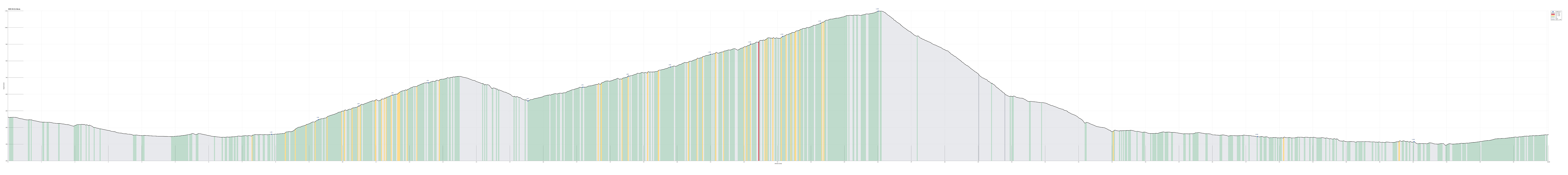
| Entfernung | 46,0km |
| Höhenmeter | 1.689m |
| GPS |
|
| Besuche anderer PBE | Sella Carnizza (1.086m) | 21.10.2025 |
|---|
Trip Summary
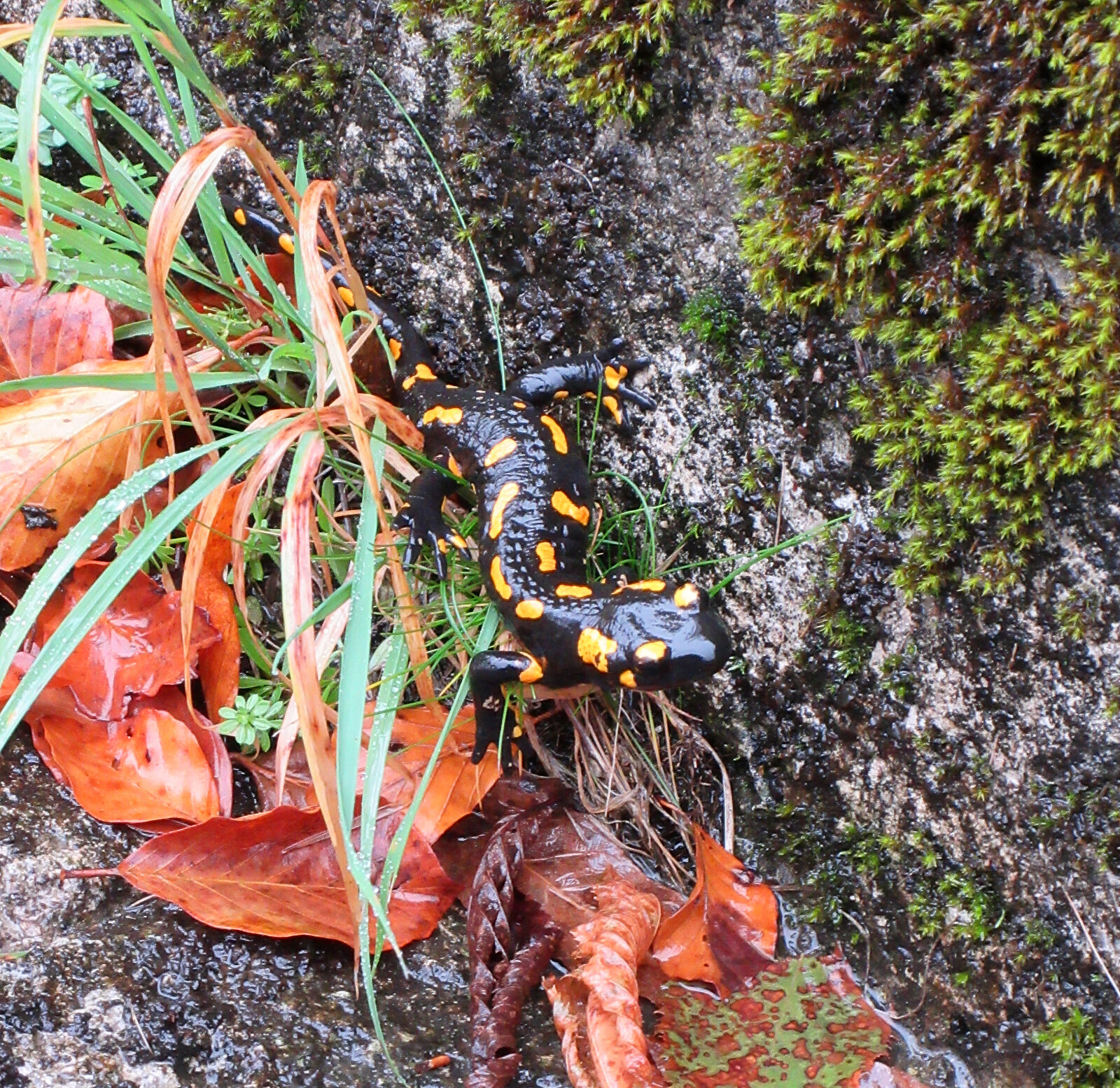
The plan for the third day of our four-days bike ride through the Julian Alps was to bike from Bovec to Moggio di Sotto via Val Resia. The weather forecast predicted rain throughout the day and it was right: it rained continuously. We first biked from Bovec down to Žaga, where we turned towards the west (and upwards again). Following the very nice mountain road towards the border between Slovenia and Italy, we enjoyed the fact that hardly any cars were on the same street. Instead, we got to see several fire salamanders that likely enjoyed the rain! :-) Before actually crossing over the border, we had to get over a small prelude saddle (where previously the Slovenian border control was?). From there, it was then a short stretch down to (and over) the Učja river. Once on the other, northern side, we eventually crossed the border and continued from there into Val Resia. This ascent through Val Resia was then really very nice (despite the rain!): amazing autumn colors, narrow road, (basically) no cars! After a while, we then made it up to Sella Carnizza, from where our descent towards Moggio di Sotto would begin. The first challenge was that the road down from Sella Carnizza (towards the west) is very steep. It was covered with leaves and it was raining: very slippery condition, requiring a very slow and careful descent. Further out the valleys, the remaining challenge was not manage our temperatures: cycling up Val Resia was all good and we were unsurprisingly warm and fine; biking down from Sella Carnizza was then very cold, even with all the clothes on that we could get our hands on. Eventually, we made it well to our target location, north of Moggio di Sotto. What we had not (not yet) understood, however, was that we could have followed the Alpe-Adria cycling path, once down in the valley of Fiume Fella. While the short stretch on SS13 was not really a problem, it clearly would have been more relaxed to choose the cycling path, which is extending in paralle just a little bit to the south. The next day, we would do accordingly! :-)
Photos
Selected photos are available as Google photo album.
Useful Resources
See also the related FB-page Hiking around Bergen, Norway.
See also another page about this four-(five-)days bike trip.


Benutzerkommentare