
Unplanned Mount Owen (04.11.2023)

Geschrieben von HHauser (Helwig Hauser)

| Startpunkt | Lyell Highway Saddle Parking (420m) |
|---|---|
| Endpunkt | Lyell Highway Saddle Parking (420m) |
| Tourcharakter | Wanderung |
| Tourlänge | 3h 00min |
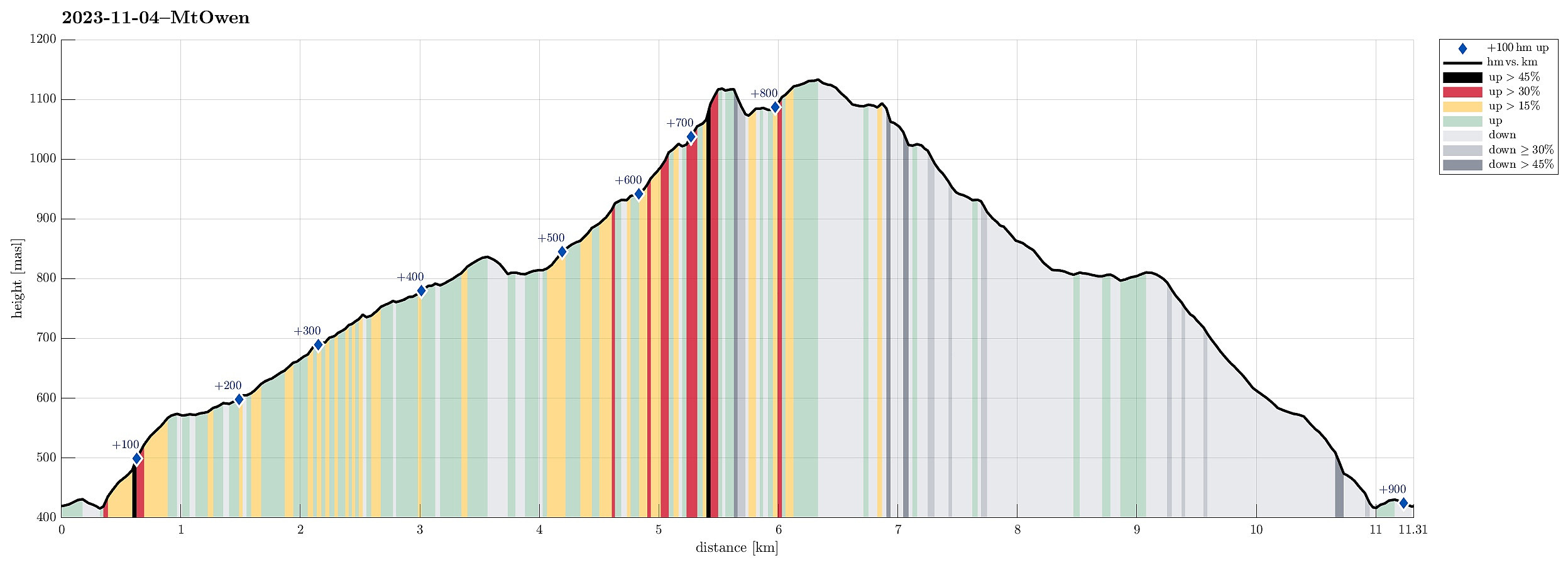
| Entfernung | 11,3km |
| Höhenmeter | 897m |
| GPS |
|
| Besteigungen | Mount Owen (1.146m) | 04.11.2023 |
|---|---|---|
| Besuche anderer PBE | Horsetail Falls Lookout (470m) | 04.11.2023 |
| Lyell Highway Saddle Parking (420m) | 04.11.2023 |
Trip Summary
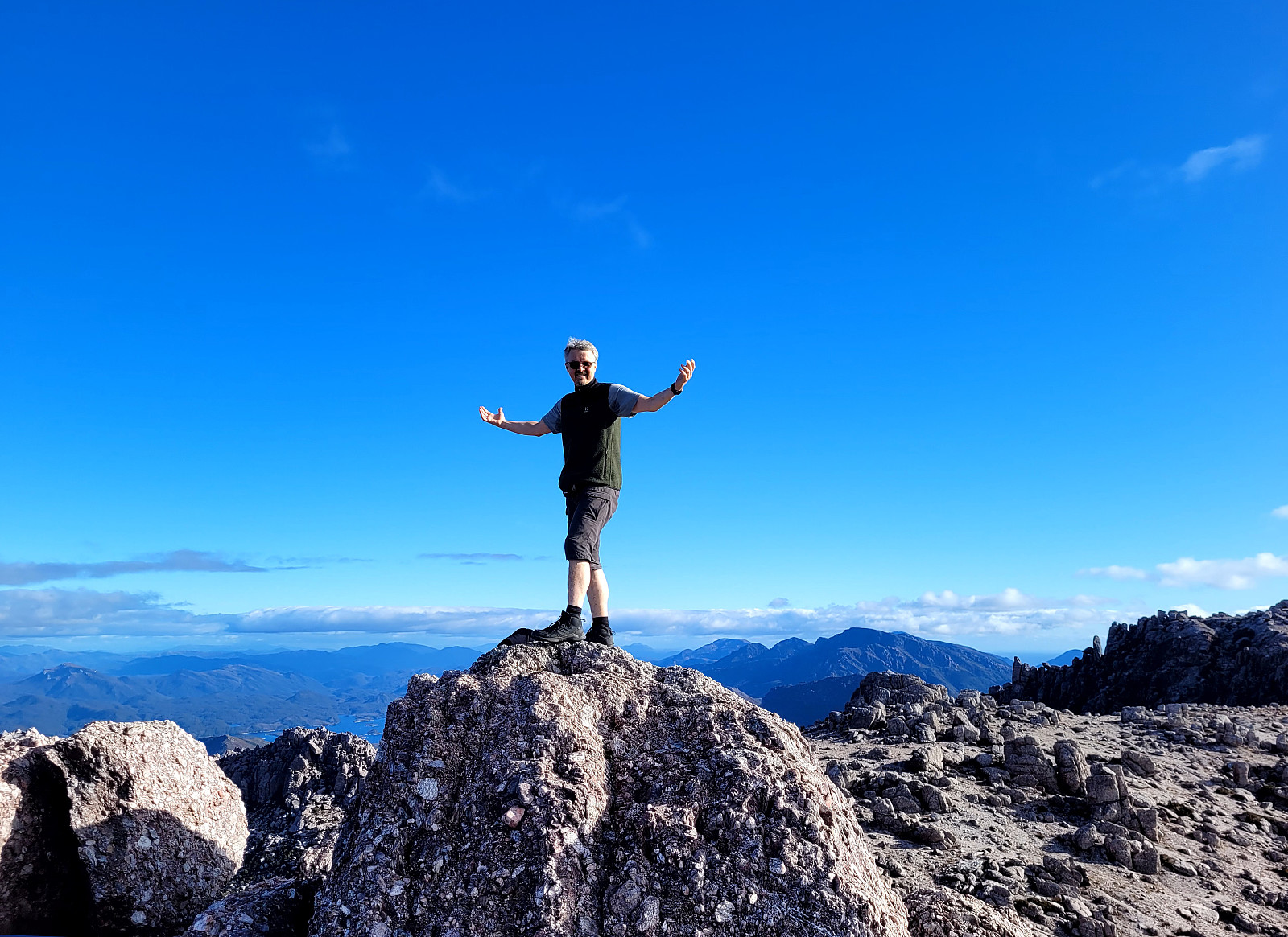
We had used most of the day to participate in a boat cruise on Macquarie Harbour (from Strahan), seeing the feared entry point (Hells Gates), the Gordon river (on the far, southeastern end of Macquarie Harbour) and the jungle around it, as well as Sarah Island (with all its dark history as a penal station). After all of this, we had no more plan than just driving a bit into the direction of the Central Highlands. Driving out of Strahan, we first headed towards Queenstown, which is strongly characterized by previous and current mining operations. This place did not appear inviting to us at all and we continued further eastwards (up the Lyell Highway Pass, first). As soon as we got close to the highest point on that saddle, we read a sign that hinted upon the opportunity to see a nice waterfall (Horsetail Falls) with just a short walk from the highway. Having not walked much anyway the whole day, we decided to give this waterfall a chance. Indeed, after only a few minutes of following a nice boardwalk along the mountain side, we got to see the waterfall (it's OK... ). At the end of the boardwalk, we got the impression that it seemed doable to step up the mountain side and continue. Once just a few height meters up there (yes, it's a bit steep, and the terrain is a bit loose; still, this ascent is no big challenge, really), we found ourselves on a gravel road that appeared to lead further up the mountain. Yet again only a few more meters up this road, we had the impression of a trail right next to the road. We decided to give this trail a chance and followed it further up the mountain. After not too long, however, we started to think that this trail possibly was more for mountain bikers than for hikers (which indeed is true). Once back on the gravel road, we then also saw a sign that confirmed this suspicion. Even though we had come to a point, where turning around would have been fully OK (we already enjoyed this little extension), we then decided to also go to the top of Mount Owen, estimating that we should still have enough daylight left for a safe descent. Following first the gravel road further up, we found a good connection to the summit trail that then was convenient to use for making the last stretch up (this summit trail is not very well marked, but with a bit of looking left and right, it's not difficult to find). Getting up the top of Mount Owen was then really very nice with fantastic views in all directions! Before then turning back, we got the impression that also including "the second peak" of Mount Owen, which actually also is a little bit higher, appeared possible (not with a trail, though). This indeed turned out to the true (and not difficult), offering even more views, especially also into the direction of distant Macquarie Harbour. Since the time of the day had progressed quite a bit, already, it was then really time to descend and to avoid getting into the dark. To do so, we basically followed the route that we had taken up (with the exception of not following the mountain bike trail, this time). Given that we "only" thought to quickly spot this waterfall near the highway, we returned highly satisfied with this completely unplanned hike! :-)
Photos
Selected photos are available as Google photo album.
Useful Resources
See also the related FB-page Hiking around Bergen, Norway.


Benutzerkommentare