
Høgafjellet and Haganesfjellet from Buabrekko (26.03.2022)

Geschrieben von HHauser (Helwig Hauser)

| Startpunkt | Tellnesvegen (35m) |
|---|---|
| Endpunkt | Tellnesvegen (35m) |
| Tourcharakter | Wanderung |
| Tourlänge | 3h 00min |
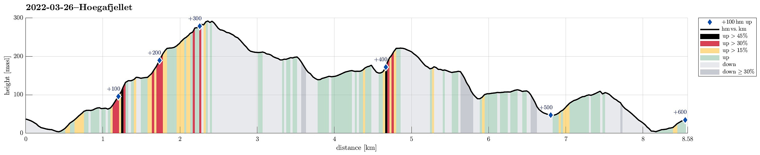
| Entfernung | 8,6km |
| Höhenmeter | 602m |
| GPS |
|
| Besteigungen | Haganesfjellet (232m) | 26.03.2022 |
|---|---|---|
| Ravnafjellet (118m) | 26.03.2022 | |
| Besuche anderer PBE | Høgafjellet Sør (300m) | 26.03.2022 |
Trip Summary
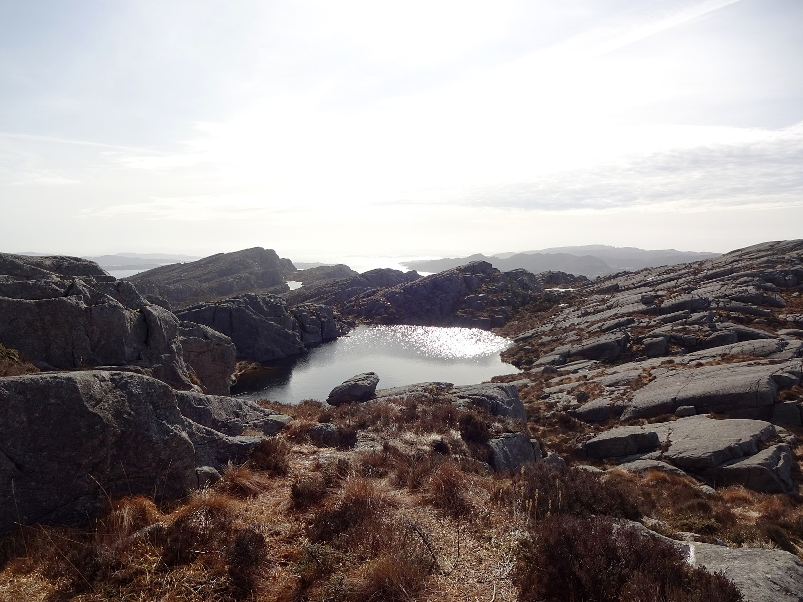
Høgafjellet and Haganesfjellet from Buabrekko. We parked near Tellnesvegen and walked down Buabrekko, crossing over the stream down from Kvernavatnet where it enters Pollen at its very northern end. On the other, eastern side, a trail leads up to the northern end of Ravnafjellet. Originally, we had planned to find a minor trail that should have forked off somewhere half way up in northeastern direction. Since we had not found this trail, we quickly found ourselves at the northern end of Ravnafjellet. There, we left the trail and continued through some relatively wet terrain northwards. Basically right west of Varden, we then found a good spot for ascending to the "next level", north of Vedatåna. There, we then also connected to a trail that circles Varden in its west. After then following the trail up to the "highest level", we ascended the southwestern top of Høgafjellet before turning around. Following the trail on the heights in the south of Høgafjellet, we passed by Kattatjørna and Brattestigvatnet in their west. We then decided to include Haganesfjellet via a probably quite unusual route, ascending to its top via its steep western side. Carefully choosing the right route, this ascent proved possible while probably not the recommended approach unless you are up for a little adventure. From Haganesfjellet, we then started our way back, following first the main trail down in northern direction. After passing Brattstigvatnet again, now on its south, we descended along a nice trail until we reached the place, where one can change in northern direction, again, passing by another lake that lies between Øvsta Ørnanipa in the northeast and Stokkafjellet in the southwest. North of Ørnanipa (the lower one), we then continued to descend further down in southwestward direction. Before stepping out to the road, however, we turned right (northwestwards) and included Ravnafjellet on our way back.
Photos
Selected photos are available as Google photo album.
Useful Resources
See also the related FB-page Hiking around Bergen, Norway.
Petter Bjørstad has a useful page about Liatårnet and also web page WestCoastPeaks.com provides useful information about Liatårnet.
Web page UT.no from the Norwegian Trekking Association recommends another hike to Haganesfjellet.


Benutzerkommentare