
Visiting Tobrik (14.12.2019)

Geschrieben von HHauser (Helwig Hauser)

| Startpunkt | Varden (45m) |
|---|---|
| Endpunkt | Myrholtet (50m) |
| Tourcharakter | Wanderung |
| Tourlänge | 2h 00min |
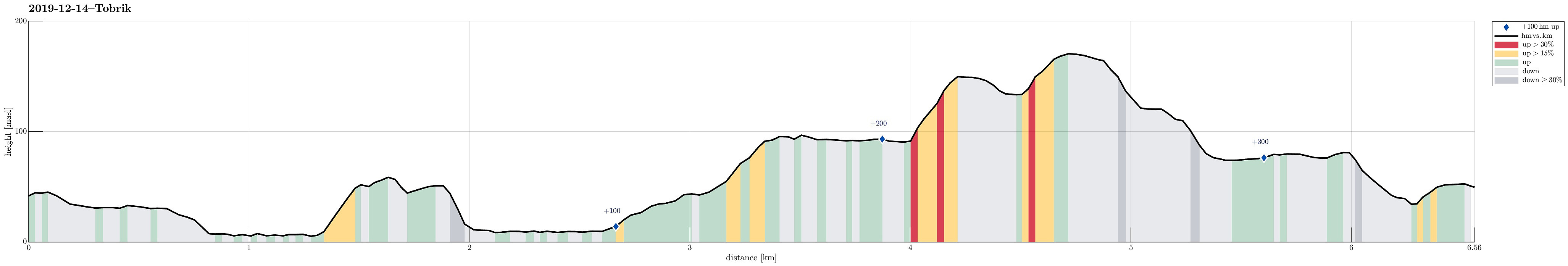
| Entfernung | 6,6km |
| Höhenmeter | 330m |
| GPS |
|
| Besteigungen | Storhovden (174m) | 14.12.2019 |
|---|---|---|
| Besuche anderer PBE | Storhovden utsiktspunkt (172m) | 14.12.2019 |
| Tjørnahuk (91m) | 14.12.2019 | |
| Tobrik (139m) | 14.12.2019 | |
| Øst for Elvareidet (60m) | 14.12.2019 |
Trip Summary
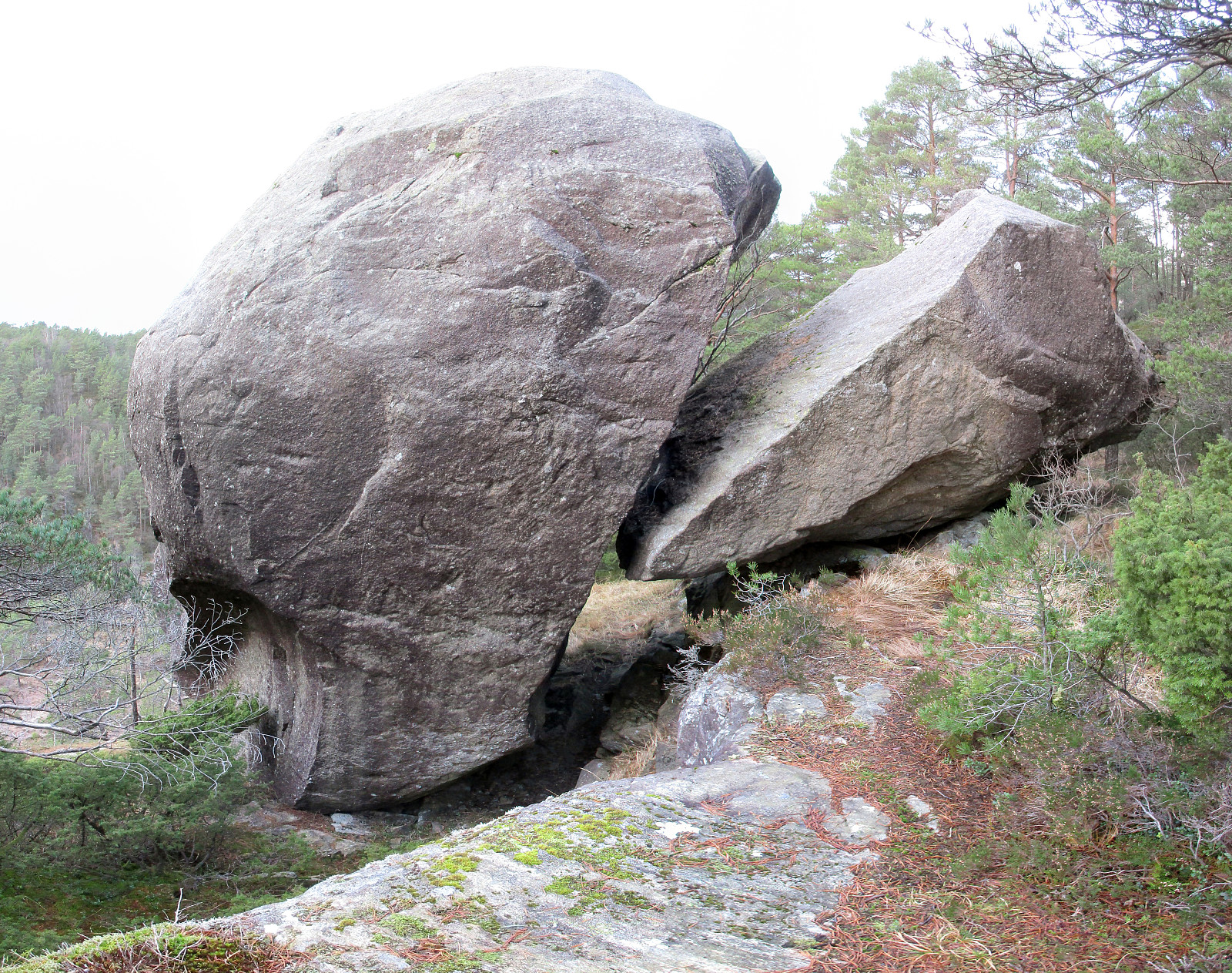
Having not so very much daylight at our disposal, we decided to "simply" do a walk in Kanadaskogen. To make this a slightly little bit more interesting, we decided to visit "The other big rock in Kanadaskogen" (Tobrik). We started from Varden and headed first towards Gjeddevatnet. We then hiked along it, continuing to Bjørndalsvatnet, just north of Gjeddevatnet. After having hiked along this little lake, also, we then followed a trail further northwards that leads to Svartatjørna. After having passed this nice little lake on its western side, we continued towards Storamyra. There, a new paved trail has emerged and along with it a wooden shelter for those, who wish to enjoy a dry break very close to Svartatjørna. Instead of staying there, we right away continued and crossed Storamyra off-trail in northeastern direction. Storamyra is confined on its eastern side by a remarkable cliff. On top of the cliff one can very well see a major rock (Tobrik) and one wonders how it came that it did not fell off the cliff in the first place! Getting up to this impressive rock, however, is not completely trivial (due to the cliff). But approaching it from the north, using a moderately steep diagonal that directly leads to the rock, is (well) possible (without a trail, though). Once at the top, one can easily explore Tobrik, both from the north and the south (and it's worth it). Apparently, it broke into two pieces some probably long time back, suggesting the names Stora-Tobrik and Vetla-Tobrik. Since the conditions were moderately slippery, we did not attempt any climb onto Tobrik, but simply enjoyed the moment and the view down to Storamyra. After a short while, we then started our hiked back to Varden, including Storhovden on our way back. Following its southern ridge down from Storhovden, we reached Krokatjørna, which we then followed on its western side. After all, we then followed a trail in southern direction to the gravel road which extends northwards from the Varden Amfi. Also this trail, before connecting with the gravel road, has been paved recently (maybe half way up to Krokatjørna). Eventually, we concluded our hike at Myrholtet.
Photos
Selected photos are available as Google photo album.
Useful Resources
See also the related FB-page Hiking around Bergen, Norway.
Web page WestCoastPeaks.com provides useful information about Tobrik (Storamyrsteinen) as well as a summary page about big rocks in Hordaland.


Benutzerkommentare