Archiv - Nach Datum
Archiv - Nach Geografie
Peakbookfreunde


Gesammelte Listen
-
Sukkertoppen topper
(90/112)
 80%
80% -
Møre og Romsdal ≥ 500m pf.
(104/161)
64%
-
Møre og Romsdal kommunetopper
(14/24)
58%
-
Sunnmøre ≥ 100m pf.
(294/531)
55%
-
2000m 30m pf. fastlandet
(99/227)
43%


Mount Kerinci
- Datum:
- 04.08.2013
- Tourcharakter:
- Wanderung
- Tourlänge:
- 10:34h
- Entfernung:
- 15,2km
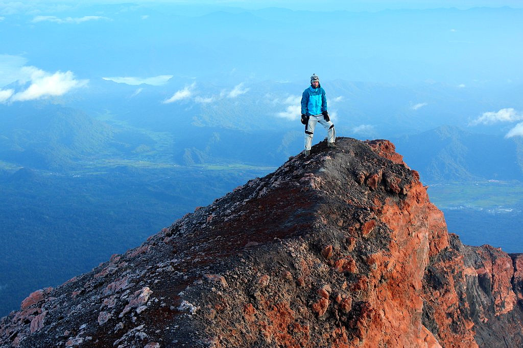 Sunrise on the summit of Gunung Kerinci
Mount Rinjani
- Datum:
- 16.07.2013
- Tourcharakter:
- Wanderung
- Tourlänge:
- 28:43h
- Entfernung:
- 37,3km
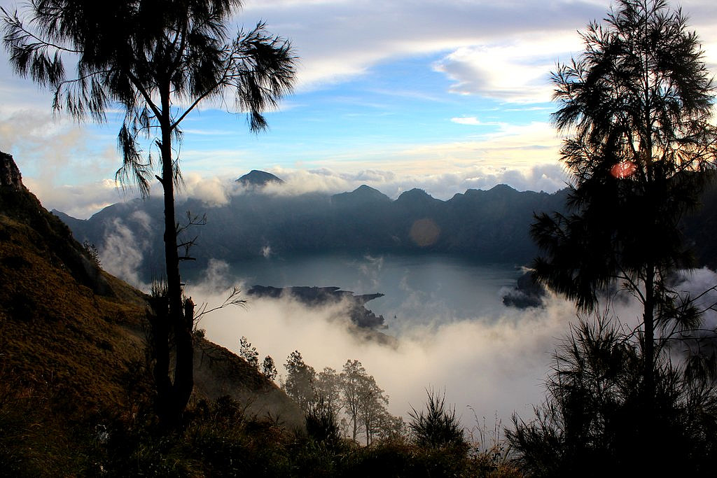 Gunung Rinjani (3726m) is the tallest mountain in Lombok and the second highest volcano in Indonesia. It takes 3 long days to do the full traverse of Rinjani including the crater lake, and we enjoyed every moment of this wonderful trek and the spectacular scenery.
See my offsite trip-report, photos and gps-track at distantpeak.blogspot.com/2013/07/gunung-rinjani.html
Gunung Rinjani (3726m) is the tallest mountain in Lombok and the second highest volcano in Indonesia. It takes 3 long days to do the full traverse of Rinjani including the crater lake, and we enjoyed every moment of this wonderful trek and the spectacular scenery.
See my offsite trip-report, photos and gps-track at distantpeak.blogspot.com/2013/07/gunung-rinjani.html
Gunung Agung
- Datum:
- 13.07.2013
- Tourcharakter:
- Wanderung
- Tourlänge:
- 6:44h
- Entfernung:
- 12,6km
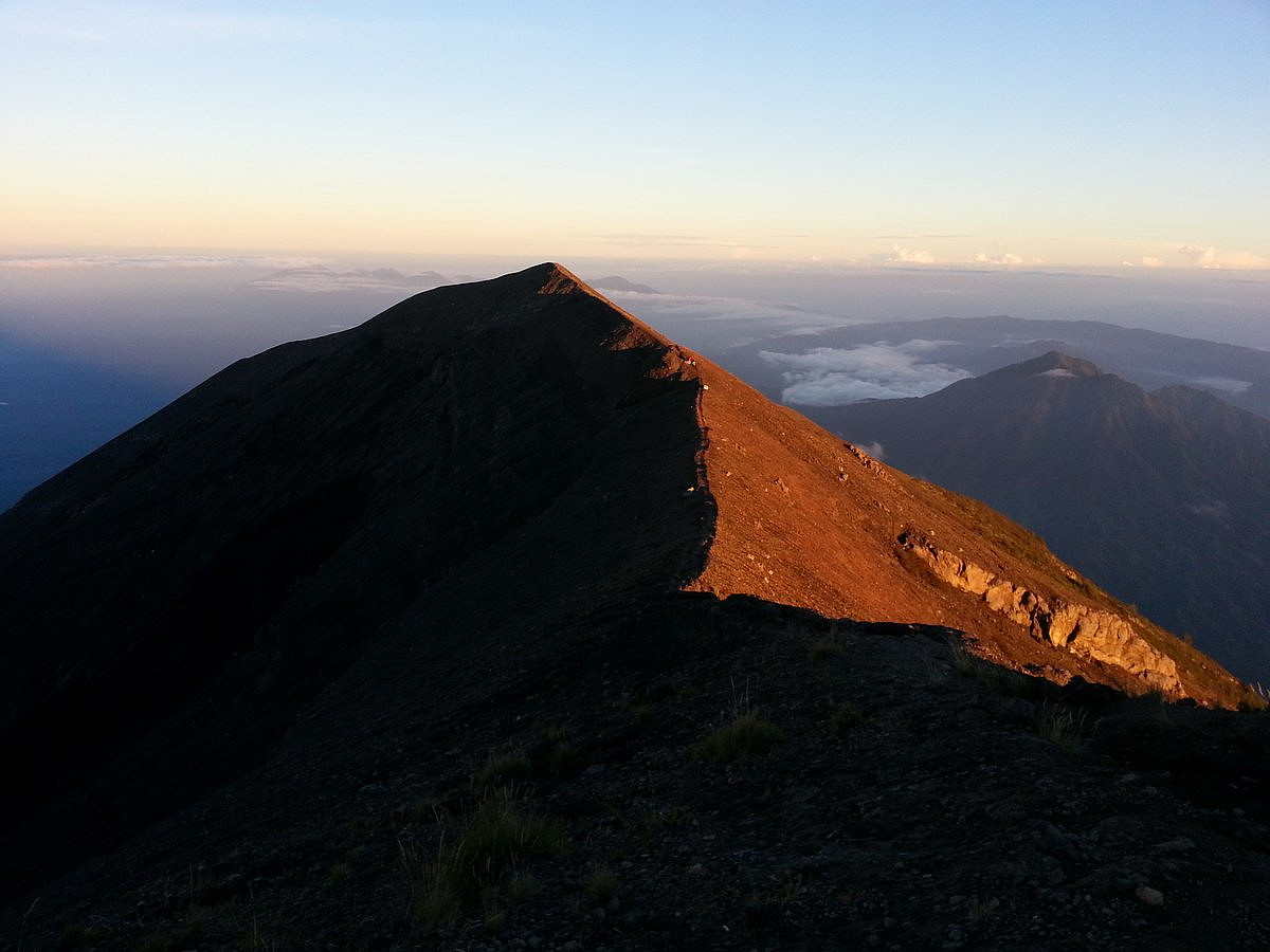 I've actually been to Bali and Gunung Agung before, sometime back in 2001. But then I only reached the false summit on the wrong side of the crater rim. 12 years later I came back to finnish the business.
See my offsite trip-report, photos and gps-track at distantpeak.blogspot.com/2013/07/gunung-agung.html
I've actually been to Bali and Gunung Agung before, sometime back in 2001. But then I only reached the false summit on the wrong side of the crater rim. 12 years later I came back to finnish the business.
See my offsite trip-report, photos and gps-track at distantpeak.blogspot.com/2013/07/gunung-agung.html
