Archiv - Nach Datum
Archiv - Nach Geografie
Peakbookfreunde


Gesammelte Listen
-
Sukkertoppen topper
(90/112)
 80%
80% -
Møre og Romsdal ≥ 500m pf.
(104/161)
64%
-
Møre og Romsdal kommunetopper
(14/24)
58%
-
Sunnmøre ≥ 100m pf.
(294/531)
55%
-
2000m 30m pf. fastlandet
(99/227)
43%


Mount Bazardüzü
- Datum:
- 25.08.2017
- Tourcharakter:
- Wanderung
- Tourlänge:
- 11:57h
- Entfernung:
- 18,6km
Mount Kerinci
- Datum:
- 04.08.2013
- Tourcharakter:
- Wanderung
- Tourlänge:
- 10:34h
- Entfernung:
- 15,2km
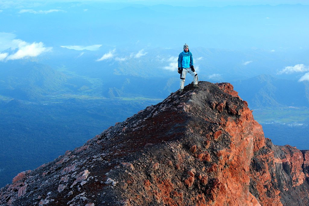 Sunrise on the summit of Gunung Kerinci
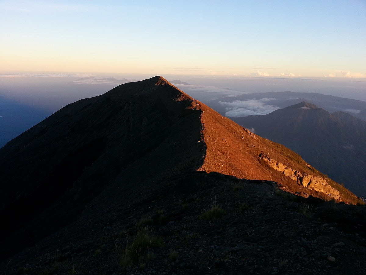
Mount Rinjani
- Datum:
- 16.07.2013
- Tourcharakter:
- Wanderung
- Tourlänge:
- 28:43h
- Entfernung:
- 37,3km
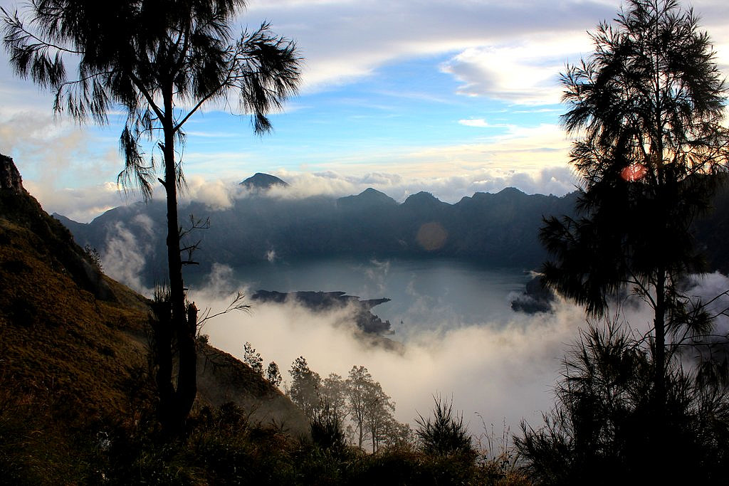 Gunung Rinjani (3726m) is the tallest mountain in Lombok and the second highest volcano in Indonesia. It takes 3 long days to do the full traverse of Rinjani including the crater lake, and we enjoyed every moment of this wonderful trek and the spectacular scenery.
See my offsite trip-report, photos and gps-track at distantpeak.blogspot.com/2013/07/gunung-rinjani.html
Gunung Rinjani (3726m) is the tallest mountain in Lombok and the second highest volcano in Indonesia. It takes 3 long days to do the full traverse of Rinjani including the crater lake, and we enjoyed every moment of this wonderful trek and the spectacular scenery.
See my offsite trip-report, photos and gps-track at distantpeak.blogspot.com/2013/07/gunung-rinjani.html
Gunung Agung
- Datum:
- 13.07.2013
- Tourcharakter:
- Wanderung
- Tourlänge:
- 6:44h
- Entfernung:
- 12,6km
 I've actually been to Bali and Gunung Agung before, sometime back in 2001. But then I only reached the false summit on the wrong side of the crater rim. 12 years later I came back to finnish the business.
See my offsite trip-report, photos and gps-track at distantpeak.blogspot.com/2013/07/gunung-agung.html
I've actually been to Bali and Gunung Agung before, sometime back in 2001. But then I only reached the false summit on the wrong side of the crater rim. 12 years later I came back to finnish the business.
See my offsite trip-report, photos and gps-track at distantpeak.blogspot.com/2013/07/gunung-agung.html
Pico do Ramelau
- Datum:
- 08.07.2013
- Tourcharakter:
- Wanderung
- Tourlänge:
- 4:13h
- Entfernung:
- 14,1km
 Mount Ramelau (2986m), sometimes referred to as Foho Tatamailau, is the highest peak in the new sovereign state of East Timor (Timor Leste) as well as Timor Island. The hike itself is very straightforward. The biggest challenge is to get to the foot of this mountain.
See my offsite trip-report, photos and gps-track at distantpeak.blogspot.com/2013/07/mount-ramelau.html
Mount Ramelau (2986m), sometimes referred to as Foho Tatamailau, is the highest peak in the new sovereign state of East Timor (Timor Leste) as well as Timor Island. The hike itself is very straightforward. The biggest challenge is to get to the foot of this mountain.
See my offsite trip-report, photos and gps-track at distantpeak.blogspot.com/2013/07/mount-ramelau.html
Gunung Hulu Kali
- Datum:
- 25.02.2013
- Tourcharakter:
- Wanderung
- Tourlänge:
- 1:11h
- Entfernung:
- 6,3km
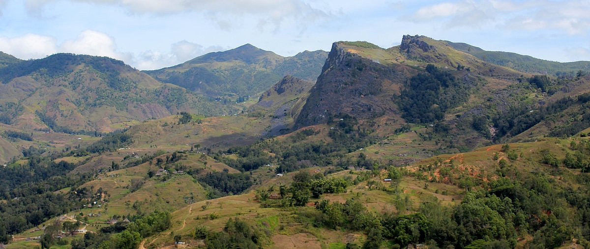
Bukit Pagon
- Datum:
- 21.02.2013
- Tourcharakter:
- Wanderung
- Tourlänge:
- 9:48h
- Entfernung:
- 19,6km
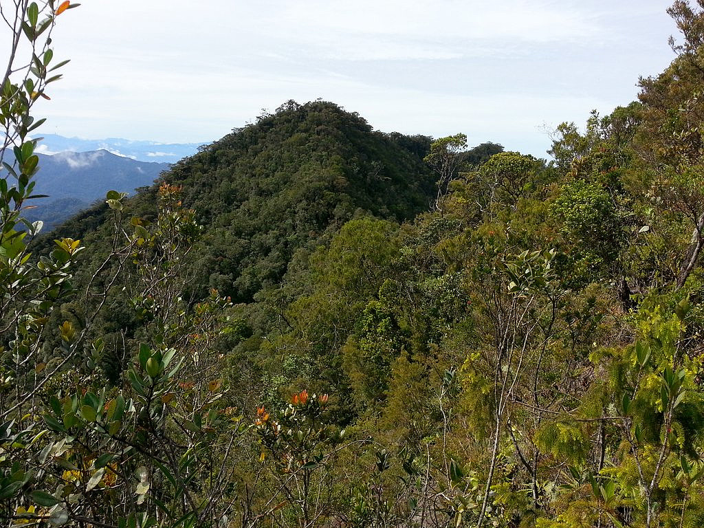 Guided tour package, costing 450 Brunei dollar per person (minimum of 3-4 clients). Long 4WD drive (4 hours each way) to basecamp. The day hike was fairly long too, almost 10 hours (incl return) in moderate pace with lots of up and downs, accumulating to more than 1800m gain of elevation ( click to see my GPS track ). Much of the hike was along an abandoned logging road, then a steep ridge with a surprisingly straightforward trail, which had fixed rope in the steepest sections. According to the guide (Haddy), only 50 people or so have been to this summit. I also returned fairly bloody, because of 3 leeches that had been eating on my two legs for a long time. Almost impossible to stop the bleeding, without a medical kit. Instead they put tobacco into my bites, and that was quite useful.
I need help to find the prominence, >>>
Guided tour package, costing 450 Brunei dollar per person (minimum of 3-4 clients). Long 4WD drive (4 hours each way) to basecamp. The day hike was fairly long too, almost 10 hours (incl return) in moderate pace with lots of up and downs, accumulating to more than 1800m gain of elevation ( click to see my GPS track ). Much of the hike was along an abandoned logging road, then a steep ridge with a surprisingly straightforward trail, which had fixed rope in the steepest sections. According to the guide (Haddy), only 50 people or so have been to this summit. I also returned fairly bloody, because of 3 leeches that had been eating on my two legs for a long time. Almost impossible to stop the bleeding, without a medical kit. Instead they put tobacco into my bites, and that was quite useful.
I need help to find the prominence, >>>
