Archiv - Nach Datum
Archiv - Nach Geografie
Peakbookfreunde


Gesammelte Listen
-
Sukkertoppen topper
(90/112)
 80%
80% -
Møre og Romsdal ≥ 500m pf.
(104/161)
64%
-
Møre og Romsdal kommunetopper
(14/24)
58%
-
Sunnmøre ≥ 100m pf.
(293/531)
55%
-
2000m 30m pf. fastlandet
(99/227)
43%


Sandvikhornet og Søvikhornet
- Datum:
- 08.02.2014
- Tourcharakter:
- Wanderung
- Tourlänge:
- 3:39h
- Entfernung:
- 11,4km
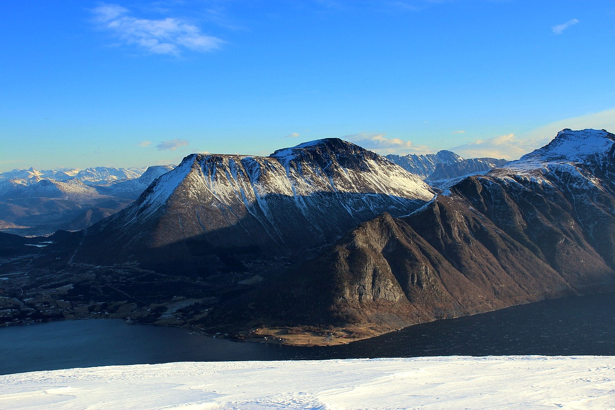
Grøtshornet og Åsen
- Datum:
- 02.02.2014
- Tourcharakter:
- Wanderung
- Tourlänge:
- 3:12h
- Entfernung:
- 8,2km
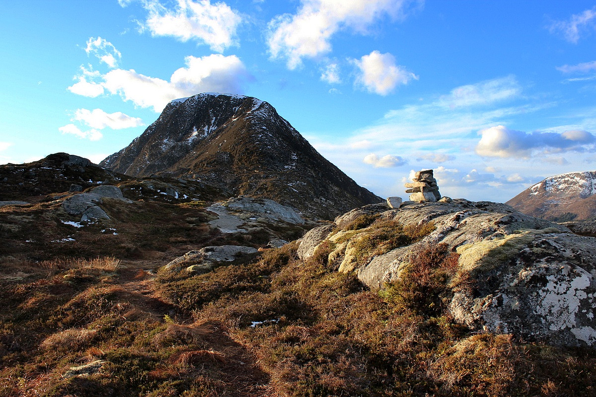 Nordryggen av Grøtshornet har en godt merket sti med upåklagelig utsikt "ut mot havet". Etter et kortvarig besøk på toppen (sterk vind!!), valgte jeg å gå ned vestsida av Grøtshornet. Her var det selvsagt ingen sti, men litt rufsete terreng og til dels bratt. Jeg kom meg etterhvert ned i dalen og videre opp Åsen. Derfra fant jeg noe som lignet på en sti som fortsatte nordover langs ryggen og tilbake til veien i Ertresvågen.
På denne turen kikket jeg til stadighet bort på østveggen av Storfjellet, for her ser det ut til å være noen interessante snørenner til topps, et mulig prosjekt for fremtiden kanskje.....
Nordryggen av Grøtshornet har en godt merket sti med upåklagelig utsikt "ut mot havet". Etter et kortvarig besøk på toppen (sterk vind!!), valgte jeg å gå ned vestsida av Grøtshornet. Her var det selvsagt ingen sti, men litt rufsete terreng og til dels bratt. Jeg kom meg etterhvert ned i dalen og videre opp Åsen. Derfra fant jeg noe som lignet på en sti som fortsatte nordover langs ryggen og tilbake til veien i Ertresvågen.
På denne turen kikket jeg til stadighet bort på østveggen av Storfjellet, for her ser det ut til å være noen interessante snørenner til topps, et mulig prosjekt for fremtiden kanskje.....
Festøykollen
- Datum:
- 01.02.2014
- Tourcharakter:
- Wanderung
- Tourlänge:
- 3:47h
- Entfernung:
- 7,9km
 Tur med Håvar. Vi hadde med både stegjern og isøks i tilfelle skare og is, men det viste seg at denne toppen ble en 99% barmarks tur. Flott vær og en fantastisk utsikt !
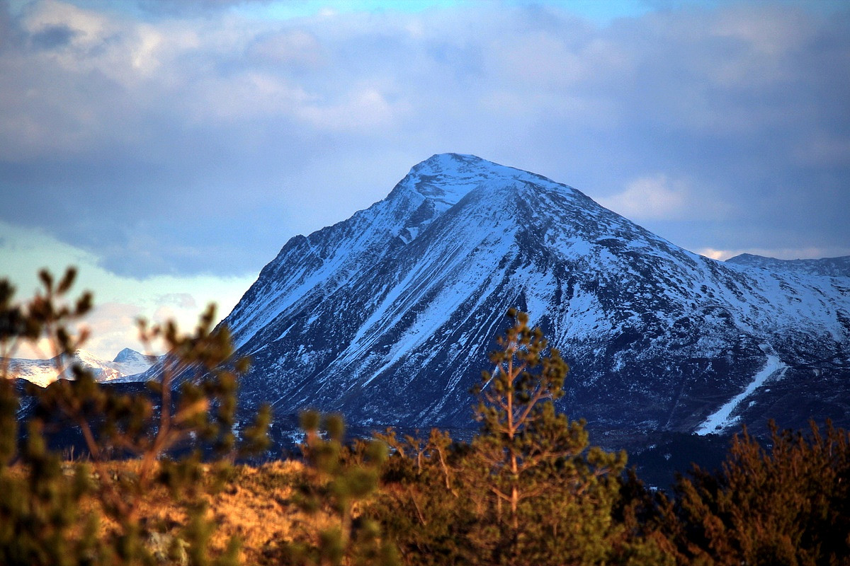
Trolltinden
- Datum:
- 26.01.2014
- Tourcharakter:
- Hochtour
- Tourlänge:
- 4:56h
- Entfernung:
- 7,6km
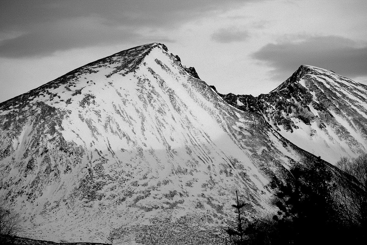 Jeg hadde hørt at Trolltinden ikke er noe optimal ski-topp, så jeg satte igjen skia og satset heller på en alpin tur til fots med stegjern og isøks. Under et tynt lag med løssnø, var det som forventet et solid lag med skare som bar vekta mi. Busker og kratt stod ikke veldig tett, så det var enkelt å finne en vei igjennom. Etterhvert kom jeg meg over tregrensa og krysset bortover mot Trolltinden i åpent lende. Sydsiden av Trolltinden er ganske bratt og med dagens skarpe føre ville det vært umulig å komme seg opp uten stegjern. Jeg fulgte en snørenne oppover, og det vekslet mellom snø og knallhard is. På det bratteste og mest isete partiet gikk jeg på alle fire (med 2 isøkser). Mot toppen ble det mindre bratt og da var det frem med stavene igjen. Jeg ble møtt av et fantastisk >>>
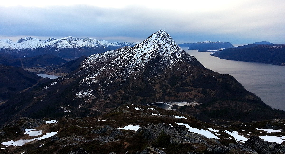
Leirvågfjellet og Solavågsfjellet
- Datum:
- 25.01.2014
- Tourcharakter:
- Wanderung
- Tourlänge:
- 2:05h
- Entfernung:
- 7,5km
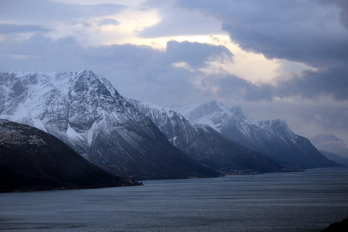 Dette ble min første kommune i Norge hvor jeg har vært på alle PF100 toppene. Sånn sett ble dagen litt historisk, he-he.
Parkerte på vestsida av brua mellom Leirvågen og Solavågen (ved et sykehjem). Herfra kunne jeg nemlig gjøre begge toppene fra "sea til summit", samt redusere CO2 utslipp ved å ikke bruke bil mellom toppene ;-)
Sterk vind idag, derfor var det ok å befinne seg i lav høyde. Det så ikke noe særlig innbydende ut på andre siden av Storfjorden, der det sannsynligvis var et "helvetes uvær" over 1000 meter.
Det er gode stier både på Solavågsfjellet og Leirvågfjellet, så dette ble en behagelig affære. Utsikten er klart best fra sistnevnte topp, p.g.a mindre skog.
Dette ble min første kommune i Norge hvor jeg har vært på alle PF100 toppene. Sånn sett ble dagen litt historisk, he-he.
Parkerte på vestsida av brua mellom Leirvågen og Solavågen (ved et sykehjem). Herfra kunne jeg nemlig gjøre begge toppene fra "sea til summit", samt redusere CO2 utslipp ved å ikke bruke bil mellom toppene ;-)
Sterk vind idag, derfor var det ok å befinne seg i lav høyde. Det så ikke noe særlig innbydende ut på andre siden av Storfjorden, der det sannsynligvis var et "helvetes uvær" over 1000 meter.
Det er gode stier både på Solavågsfjellet og Leirvågfjellet, så dette ble en behagelig affære. Utsikten er klart best fra sistnevnte topp, p.g.a mindre skog.

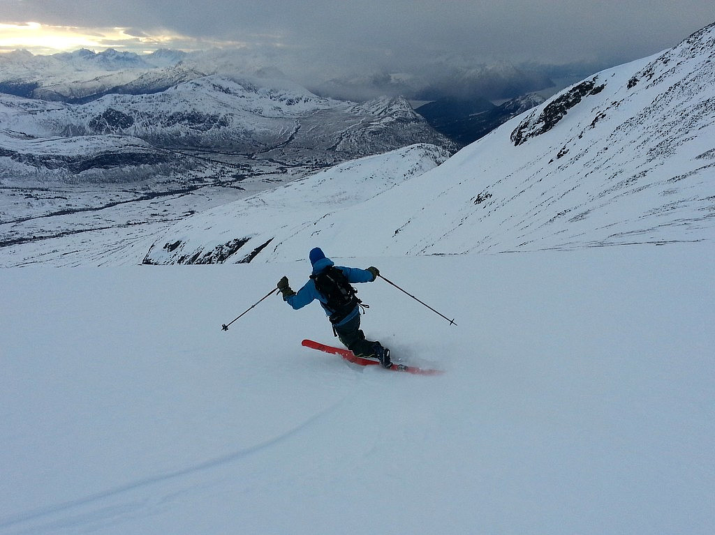
Sprovstinden
- Datum:
- 18.01.2014
- Tourcharakter:
- Randonnée/Telemark
- Tourlänge:
- 5:04h
- Entfernung:
- 11,6km