Archiv - Nach Datum
Archiv - Nach Aktivität
-
Andere Tour (3)
- Kayaking (3)
-
Fahrradtour (111)
- Fahrradtour Straße (86)
- Fahrradtour gemischt (25)
-
Fahrzeugtour (9)
- Autotour (9)
-
Fußtour (1898)
- Bergtour (1120)
- Jogging (1)
- Spaziergang (60)
- Wanderung (717)
-
Skitour (116)
- Langlauf (47)
- Tourenskilauf (69)
Gesammelte Listen
-
Utvalgte topper og turmål i Bergen
(349/351)
 99%
99% -
Alle topper i Bergen
(393/400)
98%
-
Voss ≥ 100m pf.
(96/98)
97%
-
Opptur Hordaland
(144/159)
90%
-
Stasjoner på Bergensbanen
(33/40)
82%
-
Ulvik ≥ 100m pf.
(30/38)
78%
-
Hordaland ≥ 100m pf.
(624/863)
72%
-
Mjølfjell PF > 100m
(21/31)
67%
-
Jondal ≥ 100m pf.
(15/23)
65%
-
Dagsturhyttene i Vestland
(36/61)
59%
-
Sunnhordland PF >= 100m
(105/186)
56%
-
Hordaland: Hardanger PF>=100m
(196/359)
54%
-
DNT-hytter i Hordaland
(23/45)
51%
-
Kvinnherad ≥ 100m pf.
(40/79)
50%
-
Eidfjord ≥ 100m pf.
(13/42)
30%
-
Sogndal ≥ 100m pf.
(23/81)
28%
-
Gulen ≥ 100m pf.
(15/54)
27%
-
Vik i Sogn ≥ 100m pf.
(10/46)
21%
-
Sogn - Sør for Sognefjorden PF>=100m
(31/159)
19%
-
DNT-hytter i Sogn og Fjordane
(8/47)
17%

Blånipa from Krosstølen p-plass
- Datum:
- 24.05.2025
- Tourcharakter:
- Bergtour
- Tourlänge:
- 3:32h
- Entfernung:
- 10,2km
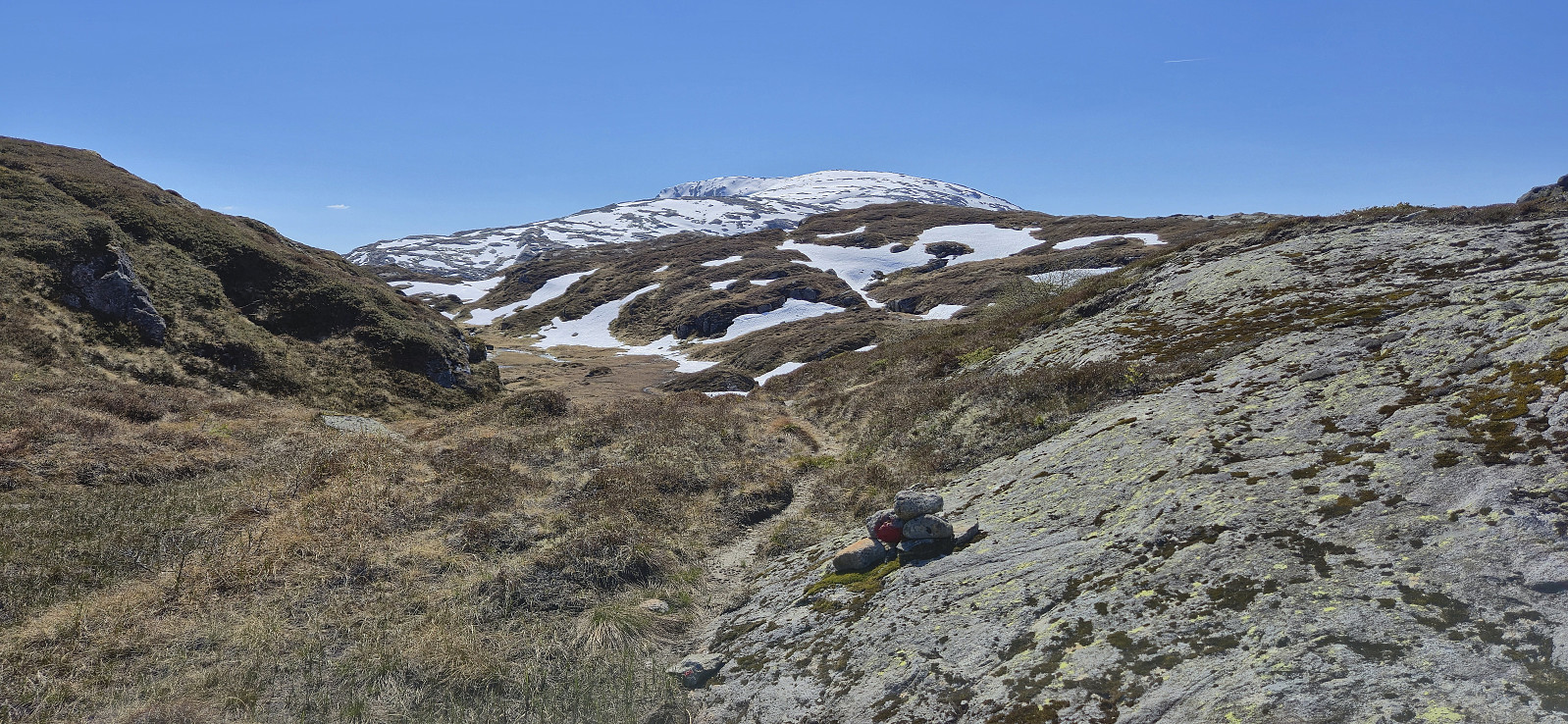
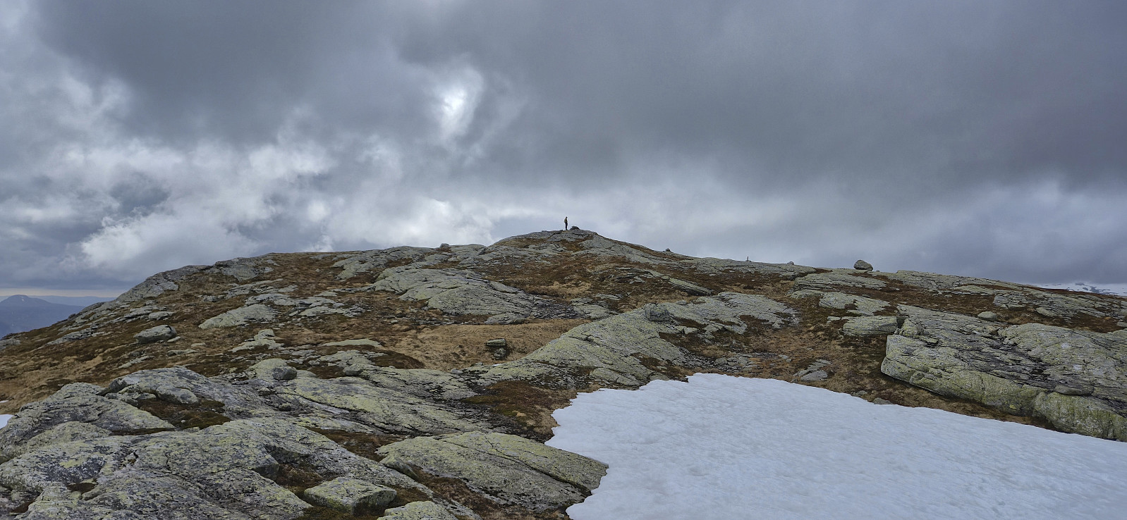 After ascending Sørskarfjellet , Endre and I drove north to Krosstølen p-plass and from there followed the marked trail to Blånipa . The markers were however not always the easiest to spot and we had to check with the GPS on multiple occasions to ensure that we were on the right track. As we got closer to the summit the route marked with blue paint also deviated quite a bit from the trail indicated on the map.
The summit was still reached without any real difficulties and we could enjoy the excellent views, even though we saw very little of the promised sunshine. In any case, the freezing wind made for a short stop and we did not stay long before descending along the alternative trail heading southwest and then north from the summit.
The marking of the descent trail was also rather inconsistent and without a GPS it would probably have been more difficult, >>>
After ascending Sørskarfjellet , Endre and I drove north to Krosstølen p-plass and from there followed the marked trail to Blånipa . The markers were however not always the easiest to spot and we had to check with the GPS on multiple occasions to ensure that we were on the right track. As we got closer to the summit the route marked with blue paint also deviated quite a bit from the trail indicated on the map.
The summit was still reached without any real difficulties and we could enjoy the excellent views, even though we saw very little of the promised sunshine. In any case, the freezing wind made for a short stop and we did not stay long before descending along the alternative trail heading southwest and then north from the summit.
The marking of the descent trail was also rather inconsistent and without a GPS it would probably have been more difficult, >>>
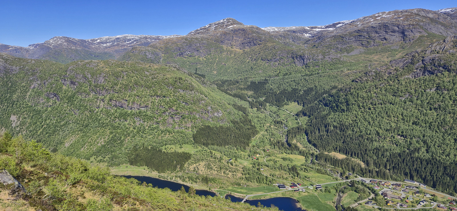
Sørskarfjellet via Tveradalsstølen
- Datum:
- 24.05.2025
- Tourcharakter:
- Bergtour
- Tourlänge:
- 2:41h
- Entfernung:
- 7,0km
 On the way home from our Friday evening hike to Noltane , Endre and I noticed that the weather forecast for the following day now suddenly looked much better. We therefore decided to have a go at the final two peaks I had left in Modalen. When Endre picked me up the morning after the weather had however changed again and during our drive to Modalen it was rather gray and we even had the occasional light rain shower.
The forecast said that the weather was going to improve later in the afternoon though, so in order to postpone the start of our real hike, we made a short stop in Romarheim on the way such that Endre could ascend Almeskila . I had already visited Almeskila back in 2019 and therefore waited in the car until Endre returned around 45 minutes later and we then continued the drive to Modalen.
Upon arriving at the small parking lot north of Sørskarfjellet the weather was not much better though and >>>
On the way home from our Friday evening hike to Noltane , Endre and I noticed that the weather forecast for the following day now suddenly looked much better. We therefore decided to have a go at the final two peaks I had left in Modalen. When Endre picked me up the morning after the weather had however changed again and during our drive to Modalen it was rather gray and we even had the occasional light rain shower.
The forecast said that the weather was going to improve later in the afternoon though, so in order to postpone the start of our real hike, we made a short stop in Romarheim on the way such that Endre could ascend Almeskila . I had already visited Almeskila back in 2019 and therefore waited in the car until Endre returned around 45 minutes later and we then continued the drive to Modalen.
Upon arriving at the small parking lot north of Sørskarfjellet the weather was not much better though and >>>
Noltane via Mælandsstølen
- Datum:
- 23.05.2025
- Tourcharakter:
- Bergtour
- Tourlänge:
- 2:54h
- Entfernung:
- 7,9km
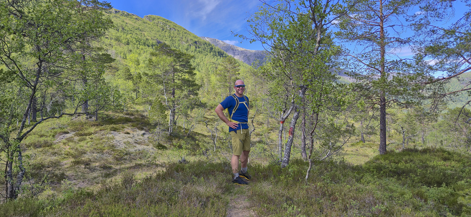 Started the weekend early to take advantage of what looked like the last day of great hiking weather for a while. Endre picked me up at my place shortly before three and together we drove to Øvstedalen north of Bolstadøyri. Here we parked at a small parking lot southwest from Mæland and started on the tractor road indicated on the map. This turned out to be a marked trail that took us all the way to Mælandsstølen .
Here the trail ended but it was straightforward to ascend the rest of the way to the summit in open terrain. On our way to the highest point we passed by Rjupetjørni and after crossing a couple of patches of snow we arrived at the unmarked summit of Noltane . After a short break to enjoy the excellent panoramic views we descended along the same route.
In summary, a great hike with excellent views that can be highly recommended. (Note that the gravel >>>
Started the weekend early to take advantage of what looked like the last day of great hiking weather for a while. Endre picked me up at my place shortly before three and together we drove to Øvstedalen north of Bolstadøyri. Here we parked at a small parking lot southwest from Mæland and started on the tractor road indicated on the map. This turned out to be a marked trail that took us all the way to Mælandsstølen .
Here the trail ended but it was straightforward to ascend the rest of the way to the summit in open terrain. On our way to the highest point we passed by Rjupetjørni and after crossing a couple of patches of snow we arrived at the unmarked summit of Noltane . After a short break to enjoy the excellent panoramic views we descended along the same route.
In summary, a great hike with excellent views that can be highly recommended. (Note that the gravel >>>
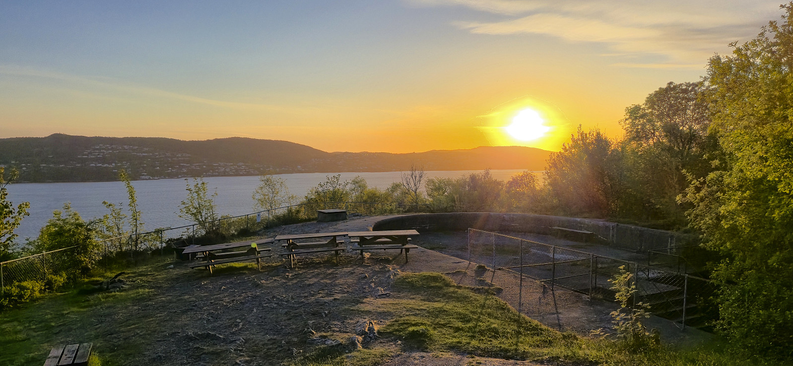
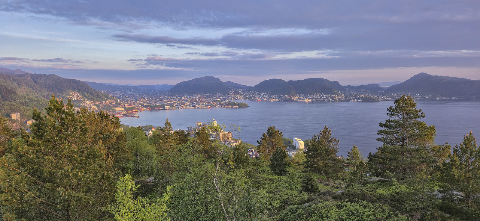
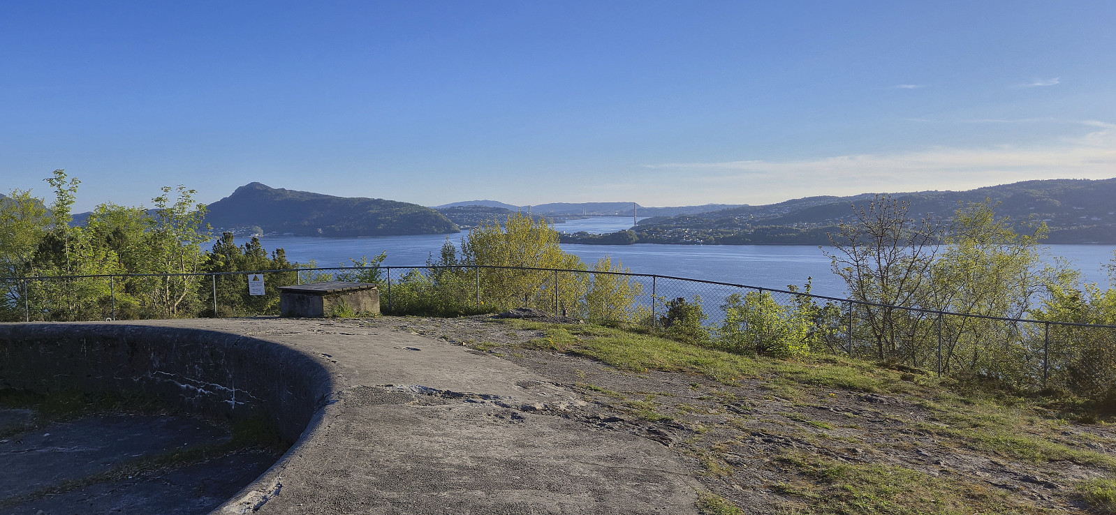
Across Hellen festning
- Datum:
- 20.05.2025
- Tourcharakter:
- Wanderung
- Tourlänge:
- 0:37h
- Entfernung:
- 3,1km
 Short local evening hike.
Gråsida from Nygard
- Datum:
- 18.05.2025
- Tourcharakter:
- Bergtour
- Tourlänge:
- 6:25h
- Entfernung:
- 10,6km
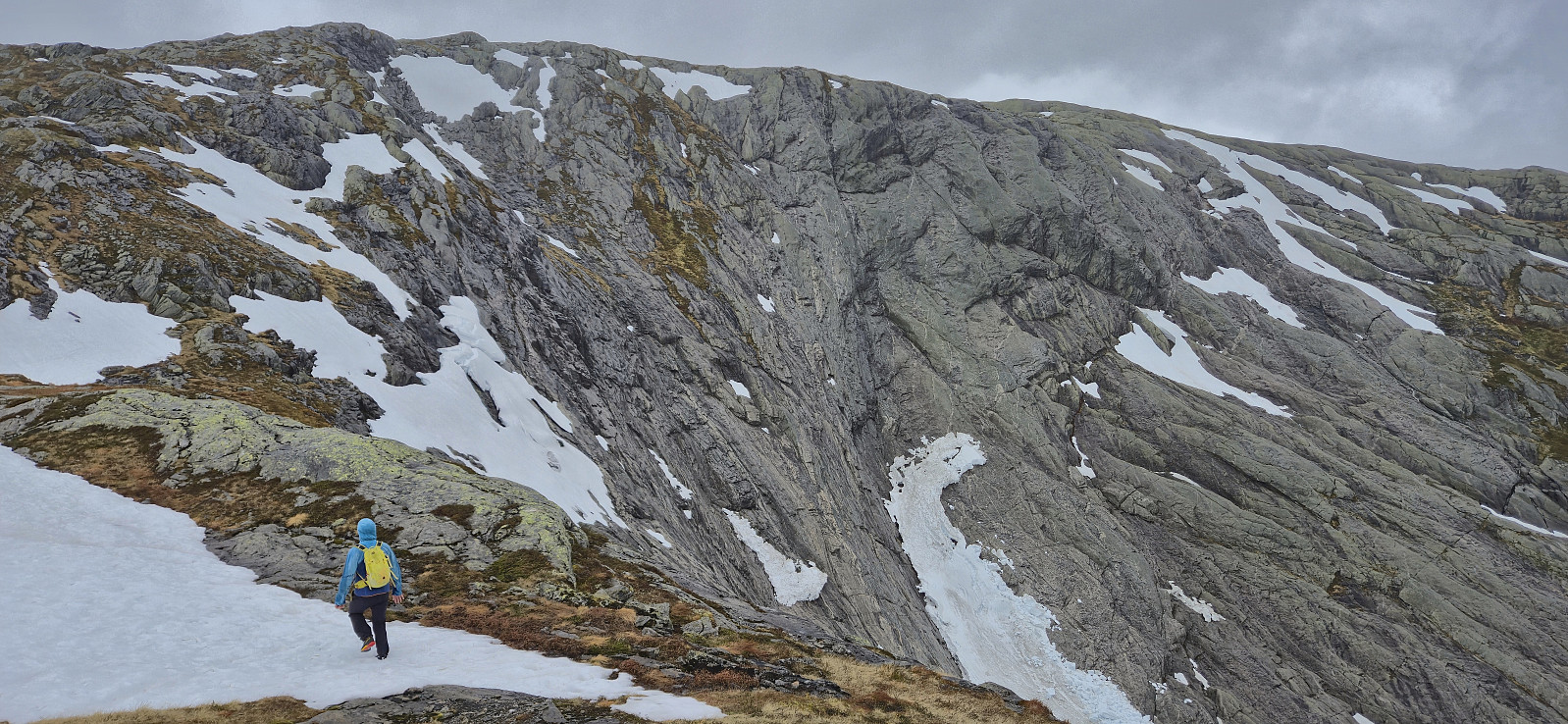
 A return to Modalen to ascend Gråsida . We found parking next to the bridge separating Midvatnet and Åbotnsvatnet, and from there walked the short distance along the road to the marked trailhead for Gråsida and Vardadalsbu . The start of the trail itself was however a bit unclear but we soon found the red T's and from there on it was relatively straightforward to follow the marked trail almost all the way to the summit.
As expected there were a couple of steep sections on the way but overall the trail did a great job at winding its way upwards. It is worth noting that the marked trail deviated quite a lot from the trail outlined on the map though. South of Rusta we had to cross a stream to continue on the marked trail on the other side. In order to avoid getting our shoes wet we made a minor detour before reconnecting >>>
A return to Modalen to ascend Gråsida . We found parking next to the bridge separating Midvatnet and Åbotnsvatnet, and from there walked the short distance along the road to the marked trailhead for Gråsida and Vardadalsbu . The start of the trail itself was however a bit unclear but we soon found the red T's and from there on it was relatively straightforward to follow the marked trail almost all the way to the summit.
As expected there were a couple of steep sections on the way but overall the trail did a great job at winding its way upwards. It is worth noting that the marked trail deviated quite a lot from the trail outlined on the map though. South of Rusta we had to cross a stream to continue on the marked trail on the other side. In order to avoid getting our shoes wet we made a minor detour before reconnecting >>>
Oksen from Granvin
- Datum:
- 16.05.2025
- Tourcharakter:
- Bergtour
- Tourlänge:
- 8:04h
- Entfernung:
- 22,9km
 Given that my only meeting on a sunny Friday had been postponed earlier in the week, I took the rest of the urgent paperwork with me and hopped on a train to Voss from where I took the bus to Granvin to ascend Oksen . After getting off the bus, I walked to the marked trailhead at Røynstrand and then followed the marked trail northwest towards the summit with the first patches of snow appearing just below 900 meters above sea level.
Shortly before getting to Oksatjørni I lost the red markers and given that I did not like the look of the terrain where the trail was supposedly heading, both steep and snow-covered, I made a short detour east to connect with the trail coming down from Ingebjørgfjellet , before both trails combined northeast of Larsbu. The final ascent to the summit was straightforward but quite strenuous >>>
Given that my only meeting on a sunny Friday had been postponed earlier in the week, I took the rest of the urgent paperwork with me and hopped on a train to Voss from where I took the bus to Granvin to ascend Oksen . After getting off the bus, I walked to the marked trailhead at Røynstrand and then followed the marked trail northwest towards the summit with the first patches of snow appearing just below 900 meters above sea level.
Shortly before getting to Oksatjørni I lost the red markers and given that I did not like the look of the terrain where the trail was supposedly heading, both steep and snow-covered, I made a short detour east to connect with the trail coming down from Ingebjørgfjellet , before both trails combined northeast of Larsbu. The final ascent to the summit was straightforward but quite strenuous >>>
Across Hellen festning
- Datum:
- 14.05.2025
- Tourcharakter:
- Wanderung
- Tourlänge:
- 0:36h
- Entfernung:
- 3,1km
 Short local evening hike.
Ørneberget and Furukammen
- Datum:
- 12.05.2025
- Tourcharakter:
- Bergtour
- Tourlänge:
- 0:52h
- Entfernung:
- 3,8km
 Short local evening hike.
Across Hellen festning
- Datum:
- 11.05.2025
- Tourcharakter:
- Wanderung
- Tourlänge:
- 0:38h
- Entfernung:
- 3,2km
 Short local Sunday hike after spending all of yesterday skiing at Finse .
Across Hellen festning
- Datum:
- 06.05.2025
- Tourcharakter:
- Wanderung
- Tourlänge:
- 0:36h
- Entfernung:
- 3,1km
 Short local evening hike.
