Archiv - Nach Datum
Archiv - Nach Aktivität
-
Andere Tour (3)
- Kayaking (3)
-
Fahrradtour (108)
- Fahrradtour Straße (83)
- Fahrradtour gemischt (25)
-
Fahrzeugtour (9)
- Autotour (9)
-
Fußtour (1769)
- Bergtour (1047)
- Jogging (1)
- Spaziergang (53)
- Wanderung (668)
-
Skitour (109)
- Langlauf (44)
- Tourenskilauf (65)
Gesammelte Listen
-
Voss ≥ 100m pf.
(96/98)
 97%
97% -
Opptur Hordaland
(143/159)
89%
-
Stasjoner på Bergensbanen
(31/40)
77%
-
Ulvik ≥ 100m pf.
(28/38)
73%
-
Hordaland ≥ 100m pf.
(610/863)
70%
-
Mjølfjell PF > 100m
(21/31)
67%
-
Jondal ≥ 100m pf.
(15/23)
65%
-
Sunnhordland PF >= 100m
(104/186)
55%
-
Dagsturhyttene i Vestland
(33/61)
54%
-
Hordaland: Hardanger PF>=100m
(183/359)
50%
-
Kvinnherad ≥ 100m pf.
(40/79)
50%
-
DNT-hytter i Hordaland
(22/45)
48%
-
Sogndal ≥ 100m pf.
(23/81)
28%
-
Vik i Sogn ≥ 100m pf.
(8/46)
17%
-
DNT-hytter i Sogn og Fjordane
(8/47)
17%
-
Eidfjord ≥ 100m pf.
(6/42)
14%
-
Etne ≥ 100m pf.
(7/51)
13%
-
Ullensvang ≥ 100m pf.
(19/153)
12%
-
Sogn - Sør for Sognefjorden PF>=100m
(17/159)
10%
-
Opptur i Sogn og Fjordane peaks
(17/177)
9%

Søre Midtfjellet, Lørdagsknausen and Blåmanen SØ
- Datum:
- 11.11.2018
- Tourcharakter:
- Bergtour
- Tourlänge:
- 3:47h
- Entfernung:
- 15,5km
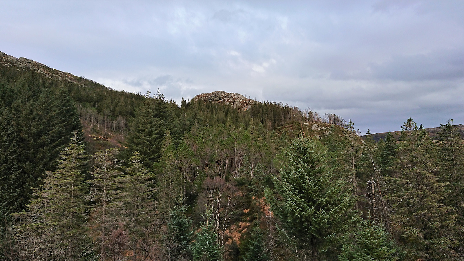 Walked from the city center to Kalfaret, from where I followed a (for me) new route up to Starefossen and onward to Søre Kamveien. Before Søre Kamveien connected with the main road toward Fløyen, I took the trail northeast via Heimtun to Fjellhytten . Continued north, but turned east before reaching the gravel road, instead following the old trail/road south, and later east, of the gravel road toward Blåmanen.
This path is clearly not very heavily used anymore, but it could be followed without much difficulty. On the way I also made a quick stop at Lørdagsknausen , which to my surprise included the remains of a small shelter. I assume this small hill, with its great views, was more frequently visited when the old trail was still in use.
Shortly after reconnecting with the main trail, I also made a quick visit of Blåmanen SØ , which could >>>
Walked from the city center to Kalfaret, from where I followed a (for me) new route up to Starefossen and onward to Søre Kamveien. Before Søre Kamveien connected with the main road toward Fløyen, I took the trail northeast via Heimtun to Fjellhytten . Continued north, but turned east before reaching the gravel road, instead following the old trail/road south, and later east, of the gravel road toward Blåmanen.
This path is clearly not very heavily used anymore, but it could be followed without much difficulty. On the way I also made a quick stop at Lørdagsknausen , which to my surprise included the remains of a small shelter. I assume this small hill, with its great views, was more frequently visited when the old trail was still in use.
Shortly after reconnecting with the main trail, I also made a quick visit of Blåmanen SØ , which could >>>
Solåsen and Hagåsen
- Datum:
- 10.11.2018
- Tourcharakter:
- Bergtour
- Tourlänge:
- 4:16h
- Entfernung:
- 18,2km
 I wanted to cover both Solåsen and Hagåsen with a single continuous hike, which seemed reasonable given their close proximity. But from what I could tell, all of the hiking reports on PB ascended Hagåsen from the southwest. I was therefore very happy to find arntfla (Arnt Flatmo) external report ( http://www.westcoastpeaks.com/Peaks/hagaasen.html ) indicating a trail towards Hagåsen from the northeast.
Having found this missing piece of the puzzle, I got up way too early on a Saturday morning and took the first bus toward Haga, getting off at the last bus stop before Hagåstunellen (bus stop: Lønnebakken). From there I walked along the smaller roads before starting my descent up Hagabakkene.
Just before the road started heading downward again, I noticed an unmarked trail heading south. After conferring with the GPS, I was pretty convinced that this had to be the trail arntfla (Arnt Flatmo) was >>>
I wanted to cover both Solåsen and Hagåsen with a single continuous hike, which seemed reasonable given their close proximity. But from what I could tell, all of the hiking reports on PB ascended Hagåsen from the southwest. I was therefore very happy to find arntfla (Arnt Flatmo) external report ( http://www.westcoastpeaks.com/Peaks/hagaasen.html ) indicating a trail towards Hagåsen from the northeast.
Having found this missing piece of the puzzle, I got up way too early on a Saturday morning and took the first bus toward Haga, getting off at the last bus stop before Hagåstunellen (bus stop: Lønnebakken). From there I walked along the smaller roads before starting my descent up Hagabakkene.
Just before the road started heading downward again, I noticed an unmarked trail heading south. After conferring with the GPS, I was pretty convinced that this had to be the trail arntfla (Arnt Flatmo) was >>>
Ulriken
- Datum:
- 07.11.2018
- Tourcharakter:
- Bergtour
- Tourlänge:
- 1:35h
- Entfernung:
- 5,7km
 Another go at the continuous competition at work for the fastest time from Montana to the upper station of Ulriksbanen, this time together with a colleague. Ended up lowering my personal best by more than 40 seconds. New record: 24 minutes and 15 seconds. After catching our breaths, we made a short detour to the summit of Ulriken, before returning to Montana.
Eineråsen
- Datum:
- 04.11.2018
- Tourcharakter:
- Bergtour
- Tourlänge:
- 1:09h
- Entfernung:
- 3,6km
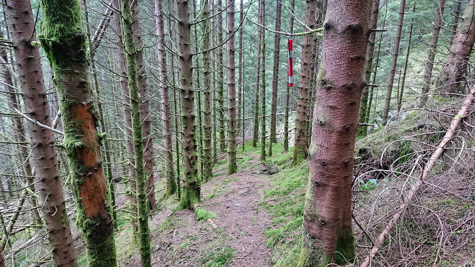 With strong winds and possible rain showers, I decided to avoid the higher peaks and instead headed for Hisdal and Eineråsen . After getting off the bus in Hisdalen, I walked south along the road for about 200 meters until locating the small gravel road heading east. The satellite images on Google Maps had indicated that this road ended just after the bridge, but to my surprise there was now a fairly new gravel road for another 300 meters.
I followed the new road until it ended, all the time looking for trails toward Eineråsen. Did not find any, and instead started my ascent along what looked like a deer track. Relatively steep at first, but the main challenge was the many fallen trees. But by switching between different deer tracks, I still made rapid progress up the hillside. Closer to the summit, >>>
With strong winds and possible rain showers, I decided to avoid the higher peaks and instead headed for Hisdal and Eineråsen . After getting off the bus in Hisdalen, I walked south along the road for about 200 meters until locating the small gravel road heading east. The satellite images on Google Maps had indicated that this road ended just after the bridge, but to my surprise there was now a fairly new gravel road for another 300 meters.
I followed the new road until it ended, all the time looking for trails toward Eineråsen. Did not find any, and instead started my ascent along what looked like a deer track. Relatively steep at first, but the main challenge was the many fallen trees. But by switching between different deer tracks, I still made rapid progress up the hillside. Closer to the summit, >>>
Forskjønnelsen, Fjellveien and Furukammen
- Datum:
- 03.11.2018
- Tourcharakter:
- Wanderung
- Tourlänge:
- 1:52h
- Entfernung:
- 9,8km
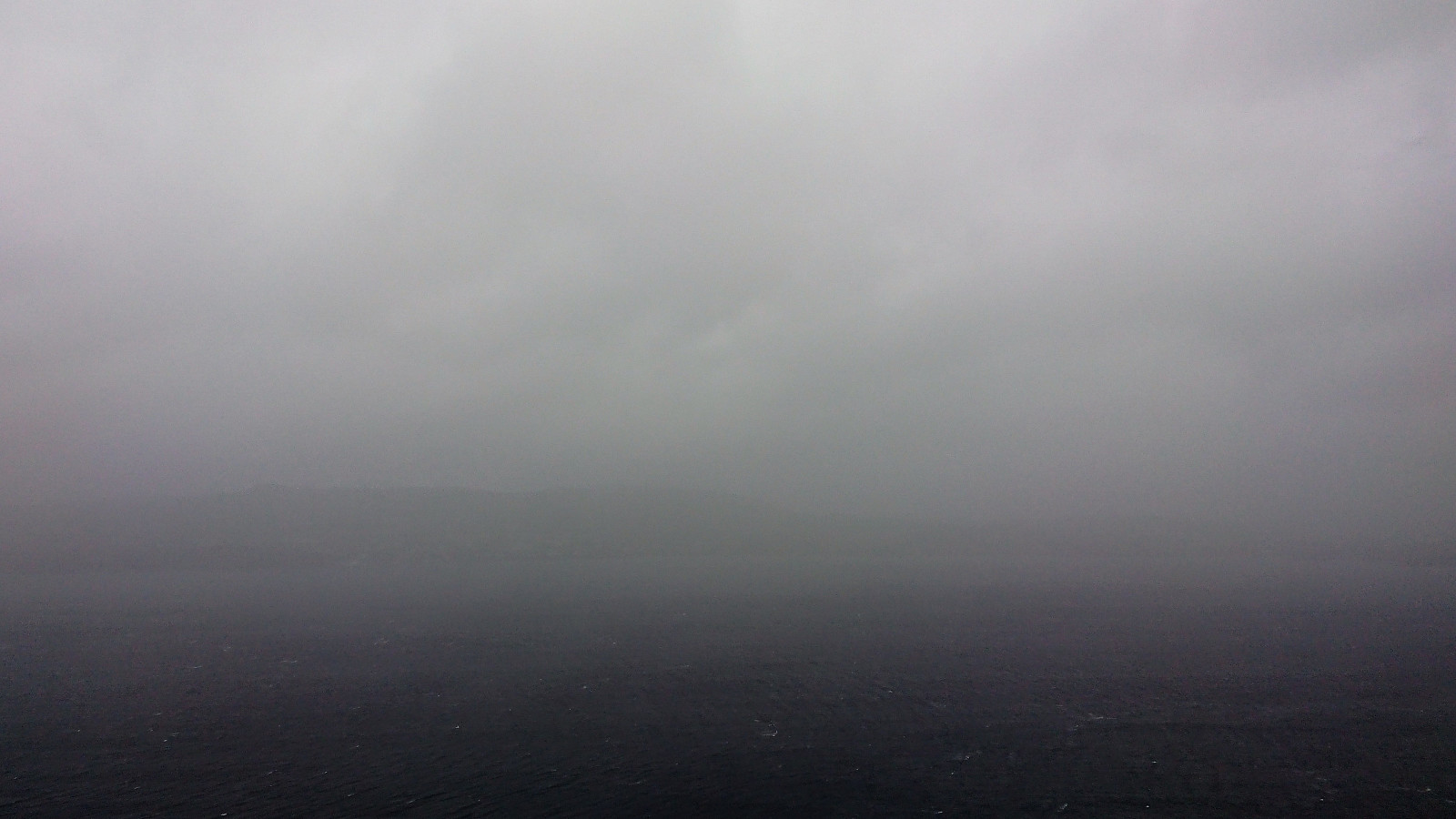 Another weekend hike with heavy rain and strong winds...
Sandvikshytten via Brennhaugen
- Datum:
- 29.10.2018
- Tourcharakter:
- Bergtour
- Tourlänge:
- 2:45h
- Entfernung:
- 9,6km
 Local hike checking out a trail splitting off from the new trail I had recently discovered on the eastern side of Munkebotsvatnet . I was hoping for an alternative route to Ankerhytten or Sandvikshytten . But instead the trail quickly split again and turned into weak deer tracks. With a bit of light climbing I still managed to make my way to Sandvikshytten via Brennhaugen, but not a route I can recommend or am likely to repeat.
Stanghelle to Dale via Storafjellet and Hestafjellet
- Datum:
- 28.10.2018
- Tourcharakter:
- Bergtour
- Tourlänge:
- 7:24h
- Entfernung:
- 17,4km
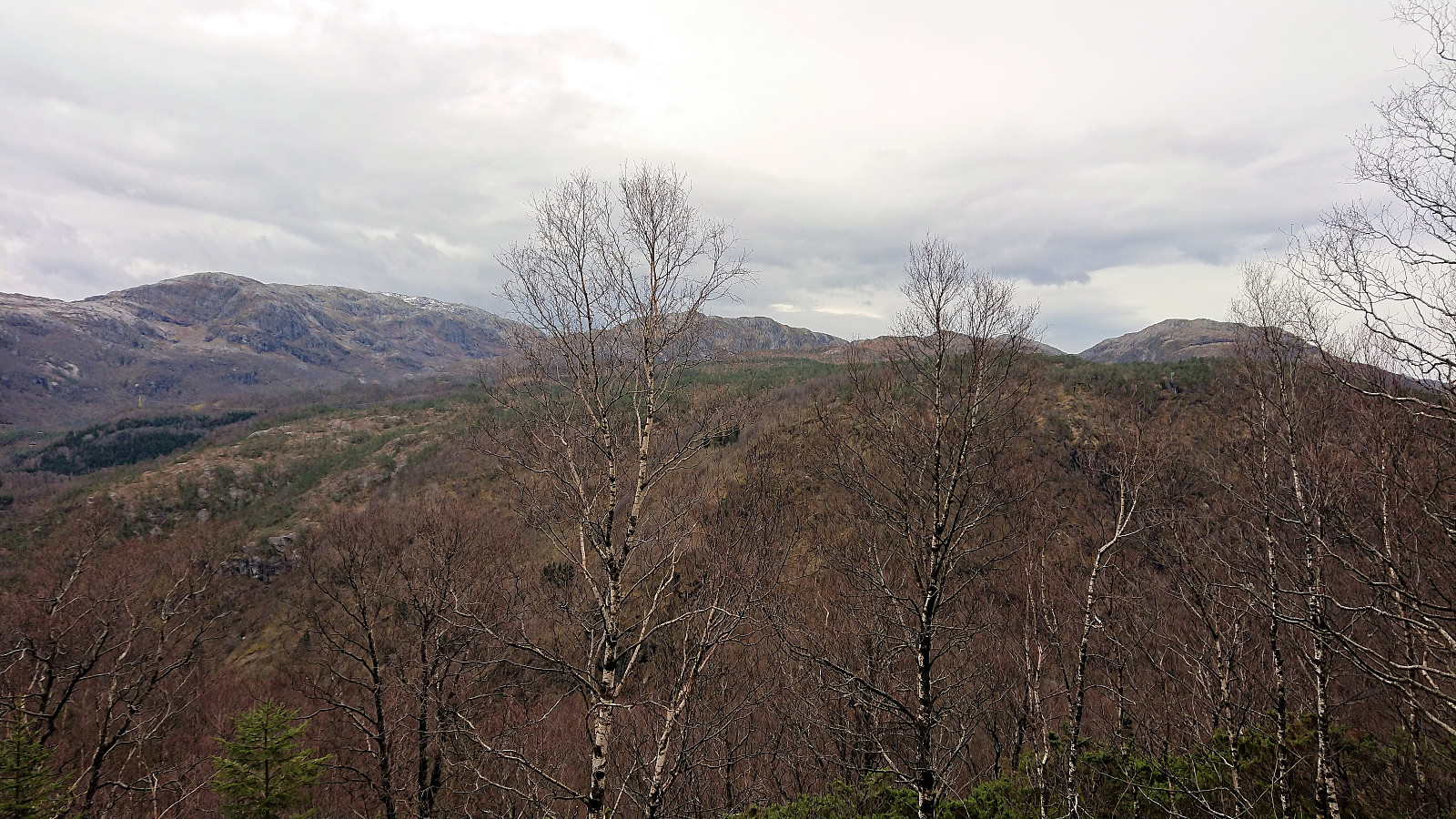
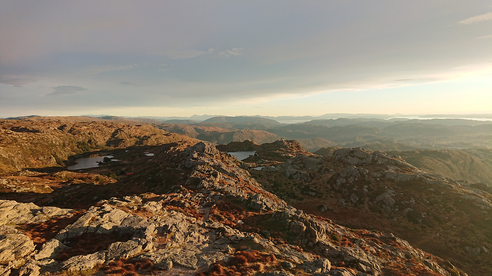
 Started by taking the train to Stanghelle and from there easily locating the marked trailhead at Åslia. The trail, which even included a couple of staircases, was easy to follow and we soon arrived at Stutto and the first good views towards Storafjellet . Stutto had its own visitor register and also provided a good view towards Hikletten .
We continued along the marked trail in the direction of Kalddalen and Kalddalselva, but as we got close to the river we lost the trail and instead had to make our own way until reconnecting with the trail shortly after crossing the river. From there on it was straightforward to follow the trail all the way to Storafjellet. The views from Storafjellet were spectacular and clearly worth a visit!
After a quick visit to the smaller cairn at the highest point, we returned to the crossroads >>>
Started by taking the train to Stanghelle and from there easily locating the marked trailhead at Åslia. The trail, which even included a couple of staircases, was easy to follow and we soon arrived at Stutto and the first good views towards Storafjellet . Stutto had its own visitor register and also provided a good view towards Hikletten .
We continued along the marked trail in the direction of Kalddalen and Kalddalselva, but as we got close to the river we lost the trail and instead had to make our own way until reconnecting with the trail shortly after crossing the river. From there on it was straightforward to follow the trail all the way to Storafjellet. The views from Storafjellet were spectacular and clearly worth a visit!
After a quick visit to the smaller cairn at the highest point, we returned to the crossroads >>>
Hellen festning and Furukammen
- Datum:
- 25.10.2018
- Tourcharakter:
- Wanderung
- Tourlänge:
- 1:07h
- Entfernung:
- 4,9km
 Short local hike after work.
Hellen festning and Furukammen
- Datum:
- 21.10.2018
- Tourcharakter:
- Wanderung
- Tourlänge:
- 1:17h
- Entfernung:
- 5,4km
 Another rainy Sunday, another short local hike.
Lone to Lønborg
- Datum:
- 20.10.2018
- Tourcharakter:
- Bergtour
- Tourlänge:
- 5:33h
- Entfernung:
- 20,8km
 Started by taking the train and bus to Lone and from there walking up to Haugo where I spotted the first signs for Ulriken . Leaving the houses behind I then followed the gravel road south until locating the marked trailhead. The trail was of better quality than expected, with only a couple of wet areas. Shortly after passing by Haukelandsvarden , the trail forked and I chose the option heading to Hauggjelsvarden .
After a quick detour to the highest point at Byfjellene , I returned to Hauggjelsvarden and from there followed the weak trail northwest. This trail disappeared before connecting with the main trail across Vidden, but it is not very difficult to locate the main trail anyway, at least not when the visibility is good.
At this point it started raining lightly and the wind also picked up a bit, but luckily the wind was coming from behind until I turned west >>>
Started by taking the train and bus to Lone and from there walking up to Haugo where I spotted the first signs for Ulriken . Leaving the houses behind I then followed the gravel road south until locating the marked trailhead. The trail was of better quality than expected, with only a couple of wet areas. Shortly after passing by Haukelandsvarden , the trail forked and I chose the option heading to Hauggjelsvarden .
After a quick detour to the highest point at Byfjellene , I returned to Hauggjelsvarden and from there followed the weak trail northwest. This trail disappeared before connecting with the main trail across Vidden, but it is not very difficult to locate the main trail anyway, at least not when the visibility is good.
At this point it started raining lightly and the wind also picked up a bit, but luckily the wind was coming from behind until I turned west >>>
