Archiv - Nach Datum
Archiv - Nach Aktivität
-
Andere Tour (3)
- Kayaking (3)
-
Fahrradtour (108)
- Fahrradtour Straße (83)
- Fahrradtour gemischt (25)
-
Fahrzeugtour (9)
- Autotour (9)
-
Fußtour (1769)
- Bergtour (1047)
- Jogging (1)
- Spaziergang (53)
- Wanderung (668)
-
Skitour (109)
- Langlauf (44)
- Tourenskilauf (65)
Gesammelte Listen
-
Voss ≥ 100m pf.
(96/98)
 97%
97% -
Opptur Hordaland
(143/159)
89%
-
Stasjoner på Bergensbanen
(31/40)
77%
-
Ulvik ≥ 100m pf.
(28/38)
73%
-
Hordaland ≥ 100m pf.
(610/863)
70%
-
Mjølfjell PF > 100m
(21/31)
67%
-
Jondal ≥ 100m pf.
(15/23)
65%
-
Sunnhordland PF >= 100m
(104/186)
55%
-
Dagsturhyttene i Vestland
(33/61)
54%
-
Hordaland: Hardanger PF>=100m
(183/359)
50%
-
Kvinnherad ≥ 100m pf.
(40/79)
50%
-
DNT-hytter i Hordaland
(22/45)
48%
-
Sogndal ≥ 100m pf.
(23/81)
28%
-
Vik i Sogn ≥ 100m pf.
(8/46)
17%
-
DNT-hytter i Sogn og Fjordane
(8/47)
17%
-
Eidfjord ≥ 100m pf.
(6/42)
14%
-
Etne ≥ 100m pf.
(7/51)
13%
-
Ullensvang ≥ 100m pf.
(19/153)
12%
-
Sogn - Sør for Sognefjorden PF>=100m
(17/159)
10%
-
Opptur i Sogn og Fjordane peaks
(17/177)
9%

Middagshorgi, Kaldenuten, Vetlekaldenuten and Haugane
- Datum:
- 19.10.2025
- Tourcharakter:
- Bergtour
- Tourlänge:
- 10:32h
- Entfernung:
- 26,7km
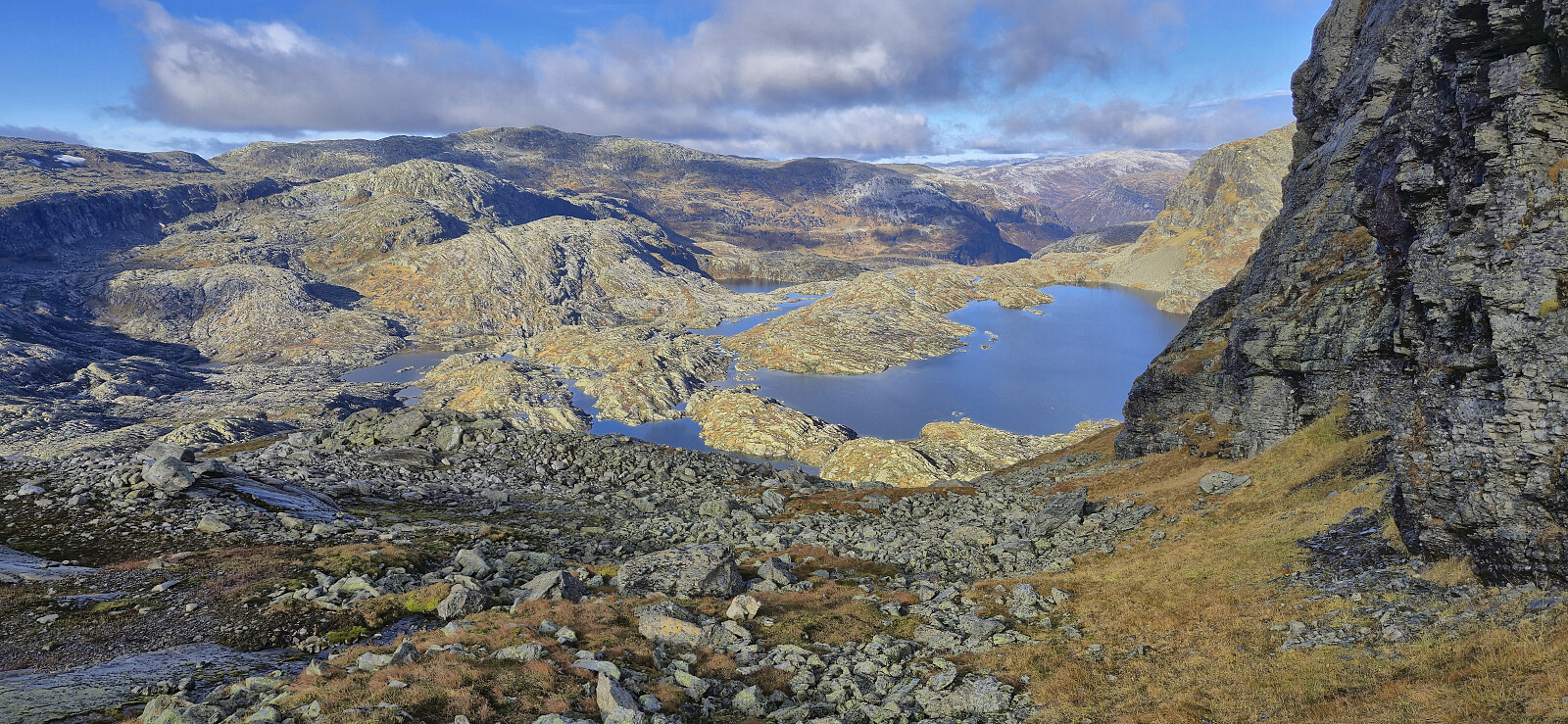
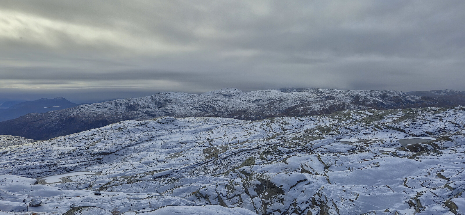 Another Sunday hike with Endre , this time with the goal for me to complete the Kvam ≥ 100m pf. list . After the drive from Bergen, we parked at Hodnaberg and started on the trail towards Kiellandbu . In Hardingaskardet we however left the main trail and instead followed a weaker trail heading to Songrø before rounding Songrøvatnet on the western side and starting an off-trail ascent of Middagshorgi .
On the way to the summit we got separated and thus chose two slightly different routes. In fact, I did not see Endre, or his footprints in the snow, until I got almost to the summit. My ascent route provided excellent views into Trongedalen and across to Kiellandbu but did require some easy scrambling that was turned slightly more tricky by the slippery conditions.
Given that Endre had already visited the three summits east of Middagshorgi, he now returned >>>
Another Sunday hike with Endre , this time with the goal for me to complete the Kvam ≥ 100m pf. list . After the drive from Bergen, we parked at Hodnaberg and started on the trail towards Kiellandbu . In Hardingaskardet we however left the main trail and instead followed a weaker trail heading to Songrø before rounding Songrøvatnet on the western side and starting an off-trail ascent of Middagshorgi .
On the way to the summit we got separated and thus chose two slightly different routes. In fact, I did not see Endre, or his footprints in the snow, until I got almost to the summit. My ascent route provided excellent views into Trongedalen and across to Kiellandbu but did require some easy scrambling that was turned slightly more tricky by the slippery conditions.
Given that Endre had already visited the three summits east of Middagshorgi, he now returned >>>
Across Hellen festning
- Datum:
- 18.10.2025
- Tourcharakter:
- Wanderung
- Tourlänge:
- 0:40h
- Entfernung:
- 3,3km
 Short local Saturday hike when a planned hike in Åsane had to be abandoned due to a closed tunnel causing traffic issues. But at least I got to confirm that Hellen festning had opened again after the recent storm with most of the fallen trees now removed.
Across Vidden
- Datum:
- 17.10.2025
- Tourcharakter:
- Bergtour
- Tourlänge:
- 7:58h
- Entfernung:
- 17,0km
 When my colleagues suggested that we take Friday off for a hike across Vidden, I of course did not need much convincing. Overall a very nice day for hiking but also a relatively cold experience due to the rather slow speed. Takk for turen!
Ørneberget
- Datum:
- 16.10.2025
- Tourcharakter:
- Bergtour
- Tourlänge:
- 1:38h
- Entfernung:
- 4,8km
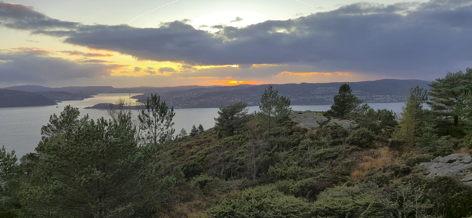 Local evening hike just before sunset.
Reinskarnuten from Ørneberget
- Datum:
- 12.10.2025
- Tourcharakter:
- Bergtour
- Tourlänge:
- 9:09h
- Entfernung:
- 26,3km
 I caught the first local train from Bergen to Ørneberget and was ready to start hiking shortly after nine. The trail from the train station down to Mjølfjell Ungdomsherberge had probably seen better days but did not present any challenges. I also made sure to have a quick look at Katteli , a cabin I had visited over three decades ago when being a pupil at Bergen Katedralskole.
Next, I followed the gravel road south to Slondalsvatnet from where I continued via a trail along the lake to Slondal and to Brauåni as the sun was rising. South of Brauåni I started on what the signs called Fagerdalsrunden before later leaving this route at Kvitli. Here I crossed the stream via a small bridge and continued on a weak trail marked by cairns (although there probably could have been a couple more) up to Kvannjolevatnet.
In order to continue the ascent from Kvannjolevatnet, >>>
I caught the first local train from Bergen to Ørneberget and was ready to start hiking shortly after nine. The trail from the train station down to Mjølfjell Ungdomsherberge had probably seen better days but did not present any challenges. I also made sure to have a quick look at Katteli , a cabin I had visited over three decades ago when being a pupil at Bergen Katedralskole.
Next, I followed the gravel road south to Slondalsvatnet from where I continued via a trail along the lake to Slondal and to Brauåni as the sun was rising. South of Brauåni I started on what the signs called Fagerdalsrunden before later leaving this route at Kvitli. Here I crossed the stream via a small bridge and continued on a weak trail marked by cairns (although there probably could have been a couple more) up to Kvannjolevatnet.
In order to continue the ascent from Kvannjolevatnet, >>>
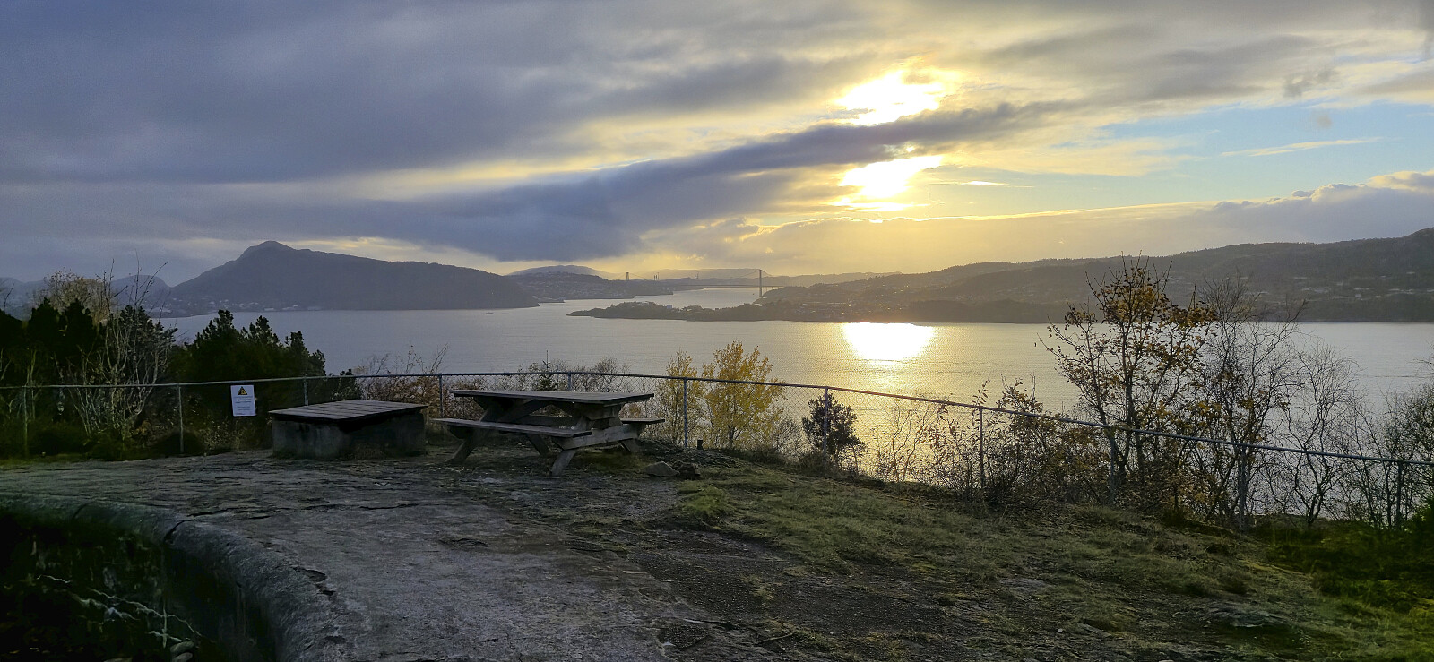
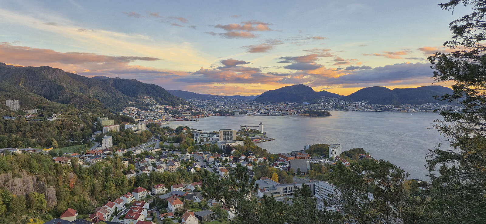
Torgallmenningen to Lønborg
- Datum:
- 11.10.2025
- Tourcharakter:
- Wanderung
- Tourlänge:
- 1:33h
- Entfernung:
- 7,7km
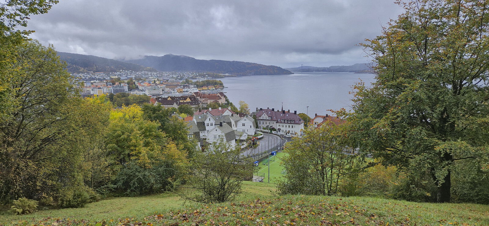 Short hike on a gray and wet Saturday.
Failed attempt at crossing Hellen festning
- Datum:
- 08.10.2025
- Tourcharakter:
- Wanderung
- Tourlänge:
- 0:32h
- Entfernung:
- 2,5km
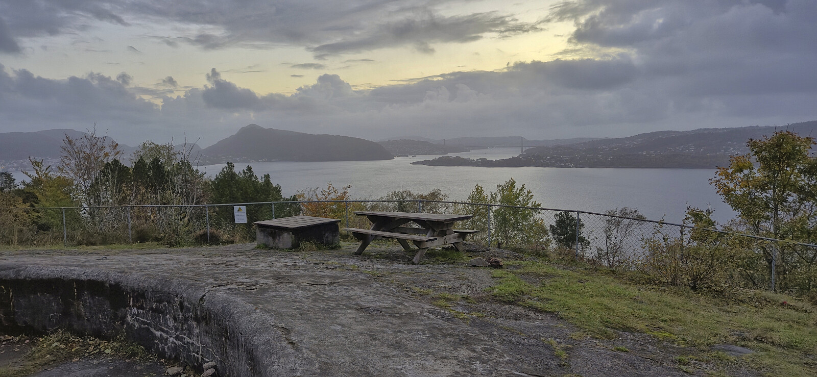 Short evening hike to Hellen festning where I had to abandoned my usual roundtrip due to barrier tape put because of the many fallen trees.
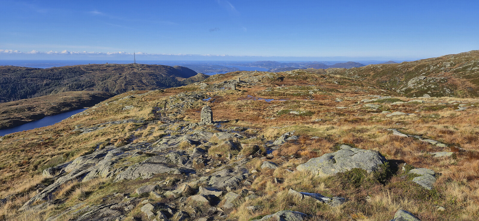
Five summits north of Brekkedalen
- Datum:
- 05.10.2025
- Tourcharakter:
- Bergtour
- Tourlänge:
- 7:45h
- Entfernung:
- 22,8km
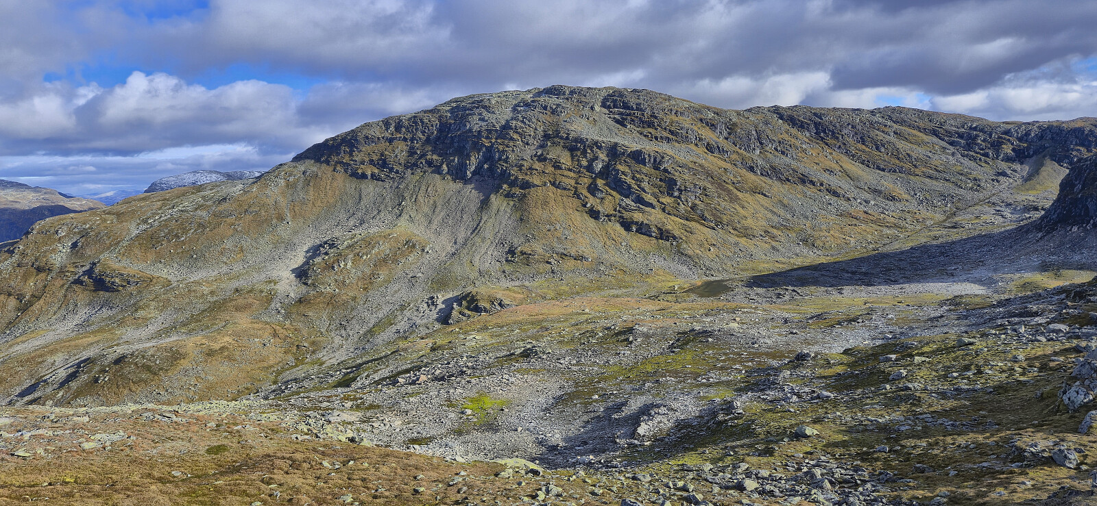 For the second weekend in a row , Endre picked me up at my place in Lønborg shortly after 07:00 for a drive to Voss. This time we however continued northeast to Stalheim and Brekkedalen. Along the way we saw lots of traces of Amy - the storm that had passed over Hordaland the night before, and even had to avoid a wire stretched halfway across the road in order to get to Stalheim Hotel, but thankfully the trees that had blocked the road had already been removed.
After paying the 50 kr toll at the start of Brekkedalsvegen we drove up to Tverraldskaret. Here we parked the car next to the road and then followed the gravel road back down to Kinnarbakken and onwards to Vikset.
From Vikset we followed an unmarked, and at times quite weak (we lost it a couple of times), trail up to Viksetskaret. Here we turned west and headed off-trail to the summit of Solheimsfjellet , which provided excellent >>>
For the second weekend in a row , Endre picked me up at my place in Lønborg shortly after 07:00 for a drive to Voss. This time we however continued northeast to Stalheim and Brekkedalen. Along the way we saw lots of traces of Amy - the storm that had passed over Hordaland the night before, and even had to avoid a wire stretched halfway across the road in order to get to Stalheim Hotel, but thankfully the trees that had blocked the road had already been removed.
After paying the 50 kr toll at the start of Brekkedalsvegen we drove up to Tverraldskaret. Here we parked the car next to the road and then followed the gravel road back down to Kinnarbakken and onwards to Vikset.
From Vikset we followed an unmarked, and at times quite weak (we lost it a couple of times), trail up to Viksetskaret. Here we turned west and headed off-trail to the summit of Solheimsfjellet , which provided excellent >>>
Hellemyrstien, Furukammen and Hellen festning
- Datum:
- 04.10.2025
- Tourcharakter:
- Wanderung
- Tourlänge:
- 3:27h
- Entfernung:
- 8,2km
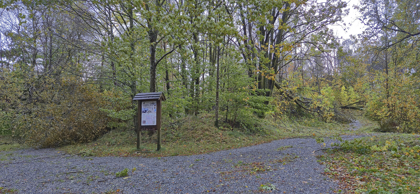 Local Saturday hike to look at the aftermath of the strong winds during the night. Lots of fallen trees, especially at Furukammen and Hellen festning .
Ørneberget NV and Furukammen
- Datum:
- 30.09.2025
- Tourcharakter:
- Bergtour
- Tourlänge:
- 0:48h
- Entfernung:
- 3,4km
 Short local hike after work.
