Archiv - Nach Datum
Archiv - Nach Aktivität
-
Andere Tour (3)
- Kayaking (3)
-
Fahrradtour (108)
- Fahrradtour Straße (83)
- Fahrradtour gemischt (25)
-
Fahrzeugtour (9)
- Autotour (9)
-
Fußtour (1871)
- Bergtour (1110)
- Jogging (1)
- Spaziergang (55)
- Wanderung (705)
-
Skitour (116)
- Langlauf (47)
- Tourenskilauf (69)
Gesammelte Listen
-
Utvalgte topper og turmål i Bergen
(346/347)
 99%
99% -
Alle topper i Bergen
(391/398)
98%
-
Voss ≥ 100m pf.
(96/98)
97%
-
Opptur Hordaland
(144/159)
90%
-
Stasjoner på Bergensbanen
(31/40)
77%
-
Ulvik ≥ 100m pf.
(28/38)
73%
-
Hordaland ≥ 100m pf.
(622/863)
72%
-
Mjølfjell PF > 100m
(21/31)
67%
-
Jondal ≥ 100m pf.
(15/23)
65%
-
Dagsturhyttene i Vestland
(36/61)
59%
-
Sunnhordland PF >= 100m
(105/186)
56%
-
Hordaland: Hardanger PF>=100m
(194/359)
54%
-
DNT-hytter i Hordaland
(23/45)
51%
-
Kvinnherad ≥ 100m pf.
(40/79)
50%
-
Eidfjord ≥ 100m pf.
(13/42)
30%
-
Sogndal ≥ 100m pf.
(23/81)
28%
-
Gulen ≥ 100m pf.
(14/54)
25%
-
Vik i Sogn ≥ 100m pf.
(10/46)
21%
-
Sogn - Sør for Sognefjorden PF>=100m
(30/159)
18%
-
DNT-hytter i Sogn og Fjordane
(8/47)
17%

Across Hellen festning
- Datum:
- 20.06.2022
- Tourcharakter:
- Wanderung
- Tourlänge:
- 0:42h
- Entfernung:
- 3,7km
 Short local evening hike after work.
Svadfjellet and Dukefjellet from Kringla to Haugsvær
- Datum:
- 19.06.2022
- Tourcharakter:
- Bergtour
- Tourlänge:
- 6:46h
- Entfernung:
- 21,8km
 For my visit of Dukefjellet I decided to combine GeirL (Geir Lie) 's ascent from Kringla with petter (Petter Bjørstad) 's descent via Hopsdalen and of course also adding my own twist. I started by taking the bus to Kringla where the bus stop is located about 650 meters south of the trailhead. In order to reduce the walk along the main road (as there is no sidewalk), I started with a minor detour around Husevatnet. This also allowed me to inspect the alternative trailhead east of the lake, but as I did not see any trail or signs indicating a trailhead, I concluded that this trail had most likely not improved since Geir used it for his descent three years earlier.
After a short walk along the main road, where it was easy to stay out of the way of the traffic, I finally arrived at the marked trailhead. As expected, there was no mentioning of Dukefjellet, rather Svadfjellet was highlighted as the >>>
For my visit of Dukefjellet I decided to combine GeirL (Geir Lie) 's ascent from Kringla with petter (Petter Bjørstad) 's descent via Hopsdalen and of course also adding my own twist. I started by taking the bus to Kringla where the bus stop is located about 650 meters south of the trailhead. In order to reduce the walk along the main road (as there is no sidewalk), I started with a minor detour around Husevatnet. This also allowed me to inspect the alternative trailhead east of the lake, but as I did not see any trail or signs indicating a trailhead, I concluded that this trail had most likely not improved since Geir used it for his descent three years earlier.
After a short walk along the main road, where it was easy to stay out of the way of the traffic, I finally arrived at the marked trailhead. As expected, there was no mentioning of Dukefjellet, rather Svadfjellet was highlighted as the >>>
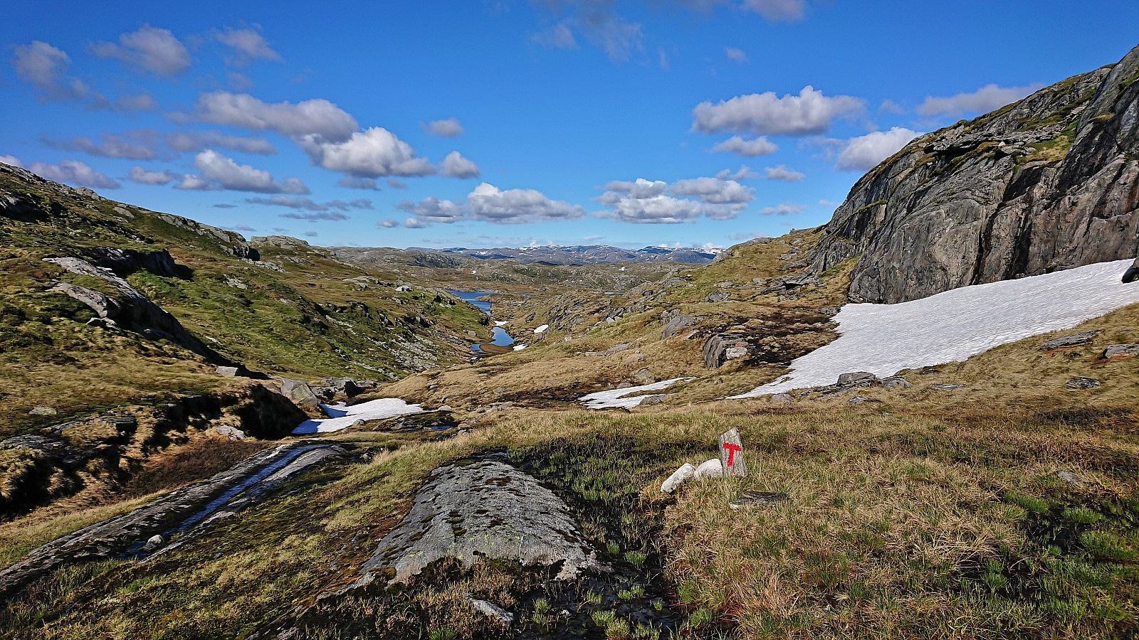
Raudnipa and Trollabotshaugen from Raunekleiv
- Datum:
- 16.06.2022
- Tourcharakter:
- Bergtour
- Tourlänge:
- 4:17h
- Entfernung:
- 15,6km
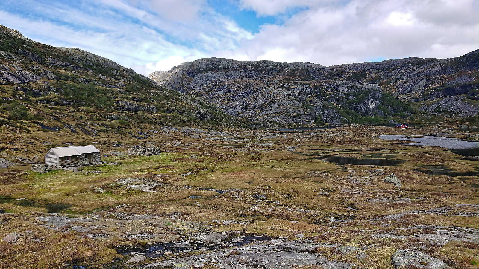
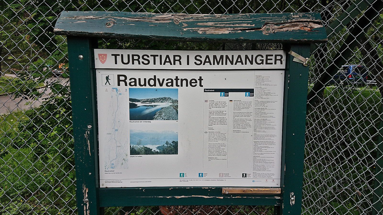 Given that I would be spending all of Friday and Saturday indoors organizing a conference, I left work early the day before and got on a bus to Raunekleiv. The plan was to revisit Raudnipa , but this time ascending from the south via Raudvatnet and also include a visit of Trollabotshaugen , a minor summit on the Alle topper i Bergen list. After a short detour along a smaller road to avoid a tunnel, the marked trailhead was located next to Raunekleiva parkering . As a side note, check out the picture used for the PB-element for the parking lot. Note how it seems to be without an entrance. ;)
I followed the marked route to Raudvatnet - a tractor road that soon turned into a trail. The vertical meters were relatively evenly spread out, resulting in an ascent without any steep sections. At Raudvatnet, I followed the trail on the east side of the lake. This is most >>>
Given that I would be spending all of Friday and Saturday indoors organizing a conference, I left work early the day before and got on a bus to Raunekleiv. The plan was to revisit Raudnipa , but this time ascending from the south via Raudvatnet and also include a visit of Trollabotshaugen , a minor summit on the Alle topper i Bergen list. After a short detour along a smaller road to avoid a tunnel, the marked trailhead was located next to Raunekleiva parkering . As a side note, check out the picture used for the PB-element for the parking lot. Note how it seems to be without an entrance. ;)
I followed the marked route to Raudvatnet - a tractor road that soon turned into a trail. The vertical meters were relatively evenly spread out, resulting in an ascent without any steep sections. At Raudvatnet, I followed the trail on the east side of the lake. This is most >>>
Fjellveien and Sandviksbatteriet
- Datum:
- 14.06.2022
- Tourcharakter:
- Wanderung
- Tourlänge:
- 1:43h
- Entfernung:
- 8,5km
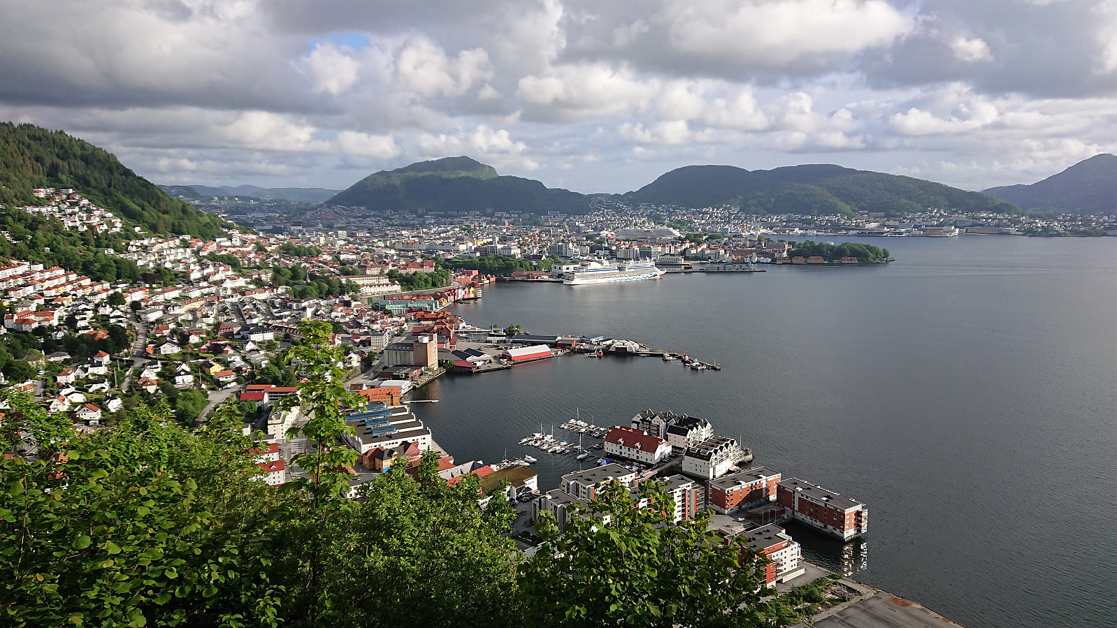 Evening hike after work.
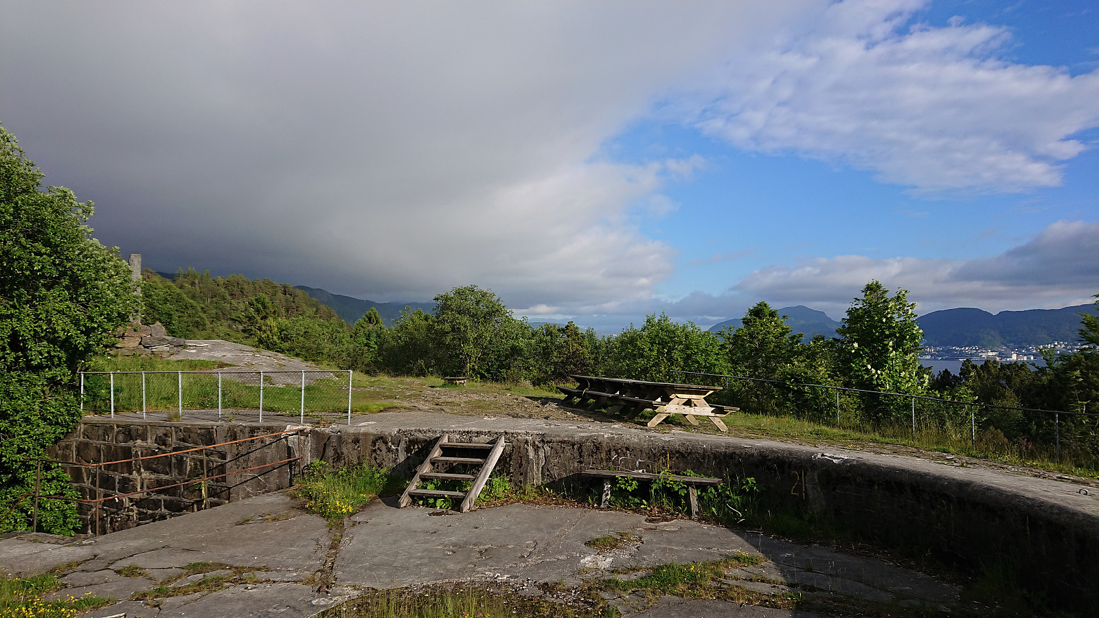
Across Hellen festning
- Datum:
- 13.06.2022
- Tourcharakter:
- Wanderung
- Tourlänge:
- 0:42h
- Entfernung:
- 3,7km
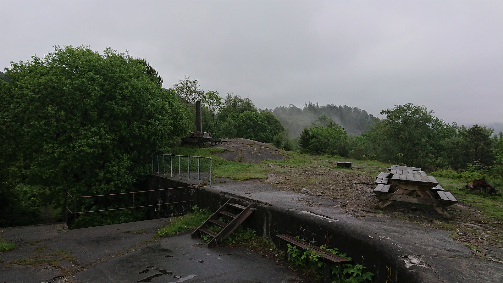 Short local evening hike between the rain showers.
Skåpet and Svartliåsen
- Datum:
- 11.06.2022
- Tourcharakter:
- Bergtour
- Tourlänge:
- 1:38h
- Entfernung:
- 5,1km
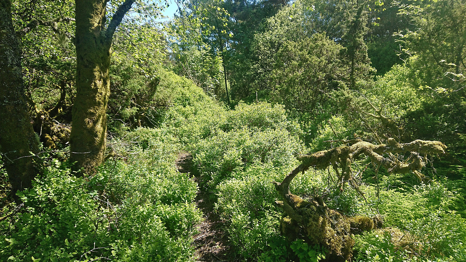
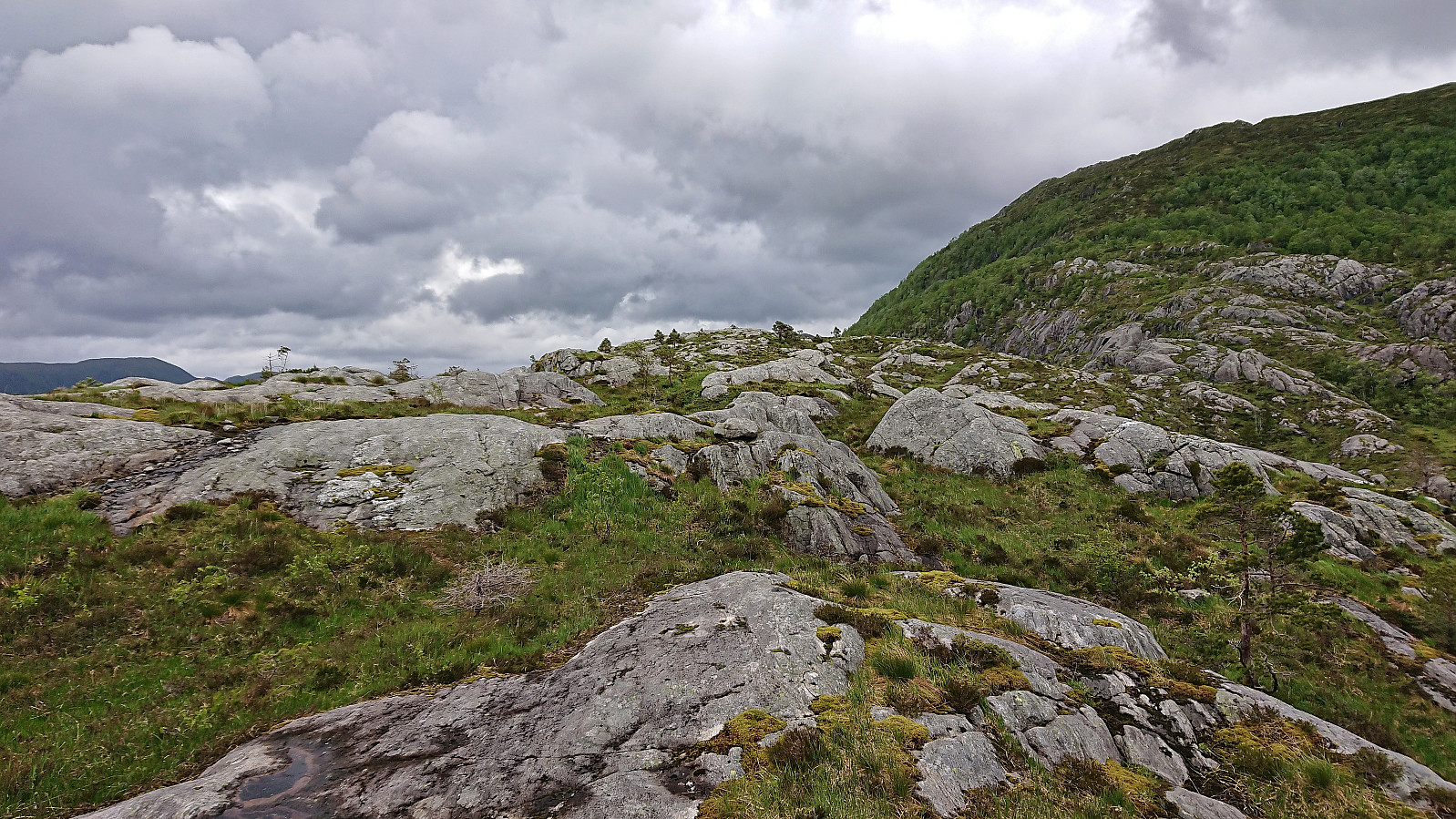 On a windy Saturday where the only question was when it was going to start raining, I decided to go for a relatively local peak I had not yet visited, namely Skåpet , yet another minor summit on the Alle topper i Bergen list. I started by taking the bus to Gullbotn and from there headed north along Øyjordvatnet. After crossing a wooden bridge and passing a couple of cabins I managed to follow a weak trail that took me almost all the way to the summit. Granted, the trail was not always to spot, but it was clearly a trail and not just an animal track. The summit provided much better views than expected.
I briefly considered continuing to Krånipa , but in the end returned along the same route. I figured I would also have the time for a visit of Svartliåsen though, another minor summit just east of the main road. This one was especially attractive >>>
On a windy Saturday where the only question was when it was going to start raining, I decided to go for a relatively local peak I had not yet visited, namely Skåpet , yet another minor summit on the Alle topper i Bergen list. I started by taking the bus to Gullbotn and from there headed north along Øyjordvatnet. After crossing a wooden bridge and passing a couple of cabins I managed to follow a weak trail that took me almost all the way to the summit. Granted, the trail was not always to spot, but it was clearly a trail and not just an animal track. The summit provided much better views than expected.
I briefly considered continuing to Krånipa , but in the end returned along the same route. I figured I would also have the time for a visit of Svartliåsen though, another minor summit just east of the main road. This one was especially attractive >>>
Tverrmeisa and Livarden from Bontveit to Haukeland
- Datum:
- 09.06.2022
- Tourcharakter:
- Bergtour
- Tourlänge:
- 2:47h
- Entfernung:
- 9,5km
 For once I managed to leave work around four and hopped on a bus to Kaland skole that connected with another bus to Bontveit. This provided easy access to a minor summit I had passed close by in the past but not bothered to actually visit, namely Tverrmeisa . When the gravel road ended south of the summit there was even a sign for Tverrmeisa, but it seems like the trail this sign refers to is no longer there. At least the trail I was on soon rather took me up towards Slettegga . I therefore ditched the trail and simply made my own way to the highest point of Tverrmeisa.
Much better views than expected, especially down to Haukelandsvatnet and even all the way to Arnavågen. The thickening fog did not help though, and I did not stay long before heading for the trail east of the summit and continue to Livarden . On the way >>>
For once I managed to leave work around four and hopped on a bus to Kaland skole that connected with another bus to Bontveit. This provided easy access to a minor summit I had passed close by in the past but not bothered to actually visit, namely Tverrmeisa . When the gravel road ended south of the summit there was even a sign for Tverrmeisa, but it seems like the trail this sign refers to is no longer there. At least the trail I was on soon rather took me up towards Slettegga . I therefore ditched the trail and simply made my own way to the highest point of Tverrmeisa.
Much better views than expected, especially down to Haukelandsvatnet and even all the way to Arnavågen. The thickening fog did not help though, and I did not stay long before heading for the trail east of the summit and continue to Livarden . On the way >>>
Across Hellen festning
- Datum:
- 08.06.2022
- Tourcharakter:
- Wanderung
- Tourlänge:
- 0:36h
- Entfernung:
- 3,0km
 Short local evening hike after work.
Cycling: Håsteinen and Slettåsen
- Datum:
- 06.06.2022
- Tourcharakter:
- Fahrradtour Straße
- Tourlänge:
- 4:59h
- Entfernung:
- 58,1km
 After two days of hiking, I switched to cycling for the last day of the long weekend and I went for a trip to Hjellestad with the added bonus of also making a quick visit of Slettåsen - a minor peak on the Alle topper i Bergen list. I left the bike behind at the unmarked trailhead northeast of the summit. The trail quality was highly variable, especially for the later return, but (at least the start) the wet areas were covered by planks or pallets. From Kjell51 (Kjell Øijorden) 's trip report , I had gotten the tip to also visit Håsteinen . So when a sign for Håsteinen showed up, I followed a trail to a location that provided great views, especially for only being 45 meters above sea level.
Next, I followed various trails towards Slettåsen, even passing a sign for Slettåsen. But there was no trail and the highest point was slightly further south anyway. As it turned >>>
After two days of hiking, I switched to cycling for the last day of the long weekend and I went for a trip to Hjellestad with the added bonus of also making a quick visit of Slettåsen - a minor peak on the Alle topper i Bergen list. I left the bike behind at the unmarked trailhead northeast of the summit. The trail quality was highly variable, especially for the later return, but (at least the start) the wet areas were covered by planks or pallets. From Kjell51 (Kjell Øijorden) 's trip report , I had gotten the tip to also visit Håsteinen . So when a sign for Håsteinen showed up, I followed a trail to a location that provided great views, especially for only being 45 meters above sea level.
Next, I followed various trails towards Slettåsen, even passing a sign for Slettåsen. But there was no trail and the highest point was slightly further south anyway. As it turned >>>
Austrefjellet and Ådneburen from Meisdalen
- Datum:
- 05.06.2022
- Tourcharakter:
- Bergtour
- Tourlänge:
- 7:21h
- Entfernung:
- 17,1km
 When my colleague yehiamokhtarfarag (Yehia Mokhtar Farag) asked if I wanted to go hiking, I of course said yes and suggested Austrefjellet and Ådneburen in Masfjorden as our targets, partly as both of these are hard to reach by public transportation on my own and because I thought they should provide great views.
Yehia picked me up at my place a bit after noon and we drove the around 1.5 hours to Andvika. Here we paid the 30 kr toll via Vipps and continued up the gravel road to the parking lot in Meisdalen . Walking up Meisdalen was a very nice start to the hike and we soon arrived at the marked trail for Ådneburen. We however decided to leave this one for later and instead continued southeast, still along a marked trail.
When the trail split west of Ådnekvamssetret , we left the main trail and followed a weaker trail to the unnamed lake east of Ådnekvamssetret. Here the trail soon pretty much disappeared, but >>>
When my colleague yehiamokhtarfarag (Yehia Mokhtar Farag) asked if I wanted to go hiking, I of course said yes and suggested Austrefjellet and Ådneburen in Masfjorden as our targets, partly as both of these are hard to reach by public transportation on my own and because I thought they should provide great views.
Yehia picked me up at my place a bit after noon and we drove the around 1.5 hours to Andvika. Here we paid the 30 kr toll via Vipps and continued up the gravel road to the parking lot in Meisdalen . Walking up Meisdalen was a very nice start to the hike and we soon arrived at the marked trail for Ådneburen. We however decided to leave this one for later and instead continued southeast, still along a marked trail.
When the trail split west of Ådnekvamssetret , we left the main trail and followed a weaker trail to the unnamed lake east of Ådnekvamssetret. Here the trail soon pretty much disappeared, but >>>
